Excessive heat and humidity in the forecast for July
The recent increase in dew point temperatures across the state has ushered in a very sticky atmosphere that has made conditions uncomfortable for humans. Heat index values pushed beyond the century mark at many locations in response to dew points above 70°F and air temperatures ranging from the upper 80s to upper 90s.
Cattle, just like humans, undergo heat stress, especially in feedlots that have no significant shading. With the predominant hide color of beef in the state being black, they easily absorb radiation on sunny days just like asphalt. Therefore, when temperatures reach the 90s and dew point temperatures soar into the 70s, feels like temperatures for cattle can push well above 110°F.
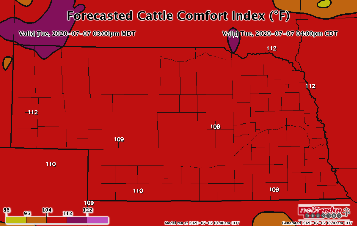
The Nebraska State Climate Office calculates Cattle Comfort Index (CCI) based upon models developed by Dr. Terry Mader, formerly with the University of Nebraska - Lincoln. Current indices are available at our Nebraska Mesonet website. Using the GFS weather model, model components including forecasted air temperature, relative humidity, wind speed and solar radiation are inputs into the CCI model to forecast the feels like temperatures for cattle.
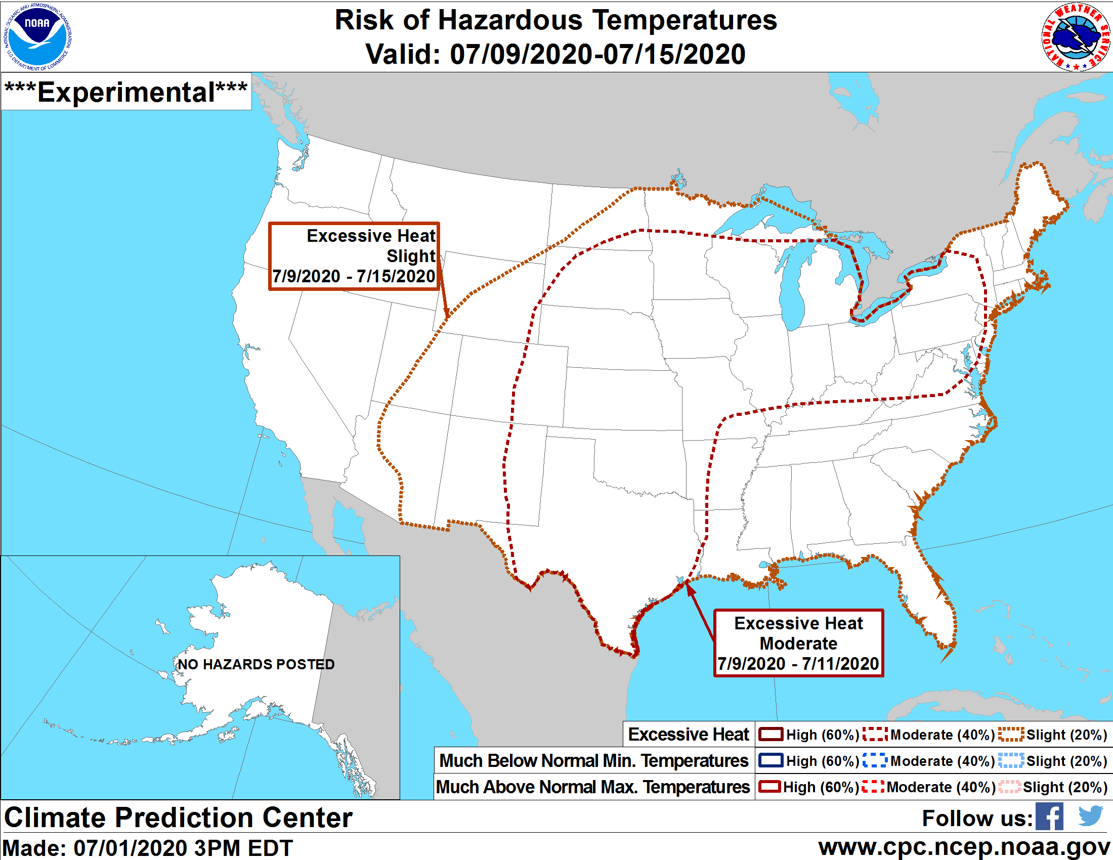
The hot and humid weather that developed this week is projected to continue through at least the middle of the month, according to the 0700 Central Daylight Time (CDT) July 1 GFS model run. A moderate risk of excessive heat is identified by the Climate Prediction Center for a large section of the U.S. If the GFS model is correct on this heat and humidity, cattle producers should be aware that the CCI indicates that feel like temperatures is forecasted to breach 105°F somewhere in the state every day at 4 pm CDT from July 2nd to July 15th, which is as far out as the GFS model runs.
There are two distinct periods within the GFS modeled output where CCI temperatures of 110°F to 120°F are widespread across the state. The GFS model forecasts this excessive heat every day from July 4th to the 10th and from July 14th to 16th. The most severe CCI values of 117°F to 122°F are forecasted to occur on July 10th and 16th covering the entire state outside of extreme northwestern Nebraska.
Producers should be aware that the GFS model indicates that the next two weeks will consistently see air temperatures above 90°F and dew points of 70°F or higher across the eastern two-thirds of the state, with several days of 100°F or greater temperatures next week across parts of southwest and south central Nebraska.
Cloud cover greater than model predictions could lower these forecasts on any given day, but the overall forecast trend is for CCI values consistently above 110°F on a daily basis somewhere in the state. Add localized heavy rainfall into the mix and CCI values could breach the 125°F mark. Producers are recommended to take preventative measures to reduce heat impacts on cattle during this forecasted heat event.
For beef cattle resources, visit beef.unl.edu.
For crops resources, visit cropwatch.unl.edu.
Source: Al Dutcher at Nebraska State Climate Office