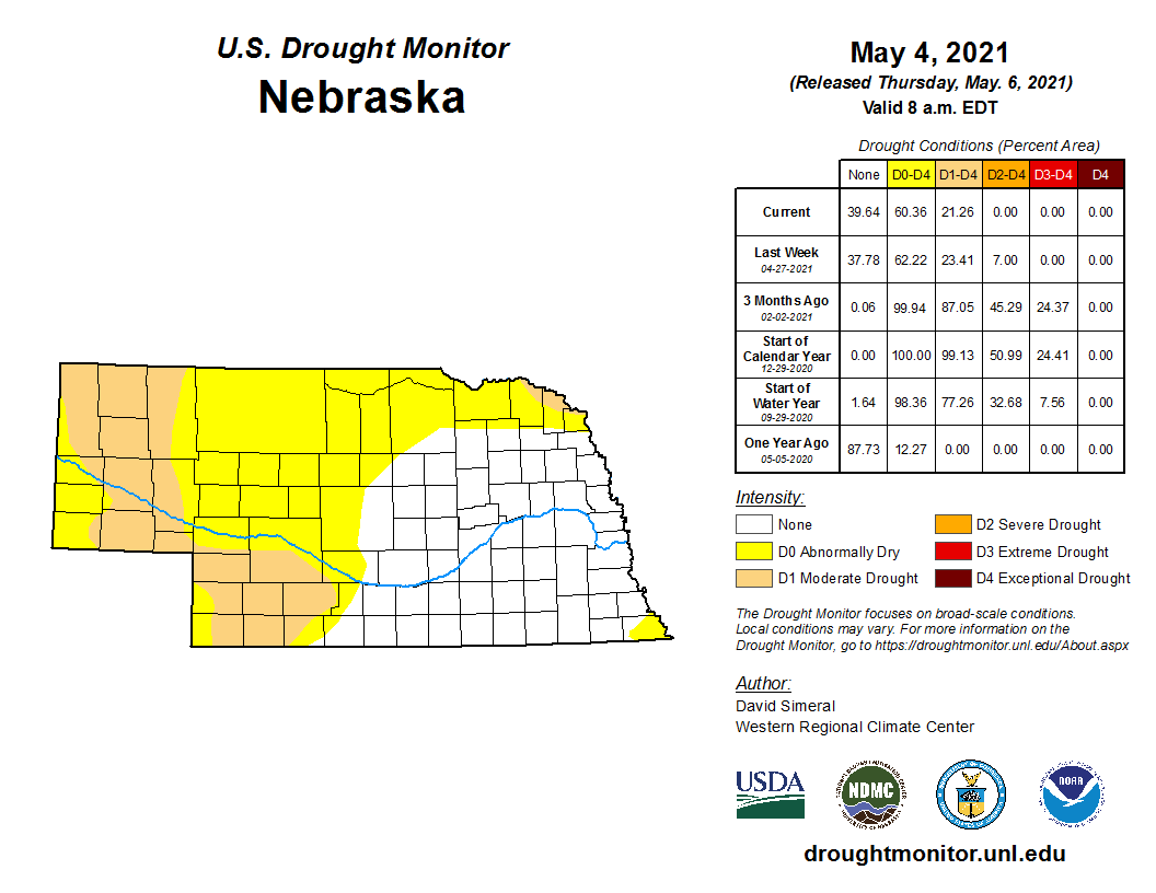
Highlights
From snow to 90 degree heat, April brought a range of weather conditions, which is typical of springtime in Nebraska. More than six inches of snow occurred in western portions of the state. Severe weather was relatively quiet however. In a month that was a bit cooler and drier overall, there were some improvements to concerning drought conditions in southwestern Nebraska counties. However, what we need is a continuation of normal to above normal precipitation in order to avoid degrading conditions. Moderate drought now covers 21% of the state and another 40% of Nebraska is categorized as abnormally dry.
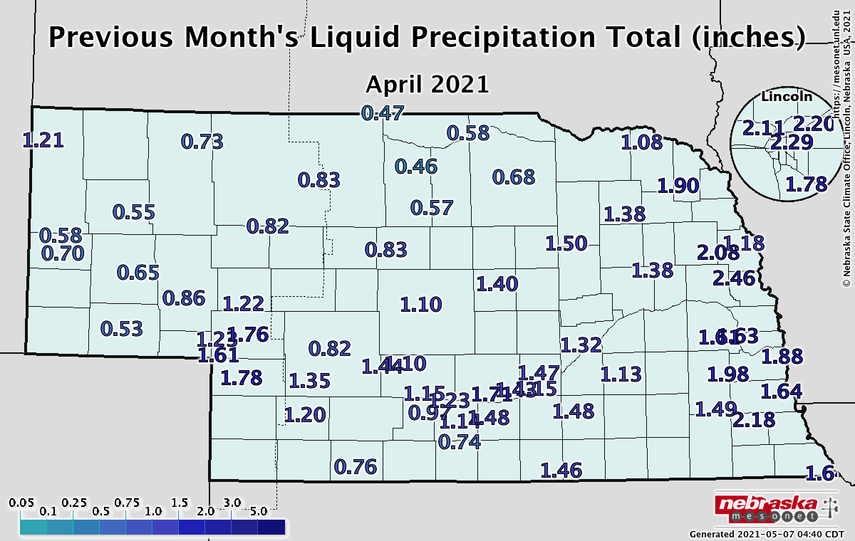
Precipitation
Precipitation came in the form of both rain and snow this April. Ten inches of snow was reported in Harrison, Chadron, and Valentine with five to nine inches in the southwest and southern Panhandle. The statewide average precipitation of 1.36 inches ranks as 25th driest since 1895. A few daily precipitation records were set as Lincoln reported 0.86 inches of rain on the 8th and Valentine reported 7.2 inches of snow on the 20th.
Severe Weather
Conditions were fairly quiet given that we are into severe weather season. No tornados were reported in Nebraska during April and there were 4 high wind and 4 hail reports. The highest wind gust observed from the Nebraska Mesonet reporting stations was 50 mph near Winslow on the 5th.
Temperature
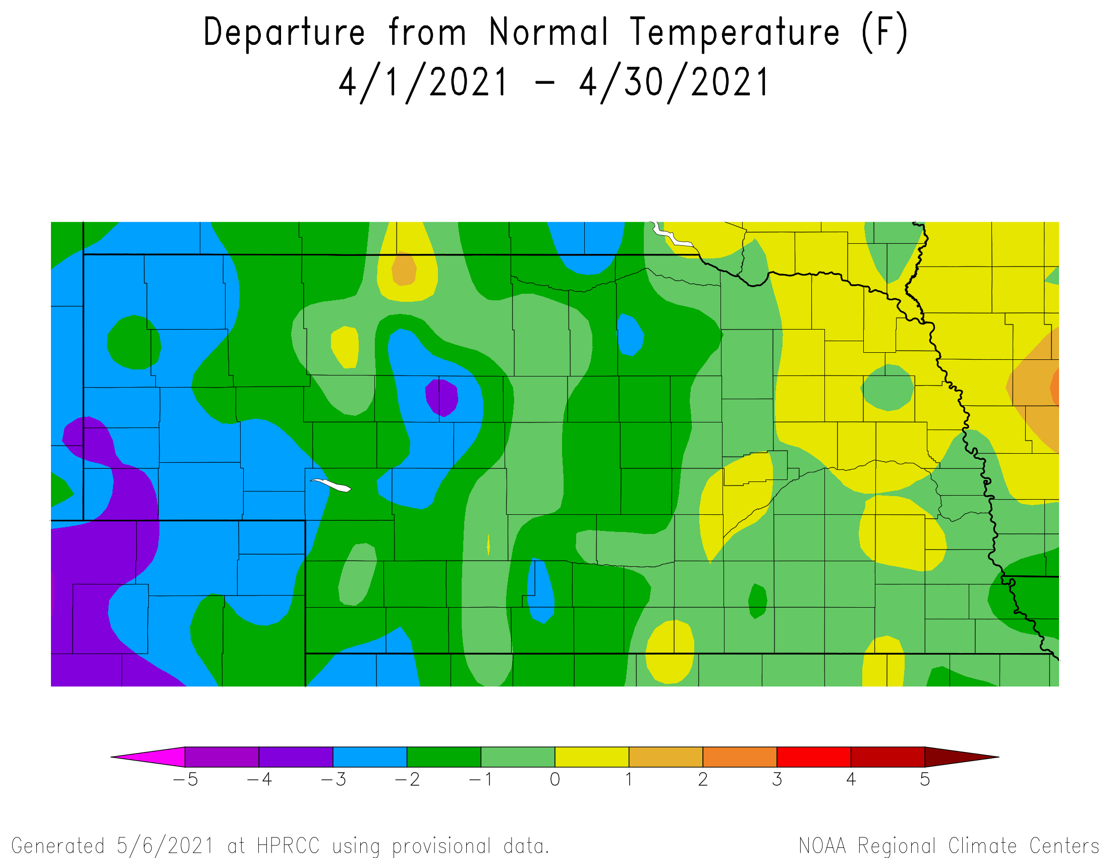
Temperatures were on the cool side of normal this April with a statewide average temperature of 47.0°F. This is one degree below normal. The lowest observed temperature for the month was 6°F near Bushnell and the high for the month was 96°F at the Nebraska Mesonet site near York. Quite a few daily temperature records were broken (18 at long-term observing sites), mostly early in the month. Highs in the 80s set records across the state, from Lincoln to Chadron and points in between. The third week of the month also reported some records with lows in the single digits and teens, including 9°F at Alliance on the 21st.
Agriculture
Temperatures during the first 10 days of April were dominated by above normal temperatures. High temperatures were consistently above 60°F, with several days of highs pushing into the upper 70's to upper 80's. A significant cool down occurred April 11-22, with high temperatures stuck in the 40's. Corn planting was non-existent through the third full week of the month due to average daily soil temperatures consistently in the upper 30's to mid 40's. Warm condition returned the final week of April and the lack of significant rainfall led to widespread planting as average daily soil temperatures breached the 50°F threshold. Nebraska Agricultural Statistics Service (NASS) indicated that 42% of the corn crop had been planted as of May 2, an increase of 36 percentage points in one week. NASS reports one fifth of the soybean crop was also in the ground across the state. The cold weather brought several rounds of hard freeze conditions to the state during the middle of April. The wheat crop may have been advanced far enough into the jointing stage across southwestern Nebraska that some damage may have occurred. The primary concern for the wheat crop continues to be the ongoing effects of drought conditions across the southwest and Nebraska Panhandle. Eighteen percent of the wheat crop is rated in the poor to very poor category and 22% of the pasture acreage was rated poor to very poor. So even with the beneficial moisture in March and to a lesser extent in April, long term precipitation deficits from last summer and fall continue to impact acreage across the western third of the state. Moisture will need to remain normal to above normal over the next 4 months or drought conditions will expand rapidly due to the lack of deep soil profile moisture.
Outlook
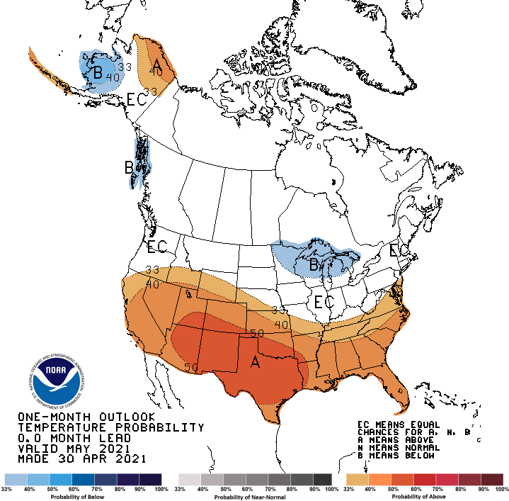
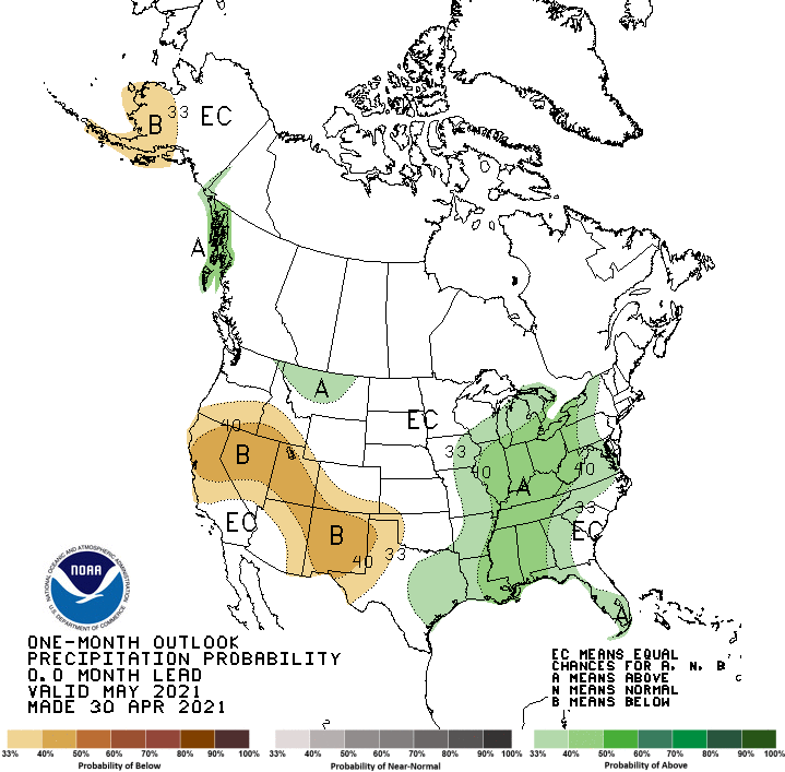
The Climate Prediction Center(CPC) indicates that the southwestern half of the state has a slight risk for above normal temperatures. This area lies on the northern periphery of an expansive area of above normal temperatures projected for the southern half of the United States. The northeastern half of Nebraska has been assigned equal chances of receiving above normal, normal, or below normal temperatures. The May precipitation outlook issued by CPC indicates equal chances for above normal, normal, or below normal moisture across the entire state. Above normal moisture is indicated for the central and eastern corn belt southward to the Gulf of Mexico. Below normal moisture is projected from California east-southeastward through the western third of Texas.
April Extremes:
Highest air temperature: 96°F, 26th, York 2WLowest air temperature: 13°F, 20th, Harrison 4 NW
Lowest wind chill temperature: -2°F, 20th, Sidney 2NW
Highest heat index temperature: 91°F, 26th, York 2W
Max wind gust: 50 mph, 5th, Winslow 6E
Highest 1-day precipitation: 1.3 inches, 9th, Concord 2E
Largest 12-hour temperature change: 52°F, 2nd, Hayes Center 3N
Highest mean sea level pressure: 1040 mb, 1st, Winslow 6E
Lowest mean sea level pressure: 1005 mb, 2nd, Naper 12SW
Source: The Nebraska Mesonet at Nebraska State Climate Office