

Above average temperatures, near-average precipitation
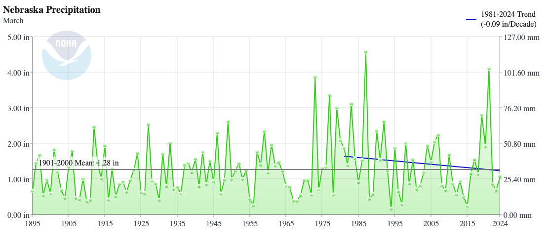
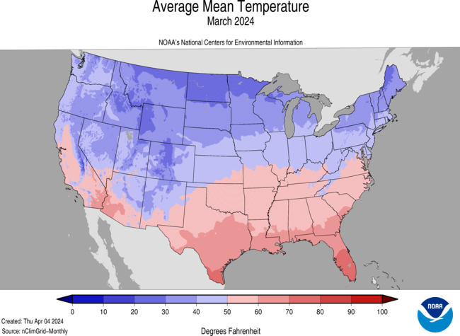
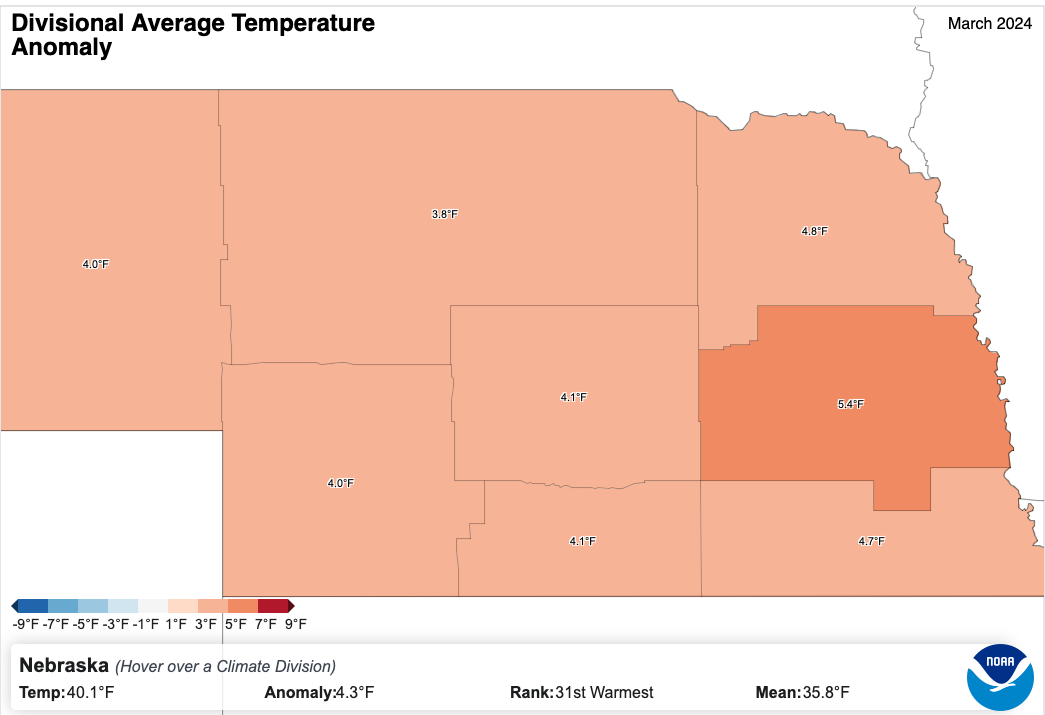
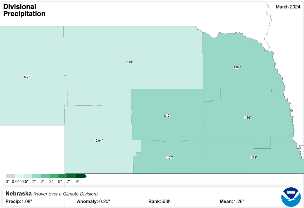
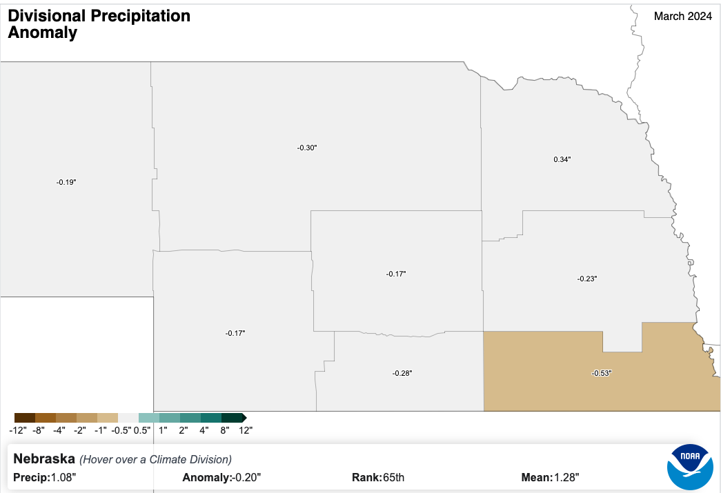
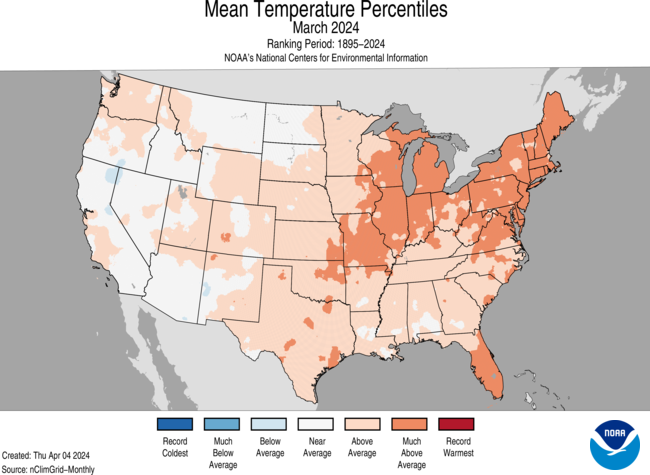
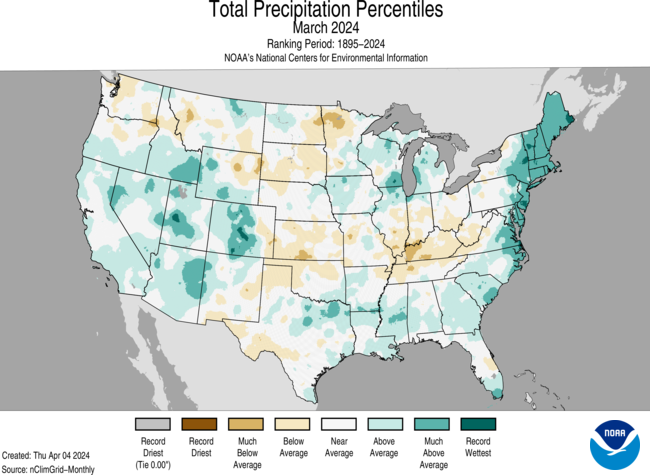
March 2024 in Nebraska finished with an average temperature of 40.1F, 4.3F above average and the 31st warmest March on record. Nationally it was the 17th warmest March on record and preliminary data from Copernicus show that it was the warmest March globally. This is the tenth consecutive month with record setting temperatures globally. Precipitation in March averaged 1.08 inches, slightly below the long-term average of 1.28".
Warm start to the month, cooler second half
The month of March picked up where February left off, with temperatures in the first two weeks of the month averaging 10-13F above average in eastern and northern sections of the state. The second half of the month featured more troughing, frontal passages, and precipitation. Temperatures in the second half of the month were below average statewide, generally 3-5F below long-term normals. Most places in the state didn't hit 70F in the second half of the month, save for a few spots in the southeastern quadrant of the state and northern sections of Nebraska had 1-2 days with subfreezing highs in the final week of the month. It was the first stretch of colder than average temperatures in the state (and much of the north central U.S.) since mid-January. The cooler temperatures halted what was an exceptionally early start to growing degree days (GDD's) and prevented a very early leaf out like we had back in 2012. 4" Soil temperatures managed the magical 50F mark in parts of southeastern Nebraska in mid-March but the cooler temperatures in the last 10-14 days pushed them back into more seasonal territory.
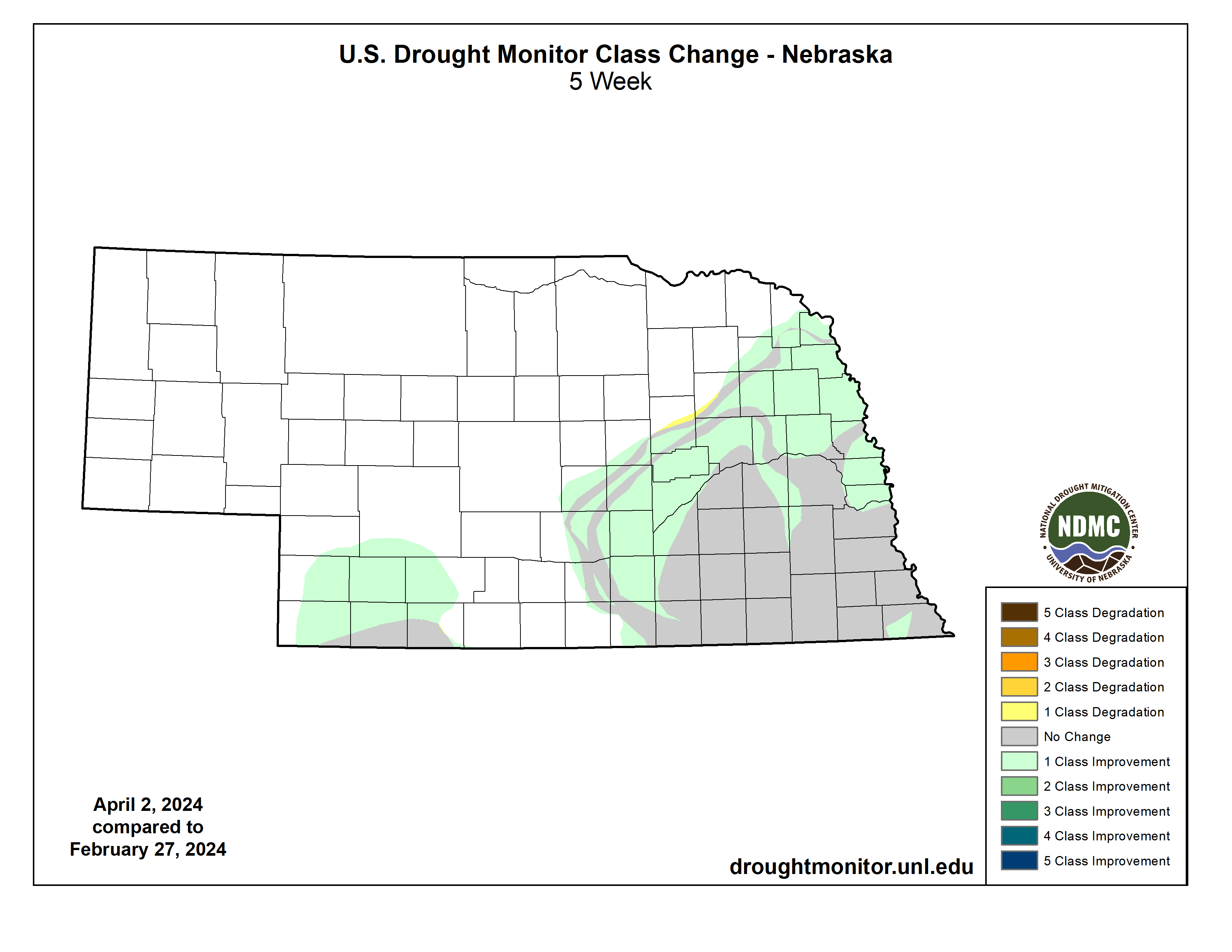
Drought Relief
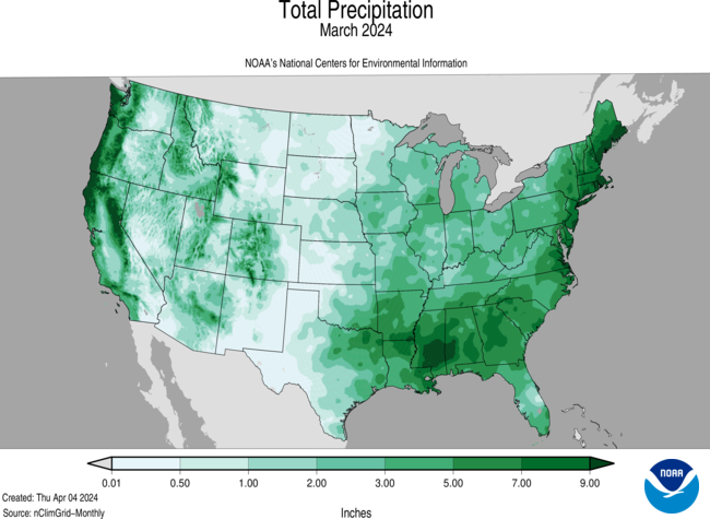
Precipitation for the month was right around the long-term median and no area of the state was near-record minimum or maximum levels for precipitation. Nevertheless, there were a few notable events in the state that brought some improvement on the U.S. Drought Monitor. In the first week of the month, a slow moving system brought needed moisture to southwestern Nebraska and dumped upwards of 20 inches of snow in west central Nebraska. The next week another system brought modest totals to the southeastern quarter of the state, helping put some top soil moisture back in the ground after a dry six weeks. The 23rd-25th brought more significant precipitation to the state, with generous rainfall totals in central and northeastern Nebraska. This led to a 1-category improvement on the U.S. Drought Monitor and brought the statewide percentage of drought under 20 percent for the first time since July 2021. This system also brought heavier snowfall totals to parts of central and western Nebraska. The moisture during this period was particularly welcome in northeast Nebraska, where precipitation had been minimal the previous two months and which had seen introduction of abnormal dryness on the Drought Monitor. Thankfully its stay was short lived.
Extremes across the state
Max Temperature: 85F, Bushnell 15S
Min Temperature: -2F, Harrison 9NE
Max Total Monthly Precipitation: 3.23", Riverton 6.17 N
Max Total Monthly Snowfall: 24.7", North Platte 1.4 W
Eric Hunt, University of Nebraska Extension


