10th Consecutive Wet May
May 2024 marked the 10th consecutive May with above average precipitation in Nebraska with a statewide average of 4.15", 0.65" above the long-term average. But as was the case last year (and most years), precipitation was not equally distributed spatially across the state. This year it was sections of central and eastern Nebraska picking up significant rainfall and seeing drought improvement or eradication while much of the Panhandle was drier than average and saw some degradation on the U.S. Drought Monitor. Several locations along the Highway 30 corridor picked up over 8 inches of precipitation in May with 10+" common in Dodge, Saunders, Washington, and Douglas counties. Parts of Richardson County also picked up over 10" for the month. A good portion of the 10+" in the Highway 30 corridor fell in less than 24 hours between the evening of May 20th and the morning of the 21st. The biggest "winner" was a CoCoRaHS observer in Bennington with 14.59" of precipitation. Last year in May that observer reported 0.53" of precipitation.
Stormy Month
For many areas in the central U.S., including much of Nebraska, May 2024 was one filled with severe storms. A big culprit was persistent troughs in the western U.S. that ejected out into the Northern Plains region, which helped set the stage for severe thunderstorms to the south and east of the base of the mean center of the trough. Severe thunderstorms occurred on multiple days in May but the most active stretch was the week of May 19th. The 21st brought flooding to parts of East Central Nebraska in the early morning hours and some tornadoes and hail to eastern Nebraska in the afternoon. The evening of May 23rd featured multiple tornadoes in west central Nebraska, with damage around Lake McConaughy. As that complex of thunderstorms moved east into the early morning hours of the 24th, there were numerous reports of wind damage across the state, particularly along and just to the north of I-80. Many of the thunderstorms throughout the month also produced flash flooding, which may have been the biggest agricultural impact, as many fields were partially or completely flooded for a period of time.
Warm East, Cooler West
As has been the case since March, the state was warmer than average, but not exceptionally so. The average statewide temperature of 59.4F was +1.0F above the long-term average, but cooler than last year and well short of the record of 68.4F set in 1934. Positive temperature anomalies were weakest in the western side of the state where a few sites came in slightly below average and strongest in eastern Nebraska where minimum temperatures were more above average. No major heat waves were noted in the month and most sites in central and eastern Nebraska did not get above the mid 80's for the warmest maximum temperature. No site had more than a few days with maximum temperatures in the 90's. Freezes were semi-common in the western third of the state early in the month and occurred well into May at the highest elevation sites. No measurable snow was reported in the state for the first time since September.
As a side note, May was the fourth consecutive month with temperatures above the 20th century average in Nebraska and June is well on its way to being the fifth consecutive month. May 2024 also marks the 14th month out of the last 18 to be above average. You have to back to late 2022 to find two consecutive months with temperatures below the 20th century average and you have to go back a decade (summer 2014) to find three consecutive months where that was the case.
Extremes and Tabular Summaries
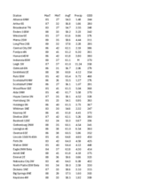
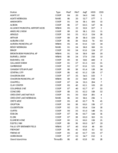
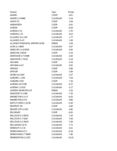
Attached are .pdf's containing Nebraska Mesonet station summaries, temperature/HDD/CDD, and precipitation summaries for stations around the state. Includes CoCoRaHS observer reports in the precipitation summary. Below are the temperature and precipitation extremes around the state in May.
Maximum Daily High Temperature: 94F, Verdel 6SSE
Minimum Daily High Temperature: 42F, Gordon 6N
Minimum Daily Low Temperature: 19F, Bushnell 15S
Maximum Daily Low Temperature: 66F, Nebraska City 2NW
Max Monthly Precipitation: 14.59", Bennington 2.9SSW
Eric Hunt, University of Nebraska Extension


