The Climate Prediction Center (CPC) released their preliminary outlook for April along with their rolling 3-month outlooks on March 17th. The CPC outlooks have taken a dramatic turn to drier than normal conditions for a substantial portion of the High Plains region this upcoming growing season. This pivot to more significant dryness is concerning considering that most of the western ¾ of the state has received well below normal moisture since early November.
The April temperatures outlook by CPC indicates above normal temperatures are likely across the southeastern ¾ of United States. The highest probabilities for above normal temperatures has been assigned to the southern High Plains region (TX, OK), with slightly lower odds extending northward through the southwestern ½ of Nebraska (Figure 1).
CPC has assigned the highest odds of below normal moisture during April to the extreme southern edge of the Panhandle and southwestern Nebraska. On a national basis, the highest probability for dryness has been assigned to the central and southern Rocky Mountain region extending eastward into the western portions of the central High Plains (Figure 2).
If the precipitation and temperature outlooks were to verify, the snowpack feeding the headwater regions of the Platte watershed would end the season (early May) below normal with a high probability of complete melt before June. When the central Rockies snowpack melts out by early June, it increases the likelihood of above normal temperatures and below normal moisture for the remainder of the growing season across the western ½ of Nebraska.
The April through June outlook for temperatures and precipitation continues the pattern indicated in the April outlook for Nebraska. Above normal temperatures are shifted slightly north of the April forecast and the probability of occurrence levels were increased slightly (Figure 3). Below normal moisture has been expanded north and west of the April forecast, with the highest probabilities assigned to the central Great Basin and the Texas panhandle region (Figure 4). For Nebraska, CPC indicates the western 1/3 of the state has the highest probability for dryness during this period.
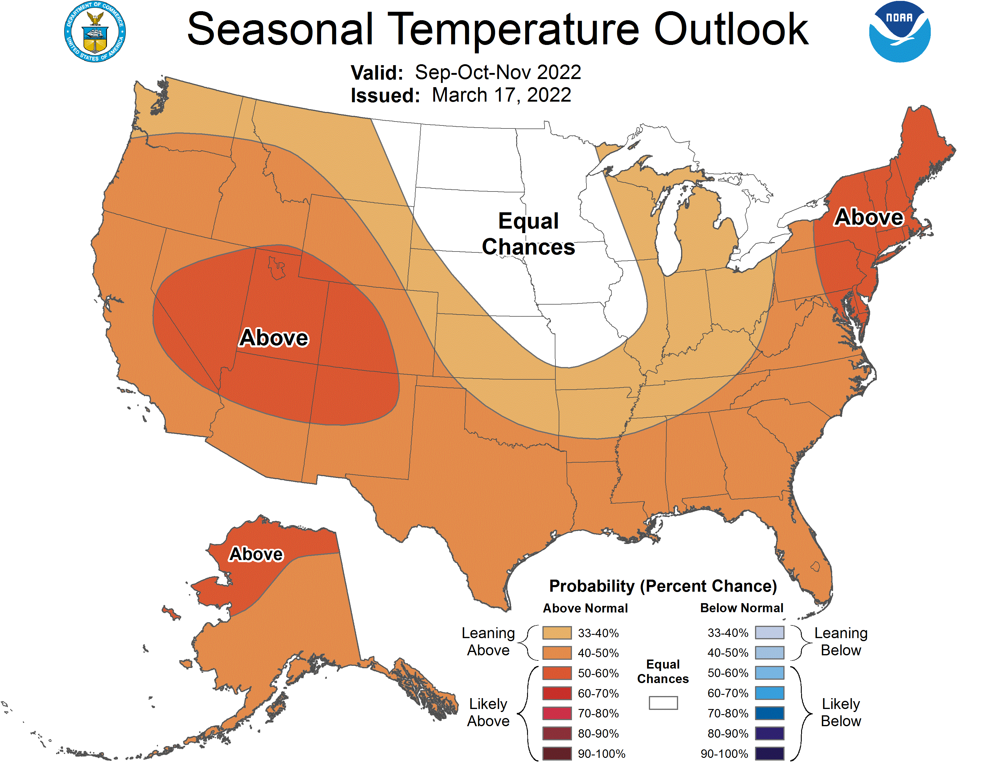
The July through September temperature (Figure 5) outlook calls for above normal temperatures nationwide. These highest probability of occurrence has been assigned to the southern High Plains northwest through the southern ½ of the northern Rocky Mountains. The panhandle, southwest and southwestern corner of the Sandhill region lies on the eastern flank of this highest probability of occurrence region.
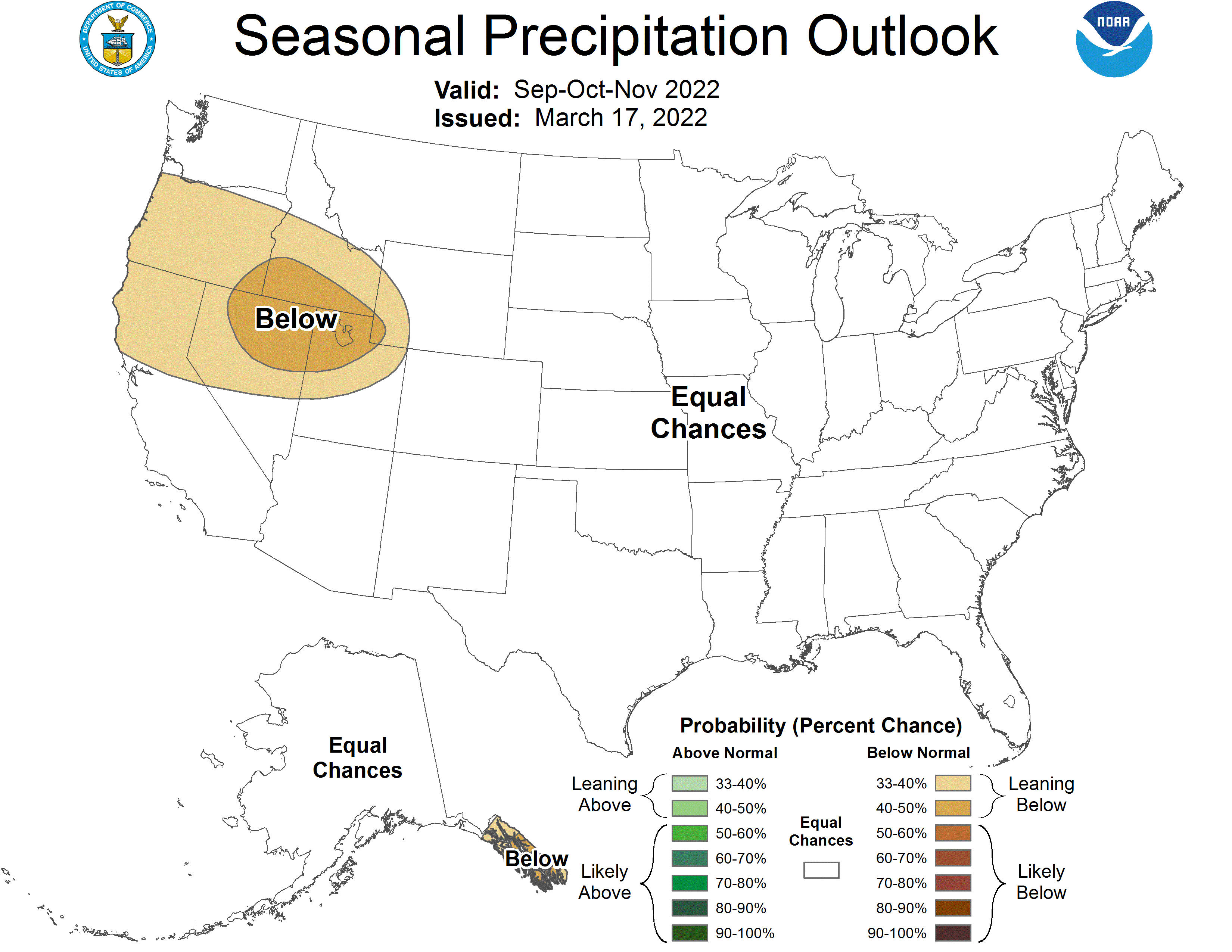
CPC shifts their forecast for drier than normal conditions into the northern Rockies and northern half of the High Plains region, including Nebraska (Figure 6). The eastern extent of this region includes southwest Minnesota and western Iowa, while the southern extend drops into north central and northeast Kansas. This is a slight expansion southeastward of the area that experienced the most significant drought conditions during the 2021 growing season.
It isn’t until the October through December period where CPC moves begins to shift the above normal temperatures southward and replaces the northern Plains (including the northern half of Nebraska) with equal odds of receiving above normal, normal, or below normal temperatures (Figure 7). The southern half of Nebraska, as well as points east, west, and south are still forecast to receive above normal temperatures. At least the precipitation outlook doesn’t appear to look as dire, with equal chances of above, normal, or below normal moisture everywhere except for Washington, Idaho, Oregon and the northern half of California.
My Thoughts
As near as I can figure out, the sharp turn toward a significantly drier forecast for the periods described above is the result of CPC extending its forecast for the end of La Nina conditions into the early summer based upon their assessment released March 10th. CPC’s consensus dynamical model forecast keeps La Nina conditions going into the May through July period, while the consensus statistical model forecast ends La Nina conditions in the April through June period.
Figure 9 shows the current global sea surface temperature (SST) anomalies and there is a pocket of above normal SST’s expanding and intensifying just off the coast of Peru. These same conditions develop last January and led to an aggressive storm pattern across the southern Plains. If this same process is again unfolding, then it should enhance the southern jet stream. This would help energy coming into the Pacific Northwest hold together as it digs toward the southern Great Basin by providing an additional feed of moisture into the upper air trough.
As these troughs move eastward, they will either move across the southern High Plains or head northeastward toward the central Plains. We have begun to see this type of activity develop since late February as the upper air trough over the Great Lakes region weakened after being semi-permanent for eight consecutive weeks. If we have entered into a new pattern favoring troughs moving into the western United States, then I would expect to see better moisture odds for the southern and central High Plains the next 4-6 weeks, something I have frequently mentioned during my talks this past winter.
With the amount of cold air still residing over Canada and the warmth building to the south of us, an increase in storm activity entering the Pacific Northwest and moving southeast toward the southern Rocky Mountains would support significant severe weather outbreaks across the central and southern High Plains. If these systems move eastward across the northern Rocky Mountains and northern High Plains, severe weather will be subdued and drought intensification would likely be rapid from Nebraska southward through Texas.
Al Dutcher, Agricultural Extension Climatologist with the Nebraska State Climate Office


