I'm dreaming of a White Easter?
Before you start throwing stuff at your screen just because of a headline, bear in mind that the snow will mostly be gone by the 31st! All joking aside, I do recommend paying close attention to the forecast as we head toward the weekend. Things could be interesting Saturday through Monday night in the Plains.
What is known
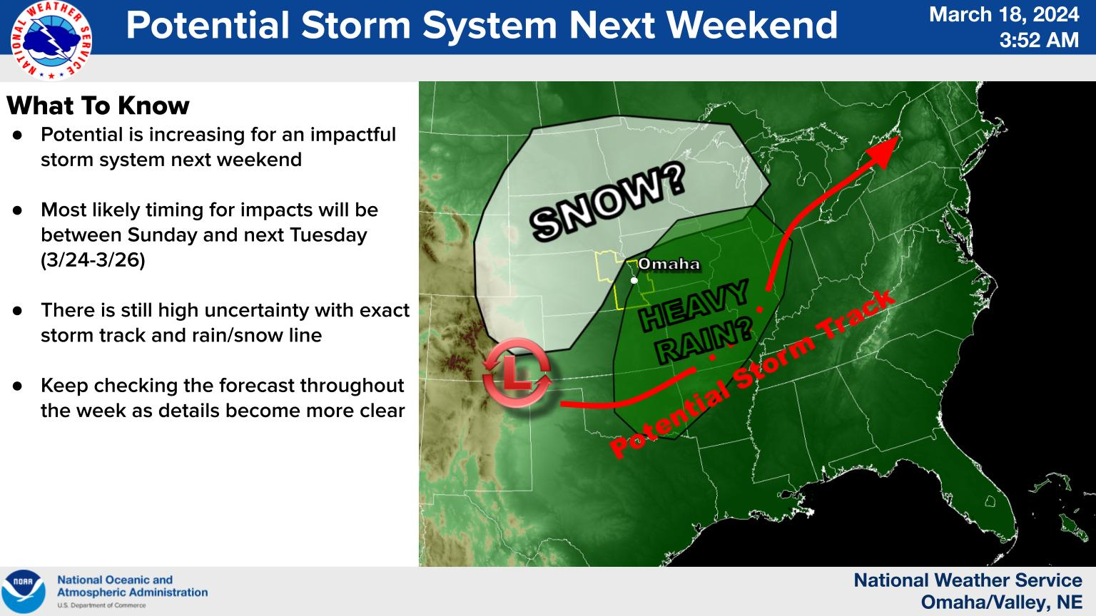
Storm is coming: There is a deep trough set to enter the western U.S. by this weekend and move into the central U.S. by early next week. This has been a consistent signal in multiple models for multiple days. In other words, confidence is increasing that there will be impactful weather in our region.
Ample moisture to work with: The trough coming into the southwestern U.S. will bring southwesterly flow aloft to the central U.S. will be moving slowly enough to allow for development of lee cyclogenesis. Meteorology to English Translation: The expected upper air pattern is favorable for bringing decent moisture into the central U.S. and to allow for a strong storm to develop at the surface.
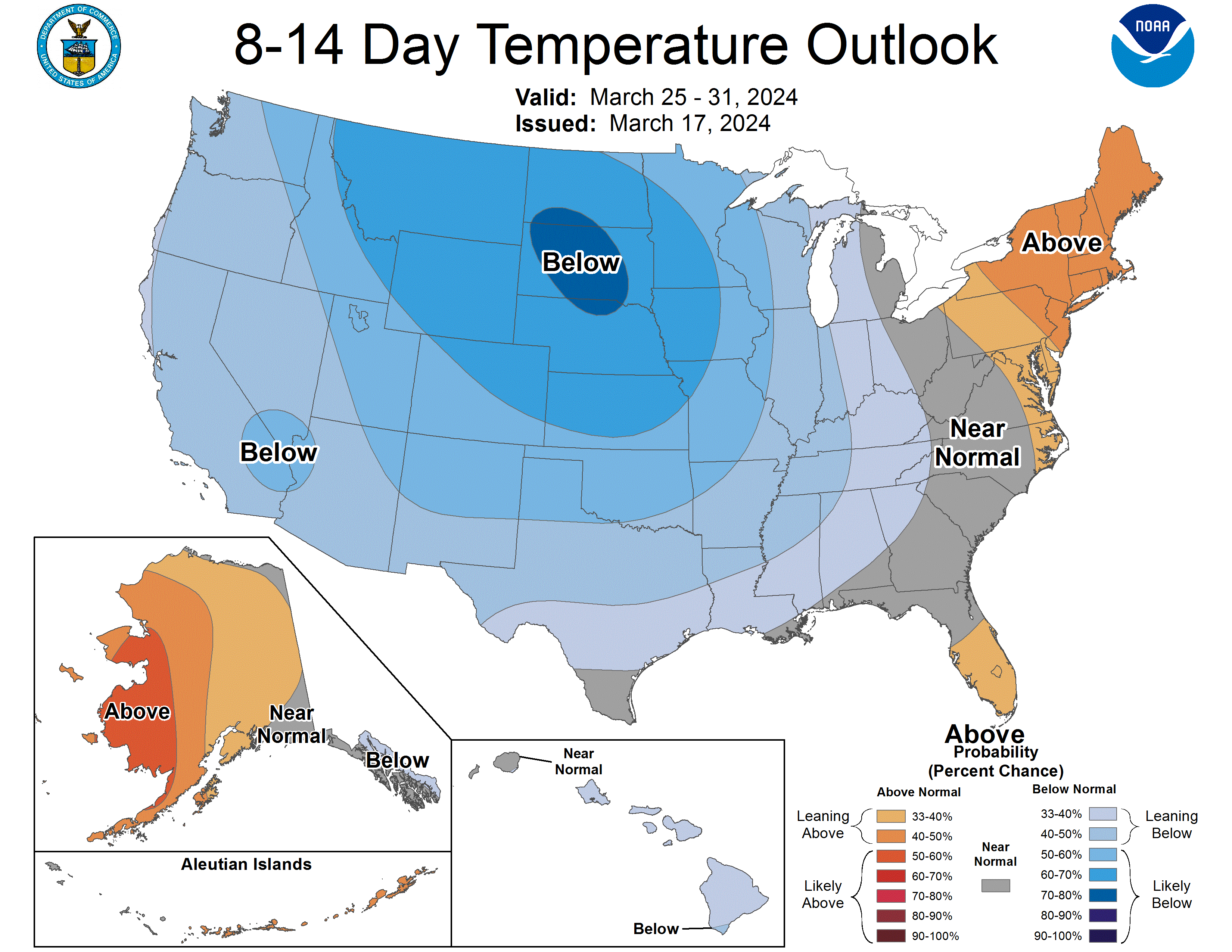
Colder temperatures coming: There will be cold air to work with and the last full week of March is going to be on the cool side with temperatures perhaps well below average at times.
General timing: The most likely period(s) of time for precipitation across the state will be Saturday morning through Monday.
What is uncertain
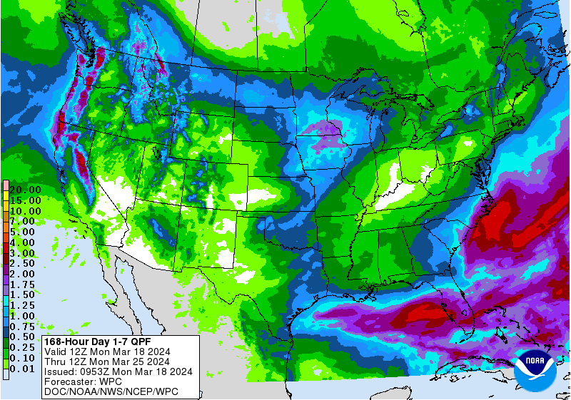
Amounts of precipitation: The WPC currently projects all of Nebraska and the greater region to receive moisture over the next week. The setup currently favored in the models would suggest higher amounts in eastern Nebraska and lower totals in the West Central and Panhandle regions of the state. Right now I would say an inch plus of moisture looks probable in the far eastern side of the state. But the track and intensity of the storm system could mean these totals are a low projection or too bullish. Thunderstorms would also be possible in eastern Nebraska on Saturday night into Sunday. In any event, the moisture would be welcome across all of central and eastern Nebraska and would be especially welcome in northeastern Nebraska.
Snow: The models have been hinting at decent chances of snow as we head into Sunday night and Monday morning across the northern half of the state, with highest probabilities of 3-6" of snow between Niobrara and Hartington. But there is a non-zero chance of 3-6" of snow as far south as the I-80 corridor from Grand Island to Omaha between Sunday night and Monday afternoon. Snow that falls in the overnight or early morning hours in late March will have a much higher probability of efficient accumulation than during the midday hours. Thus, the timing of snow that does fall will be important too. At the present time, this does not look like a significant blizzard risk. But travel on Sunday afternoon and Monday next week could absolutely be affected, particularly in northern sections of the state.
Severe threat: The SPC currently shows "Predictability too low" for severe weather this weekend in their convective outlook. But don't be shocked to see a severe thunderstorm and winter storm watches overlapping in parts of the Western Corn Belt this weekend if there ends up being a hail risk from elevated storms off a warm front. Also it will be possible that some places with a snow risk could get into the 60's for a period of time on Sunday before temperatures come crashing down. So be prepared for some temperature swings this weekend as well.
Eric Hunt, University of Nebraska Extension