The Deep Freeze
As of the current writing temperatures across the state are generally in the mid teens to low 20's with plenty of wind blowing snow around in areas east of North Platte. You missed out on the fun yesterday Panhandle residents! But this is a just brief little teaser for what is coming in a few days. A front will move through the state on Thursday morning bringing seasonally cold maximum temperatures in the mid to upper teens in eastern NE and 20's in western NE. Later on Thursday a storm system will develop just to our west and there will be sufficient moisture to bring snow to most of the state, with snowfall of 3-6" possible in east central and southeast NE. As a side note- this storm will really intensify once it gets to our (south)east so please be careful if you have travel over toward the Great Lakes on Friday. Blizzard conditions look likely in Chicago, Grand Rapids, and Milwaukee for example.
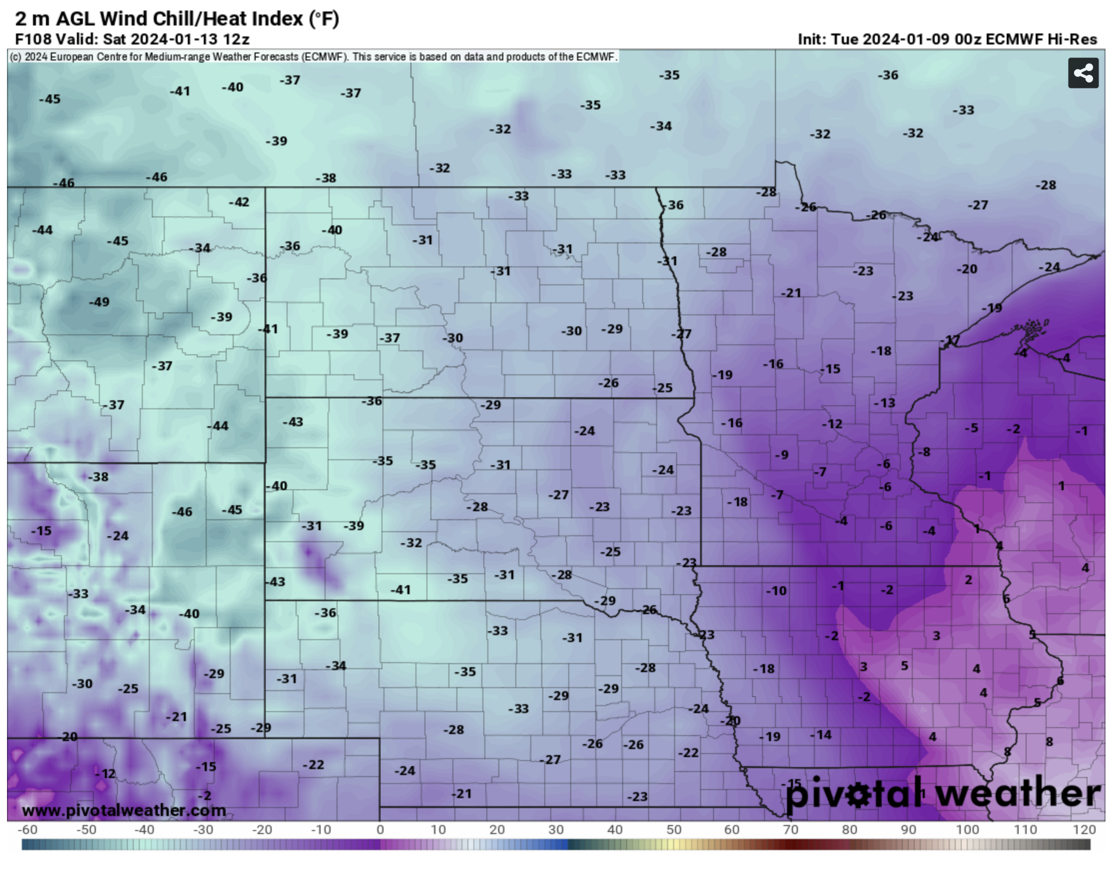
Be prepared for extreme cold
Behind the storm we will have even colder temperatures for most on Friday- with maximum temperatures around 30 in the highest elevations of the Panhandle, lower single digits in north central and northeast NE and upper single digits in the Omaha and Lincoln areas. Then the main arctic front starts entering the state Friday night and should clear the Missouri River by noon on Saturday. Wind chills could easily drop to 40 below in the Panhandle on Saturday morning and temperatures will drop below 0 everywhere in the state by Saturday afternoon. Winds will be quite strong behind the front on Saturday before backing off to more reasonable levels on Sunday and Monday. Nevertheless almost every one in the state can expect to have at least a few hours of 30 below wind chills and 40-50 below wind chills may be possible on Sunday morning in the eastern half of the state if winds are still a little strong.
The Panhandle and parts of the southwest should recover to the single digits on Sunday and into the teens Monday. But most of central and eastern NE are likely to remain below 0 all of Sunday and Monday. Eastern Nebraska is likely to remain subzero until closer to noon on Tuesday. All told some parts of north central and northeast NE are looking at upwards of 72-80 consecutive hours below 0. The I-80 corridor from Kearney to Omaha will likely remain below 0 for at least 36 consecutive hours and 48-60 hours of consecutive of subzero temperatures seems possible between Saturday and Tuesday. Daytime highs on Sunday in east central and northeast NE may struggle to get above 10 below. A thaw will begin on Tuesday with above freezing temperatures in the 30s and 40's across western NE , Grand Island should approach 20 and the extreme east should get back above 0. Wednesday looks nicer still with above freezing temperatures likely in central and western NE.
For a little fun trivia, 60-72 consecutive hours of subzero weather for places like Omaha, Norfolk, Columbus, Lincoln, Wayne, and Valentine is impressive but nowhere close to a record. We'd need it to be 180-210 hours to do that. We thankfully won't approach that level of brutal this time.
Eric Hunt, University of Nebraska Extension