


Preliminary damage from Friday coming in
Friday afternoon was a rough one in Nebraska and Iowa, with the Omaha are office issuing a record number of tornado warnings for a single day. Preliminary damage assessments are still coming in but as of now, we have confirmed EF3 damage in Lancaster County (Garner Industries building, northeast of Lincoln) and southwest of Elba in Howard County. Recommend going to the Hastings and Omaha NWS pages for the full report.
More storms coming
Today is a much nicer day across the state with mostly sunny skies and temperatures in the 60's. Exception is a small area of light showers around Gordon in the Panhandle. I hope you are enjoying it because tomorrow kicks off another active stretch of weather, especially for the eastern half of the state. The first potential round of severe weather is tomorrow afternoon when a line of storms may develop around Highway 81 and move east. High winds and hail are the main risks. The good news is that the storms are not likely to last long in any one place so flash flooding is a lower risk. There also is a possibility that the front will be moving through eastern NE a bit earlier and storms don't develop until western Iowa and far southeast Nebraska. This is suggested by the latest NOAA HRRR.
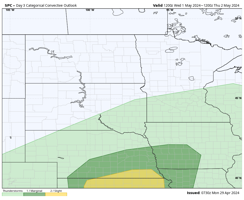
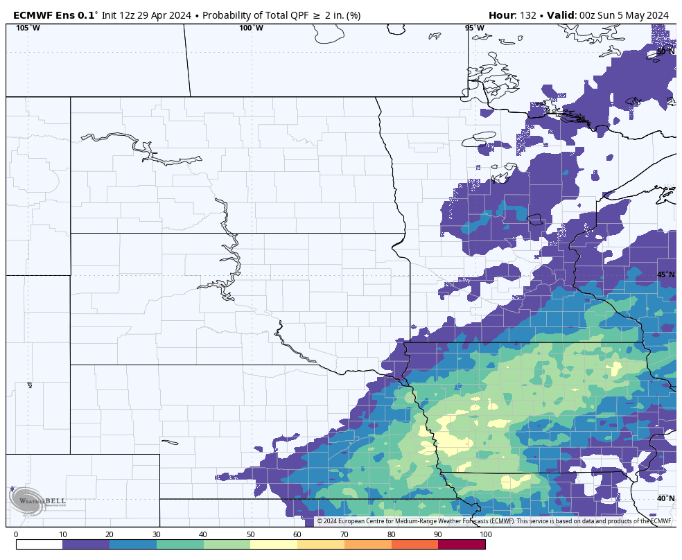
There is another chance of severe weather across the southern portions of eastern and central Nebraska later on Wednesday into Thursday morning. This is in response to another deeper longwave trough moving into the central U.S. and an associated surface low in western Kansas with a warm front extending along Highway 36. This is a good recipe for a large area elevated convection for the eastern half of the state. Biggest threat would be hail and the potential for flash flooding, especially between Holdrege and Columbus. Note that the WPC has put much of the eastern half of the state in the slight risk for excessive rainfall. Additional rain storms will be possible across the entire state this weekend and again early next week.
Eric Hunt, University of Nebraska Extension