No blizzards, wind chill warnings, snow squall warnings, or fog Sunday-Friday
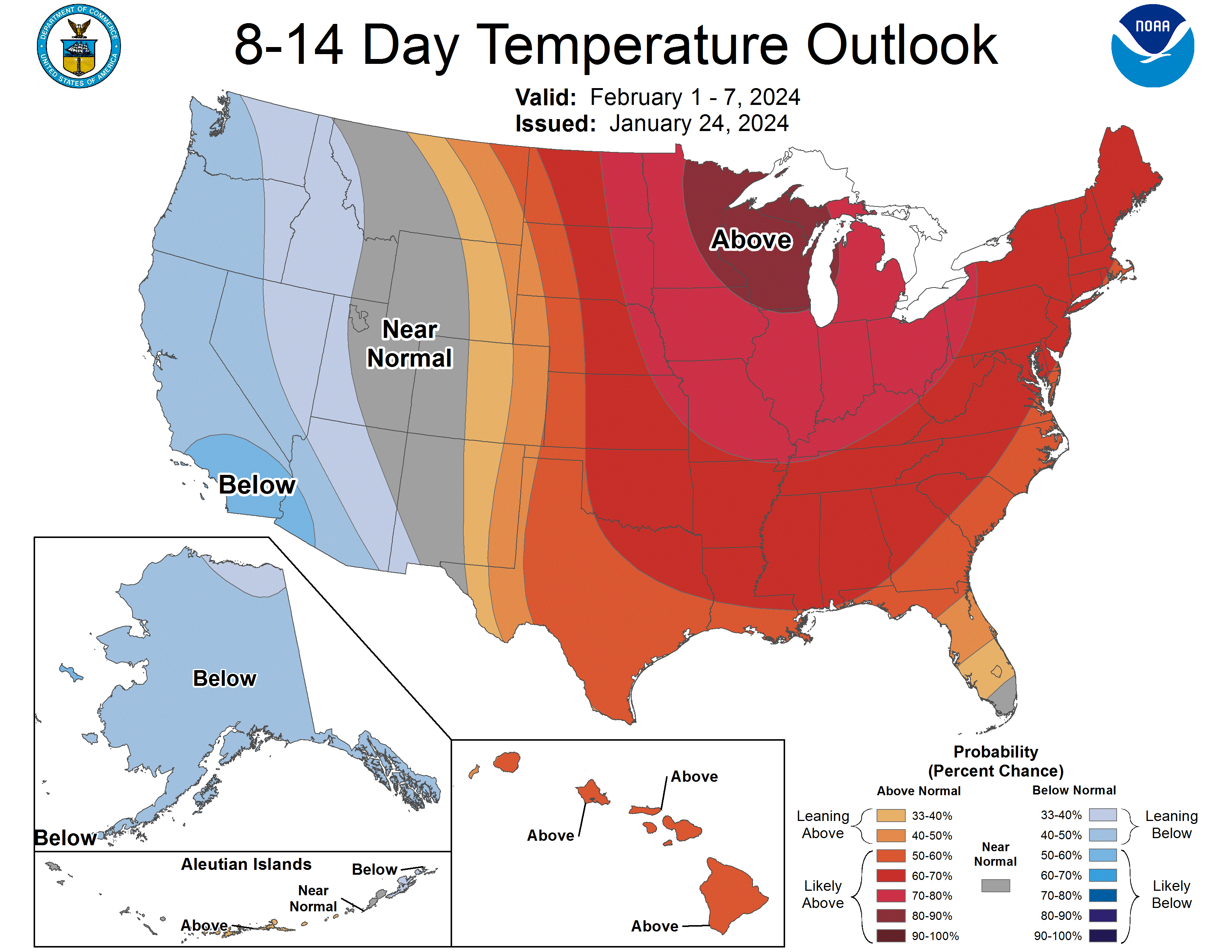
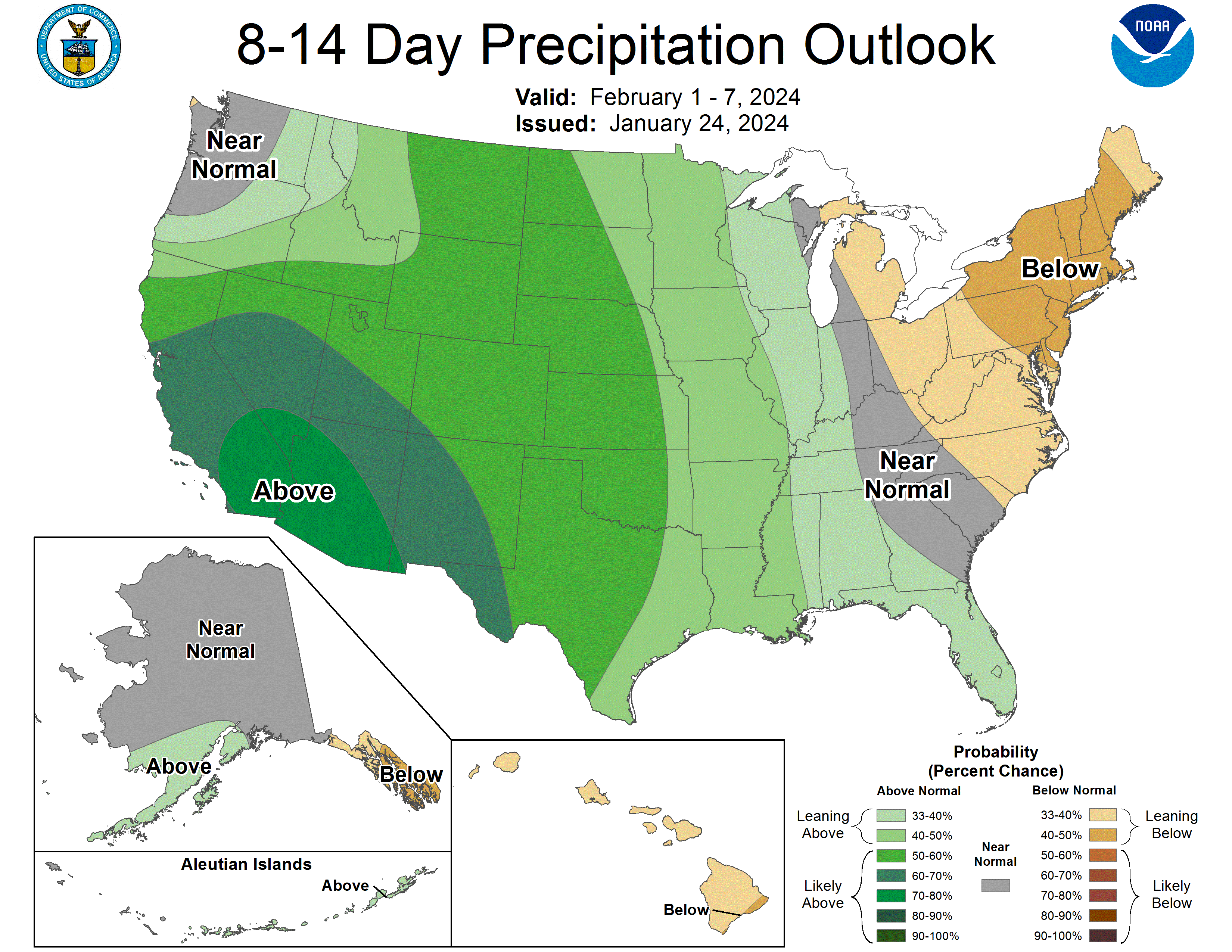
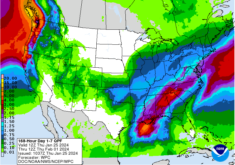
For residents of eastern Nebraska, the weather this week has been more like Groundhog Day. Fog in the morning and cloudy, damp, and 34 in the afternoon. Western and North Central Nebraska have had more sun, particularly the Panhandle. This will change this weekend as we get some drier and warmer air pushing in from the west. Matter of fact most of next week looks very quiet across the entire state with no precipitation expected anywhere between tomorrow morning and next Friday afternoon. With strong upper level ridging in place most of next week, we will have more sunshine and even milder temperatures than this week. Suspect most of the state, outside of maybe the northeastern corner, should have at least one day in the 50's. Can't even rule out 60 in some places near the Kansas border in south central or southwestern NE.
But nothing lasts forever and the quiet weather may be coming to an end by next weekend. Model run to run consistency isn't there yet but what is likely is a sharp trough will be moving into California next week and will work its way to the east. The big question is whether it moves more directly east and stays to our south (which still would give us clouds and wind) or does it move toward the northeast and give us a shot at precipitation and wind. Think we'll have a better answer on that by early next week. This storm system would not be drawing in arctic air so we aren't looking at a return to bitterly cold temperatures during the first week of February. Nevertheless, the setup could be favorable for snow next weekend across western Nebraska. In the eastern half of the state, precipitation would more likely be in the form of liquid and may make its way directly into the ground given that the ground isn't particularly frozen in areas where snow pack has been deeper.
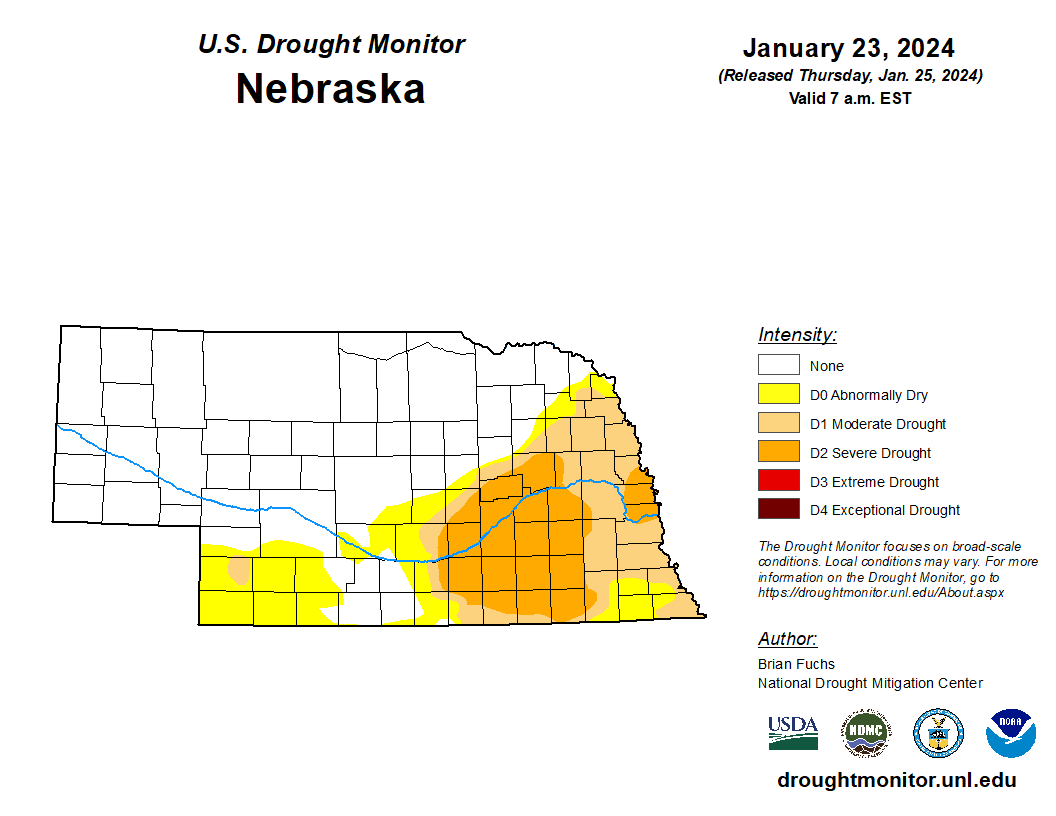
No more extreme drought
Earlier in the month we lost the last of the exceptional drought and now we have lost the extreme drought too. For the first time since the map from March 8, 2022, we have no extreme drought in this state. In case anyone is keeping score at home, the last time we were free and clear of all drought in the state was the map from June 9, 2020. Be nice to cross that threshold this spring. It's possible if we can keep getting storms rolling into our area of the country.
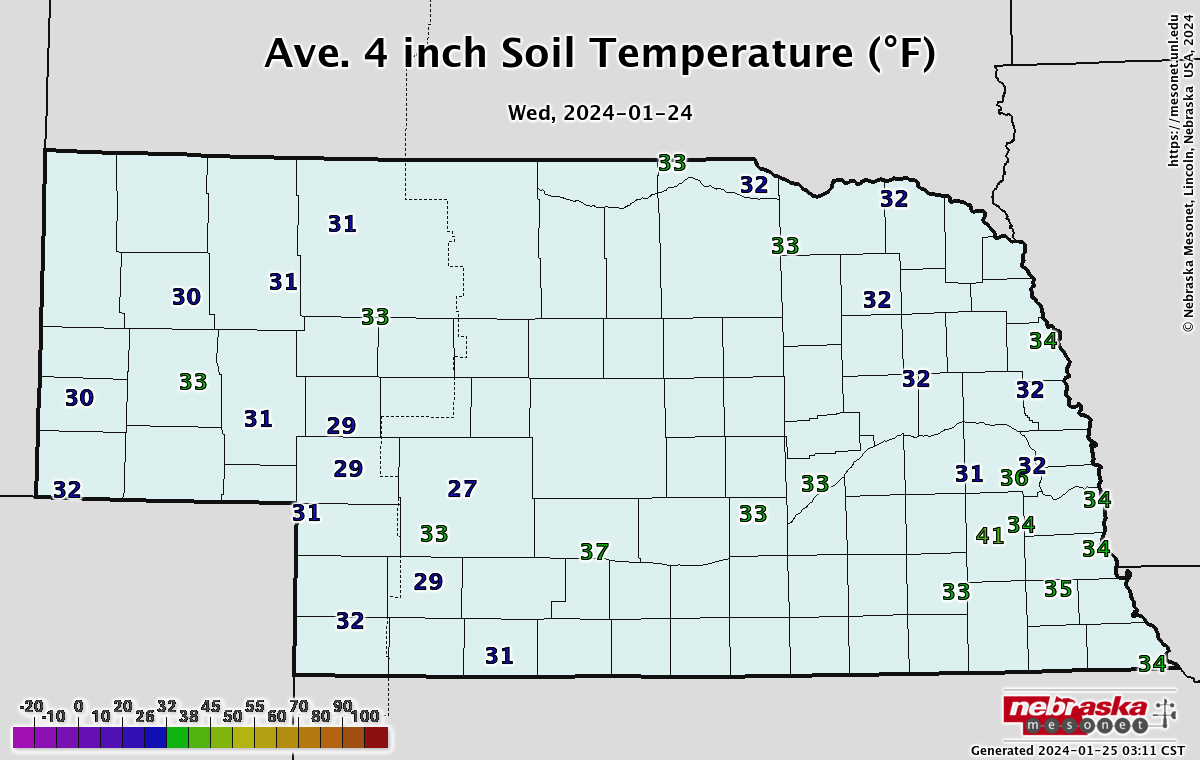
Ground not totally frozen?
A look at soil temperatures across the state continues to show unfrozen ground (at least at 4") across southeastern Nebraska and maybe marginally frozen ground across northeastern Nebraska. Even with a very cold 10-day stretch, the snow cover has kept those temperatures from dropping too much. Thus, don't assume that just because it was below 0 for three straight days that you have a deep frost layer. It's possible that frost doesn't extend more than an inch or two because of how warm December was and how much insulation much of eastern NE has had in the form of deep snow. In western NE where snow pack was less, soil temperatures are safely below freezing at 4" and at 8". Some locations in the Panhandle also show temperatures below 32 at 20".