
Drought Update
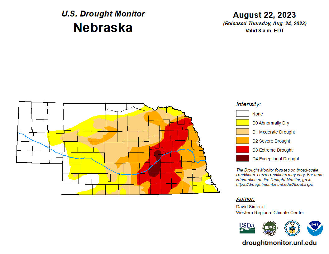
For the first time in several months, there were no changes on the United States Drought Monitor map. A bit over half the state is in drought with roughly 15 percent in extreme to exceptional drought.
Precipitation Update
With an historic ridge in place over the central U.S., most places in the state received no precipitation over the past seven days. Exception was in the Panhandle where most places picked up some rain and parts of Kimball County picked up over an inch. Precipitation should be plentiful across the southern part of the state this weekend with scattered showers elsewhere. The prognosis for precipitation in eastern NE doesn't look great after this weekend.
Soil Moisture Update
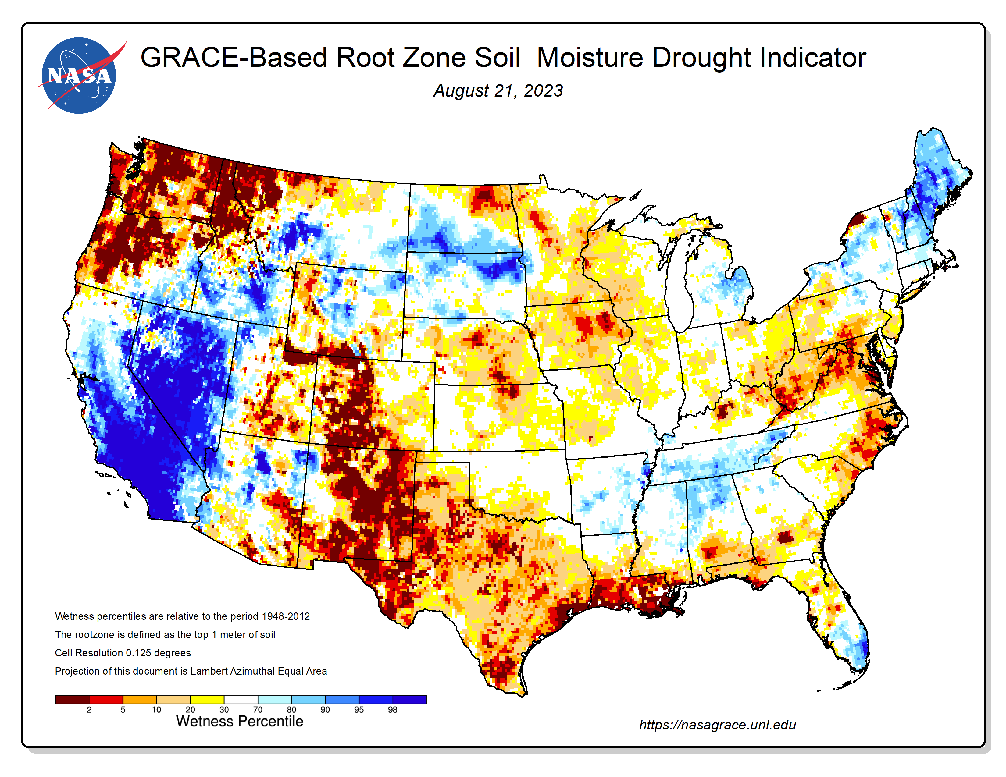
After several weeks where precipitation was falling and keeping at least the top part of the root zone sufficiently moist, Mother Nature has shut off the tap and it is starting to show in the root zone percentiles. The most recent product from NASA GRACE is probably a somewhat accurate reflection for much of the state. As I mentioned in the update last week, there simply hasn't been that much true deep moisture recharge. So now that we are drying out the top layer of the soil, our percentiles are going to start looking on the low side again.
.Vegetation and Crop Condition Update
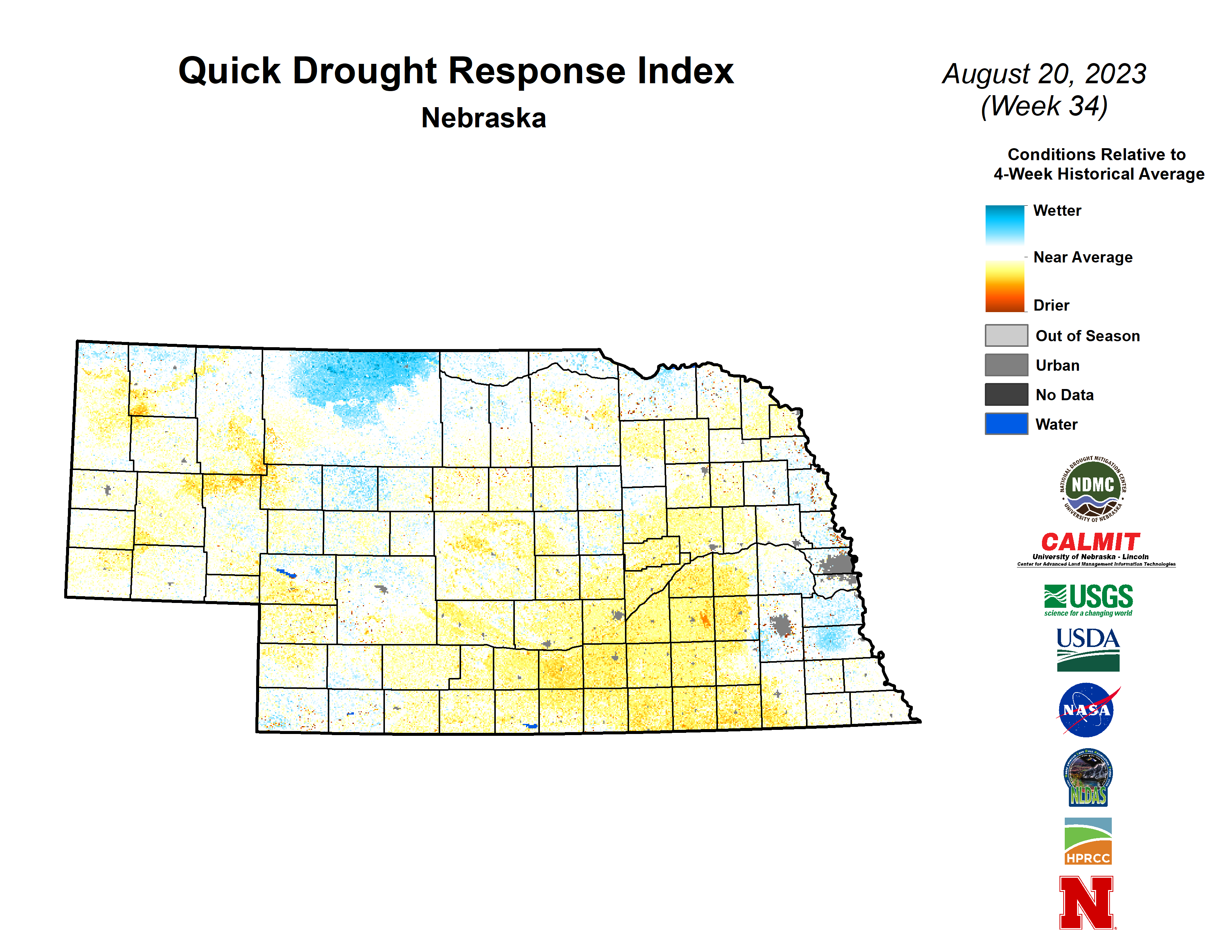
VegDRI continues to show the most acute dryness occurring from Grand Island to Seward and down to the Kansas border. QuickDRI also shows this same area as being stressed and also is picking up on the relative dryness across central Nebraska over the past 3-4 weeks. QuickDRI is depicting widespread moist conditions, reflective of healthy vegetation, across Cass, Otoe, and southeastern Saunders counties. Those areas have experienced very high dewpoints during the recent heat wave but generally have been under 100F for highs.
The most recent Crop Progress Report shows that corn is a bit ahead of schedule with 43% in the dent stage compared to the 5-year average of 36%. A very strong majority of corn (83%) is at least in the dough stage. Condition ratings as of Monday showed 61% good to excellent (G-E) and 18% poor to very poor (P-VP). The latter number will likely be higher on next Monday's report with this heat wave and the heat is definitely taking some of the higher end yield potential away at a minimum.
Soybean is a behind the 5-year average for pod setting (82%) and comes in with a condition rating of 58% G-E and 17% P-VP. The lack of rainfall in the last 10 days for most of the state is highly unfavorable for robust pod production on rainfed soybean crops and the heat isn't helping. Sorghum is checking in with 74% in G-E and 4 % P-VP and is about on track for heading (89%) and coloring (27%). Pasture condition ratings are about where they have been in recent weeks with 63% G-E and 8% P-VP.
Extreme Danger for Cattle
One of the many unfortunate outcomes of the heat this week has been the tremendous stress put on our livestock. While it has been hot everywhere statewide for most of the last week, save for last Sunday in parts of north central NE, the heat has been especially bad in the eastern NE where temperatures in the upper 90's to low 100's have been combined with dewpoints in the upper 70's to low 80's, sunny skies, and low winds. The cattle comfort index (CCI) takes all of these factors into consideration, as opposed to just temperature and humidity like the heat index, though the numbers look somewhat similar. Max CCI values have been crossing the extreme threshold (104F) routinely for much of the eastern half of the state since last Saturday and in southeastern corner, it has crossed into the "Extreme Danger" category on multiple days. The following Nebraska Mesonet sites have had at least 2 days in the extreme danger category on the Cattle Comfort Index over the last week: York 2W (4), Cook 4SW (3), Eagle 3NW (3), Firth 3N (3), Lincoln East Campus (3), Walton 5NW (3), Wilber 1W (3), Winslow 6E (3), Oakland 4W (2), Rulo 5SW (2), Scottsbluff 2NW (2).