Drought Relief
Significant precipitation fell over the state in the last week and we did see a large area from central into eastern Nebraska get a 1-category improvement on the U.S. Drought Monitor. This reduced the percentage of the state in severe drought from over 70 percent down to 48 percent. The percent of the state in extreme drought was effectively the same at around 8.5%. The improvement was partly due to the rain that fell on Monday, with much of the eastern half of the state picking up over an inch. Pockets of central and northeast Nebraska had a little over 2". The improvement was also attributable to seasonally robust precipitation that has fallen over much of southern and eastern sections of Nebraska since the end of October. Several places have had over 4.5" and isolated areas of eastern NE have picked up over 6". Soil moisture continues to improve in the southeastern quadrant of the state with many places back into the near-normal range according to NASA's SPoRT LIS model. Still a ways off being fully recharged but this is a big improvement over a month ago. Unfortunately, this moisture has mostly missed the most drought plagued areas of the Panhandle. Long way to go before the drought is over in that region.
Football forecast
Conditions look pretty decent for a late November football game. At kickoff temperatures should be in the mid to upper 50's, skies should be mostly sunny, and wind speeds should be around 10 mph out of the south. Not t-shirt weather but certainly not bad for late November. Bigger question is will Nebraska finally beat their nemesis and end their bowl-less streak. We think Nebraska plays hard and gets the job done on the field Saturday afternoon and prevails in four sets at Devaney against Wisconsin on Saturday night.
Cooler temperatures
Temperatures will be pleasant this weekend across the state with temperatures exceeding 50F statewide and likely getting into the 60's in parts of western Nebraska tomorrow and Saturday. A cold front will be moving through on Sunday night into early Monday morning, which will bring a shot of seasonally cool air into the state. Coldest temperatures will be found across northeastern Nebraska where highs may struggle to get above freezing on Monday. Temperatures will moderate a little bit on Tuesday but still staying just slightly below seasonal levels. There will be a slight chance of precipitation along the front on Monday morning and again on Tuesday in eastern Nebraska. Speaking of cooler temperatures, we finally are at a point where our soil temperatures at 4" are routinely staying under 50F.
I'm dreaming of a White Thanksgiving?
By Wednesday our attention turns toward a system moving from the western U.S. and out into the Central Plains. This does not look to be a particularly potent storm system and it won't be working with a significant amount of Gulf moisture in our area. Nevertheless, this will be worth watching because it will have cold air to work with and because of the timing could be problematic for travel. In other words, there is a non-zero chance of light snow falling across the state during the day on Thanksgiving and Friday morning. The WPC shows around a tenth of an inch is probable for most of the state between Wednesday night and early Friday morning.
The last few ECMWF ensemble runs show a chance of up to 3" falling in the I-80 corridor during this time period and a greater chance for more snow further east into Iowa and Illinois. Given the colder temperatures, it is likely that precipitation would fall as snow across most of the state, though it may mix with rain in the far southeast part of Nebraska. But there is some chance that this system dives a little further south and precipitation misses most of Nebraska entirely. Recommend checking the forecast on Sunday and Monday as details will be much more clear by then. There is a chance this could be an impactful system with regard to travel on Turkey Day into Friday morning.
Cold as ice
The coldest air of the season arrives after Thanksgiving with temperatures likely staying below freezing for high temperatures statewide next Friday and Saturday. Exception would be the southwest Panhandle. High temperatures in eastern Nebraska may struggle to get out of the mid 20's next Friday. Low temperatures likely will be in the teens next weekend with single digit low temperatures being probable along and north of Highway 20. Temperatures should start to moderate to more seasonal levels by Sunday in western Nebraska and further east by Monday. CPC is bullish on cold in our region during the time period and pretty much all model runs show at least 2-3 pretty chilly days. This does not appear to be a prolonged cold snap but it does appear that we may have more frequent cold fronts coming into the region in early December. This will mean oscillating back and forth between relatively mild and relatively cold with neither being dominant. Regardless, the persistent warmth we have had this fall appears to be coming to an end.
Temperature and Precipitation Roundup
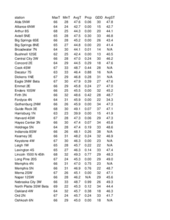
Below are the temperature and precipitation extremes around the state over the past week:
Maximum Daily High Temperature: 71F, North Platte Regional Airport
Minimum Daily High Temperature: 37F, Bushnell 15 S
Minimum Daily Low Temperature: 10F, Harrison 20 SSE
Maximum Daily Low Temperature: 50F, Falls City Airport
Max Weekly Precipitation: 2.24", Hubbard 3.1 SW
Max Weekly Snowfall: 0.1", Concord
Eric Hunt, University of Nebraska Extension
Camille Shifrin, Nebraska State Climate Office


