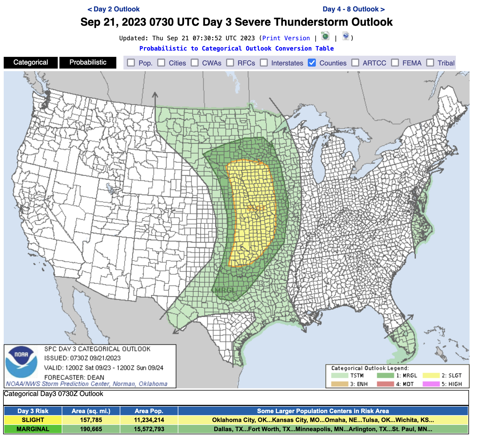
Bottom Line Up Front
Anyone with outdoor plans on Saturday afternoon in eastern Nebraska should pay close attention to the weather. This includes a football game in Lincoln with 84 thousand friends. It's too early to pinpoint exact details and timing but there is a risk of severe storms, primarily hail and high winds in the eastern third of the state between 2PM and 8PM.
Details
A potent upper level storm storm will move into the northern Plains on Saturday with a surface cold front oriented in a north-south manner trailing behind it. Ahead of it there will be decent low-level moisture in place and there will will be wind shear necessary for the potential for severe thunderstorms. At this time, this is not expected to be a highly significant severe weather event (i.e., not expecting a major tornado outbreak) and there is still uncertainty as to the timing and exact locations that are most likely to get heavy storms. What happens Friday night may have an impact on Saturday too. If there is widespread convection early on Saturday morning in our area, then we will need to watch what happens with outflow boundaries and how long clouds hang around that would decrease instability.
Eric Hunt, University of Nebraska Extension and Nebraska State Climate Office