Frozen mess possible
Tomorrow afternoon and evening could be interesting for much of the eastern portion of the state. A modest area of high pressure to our east will help keep winds easterly and colder air in place at the surface statewide while a shortwave moves out of the Rockies and into the Southern Plains. The latter should allow for moisture to stream up from the south into the state, which will keep a low deck of clouds in place during the day and likely will allow for the formation of drizzle across northern Kansas and the southeastern quadrant of the state by late afternoon and spreading further north in the evening hours. The big question is air temperature.
The GFS and ECMWF show temperatures being above freezing in the I-80 corridor at the onset of any precipitation in the late afternoon hours and below freezing to the north. The high-resolution models (HRRR and NAM) keep the colder air locked in longer, which would mean an extensive period of freezing drizzle for all of eastern NE, not just northeast NE, on Friday night into very early Saturday. Travelers coming into Lincoln for the volleyball match on Friday night should be aware that untreated surfaces may be slick. Most indications currently show precipitation picking up intensity and changing over to all rain in southeast Nebraska on Saturday morning and remaining a mix of freezing rain and sleet in northeast Nebraska. Some snow will be possible a bit further west over toward Highway 281. A quarter to half inch of rain will be possible from Lincoln down to Falls City and ice accumulations of 0.2" will be possible between Highway 30 and Highway 20 in northeast NE. The western half of the state will miss out on most if not all of this moisture. No one wants ice but additional moisture would sure be nice in areas still stuck in extreme drought.
I think it will be more apparent by tomorrow morning whether we are looking at drizzle or freezing drizzle and a period of freezing rain in the I-80 corridor on Friday night. The location of the area of high pressure would favor keeping sub-freezing temperatures in place until at least 7PM, which would mean at least a 2-3 hour period of freezing drizzle. Temperatures at noon tomorrow will be telling. If it's closer to 30 in Omaha and Lincoln (as suggested by the GFS and ECMWF), we're likely out of the woods. If it's still stuck around 23-25F (as the NAM would suggest), then it's likely those areas are going to remain below freezing into Saturday morning. The threat of ice is less toward the Kansas border but even areas along Highway 136 in southeast Nebraska should be prepared for possible slick spots tomorrow afternoon.
Moderating temperatures
Upper level ridging will be overhead by Saturday afternoon, which will help bring more seasonal temperatures for everyone on Saturday and mild temperatures on Sunday. Temperatures over 50F are a good bet in western and southern sections of the state and should easily get to 45F in northeast Nebraska. That may qualify as a heat wave up there after the last few days. Temperatures should remain mild through early next week statewide. Another trough will move into the upper Midwest on Tuesday, which will drive a cold front at the surface into the state. Temperatures will drop back to seasonal levels in the lower to mid 30's in eastern Nebraska and between 35-45F in the western half of the state on Wednesday and Thursday. Temperatures being moderating again on Friday and should be in the 50's by Saturday across the Panhandle.
A Green Christmas?
The projected upper air pattern next week will put us in northwest flow between ridges and troughs. This is not a conducive pattern for meaningful precipitation in this part of the country so expect dry conditions to prevail next week. The CPC suggests warm and dry conditions in the week leading up to Christmas are very likely as well. This is not good news for areas of northern and western Nebraska that really need moisture. It also means that betting money on a White Christmas isn't likely to end up working in your favor. There are hints of something possibly brewing right after Christmas for the central U.S., followed by a shot of much colder air. The return to cold temperatures after Christmas would seem the more likely of the two coming true given the phase of the MJO. I'm more skeptical of significant precipitation. But it is something to watch for sure, especially given travel schedules during that time of year.
Last update of 2024
I will be starting vacation at the end of next week. Thus, this is my last update for 2024. Look forward to providing useful content for you all in 2025.
Temperature and Precipitation Roundup
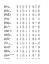
Below are the temperature and precipitation extremes around the state over the past week:
Maximum Daily High Temperature: 69F, Ord Evelyn Sharp Field
Minimum Daily High Temperature: 17F, F Springview 2NW
Minimum Daily Low Temperature: 5F, Concord 2E Mesonet
Maximum Daily Low Temperature: 39F, Falls City Brenner Field
Max Weekly Precipitation: 0.11", Pierce
Max Weekly Snowfall: 1.5", Gordon 2 E
Eric Hunt, University of Nebraska Extension


