Blizzard and the Polar Vortex does yoga
Unfortunately the first half of the headline isn't talking about a treat at Dairy Queen and the polar vortex stretching means someone is in for very cold temperatures. That someone is the north central states.
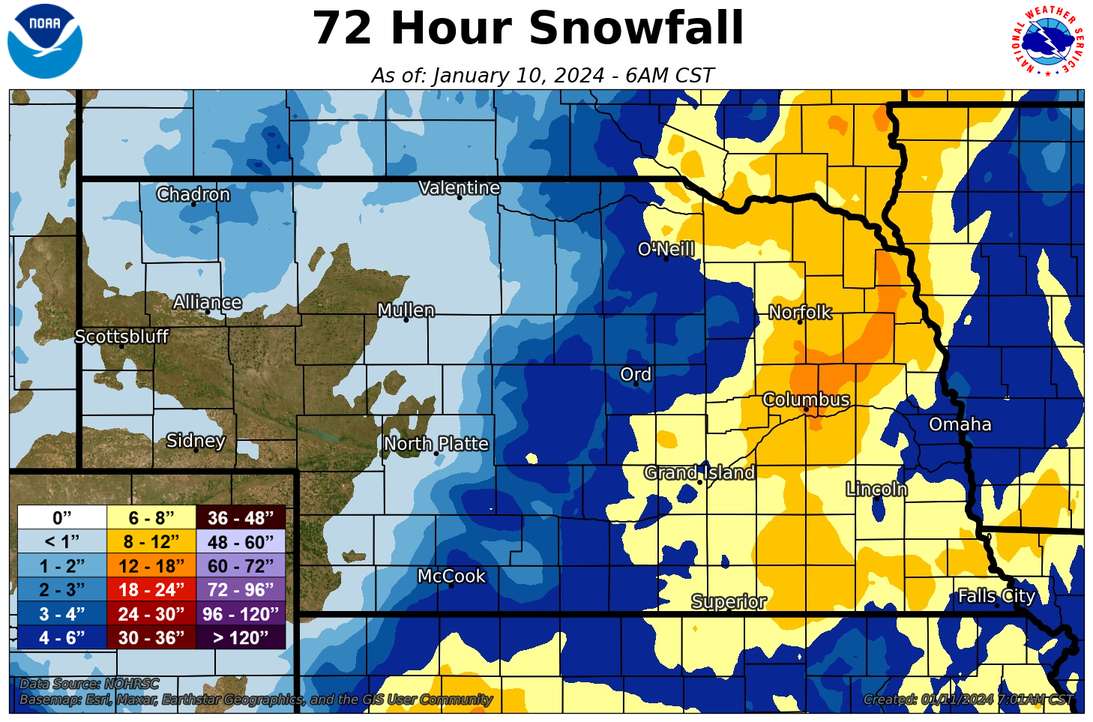
Things appear to be coming together for a relatively short, but intense, round of snow overnight followed by higher wind speeds. Other than the Panhandle, most of the state should get some snowfall with increasing amounts as you go east. Snowfall totals over 4" are likely everywhere east of Grand Island snowfall totals of 6-10" are possible across east central Nebraska. Winds will also be gusty by early Friday morning and a blizzard warning has been issued for the northeastern corner of the state by the Sioux Falls office. It's possible Omaha/Valley may upgrade some of their forecast area to a blizzard warning too.
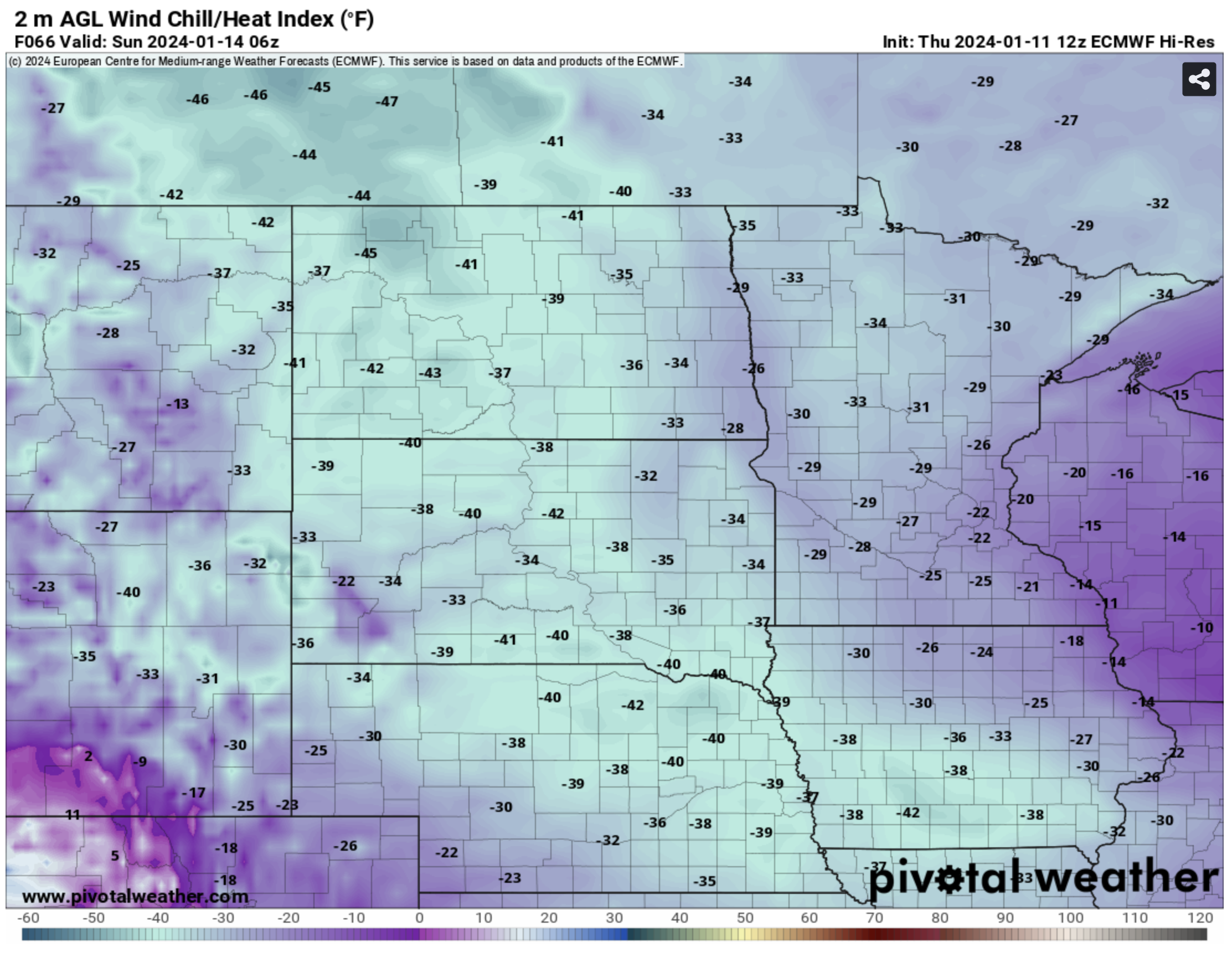
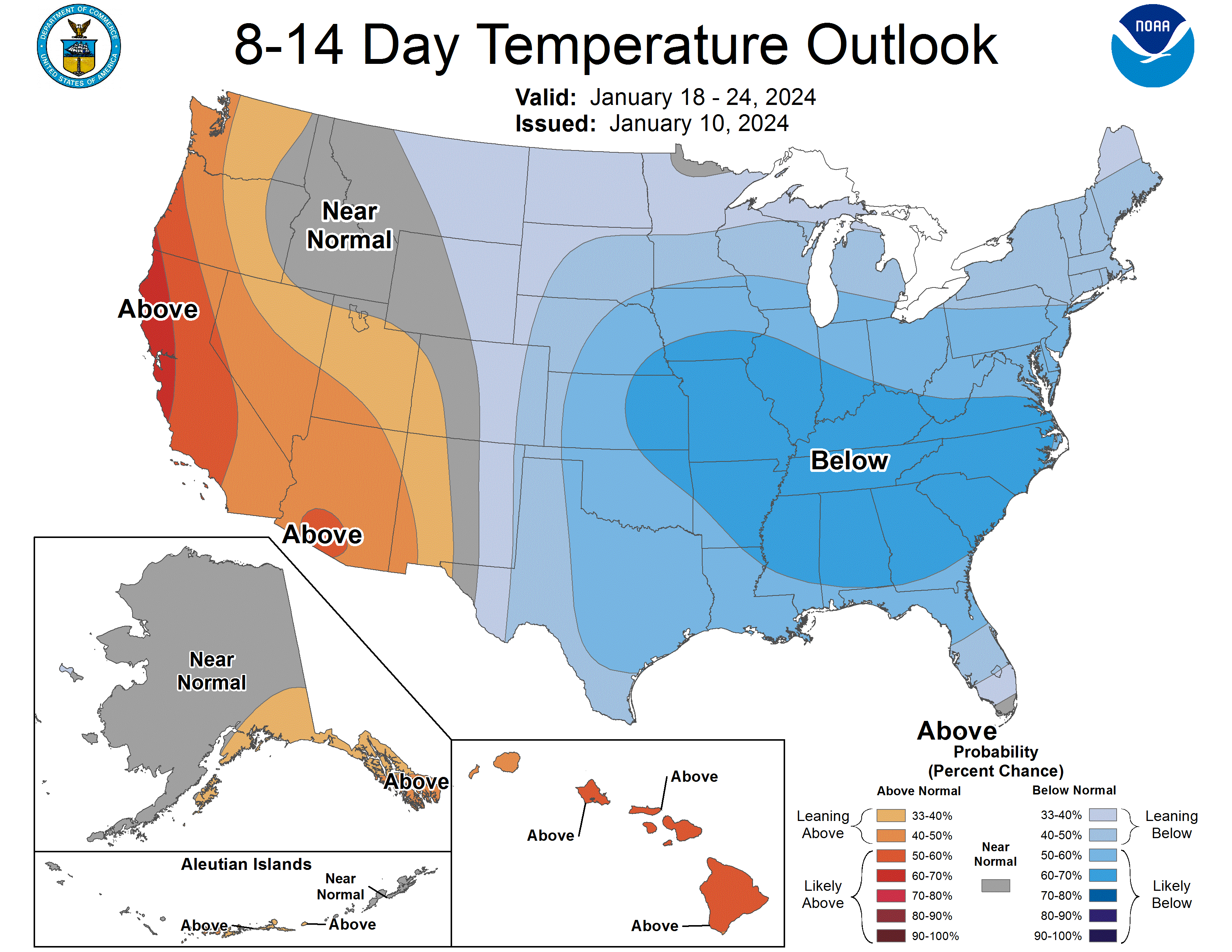
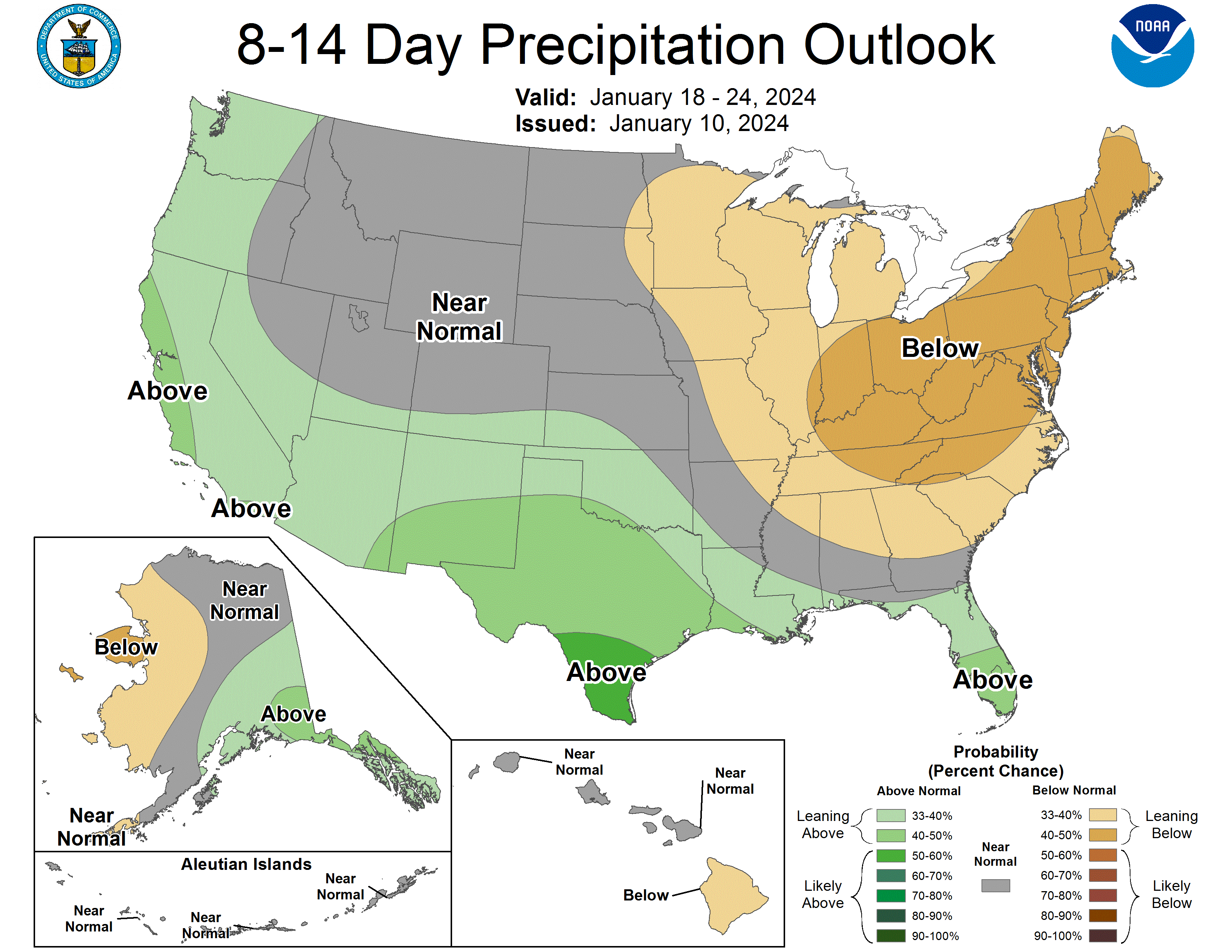
After the snow is finished tomorrow morning, the focus turns toward the beginning of a prolonged cold snap, especially for the eastern half of the state. For the Panhandle this won't be quite as bad but wind chills will still be very cold on Saturday and Sunday mornings. Expectation for a prolonged period of subzero temperatures still looks like a good bet in north central, northeast, and east central Nebraska. Places like Hartington, Niobrara, and Concord can expect up to 100 consecutive hours of subzero temperatures. Further south toward I-80 it could easily get in the 72-84 consecutive hour range if we manage to stay below 0 on Monday. Things moderate a little bit Tuesday and then more so on Wednesday. There's a reasonable chance areas south of I-80 and west of Grand Island get into the 30's and 40's on Wednesday. With the polar vortex stretching another round of very cold air appears likely late next week, especially for eastern Nebraska. This doesn't look like subzero highs cold but I wouldn't bet on it being much above 10 next Saturday in the eastern third of the state. Temperatures look more seasonally cold in the West Central and Panhandle sections. There are periodic chances for snow later this weekend in the Panhandle but nothing too significant. Moisture in that part of the state would be welcome.
Drought Update
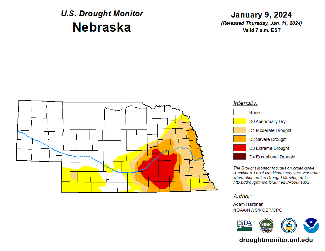
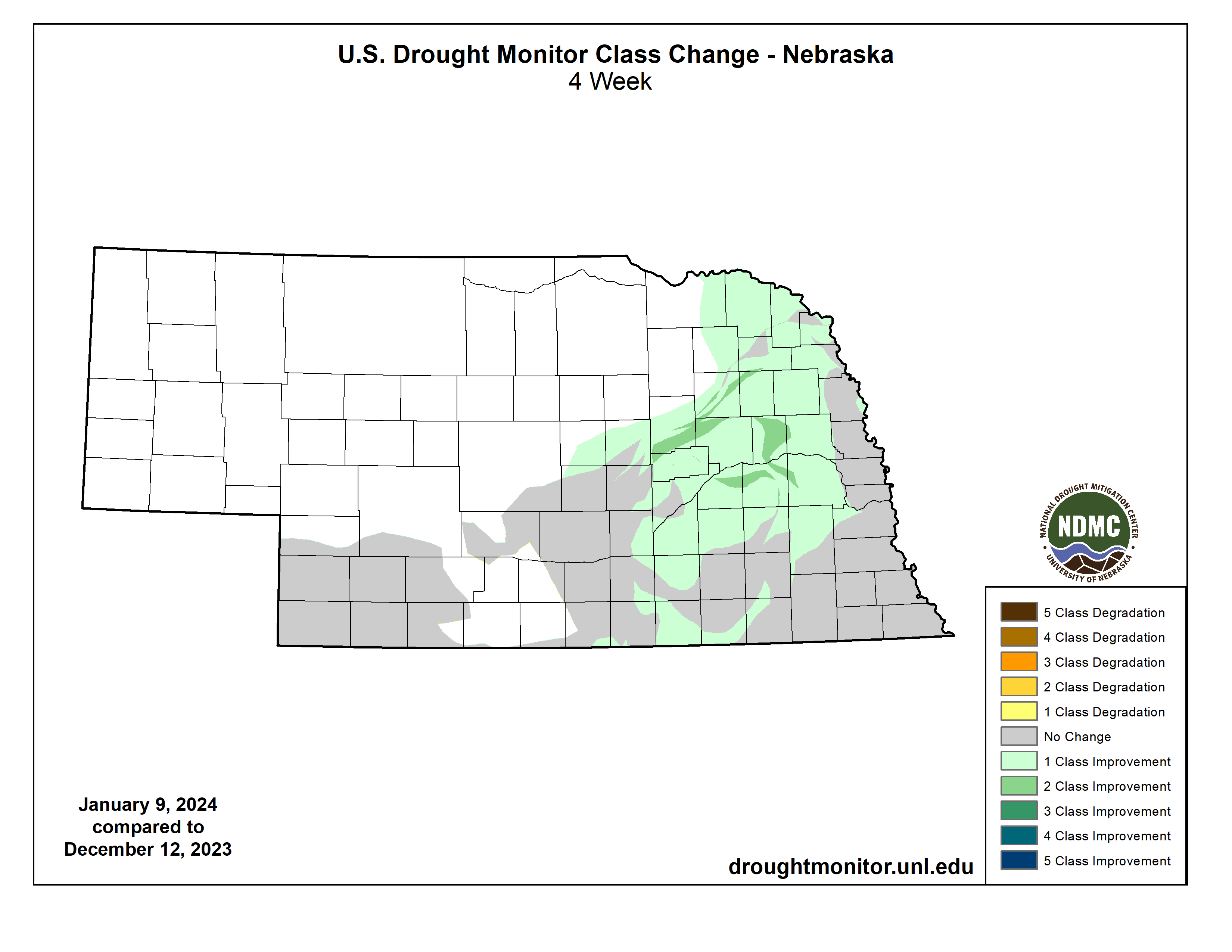
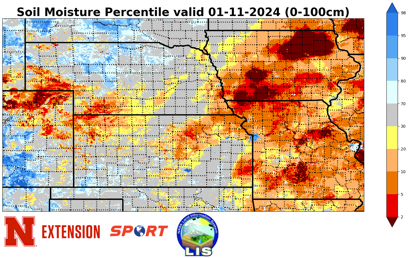
The wet snow we had earlier this week across the eastern 2/3 of the state was needed moisture and in some cases helped improve conditions on the latest U.S. Drought Monitor. The best news is the last remaining area of exceptional drought (D4) in Butler County has been upgraded to extreme drought (D3) so for the first time since July 26, 2022 we have no D4 in the state. And to celebrate Mother Nature is giving us a blizzard and ideal weather for polar bears.
Precipitation Update
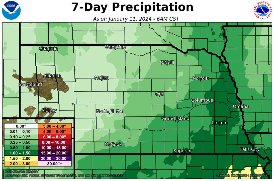
Most of the state received some moisture (sorry Scottsbluff!) but precipitation amounts over an inch were realized in parts of eastern Nebraska. In areas along and north of Highway 30 where air temperatures were slightly colder and all snow accumulated, upwards of a foot of snow fell. In theory, this will be good moisture for the top soil later this winter or early spring, which would be welcome news after spring 2023.
Eric Hunt, University of Nebraska Extension