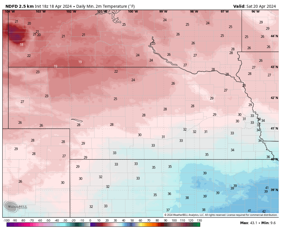

Cool spell and more snow for the Panhandle
We are in day 1 out of 4 of temperatures being below average as a broader trough slowly makes its way through he central and eastern U.S. The good news is we aren't talking about record cold but it still will be cool, especially in western Nebraska where there will be more extensive cloud cover and chances for precipitation. A frontal boundary will more or less be stalled somewhere between northern CO and the southern Panhandle and with some moisture advection into the region, precipitation is likely tomorrow and Saturday morning from Kimball to Ogallala and down into northwest Kansas. A period of moderate snow is possible Saturday morning in these areas, with 2-4" possible in Sidney and Big Springs.The rest of the state can breathe a sigh of relief as no snow is expected outside the southern Panhandle and Southwest corner. But highs on Saturday are going to be generally in the 40's west and upper 40's to low 50's east. Furthermore, sub-freezing temperatures are likely statewide in the mornings, with the exception of the far southeast, where it is a bit more questionable. The current forecast shows temperatures dropping into the 20's north of the Platte on Saturday and Sunday mornings and in the low 30's south of it. This is not likely to be a long duration freeze in eastern and southern sections of Nebraska . But it may be problematic for sensitive vegetation that thought it was June already.
Warmer weather returns
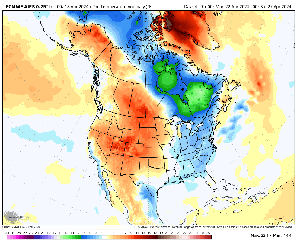
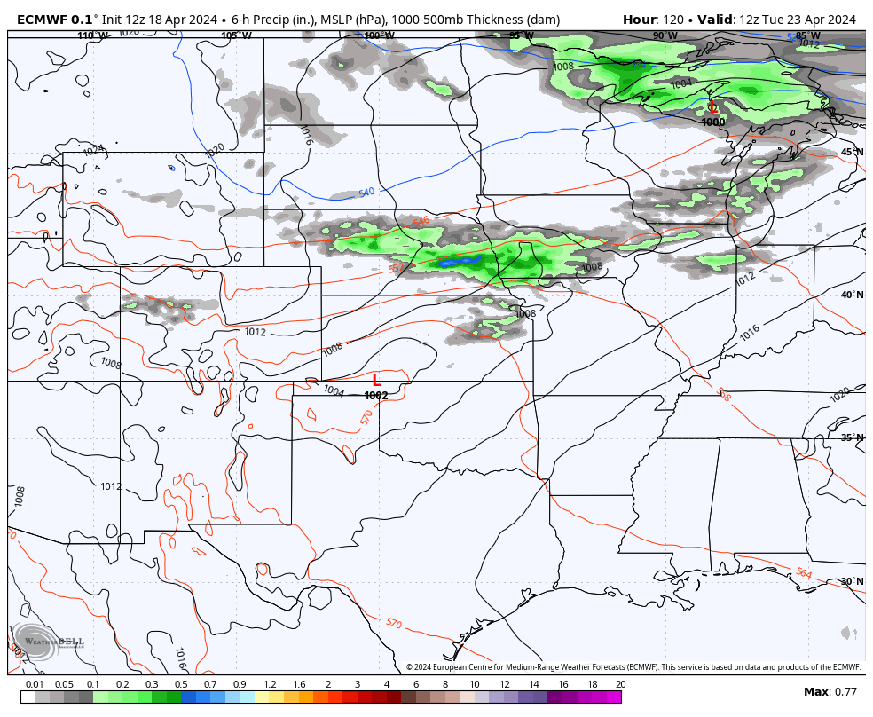
Upper level ridging starts to return by Sunday afternoon with a nicer day to end the weekend. Temperatures should bump up another 10-15F on Monday, with most of the state seeing highs in the upper 60's to mid 70's. A cold front is likely to move through the state by Tuesday morning, which will temporarily bring temperatures back to more seasonal levels in the 60s. It also looks increasingly likely that the I-80 corridor in central and eastern Nebraska will have a period of showers and scattered thunderstorms. Rainfall is not expected to be significant but a half inch would be possible in Columbus, York, Lincoln and Omaha. After the brief shot of cooler air and moisture, temperatures look to return to the 70's statewide from Wednesday-Friday. A high of 80-82 would be possible across the Kansas border in this period. Nighttime temperatures are expected to be seasonal and pleasant. No additional freezes are likely next week. Planting windows should be reasonably open later next week.
Storms next weekend?
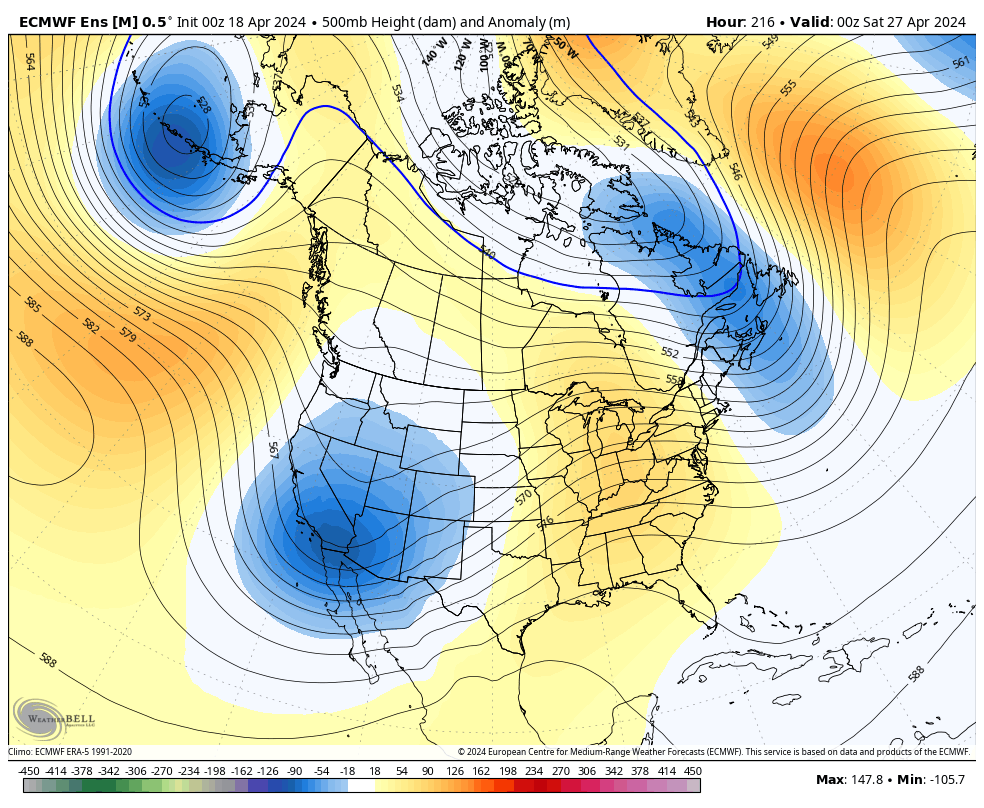
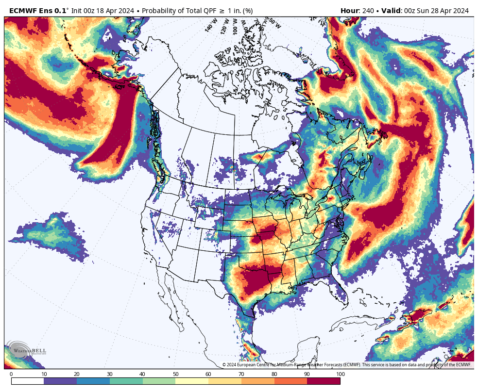
By the end of next week, we will be turning our attention to another sharp trough entering the southwestern U.S. Exact details, including how quickly it fully ejects into the central Plains, are a bit uncertain at this point. But there will certainly be periodic chances for rain and thunderstorms starting Friday night. Severe weather would certainly be possible next weekend in central and eastern NE as would the potential for heavier rainfall. The current prognosis from the ECMWF Ensemble shows that an inch of rain over the next 10 days (much of which would be next weekend) is likely in eastern and northern sections of the state and possible in the southern sections of the state. Recommend paying attention to the forecast carefully by late next week but I wouldn't cancel outdoor plans for next Friday night or Saturday just yet.
Moisture and drought update
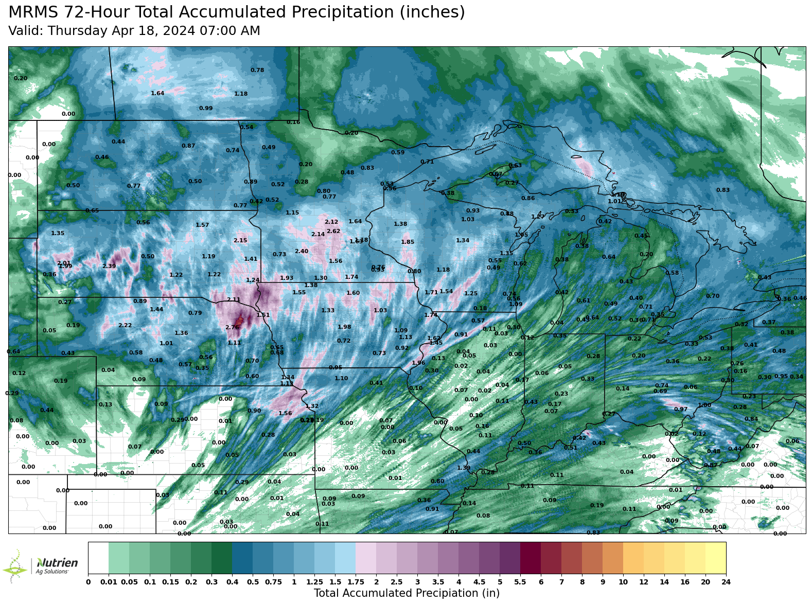
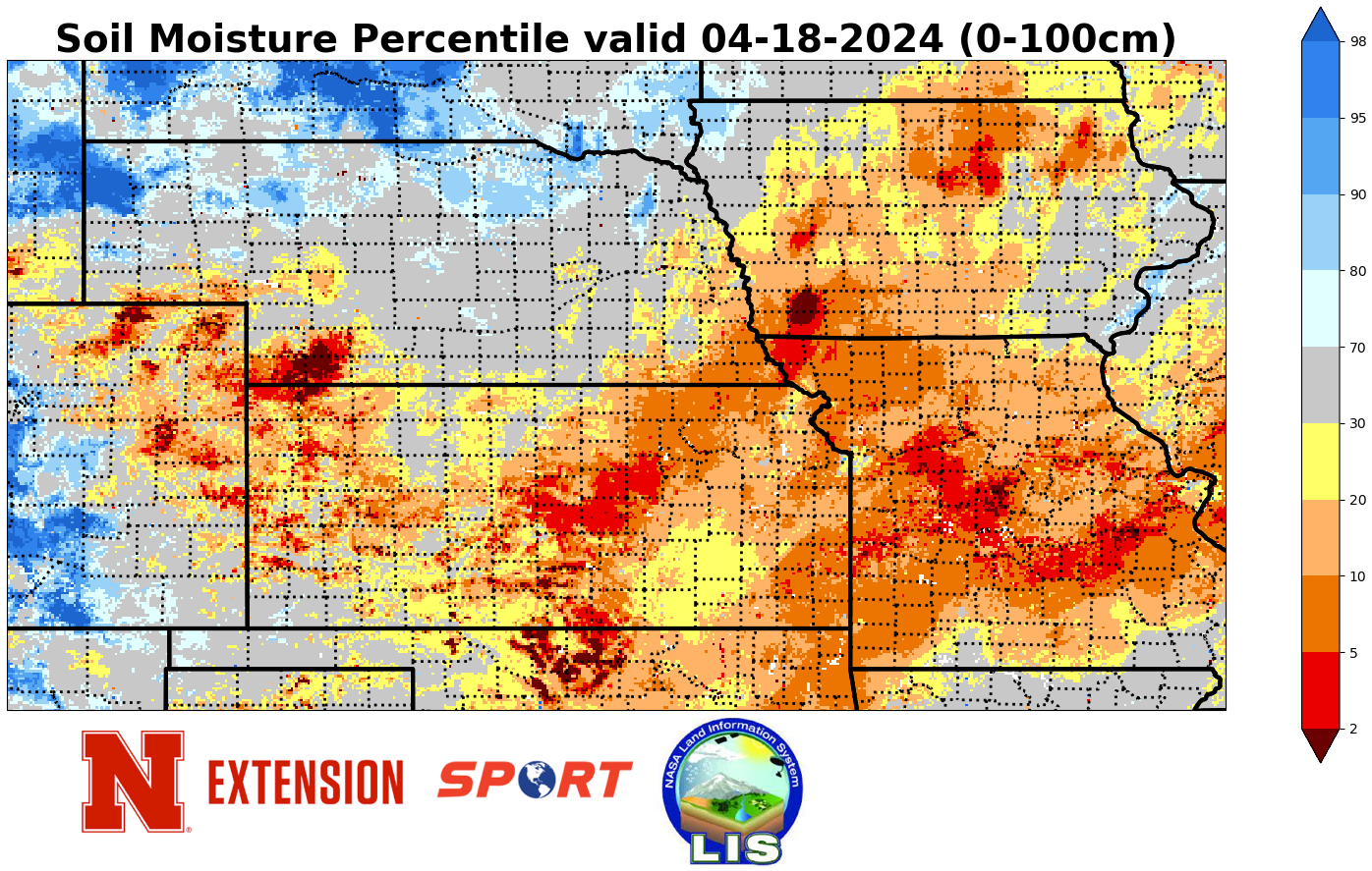
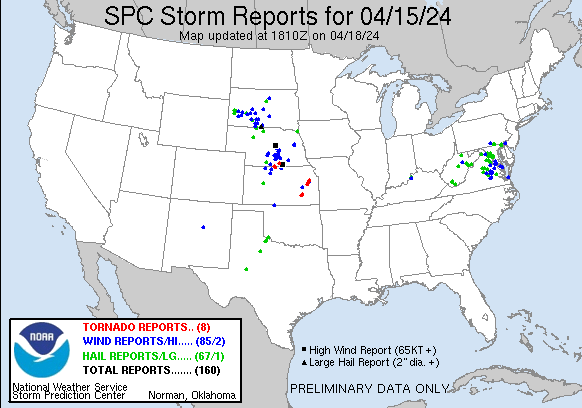
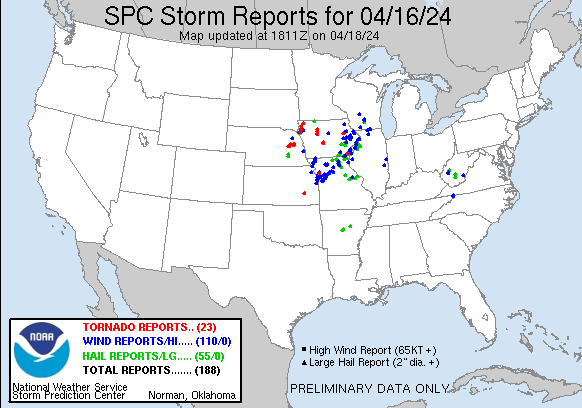
Most of the state saw some moisture over the past week (sorry far SW) but it was certainly not evenly distributed. Heaviest precipitation was confined to northeast corner of the state where amounts in excess of 2 inches were common and some locations in Wayne and Cedar counties picked up over 4". Elsewhere amounts were generally between 0.5"-1.25". This moisture was welcome but in areas where amounts were under an inch, it didn't make a big improvement in soil moisture percentiles compared to a week ago. Of course, the first part of the period was very warm and breezy so the improvement compared to Monday was more meaningful. There was also some severe weather in south central Nebraska on Monday evening with a brief tornado touchdown in Webster County. There was a bit more on Tuesday in the area close to the main surface low, with tornado reports in Platte and Colfax counties.
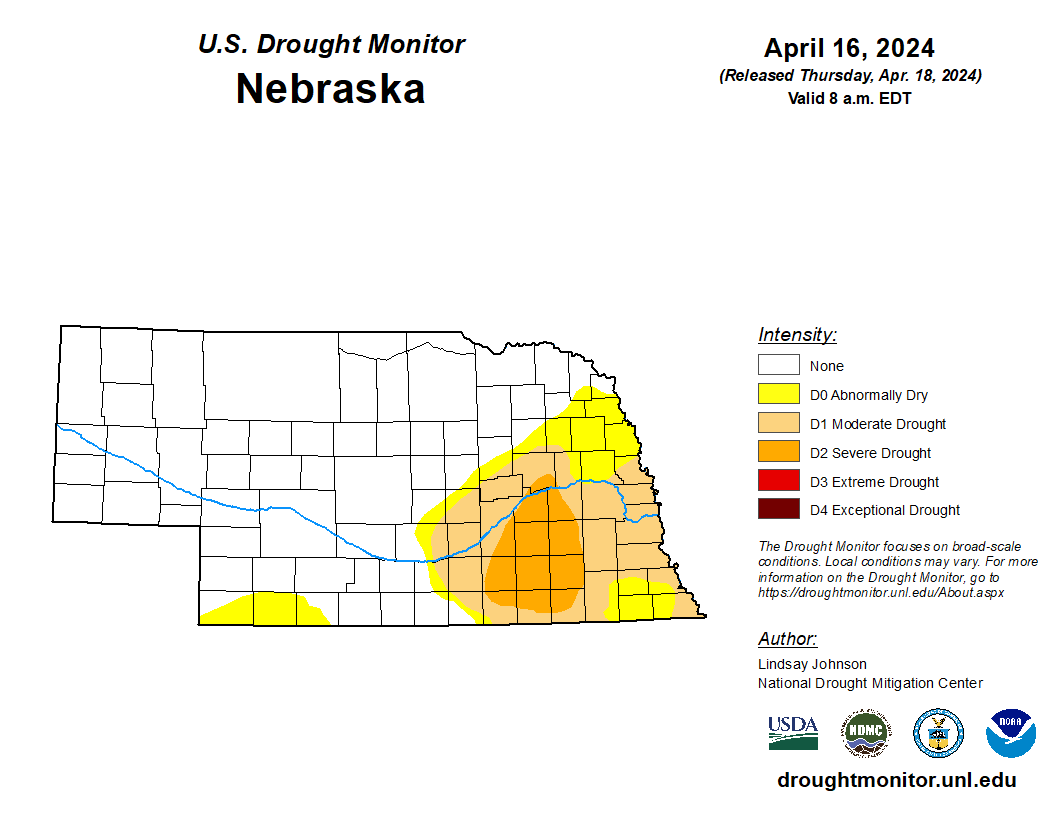
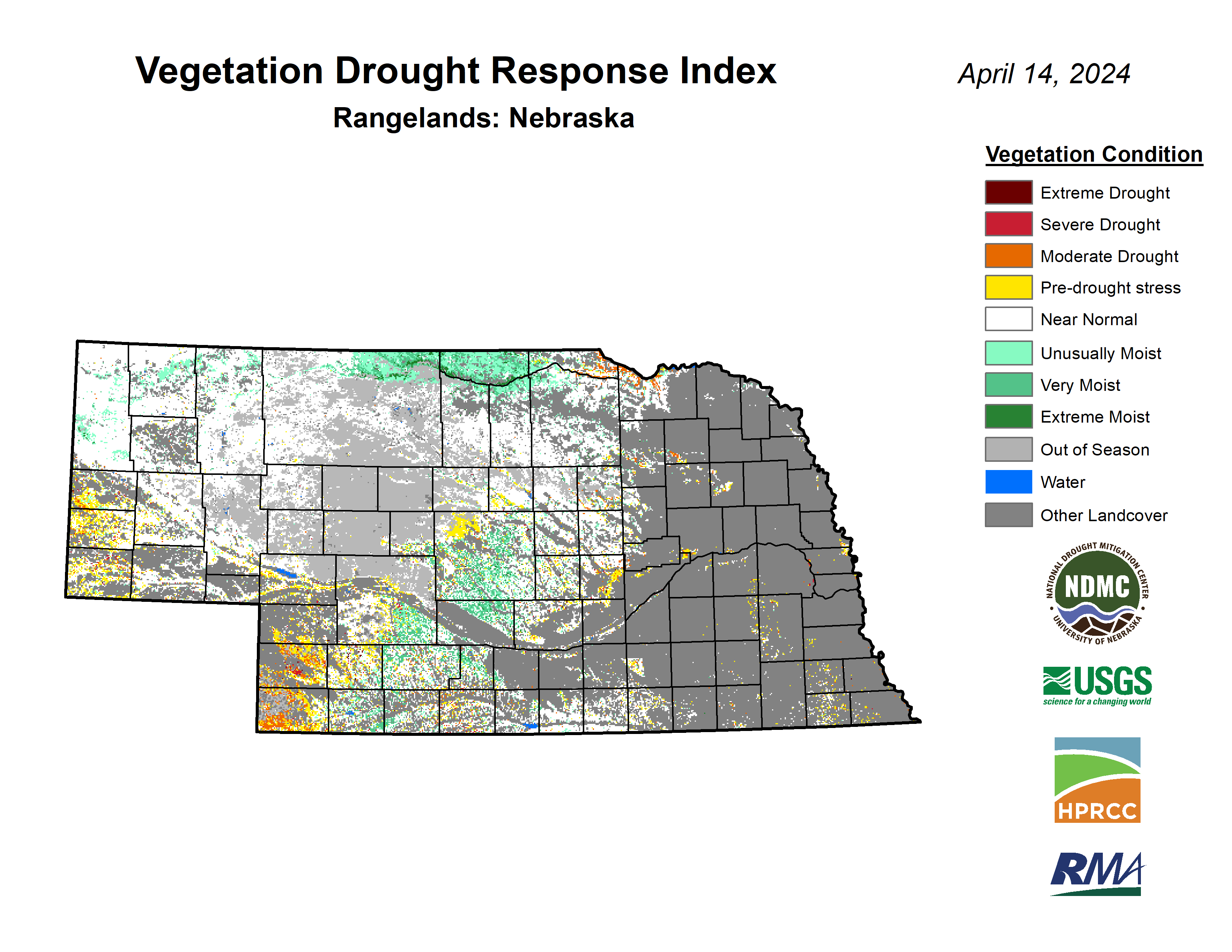
The area of the state that has been driest has shifted from northeast NE (where it is now sufficiently moist) to the opposite corner. Most of Chase, Dundy, Hitchcock and southern Hayes counties have picked up just a little over an inch since early February and one CoCoRaHS observer in southern Hayes County has picked up under 0.25" total. This recent dryness is very apparent on the root zone soil moisture percentiles map, especially in Hitchcock County. The latest Rangeland specific VegDRI map also suggests a moderate level of vegetation stress. Therefore, the expansion of abnormal dryness on the U.S. Drought Monitor in that southwest corner was absolutely warranted this week. Thinking a bit more broadly, it is the northern part of an area in the High Plains that is starting to head in the direction of drought and is an area that I am getting concerned about for drought impacts this season as most projections show that area in a higher risk for precipitation deficits this summer. So if drought is in place going into the summer in places like Benkleman, it has ample opportunity to get worse quickly. So one of these next storm systems absolutely needs to deliver good moisture into the area to reduce that drought risk. At this point, impacts to winter wheat seems to be relatively minimal as it is checking with solid ratings on the recent NASS reports.
Temperature and precipitation extremes over the past week
Attached are .pdf's containing the average temperature, growing degree days, and total precipitation for each station that had no missing days over the last week. Includes CoCoRaHS observer reports. Below are the temperature and precipitation extremes around the state over the past week
Maximum High Temperature: 93F, Superior
Minimum High Temperature: 50F, Kilgore 1NE
Minimum Low Temperature: 16F, Bushnell 15S
Maximum Low Temperature: 59F, Tecumseh
Max Precipitation: 4.77", Carroll 6.35 WSW
Max Snowfall: T, Alliance 5.4 E
Eric Hunt, University of Nebraska Extension


