Chance of moisture
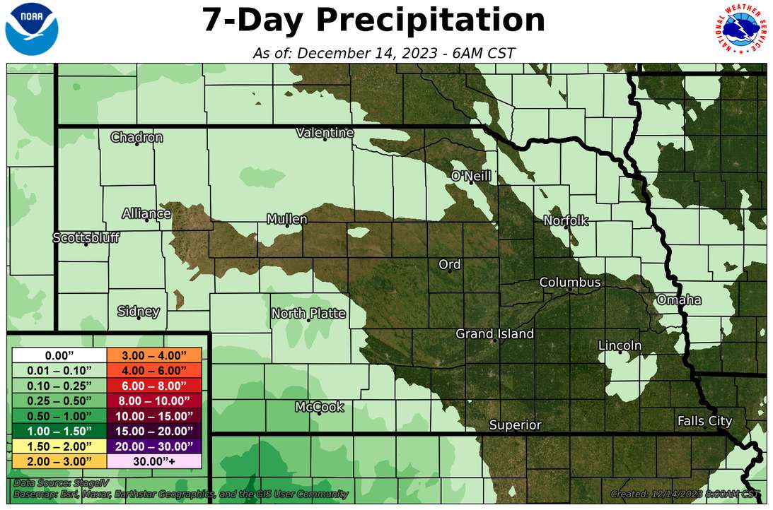
A slow moving upper level low centered over the southwest will slowly work its way east over the next few days. We are going to remain north of the center but southwest Nebraska has already picked up some decent moisture and prospects are looking good for south central and eastern portions of the state to pick up some moisture in the next 36 hours. Amounts may even exceed a half inch in parts of south central Nebraska between Holdrege and Hastings. As the upper low starts moving to the northeast, an area of light showers will develop to the northwest of the upper low across eastern Nebraska. At this time it appears to be all rain and don't see anything that makes me think otherwise.
Mild and dry week forthcoming
A cold front will pass through the state on Sunday afternoon to evening which will lead to more seasonal temperatures on Monday. Otherwise upper level ridging will dominate next week, which will lead to dry and mild conditions for the state for the remainder of the week. Record temperatures are not expected but it will be 10-15F above average on a consistent basis the second half of next week. A change may be coming as we get closer to Christmas. Details this far out are fuzzy but it looks like a storm will be hitting California next weekend and then moving into the central U.S. around Christmas. At this time it appears that there will be a decent potential for rain in eastern Nebraska and maybe snow in western Nebraska. Given it's still 10 days out I'm hesitant to make any projections but it's possible that a White Christmas for parts of the state aren't completely out of a question.
Update
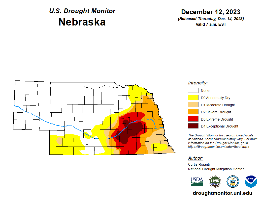
The latest U.S. Drought Monitor showed some expansion of abnormal dryness into parts of southwest Nebraska, in particular Frontier, Hitchcock and Red Willow counties. Otherwise there was no change on the map this week and a little over 25 percent of the state is still in drought. Most of the state received no measurable precipitation in the last seven days (prior to this morning), with the exception of the southwest corner of Nebraska. This was, of course, well after the cutoff for the U.S. Drought Monitor this week. As of the current writing, light to moderate rain was falling over portions if central and eastern Nebraska.
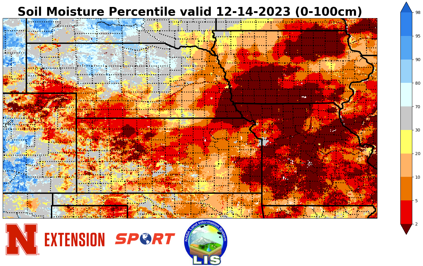
Soil temperatures at 4" are generally in the mid 30's across the state with a few Panhandle locations in the lower 30's. Locations receiving precipitation currently or will have moisture in the next 24 hours are places where soils temperatures are safely above freezing, which means infiltration won't be an issue. Many of the areas that are getting moisture out of this are also locations where soil moisture percentiles are on the low side so any moisture is welcome.
Eric Hunt, University of Nebraska Extension