Short Update
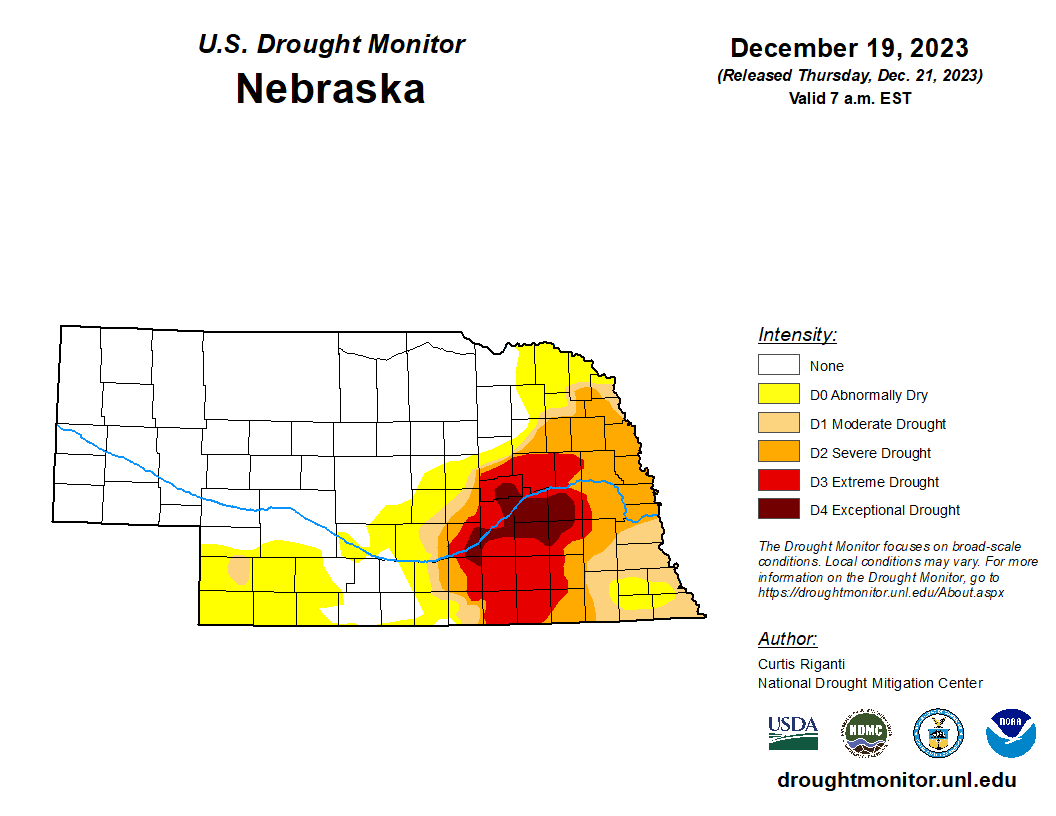
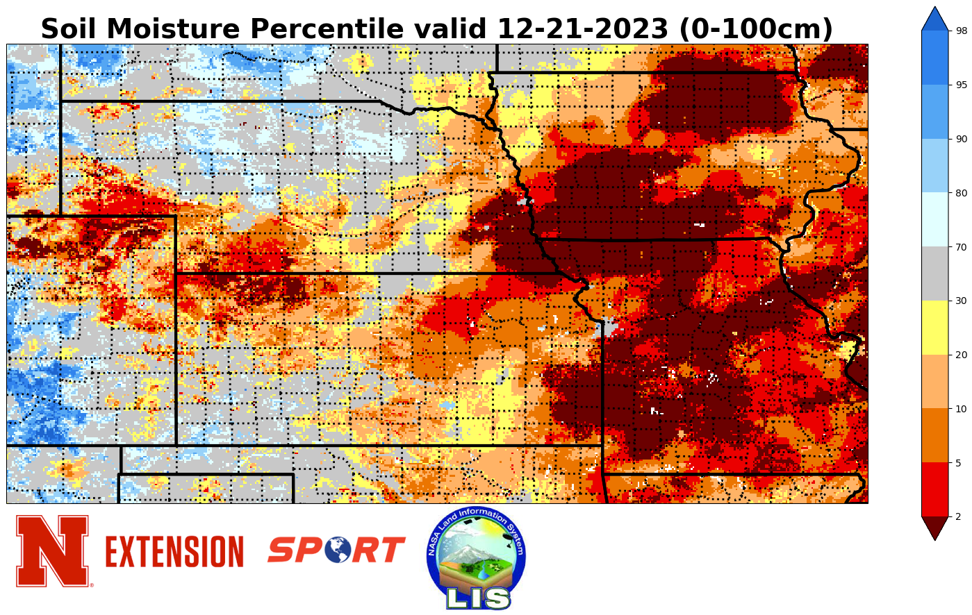
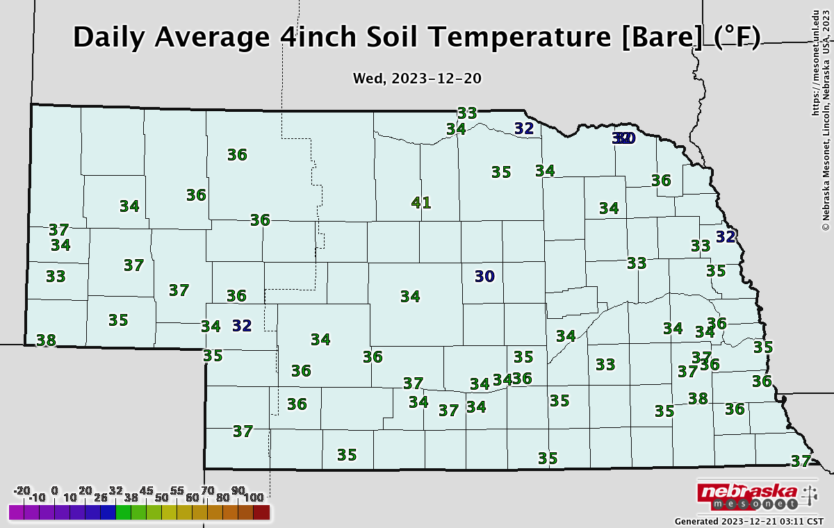
The rain last week led to improvement in soil moisture for parts of eastern NE and some improvement on the U.S. Drought Monitor in York and Hamilton counties. For southern Hamilton County, that is the first time they have not been in exceptional drought since May. So that is welcome news. Welcome rain also fell over a good portion of eastern NE last week, with widespread amounts between 0.25 and 0.50". The exception was the far southeastern corner, which generally had under a tenth of an inch. Thus, there was no improvement to the soil moisture percentiles in that region. Otherwise, most of the state has had a very mild week and a mild month. The north central and northwestern sections of the state have been especially warm, bordering on a top-10 warm December. The eastern side of the state has had just enough clear and calm nights to drive lows into the 18-22 range and enough cloudy days to keep highs from exceeding the 40's that often. But the warmer temperatures have kept the ground thawed and that is critical as we head into Christmas.
Santa's Presents
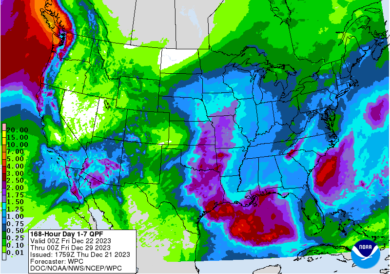
There is a very good chance Santa is going to bring widespread improvements to soil moisture across a large portion of the region. Indeed, current projections are for the whole state to get some moisture with over an inch a reasonable probability for the eastern 1/3 of NE.
Here is what I am confident of:
Widespread rain on Christmas Eve (especially in the morning) in the eastern half of Nebraska. Amounts could exceed an inch in the eastern third of the state. Rumbles of thunder possible.
1-3", maybe 4" of snow across the Panhandle and parts of West Central Nebraska on Christmas Eve. Be careful if traveling west of North Platte.
What is still uncertain:
How strong the storm is and quickly it exits our area. The GFS is a bit weaker and quicker with its solution. If it verifies, precipitation would transition to snow for parts of central and northeast Nebraska overnight on Christmas Eve after a period of rain. Precipitation would be mostly over by Christmas morning in central Nebraska and by midday further east. The ECMWF is slower and stronger. If the ECMWF verifies, a good portion of western and central Nebraska are in for a prolonged period of moderate snow. For an area from Valentine down to Kearney, a period of freezing rain first is possible. So this would mean significantly more travel difficulty on Christmas Day between Aurora and North Platte and from Norfolk to Valentine. Further east, the ECMWF solution would mean a prolonged period of a cold rain, which would bring rainfall totals up into the 1.5-2.5" range followed by a period of light snow. My best advice is to pay close attention to the forecast in the next 36 hours and adjust travel plans accordingly if need be.