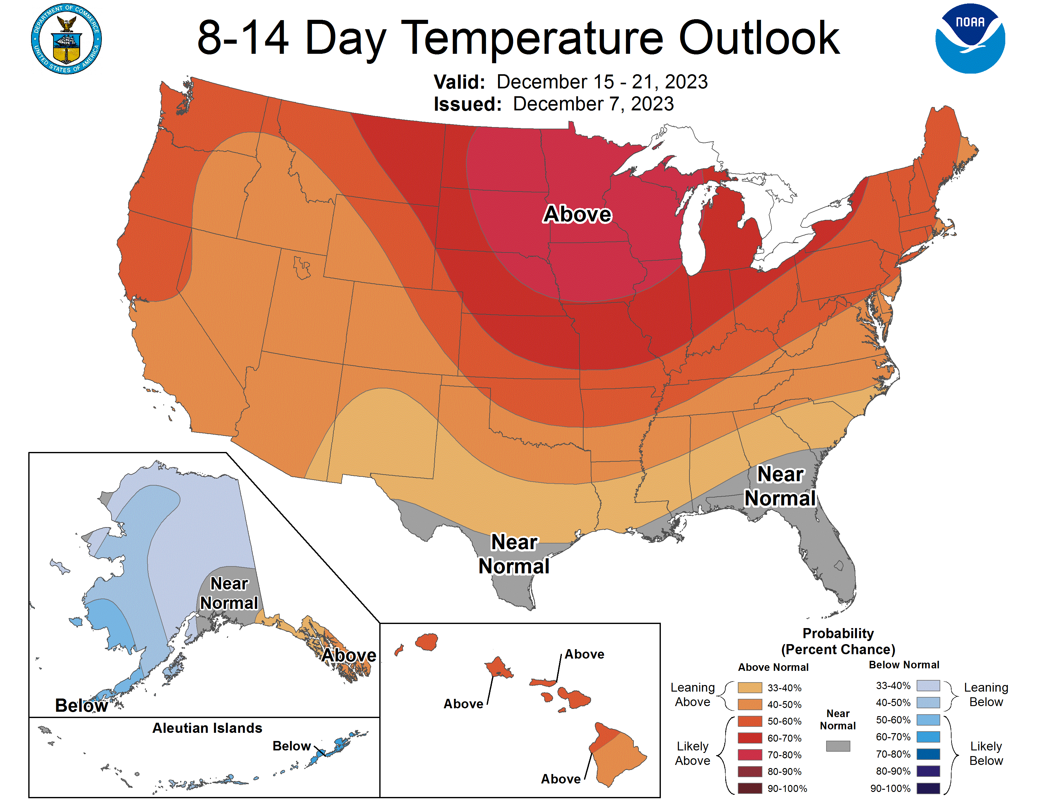

Continued mild
Near-record warmth is the story across parts of state today. While this level of warmth won't persist, all signs point to mild weather generally persisting for the next few weeks and quite possibly through the holidays. The CPC is quite bullish on warmth for the week before Christmas in our neck of the woods at least. This does not mean that will be 55-60F every day or that there won't be any snow. It simply means that there is a very low probability of another cold outbreak like we had right around the holidays last year.
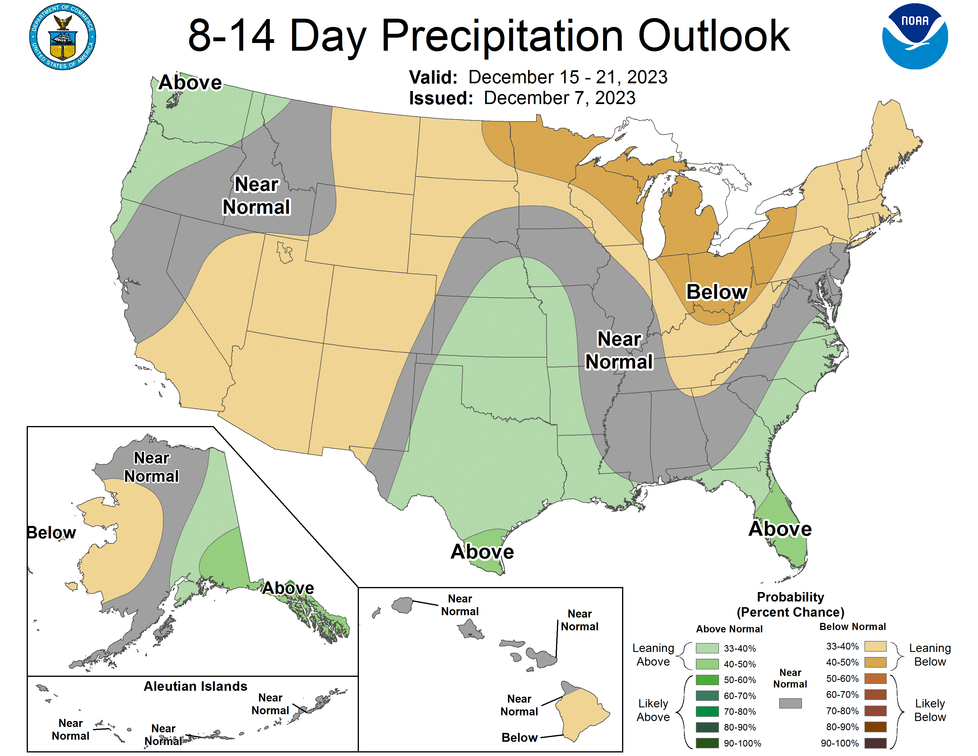
Chance of precipitation late next week
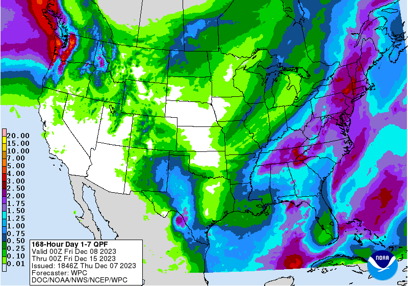
Recent ECMWF runs are showing a possibility of a modest storm system moving into the Central Plains late next week and bringing a shot at decent moisture for most of the state. At this point it appears to be rain in eastern Nebraska and a mix of rain and snow in central and western Nebraska. But that is still more than 7 days out so I wouldn't bet the farm on it just yet!
Precipitation and Drought Update
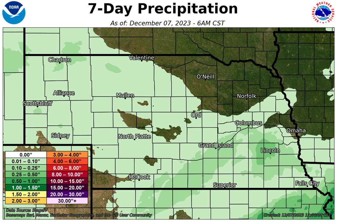
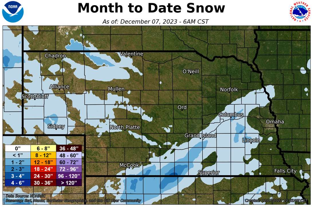
A couple of weaker shortwaves moved through the state over the weekend bringing light rain and snow to parts of south central and eastern Nebraska, with most places picking up under a tenth of an inch of liquid water equivalent (LWE). Exception to this was over northwestern Lancaster County and eastern Seward County where a heavier deformation band of snow set up on the northern side of an upper level low late Sunday afternoon. In those areas a third to half an inch of LWE was received and the narrow snow band from north Lincoln and points west was pretty visible on Monday morning during a brief period of clearer skies. But most of the state received no measurable precipitation over the previous seven days. The U.S. Drought Monitor remains unchanged from the previous week. A little over a quarter of the state is in drought, a marked improvement over last year at this time. Unfortunately, large sections of eastern Nebraska are still in extreme to exceptional drought.
Soil Temperature and Soil Moisture Update
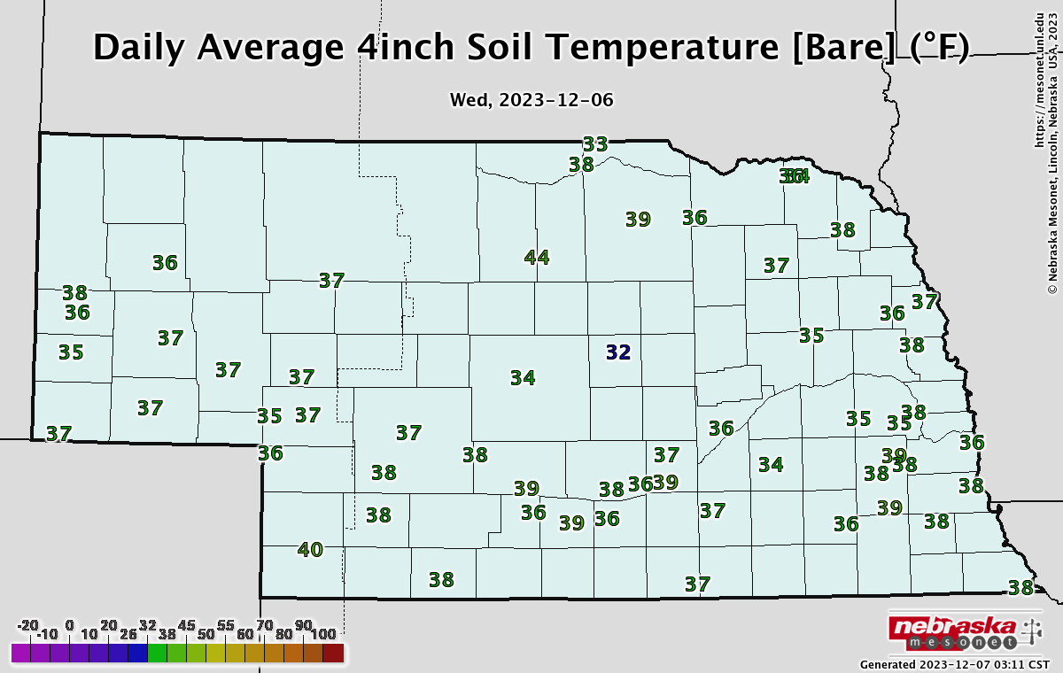
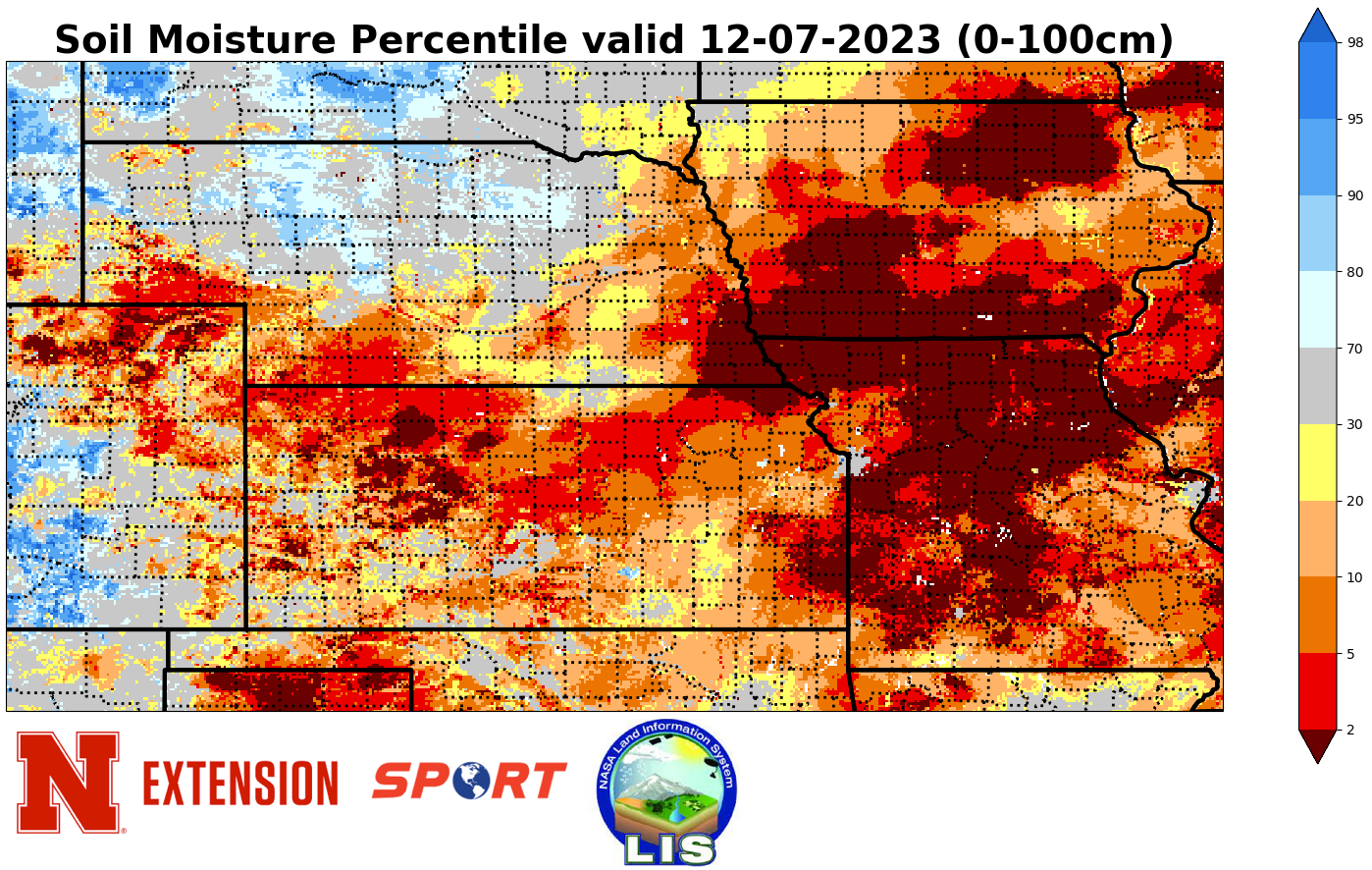
Soil temperatures are generally in the mid to upper 30's across the state. The latest soil moisture percentiles from SPoRT LIS continue to show the driest conditions in the southeast and southwest corners of the state with much better conditions (relative to normal) across north central and northwestern Nebraska.
Eric Hunt, University of Nebraska Extension