Very mild and wet
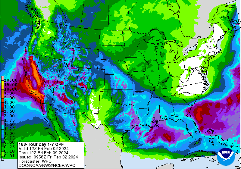
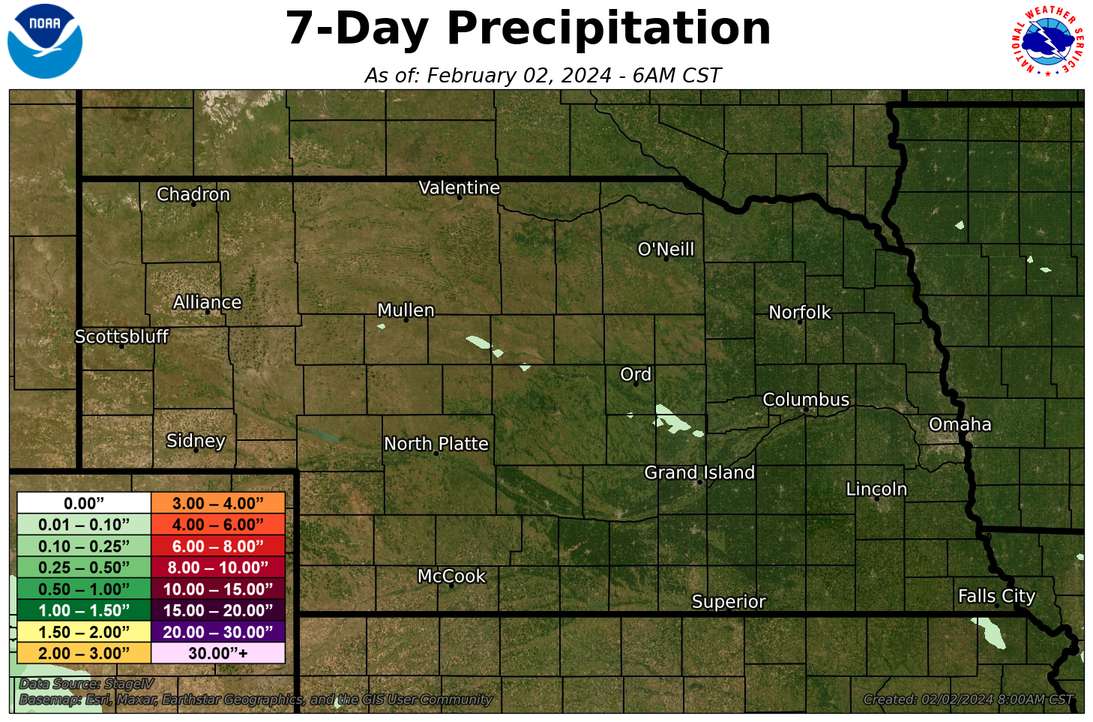
After a gorgeous week for much of the state with sunshine and temperatures running 20-30F above average for most of the last five days (northeast Nebraska has been comparatively more seasonal), we are entering into a more active pattern. The first storm of interest is currently over the southwest and is moving into the Central Plains. With no true cold air to work with, this will be a rain making system with only the higher elevations of the Panhandle having a chance of snow. Rain should move into the western and central portions of state tonight with rain expected to fall nearly continuously during the day tomorrow and into Sunday morning for the majority of the state. Exception will be the eastern portion of the state, particularly northeast Nebraska, as high pressure over the Great Lakes region will be limiting the eastern extent of moisture. The GFS brings some moisture all the way into western Iowa while the ECMWF has been keeping the rain mostly west of Highway 77. But there is good agreement in the global models of an inch-plus over most of south central and central Nebraska, with some chances of an inch in places like North Platte and McCook. For southwestern Nebraska, this would be very welcome moisture as they have generally missed out on the bigger precipitation events the past two months. Reasonable moisture should also fall in the Panhandle, which has been a bit drier of late too. Temperatures will be cooler this weekend with cloud cover and precipitation but still above average, particularly at night.
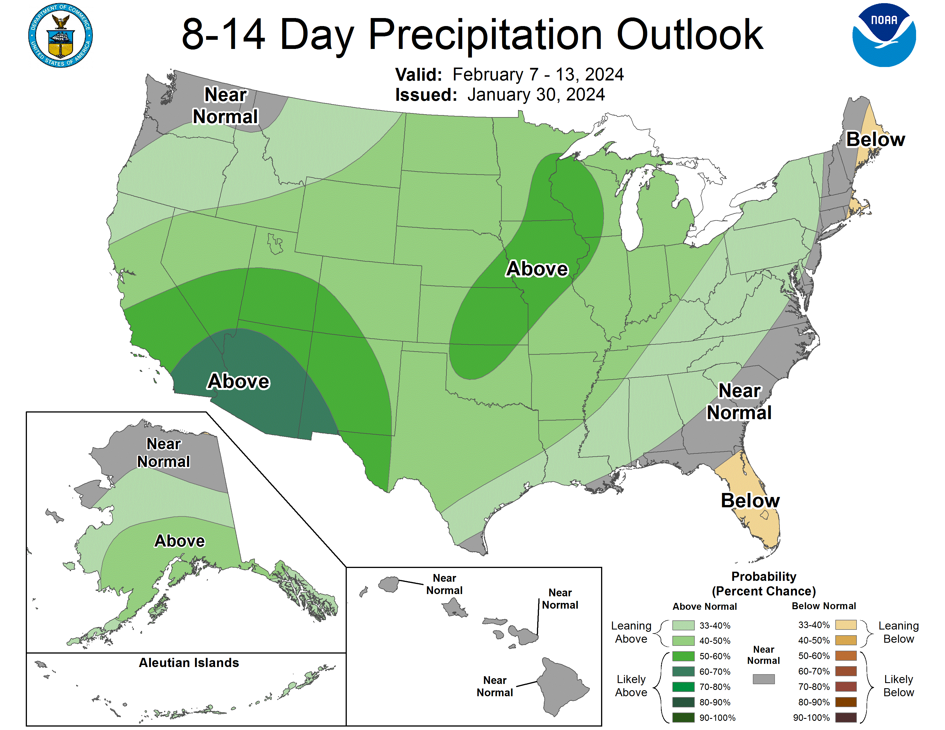
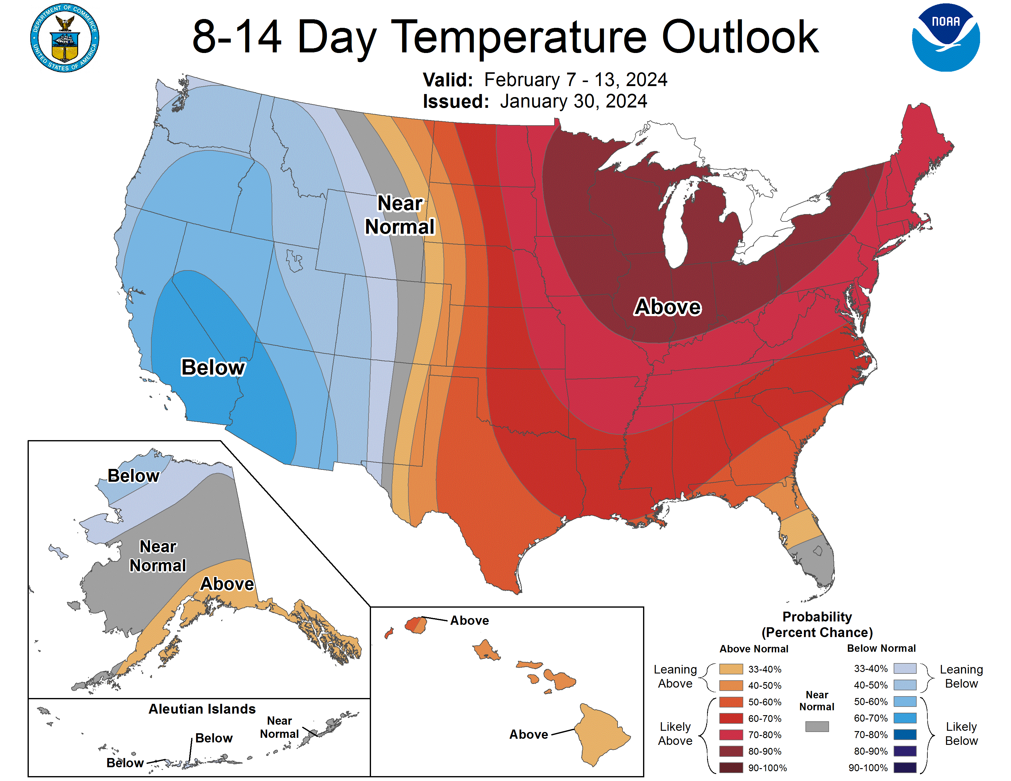
Drier weather will be the rule Monday-Wednesday across the state and it will be very mild again. Probably not record warmth on any given day but 20-25F above normal will be the rule through next Thursday, particularly in the eastern half of the state. Nighttime low temperatures are not likely to be spending much time below the freezing mark in southeast Nebraska in the next week and there may be a chance of the winter wheat starting to break dormancy as we will likely be averaging over 50F for multiple days in a row in places like Fairbury and Beatrice. Farther to the west, temperatures will still be mild next week but less mild relative to average than the east. With an approaching system coming in later next week, a cold front should slowly work its way east Thursday into Friday, which will drop temperatures back to more seasonally mild temperatures in the 30's and 40's after the frontal passage. Precipitation also looks likely with this next system with eastern Nebraska a bit more likely to get a decent rain on Thursday with this system. Snow is certainly possible in the Sand Hills region of the state on Thursday and I'm suspicious thunderstorms could be possible in eastern Nebraska.
Looking a little deeper into the crystal ball, it appears we may be entering a colder and stormy phase in the second half of February. The CPC's official outlook for February is mild and this will absolutely verify the first half of the month. Areas east of Grand Island have a chance at breaking, perhaps even smashing, the warmest start to February on record. Hence the concern about winter wheat breaking dormancy much earlier than usual. But a strong cold snap could push those average temperatures back down a bit closer to long-term averages for February. We shall see what happens.
Drought and soils update
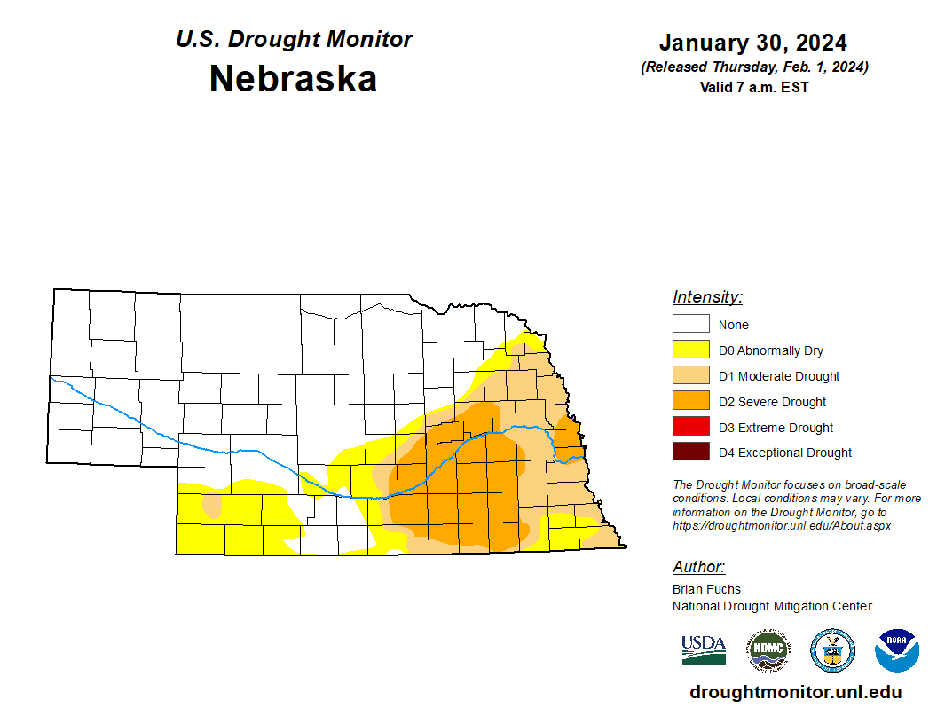
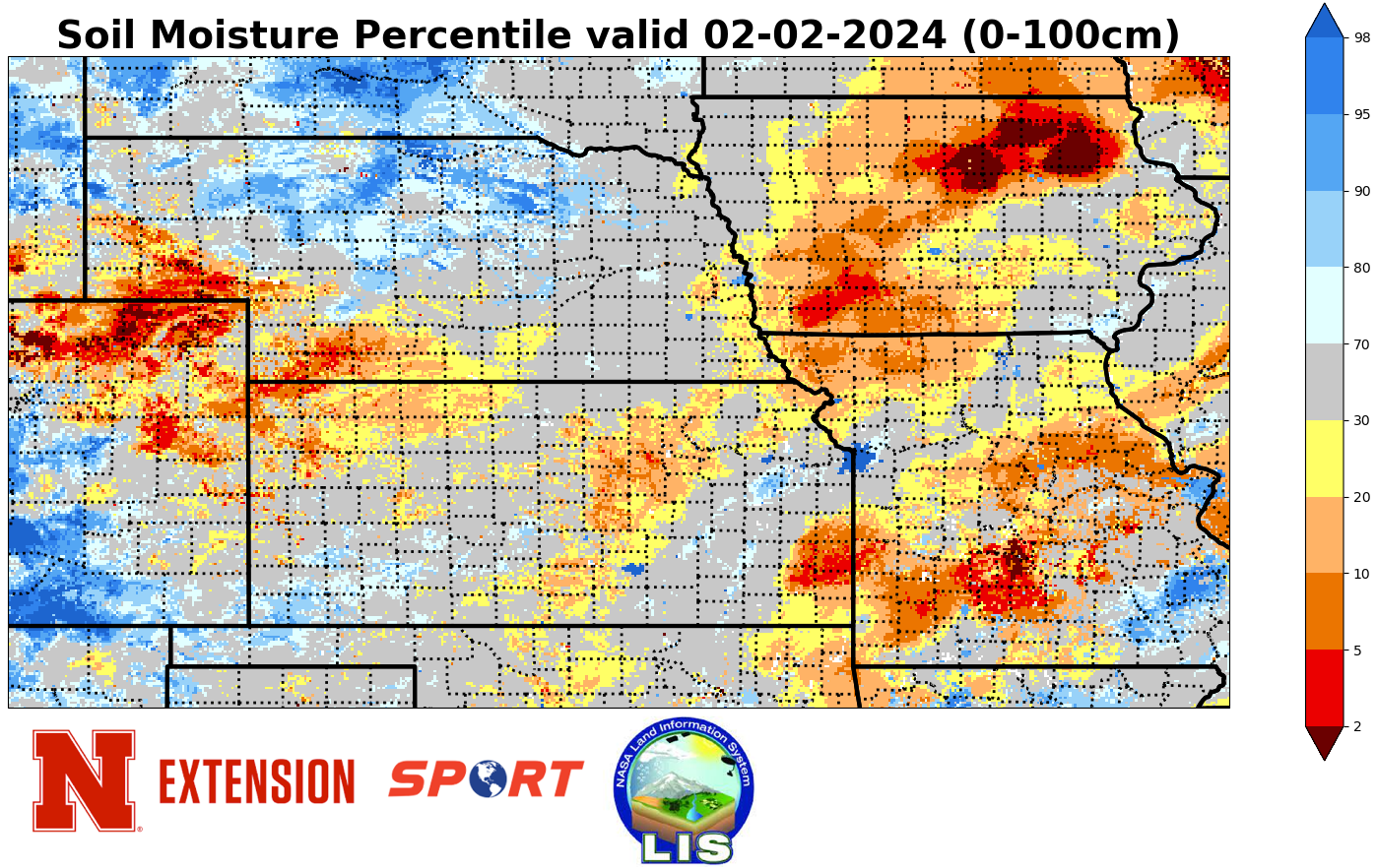
No change on the U.S. Drought Monitor over the last week, though we may see some improvement in the central sections of the state next week if the forecast verifies. Essentially no one in the state has received any precipitation over the last seven days, which isn't necessarily a bad thing, as significant rainfall in the past The warm temperatures have allowed the snow melt to expedite but the lack of rain has offset the ice jam threat somewhat. Where the ground is fully thawed the snow has melting in nicely and we have seen improvement in soil moisture percentiles across eastern Nebraska. Thawed ground should have no issues holding the rain this weekend but in places where there is still a bit of a frost layer, expect some ponding in fields until that layer thaws fully and allowing infiltration.
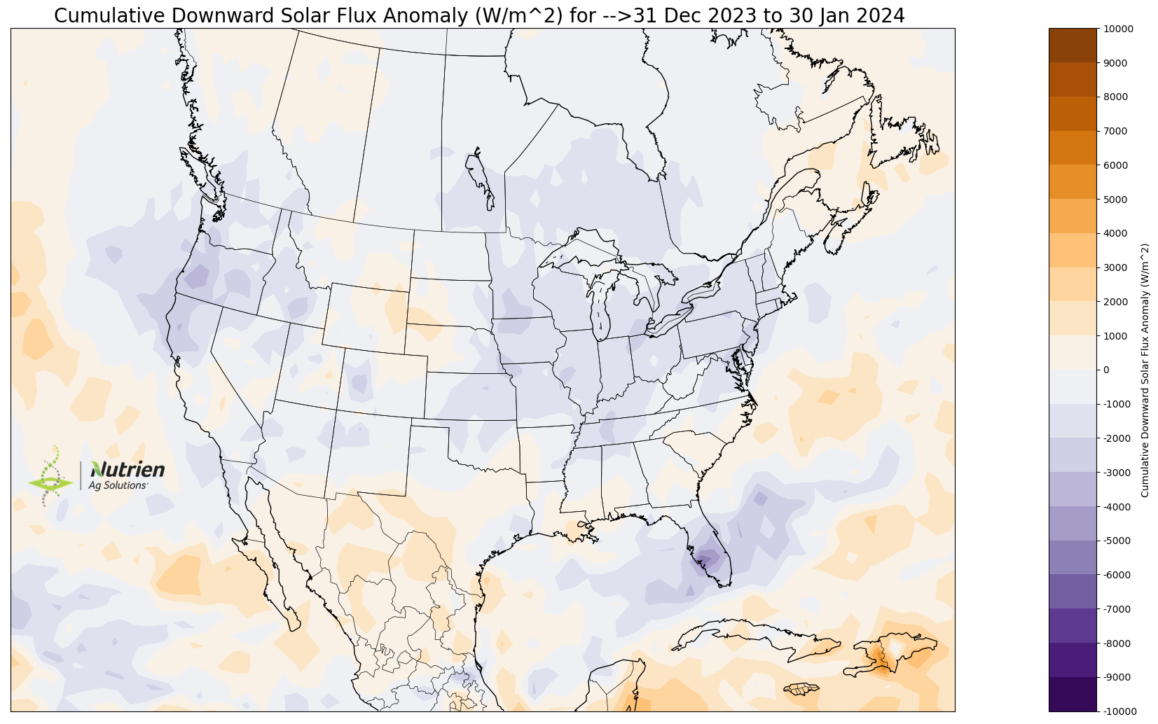
Gloomy January
The last figure in the slideshow today (thanks to Eric Snodgrass of Nutrien for the figure) reveals that it was a cloudier than average January across much of the U.S., including eastern Nebraska. Western Nebraska, which typically is sunnier anyway, had even more sun in January than usual. But as Dr. Galen Erickson, professor in Animal Science, would say "There is seldom a bad day in the Panhandle."
Eric Hunt, University of Nebraska Extension