Spring Punctuated by Winter
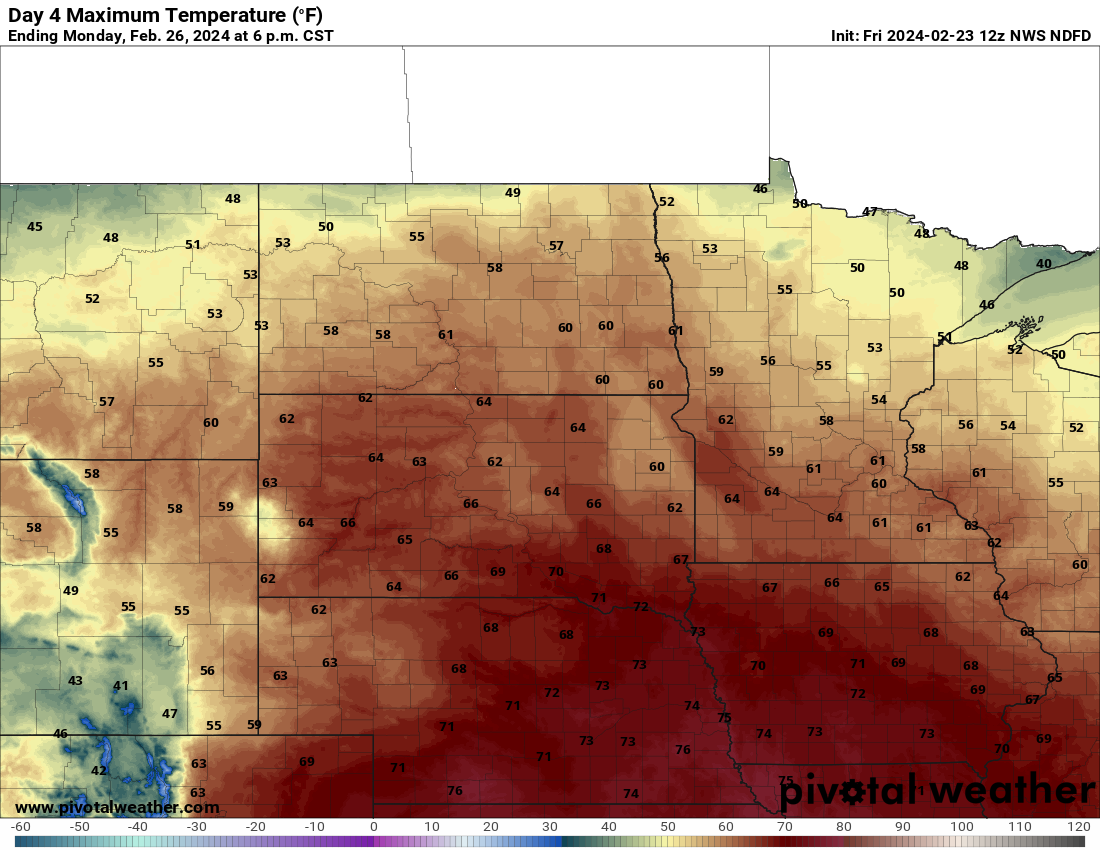
Above average temperatures this weekend will be followed by record-level warmth on Monday for much of the state. Exception to the near-record warmth will be across the Panhandle where high temperatures will "only" be in the 60's. Elsewhere temperatures should exceed 70 and many places could exceed 75. Wouldn't shock me if some locations in central or eastern Nebraska don't manage to crack 80 on Monday, which would be the earliest such reading on record in those locations. But the very warm weather is coming to end (temporarily) on Tuesday.
The big questions right now are: The timing of the frontal passage and the chance for light rain or snow after the frontal passage
The latest model runs have expedited the speed of the western trough and the associated cold front and developing storm system with it. This means the frontal passage will have made it through western NE by midnight Tuesday and should clear the Missouri River by midday. Behind the front temperatures will be 30-40 degrees colder than on Monday statewide, with sharpest 24-hour changes in northeast Nebraska. For what it's worth, the latest ECMWF run has the front through the state by early Tuesday. That would mean temperatures hold steady or slowly fall through the day on Tuesday in the eastern half of the state and maybe warm up just a little from morning lows in western NE. IF the front is a bit delayed, the southeastern quadrant of the state could shoot up to 60-65 pretty quickly on Tuesday morning and then see temperatures crash 20 degrees in the afternoon. Pay attention to the forecast Monday night to know what clothing to plan for on Tuesday.
With the speed of trough and the storm system not necessarily getting it's act together in time to deliver the good, deep moisture we need for rain/storms ahead of the front or a cold rain/snow behind it, I'm fairly skeptical of the state picking up any meaningful moisture early next week. Can't rule out isolated storms along the front or a short period of light snow Tuesday night in eastern NE if the upper level support is sufficient. But right now don't count on significant precipitation anywhere in the next week. That may well change as we head into early March and what looks to be an active pattern shaping up. The 8-14 day outlook from the CPC is rather bullish on moisture in the state in the first week of March so hopefully the subsequent storms are slower moving and allow for good moisture return into our area. I am much more confident of late next week and the first few days of March being warm to very warm. Depending on how warm the nights are, it seems feasible that winter wheat may start breaking dormancy fairly early this year and that is a big problem if we have a major cold snap later in March.
Moisture update
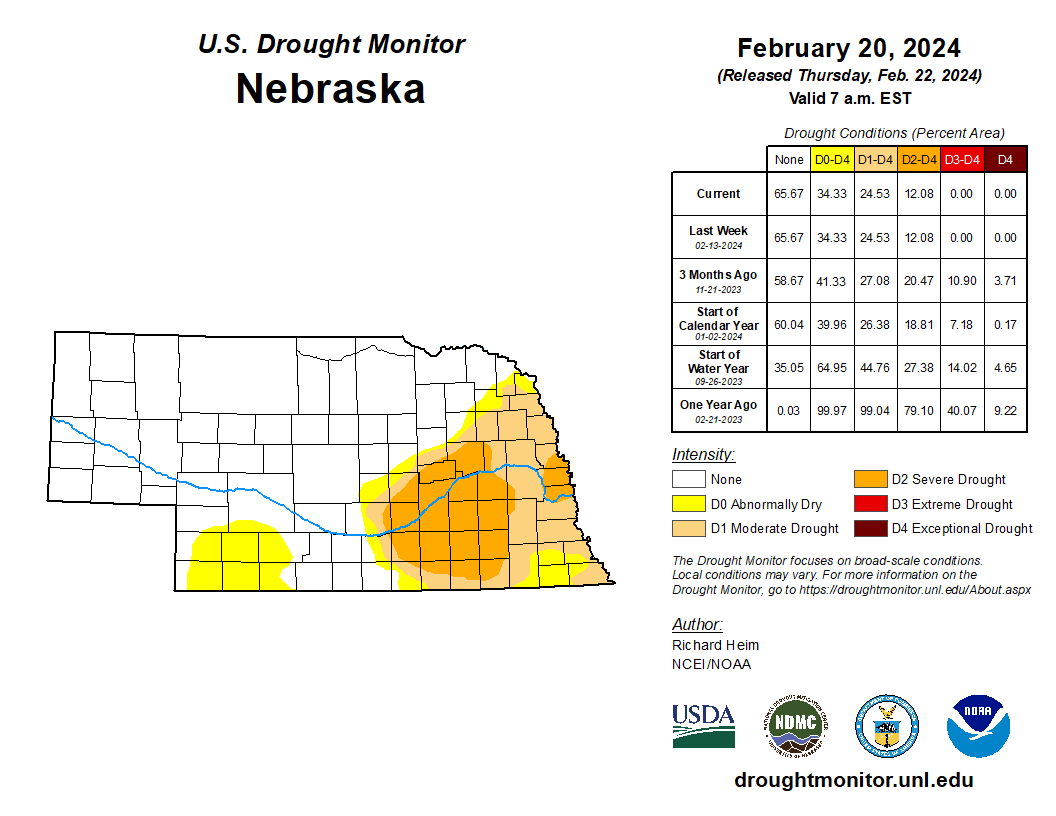
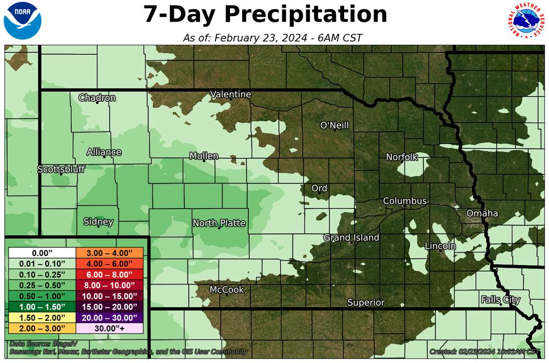
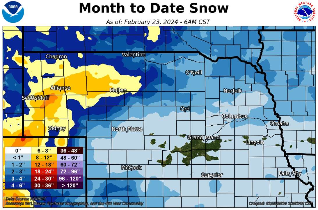
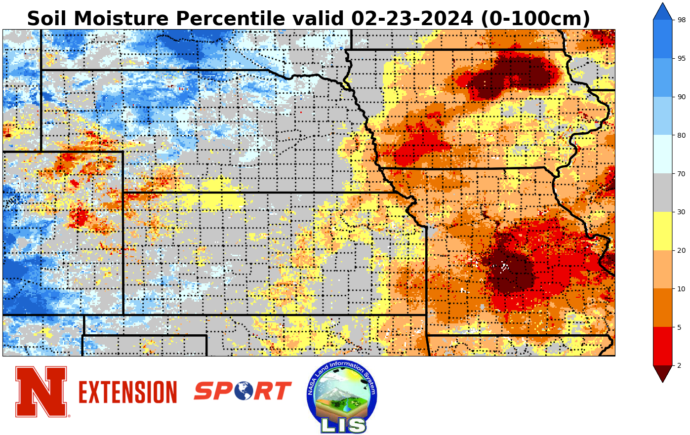
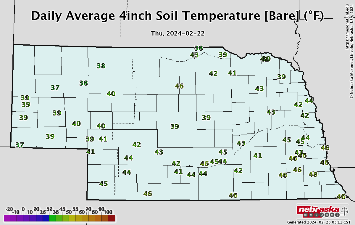
No changes to the U.S. Drought Monitor this week and only the southern Panhandle and west central Nebraska have received measurable precipitation since last Friday morning. It has been a "wet" February in the western part of the state, much of which has come in the form of snow. This has improved soil moisture a bit across western Nebraska. Further east it has been mostly bone dry with minimal precipitation, save for some 1-2" snow totals last Friday in the northern reaches of eastern and central Nebraska. Most of central and eastern Nebraska have received under 1" of snow this month and some locations have not had measurable snow in February. This is likely to be tied for the lowest February snowfall on record in Lincoln and many places are going to finish top-5 lowest for the month of February. Between the lack of recent moisture and very mild temperatures, soil moisture is starting to go the wrong direction again in eastern Nebraska. Easily correctable with good moisture in March but we are starting to lose the benefit of the precipitation we received earlier this winter.
Eric Hunt, University of Nebraska Extension