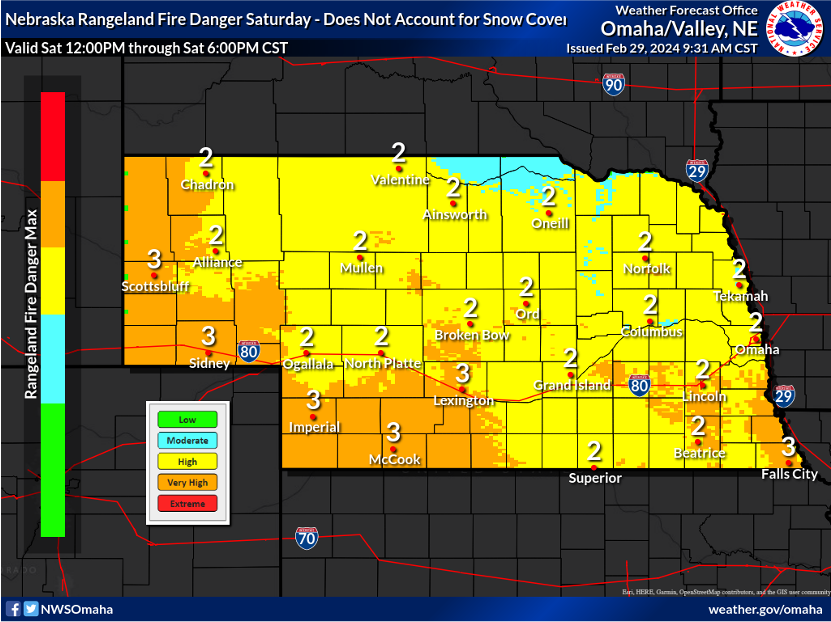
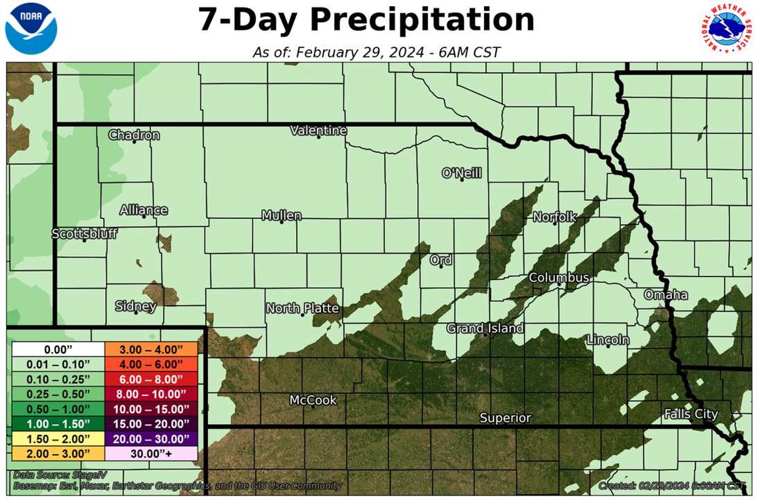
High Fire Danger Risk
Biggest weather related story in the coming days will revolve around the fire risk that exists and will persist through the weekend. The risk will be a little less across central and eastern Nebraska tomorrow and into the weekend as more low-level moisture works into the area. Nevertheless, please refrain from controlled burns and such until conditions improve. We don't need a repeat of Monday's fires.
All-time record warmth
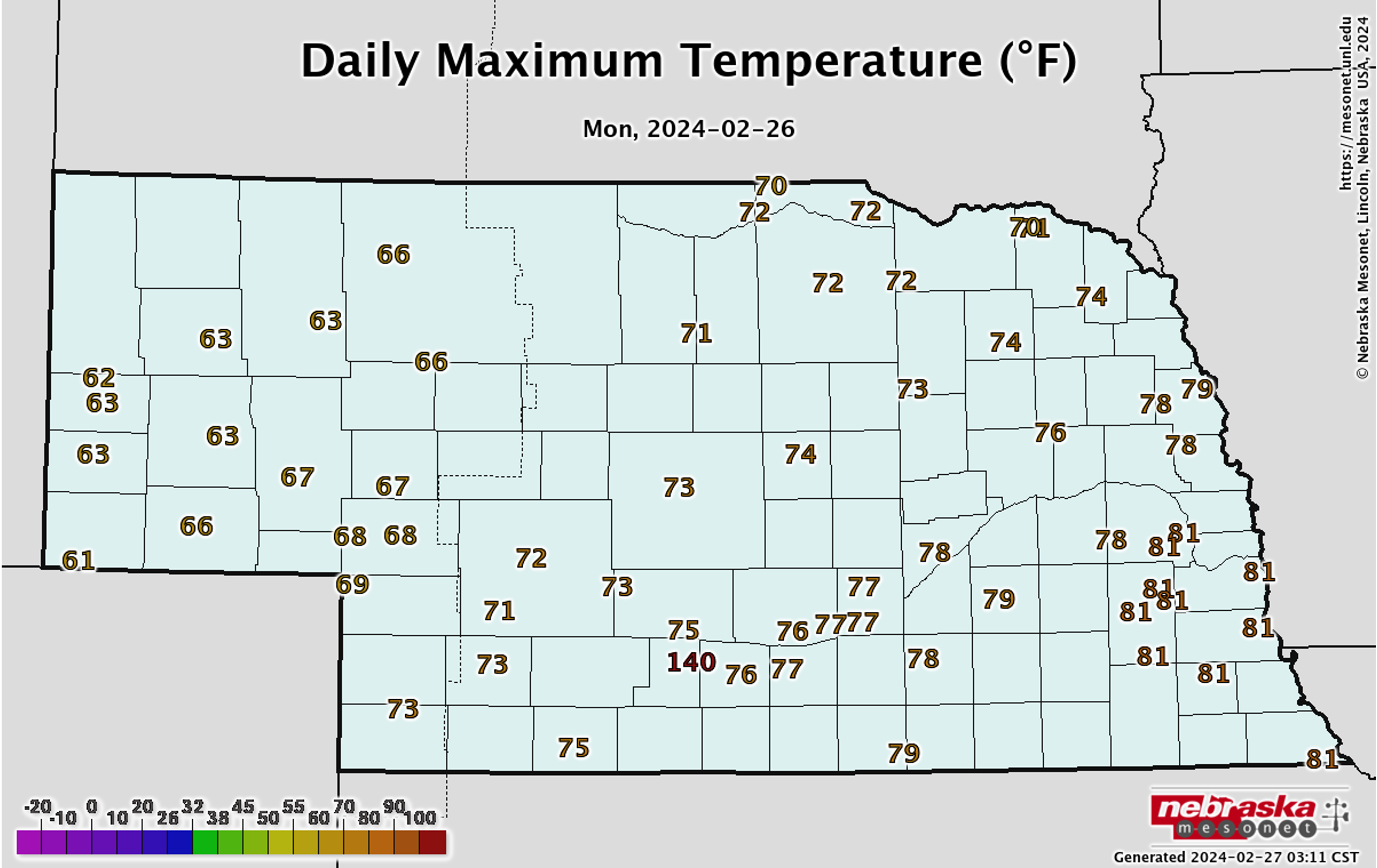
Temperatures on Monday set new all-time records for the earliest 80F degree temperature in southeast Nebraska, including the first 80F readings in regular February (i.e., not counting years with a leap day) on record in Omaha and Lincoln. Temperatures were above average everywhere on Monday and were very warm across central and eastern Nebraska.
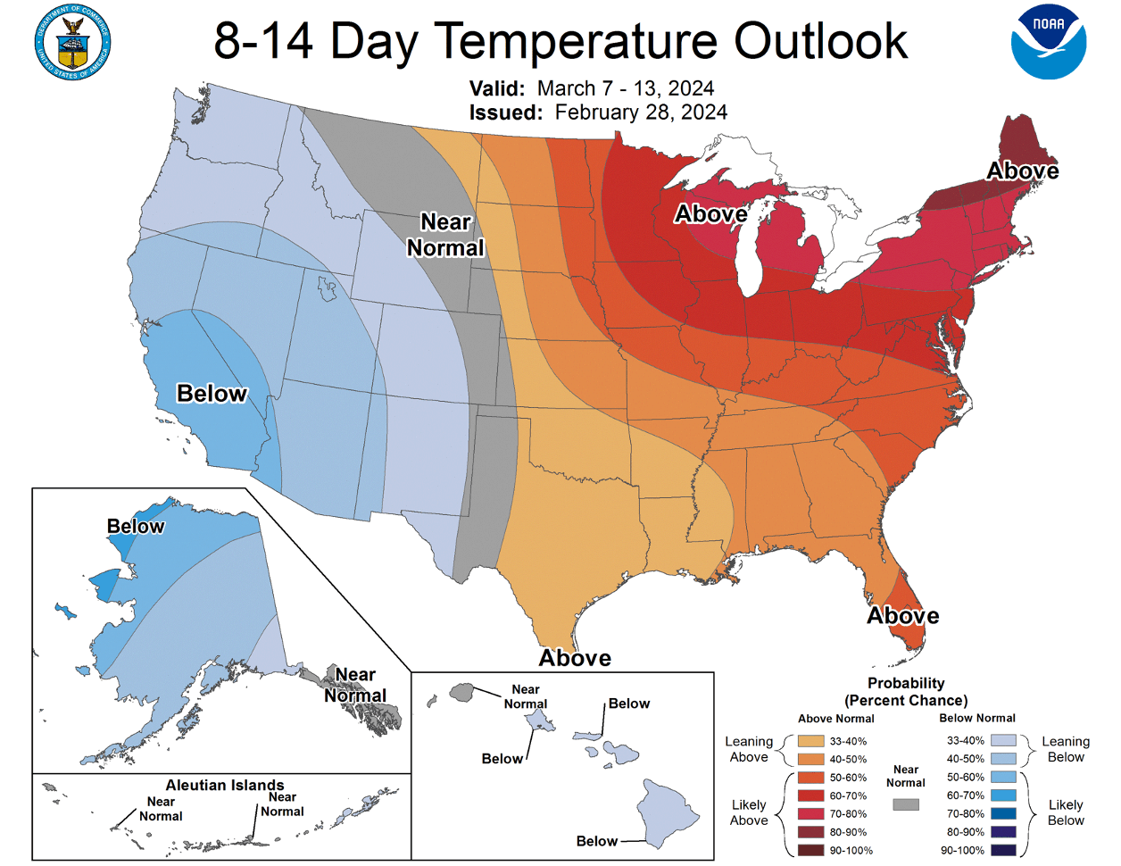
Wild swings in temperature
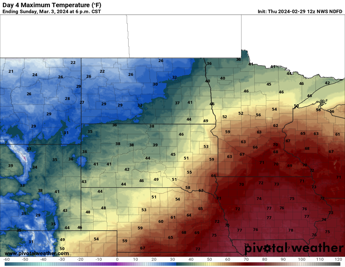
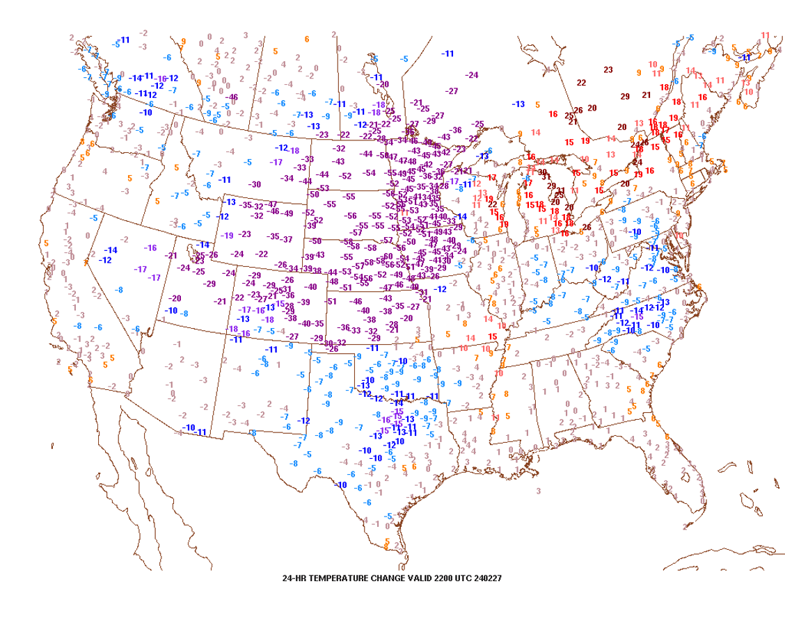
A powerful cold front moved through the state on Tuesday and brought near-record temperature drops over the course of a 24-hour period. Some sites in northeast Nebraska approached 60F degree actual air temperature drops between Monday afternoon and Tuesday afternoon, with air temperatures going from the upper 70's to the upper teens. Lows were in the single digits across most of the state on Wednesday morning with subzero wind chills. After a more seasonal day yesterday, temperatures today have generally shot up 10-25F compared to this time yesterday. Expect temperatures to be 25-35F above average through Saturday in western and central Nebraska and through Sunday east of Norfolk. Temperatures will be cooler behind the frontal passage (which looks to come through dry) but temperatures will generally be above seasonal averages next week, especially in eastern NE. Temperatures could be closer to average in the Panhandle.
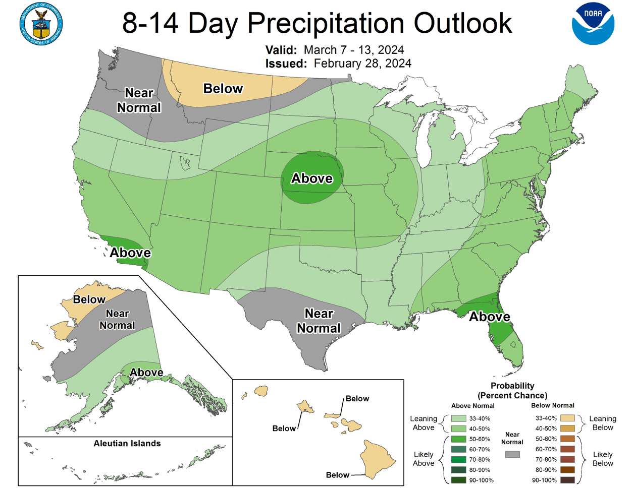
Moisture coming?
Right now it appears that there may be a storm coming into the central U.S., which would bring about a chance for moisture across the entire state and perhaps bring significant moisture into the eastern half of the state. But this is still about a week out and a lot of details aren't clear yet, including placement of the surface low, strength, and speed. It is possible it could be a multi-day event starting next Thursday and go through Saturday. Snow would be possible in western Nebraska under a slower storm scenario. Note that the GFS is not bullish on moisture across the state while the ECMWF is more generous.
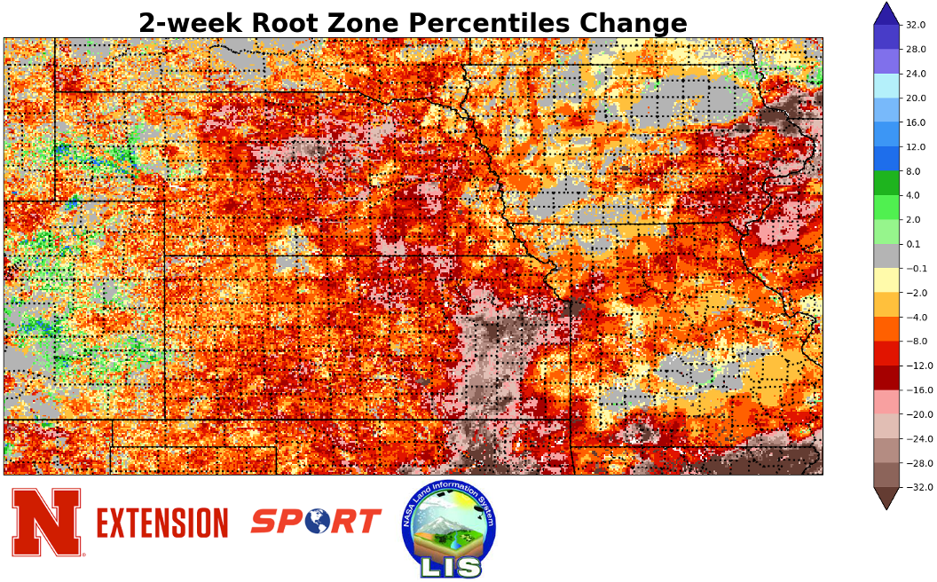
Soil Moisture and Drought Update
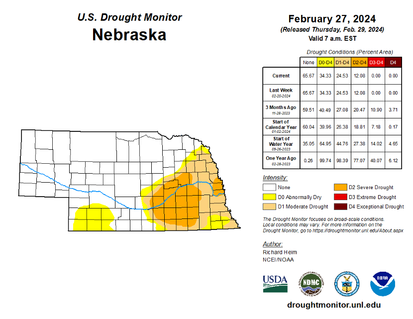
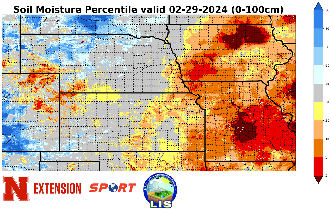
Moisture next week would be welcome to reduce the fire risk but it would also be useful in helping recharge the top part of the soil profile. There is still reasonable moisture at somewhat deeper depths but the top part of the profile has dried out significantly according to SPoRT LIS runs in the past few weeks. In addition, the southeastern corner of Nebraska has generally not received any meaningful moisture in over a month. A dry March will mean that drought expansion gets to be more likely and will increase the rain needed later in the spring to have a decent profile of moisture going into the spring. As it is, the percentage of the state in drought or abnormal dryness has been virtually unchanged in the past three weeks. But this will change if moisture doesn't materialize in March.
Eric Hunt, University of Nebraska Extension