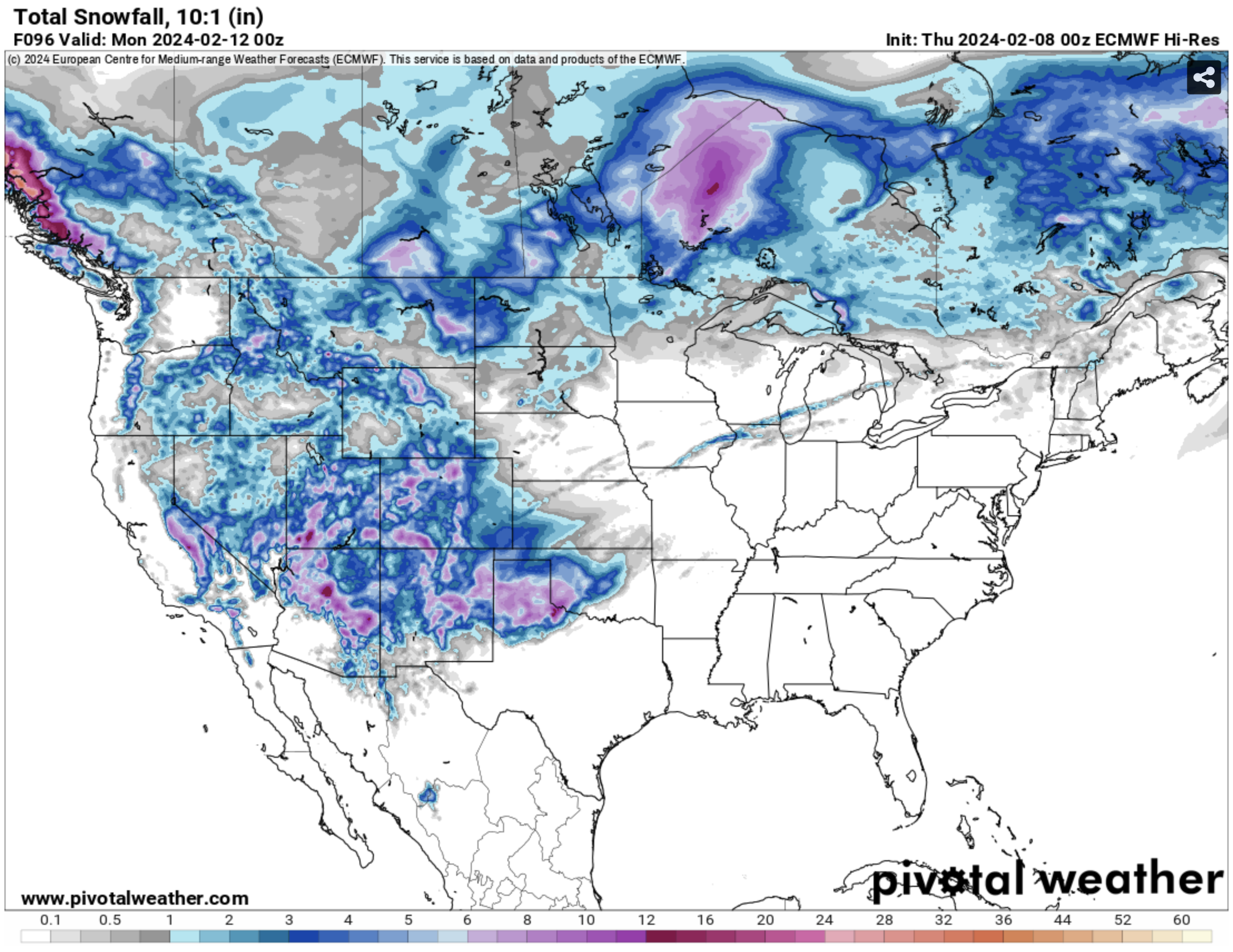
Light precipitation possible through Saturday
We have had a windy few days across most of the state and temperatures are dropping back closer to seasonal levels. Most of the next week will be quiet and dry with temperatures generally a bit above seasonal normals. But we do have a few chances across sections of the state in the next 48 hours. First, a shortwave will be moving across the southern half of the state tomorrow and that will bring chances of rain to areas along and south of the Platte. Rainfall amounts are not expected to be significant, with a 0.25" possible in parts of southwestern and south central Nebraska tomorrow afternoon and between 0.10-0.25" possible further east during the evening hours.
Then on Saturday, upslope flow from an area of low pressure to the south will allow for a period of light snow in the Panhandle, particularly between Sidney and the Wyoming border. Significant amounts of snow are unlikely- 4" maximum in the highest elevations of Kimball County- but be prepared for snow if you are traveling through that part of the state on Saturday. After Saturday, it appears that we have a quiet week in terms of precipitation at the moment, but I can't rule out a period of light snow between Thursday night and Friday afternoon across the northern and eastern thirds of the state week with an Alberta Clipper type system rolling into the region later next week.
More seasonal temperatures ahead
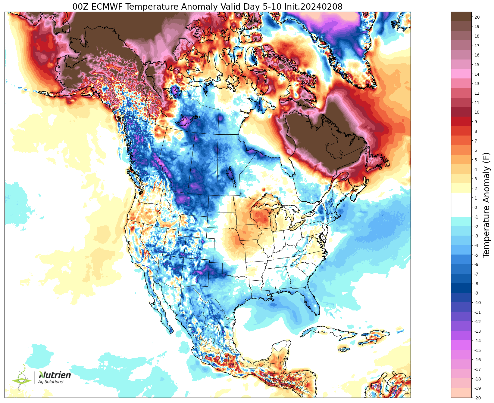
Over the next week temperatures are still going to be on the mild side for February, particularly in eastern Nebraska, but less so than we have been the past few weeks. For eastern Nebraska, think temperatures running more like 4-8F instead of 15-25F as we have had for the last two weeks. Highs should generally be in the 40's in the next week with areas along and south of I-80 cracking the 50 degree threshold next Wednesday and Thursday. The bigger difference is temperatures will be safely below freezing at night, which sounds like a "Well duh" statement in February but we have spent a lot of time above freezing at night of late. Similar story for temperatures next week in central sections of the state, though anomalies will be a little weaker as average highs in central Nebraska are slightly higher than in the east. The western portion of the state will be seasonally cold this weekend with subfreezing highs likely on Saturday in the Panhandle where snow falls. Temperatures will be closer to seasonal normals next week in western Nebraska with highs in the upper 30s to mid 40's most common.
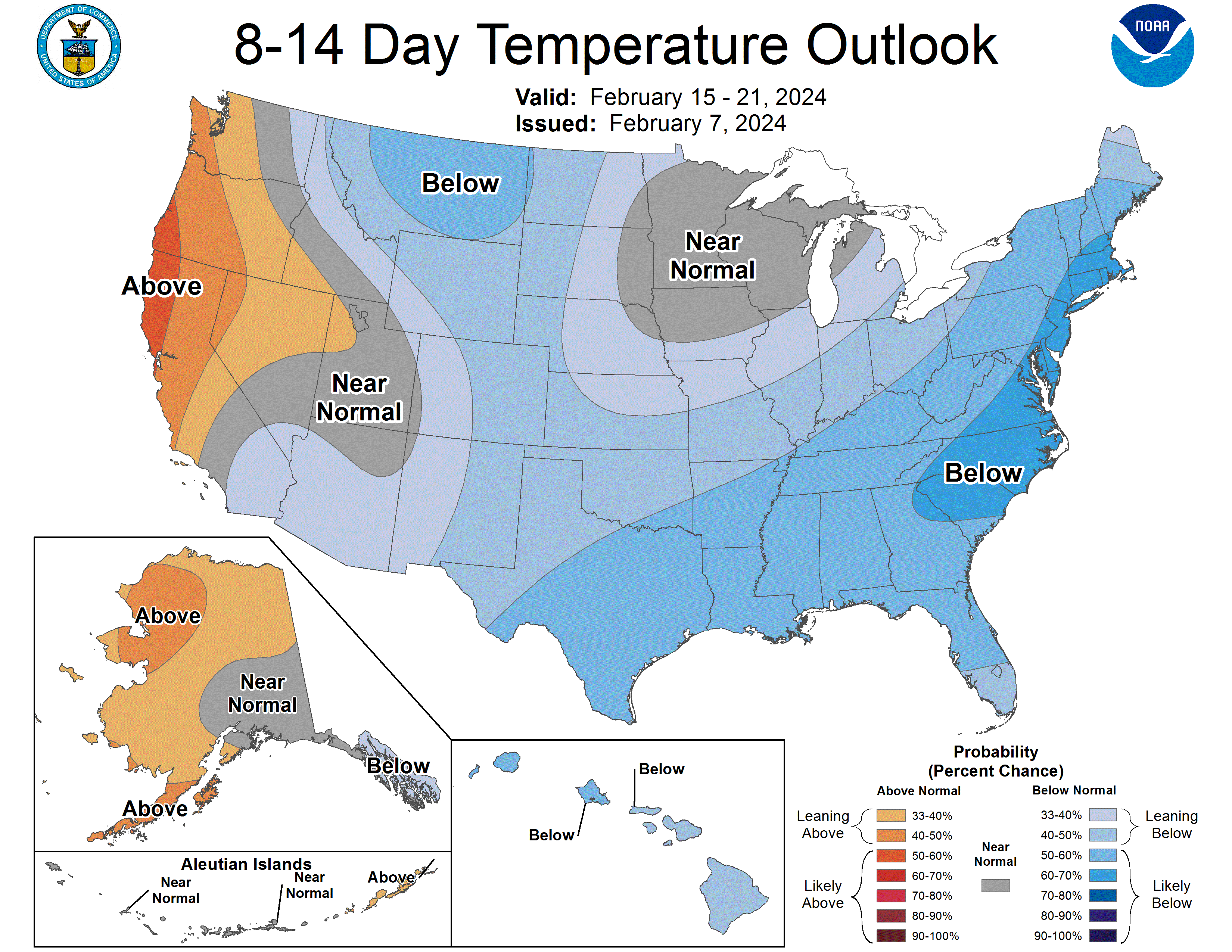
Colder second half of February
This statement should be interpreted both literally and with context. In a literal sense, the second half of February is most likely going to be colder than the first half of the month. Though given that we are off to a record or near-record warm start to the month, being colder isn't necessarily an impressive feat. The question is it just going to be colder because it will be seasonal/normal or are we looking at legitimately cold temperatures (e.g., subzero lows and highs in the teens or colder) settling over the Central Plains and Western Corn Belt?
At this time, I am strongly favoring the first solution because I am not seeing any signal that the cold air in western Canada is going to spill deep into the central U.S. and sit there for any period of time. While we are likely to have some colder days in there, especially across the northern portion of the state, I am expecting the coldest air to remain north of Nebraska. This is good news for calving season.
Beneficial moisture
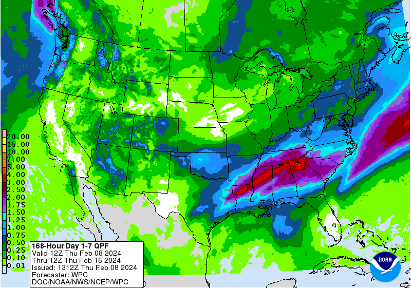
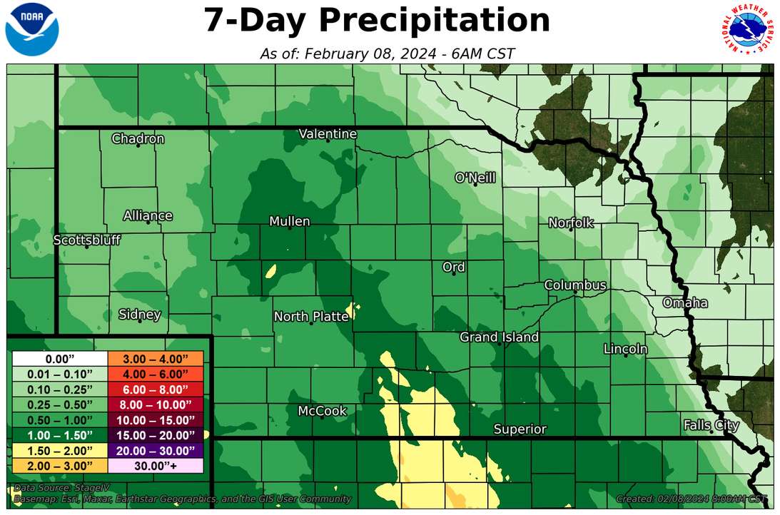
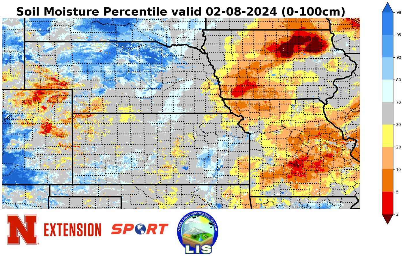
With the exception of the far eastern corner, most of the state received beneficial moisture over the last week. Indeed many locations in south central and central Nebraska received over an inch, which guarantees that February will be above average. Biggest winner over the last week was Callaway 0.2 S in Custer County with 1.77". Second place goes to Wilcox 0.19 WSW (CoCoRaHS/NeRain) in southwest Kearney County with 1.56". Other parts of the state picked up less last weekend but a majority of locations did receive a half inch or more. With warm ground temperatures for this time of year, a good portion of that moisture found its way into the soil profile. Combined with the last bit of melting snow, soil moisture is continuing to improve in both a real and relative sense. Regarding the latter, soil moisture percentiles continue to improve across the state. A majority of the state is now categorized as being near-normal to wet, which is a big improvement from the beginning of the water year.
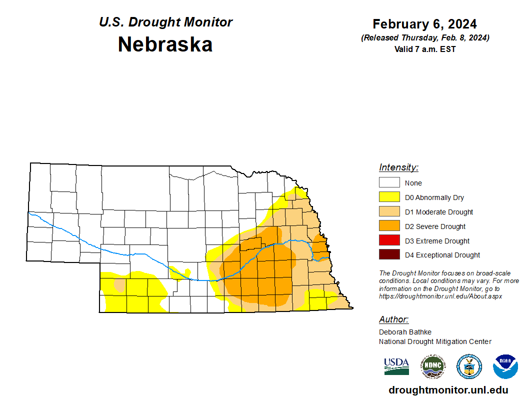
The robust precipitation in south central Nebraska and moistening soils was enough to get some improvement on the U.S. Drought Monitor. Improvement was noted in parts of 20 counties across central and southern portions of Nebraska, including almost all of Franklin and Kearney counties. We now are at ~65 percent of the state in "None" (i.e., no drought or abnormal dryness), the best we have been since the map dated June 23, 2020. Be nice to see that number get to 100 later this year, though admittedly there is a lot of work to do in east central Nebraska before we can achieve that.
Eric Hunt, University of Nebraska Extension