Bitter cold and then a thaw
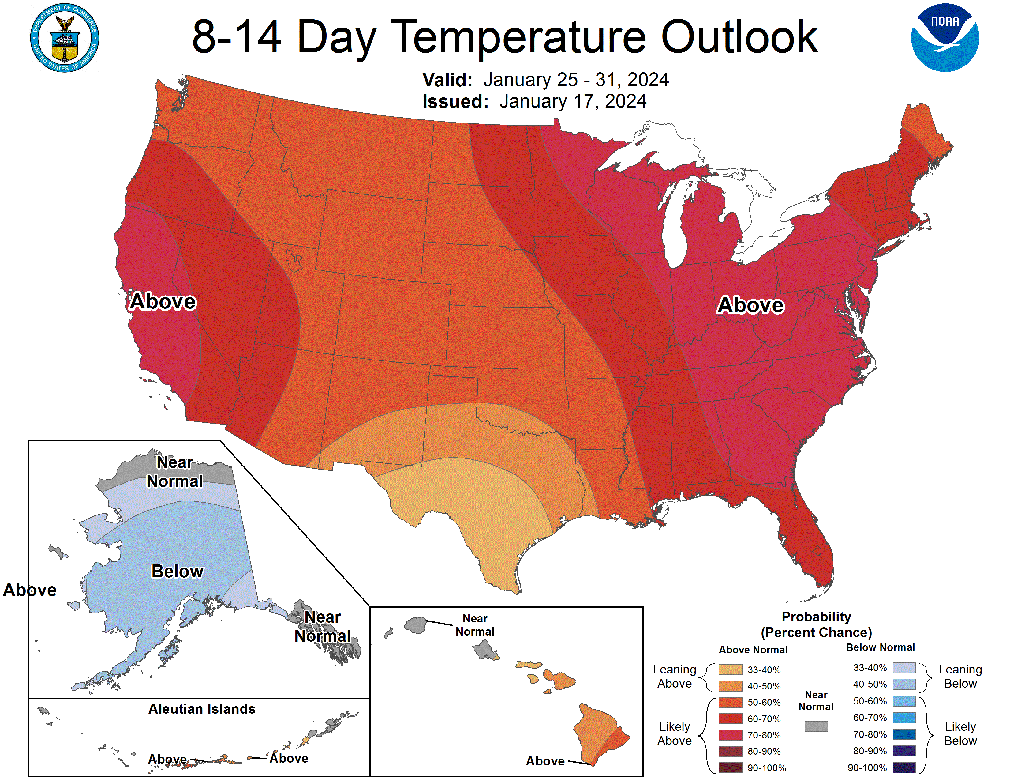
The outlook contains good news and bad news. The good news is next week will be much milder across the state, though being locked in a deep freeze would have been warmer than being outside in Nebraska last weekend. The bad news is we have one more shot of arctic air to go through and the thaw next week deserves some context. Let's start with the cold. As of this writing, a strong cold front and associated shortwave is moving into the state bringing light snow, wind, and bitterly cold air. Today will not be a good afternoon for travel in northeast Nebraska and the evening commute could be tricky in Omaha and Lincoln as well. It should pass through the entire state by this evening and high temperatures will be in the single digits almost everywhere in the state tomorrow. A strong surface high will be centered over the eastern side of the state by Friday night. This will bring light winds but with near optimal radiational cooling, temperatures are likely to be within a few degrees (+/-) of 20 below on Saturday morning in eastern Nebraska and in the 10-15 below range between Grand Island and North Platte. Any light wind speed will help push wind chill values into the 35-40 below range. Temperatures will warm into the teens in western Nebraska but will remain very cold in the eastern half of the state. Daytime highs may remain below 0 in the far eastern side of the state with a calendar day high occurring closer to midnight. By Sunday temperatures should warm into the 20's (central and east) and well into the 30's and low 40's in the Panhandle.
While temperatures will be much more mild next week, we are not necessarily looking at a pleasant week, especially in eastern NE. Western Nebraska will be comparably nicer.
The Setup
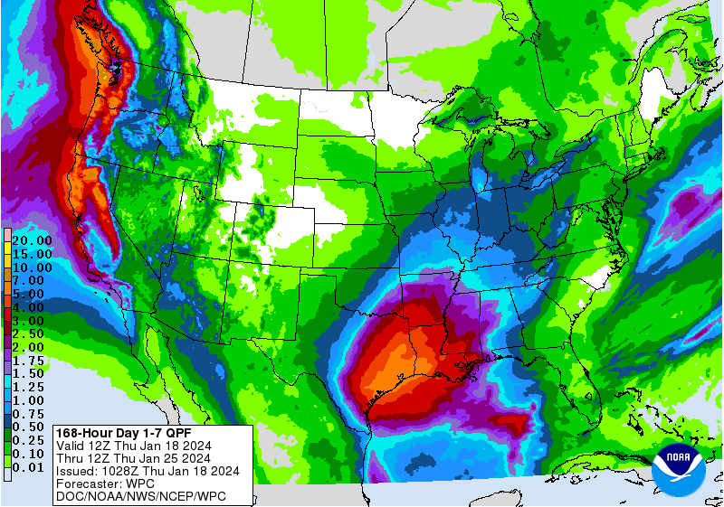
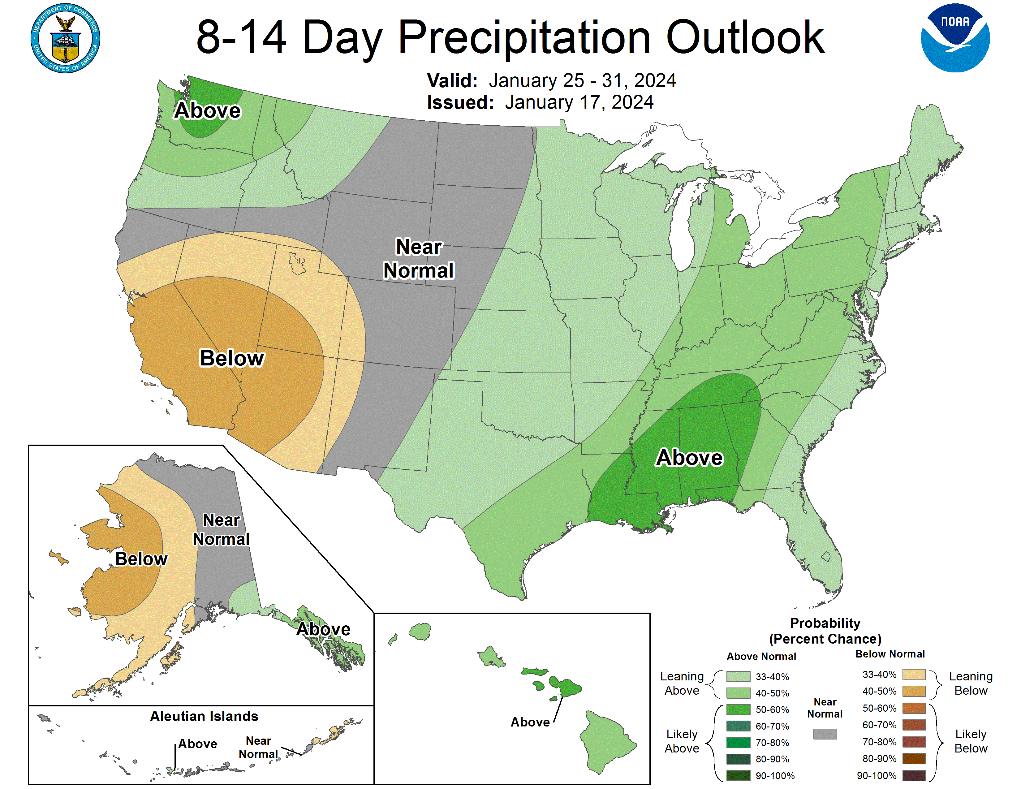
With a strong surface high anchored over the southeast, warmer and more moist air will start to flow our way. This is going to lead to plentiful cloud cover over the eastern portion of the state and we may need to watch out for pockets of fog and freezing drizzle as that warm, moist air spreads over a cold snowpack. That's not in the official forecast right now but it wouldn't surprise me if that happened. The main storm track will be well to our south and east next week but the eastern side of the state is likely to be on the western edge of the precipitation. Thus there are chances for light rain or light snow on Monday night and better chances again about a week from now. Significant precipitation is not expected at this time but I recommend paying attention to the forecast as a slight westward shift would mean higher amounts of precipitation, which could possibly be snow instead of rain. At this time it appears that everyone in the state should spend some, if not a lot of time, above freezing next week and overnight lows in the eastern third of the state will be warmer than our highs have been for the last 7 days. The North Central, West Central and Panhandle regions can expect more diurnal range than other areas of the state but overnight lows should still generally be above average. Sunshine will be far more plentiful in this part of the state as well, which should allow for quicker snow melt and temperatures getting into the 40's for highs. So if you want nicer weather next week, it would be a good time to visit Alliance, Scottsbluff, or Chadron.
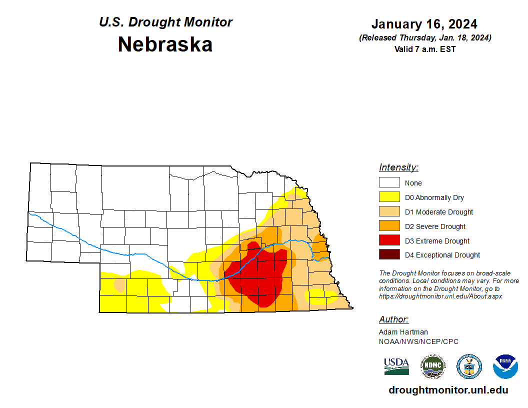
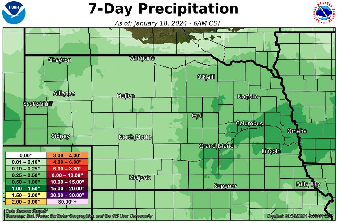
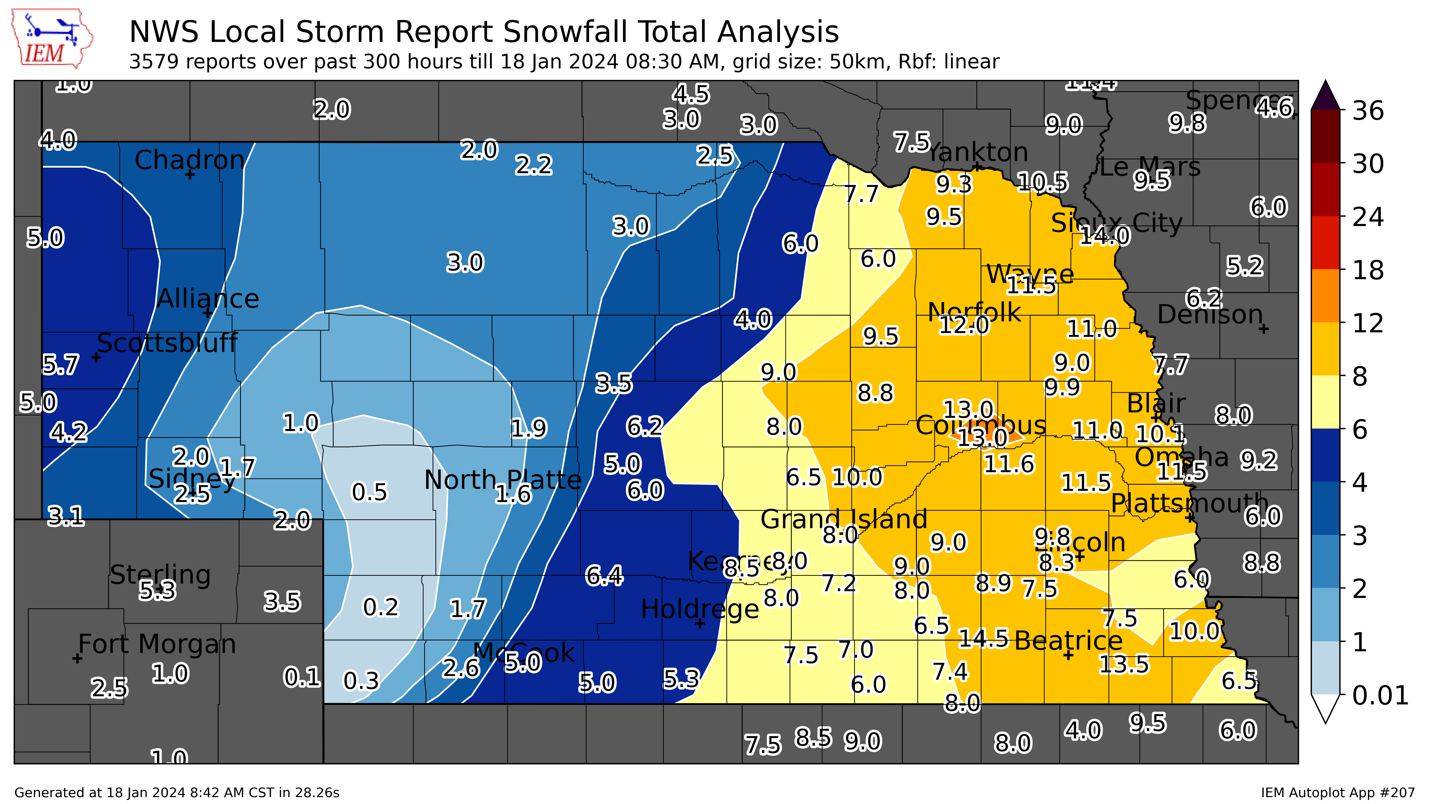
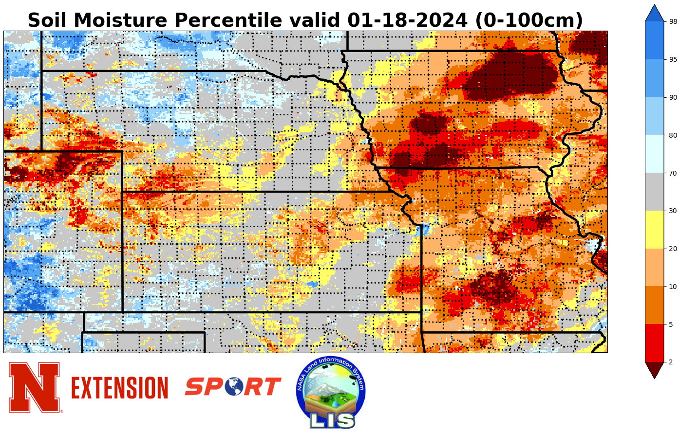
Drought and Precipitation Update
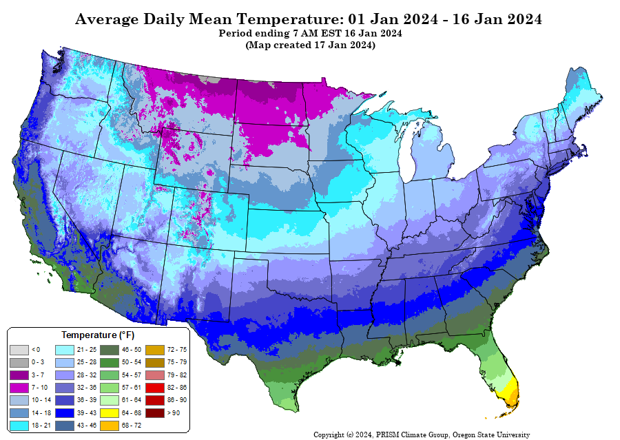
Recent precipitation was enough for a 1-category improvement to moderate drought (D1) in Burt and western Washington counties last week. Most of the state received some precipitation but heaviest amounts were in the Highway 30 corridor from Omaha to Columbus where snowfall totals were highest last Thursday into Friday. The Panhandle missed out on the snow last week but picked up a few inches early this week and then again yesterday. The moisture was welcome in that area too as it has been on the dry side since mid-fall. Southwestern Nebraska has also been dry in recent months and is the one part of the state that has missed out on the snowfall. Will be interesting to see how well the winter wheat in that region held up after the extreme cold last weekend with little snow cover.
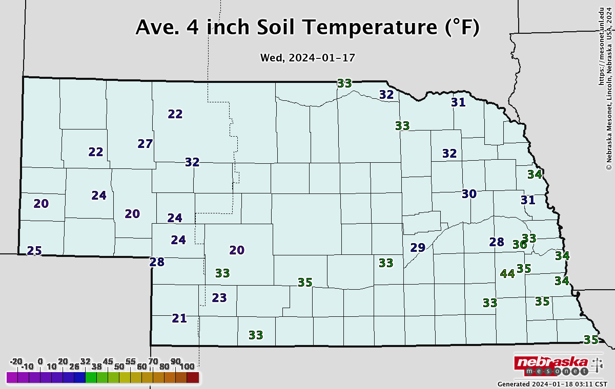
Historic cold
A week ago I joked that the polar vortex was doing yoga but the cold from the PV stretching was no joke and it was historic. Every climate division in the state has had a top 10-cold for the common period of record from January 8-17 and many places in North Central and Northeast Nebraska spent over 80 hours consecutively below 0 and much of that with wind chills in the 35-40 below range. Quite the change from last month when we had the warmest December on record statewide.
Eric Hunt, University of Nebraska Extension