
Snow forthcoming
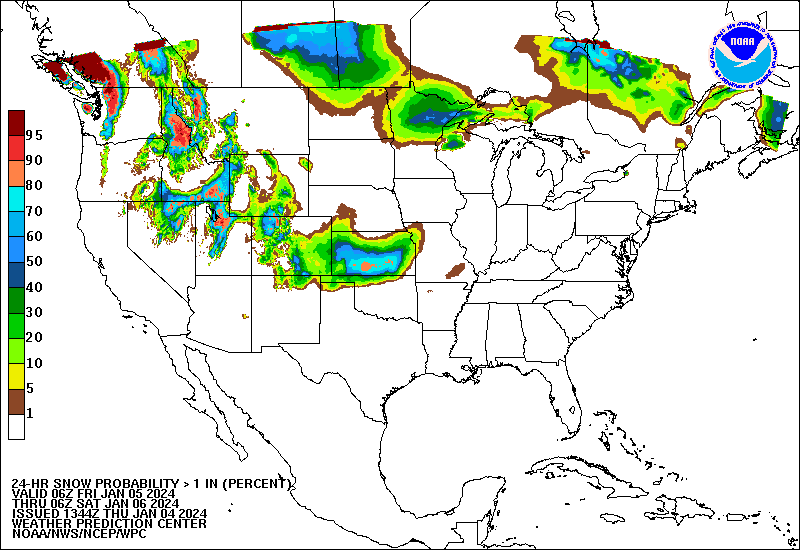
Appetizer: A modest shortwave will be moving through the Southern Plains, which will bring a chance of snow to the southern third of the state tonight and early tomorrow morning. Best chance for accumulating snow over an inch will be over southwest Nebraska.
Main Course: After a break this weekend and maybe even some sun (yay!), our attention turns to the storm system moving from the Four Corners into the central U.S. At this point I don't have much to add to what I wrote about yesterday. The expectation is still for a surface low (with an expansive precipitation shield) to move from New Mexico into Oklahoma before moving northeast toward the Great Lakes. A prolonged period of snow is possible for the eastern half of Nebraska starting early Monday, with some period of heavier snow possible between York and Nebraska City. It is also possible that there would be a period of rain and/or sleet initially in the southeastern section of the state. As of now, it appears west central and north central Nebraska will get some snow (few inches) and the Panhandle will miss out. But a more northward track could mean the entire state sees some snowfall. Snow totals in central and eastern NE are harder to pin down at the moment but there is a reasonable chance at 6 inches of snow along and south of Highway 30 and east of Highway 81. Bottom line- unless you live west of Ogallala or Big Springs, be prepared for some travel issues on Monday into early Tuesday.
Dessert: Mother Nature appears to be also offering dessert next week in the form of more snow for the northern 3/4 of the state on Wednesday night into Thursday and then maybe another round for everyone by next weekend. Both are still a ways out but be prepared for additional snow at various points next week, perhaps significant snow.
Temperatures
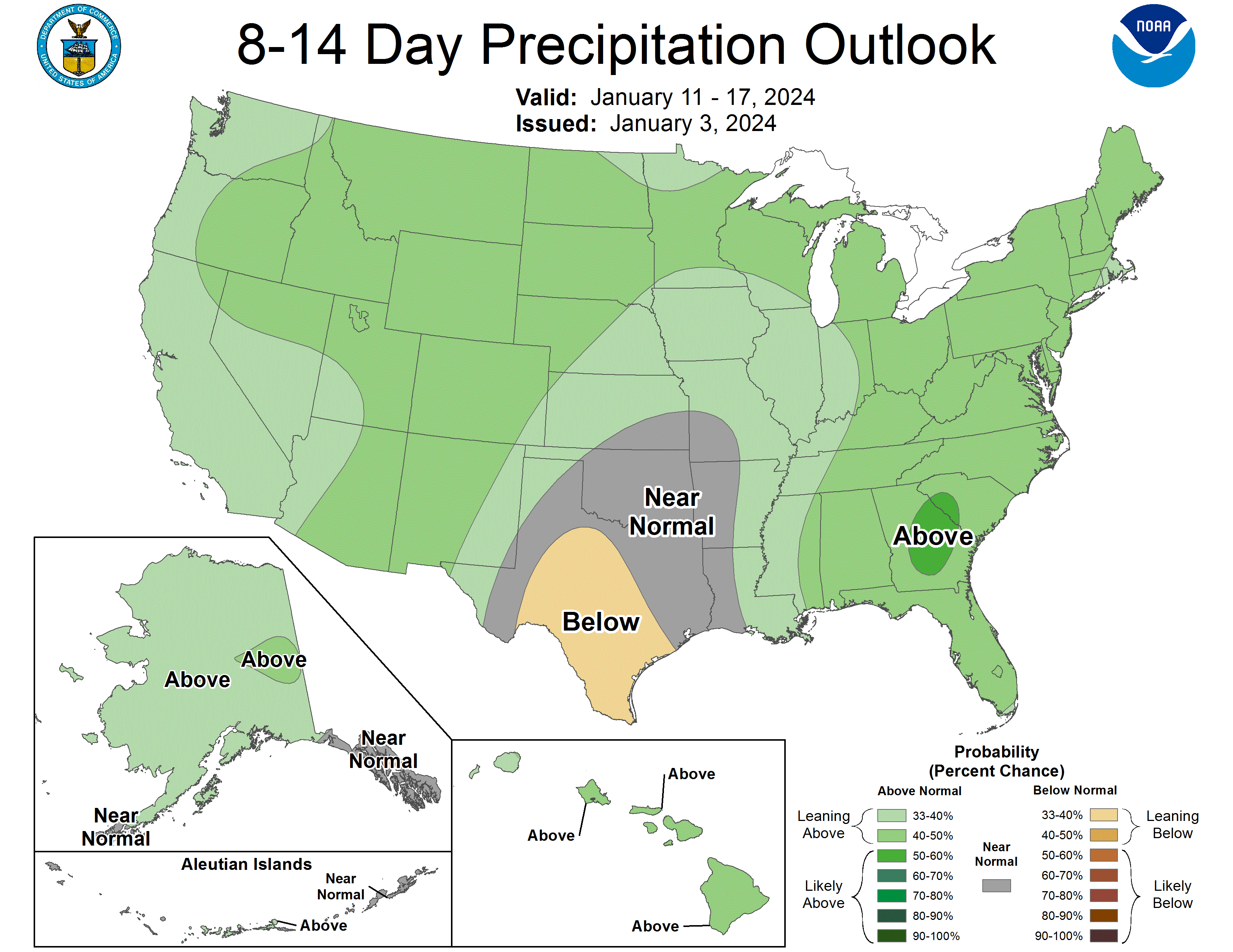
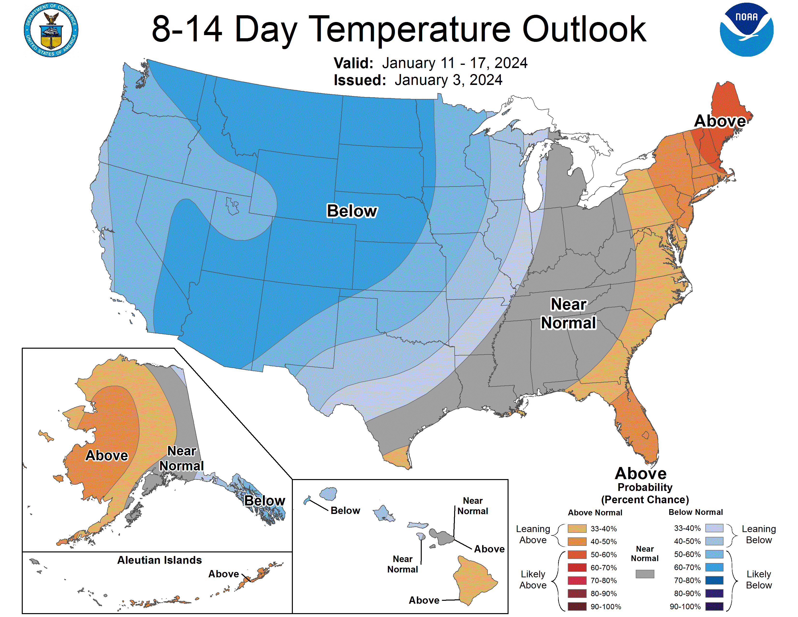
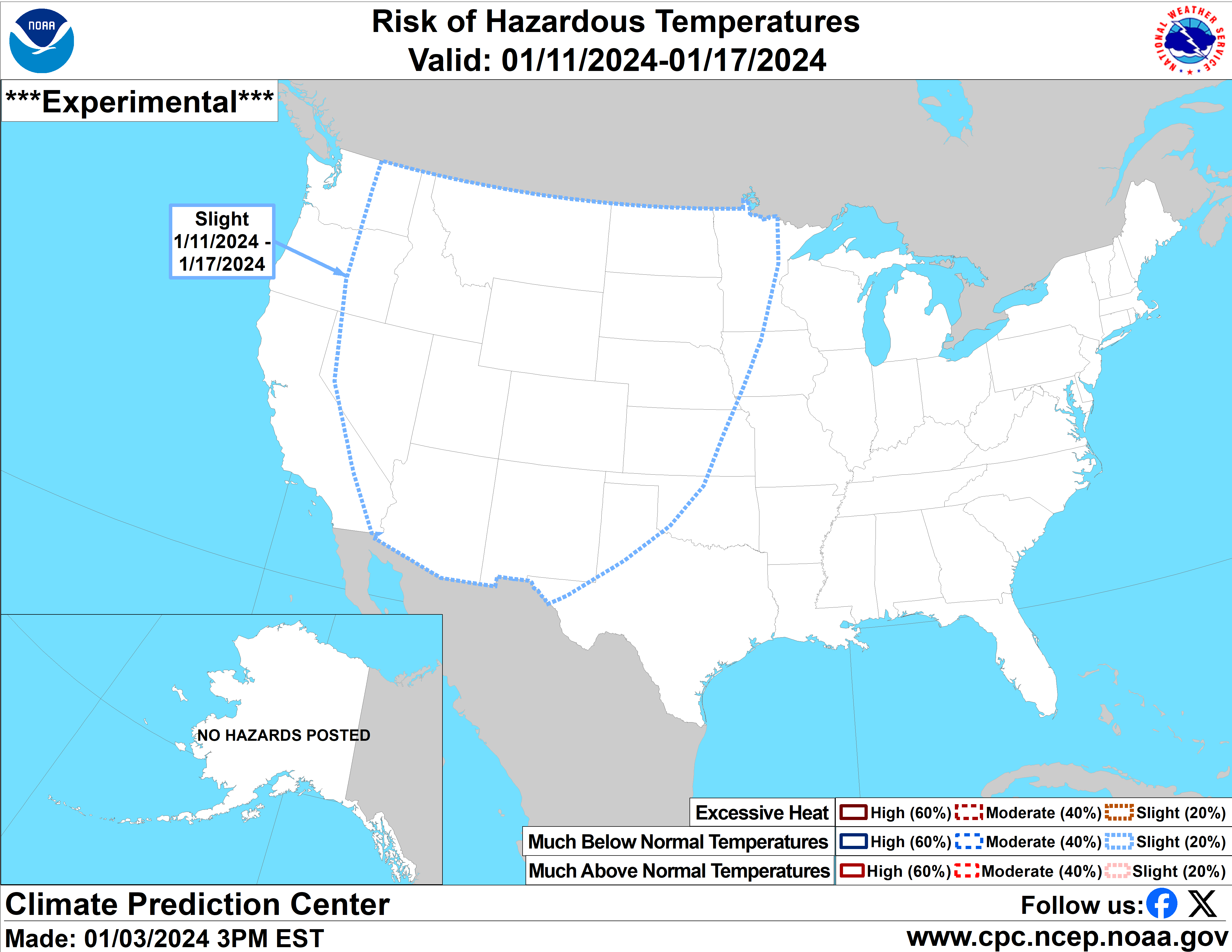
The CPC has highlighted the entire state (and much of the central U.S.) as being at risk for extreme cold between January 11-17. Right now it appears next Sunday-Wednesday will be seasonal across the state (with some warmer temperatures in southwest NE) and then it will turn much colder by late in the week, potentially very frigid by Friday. Get ready for subzero temperatures statewide later next week and northeast Nebraska has a shot of struggling to get above 0 for a high next Friday. That is not an official prediction but is within the realm of possible. This also does not appear to be a glancing blow of cold air either. It may around for a while.
Drought improvements
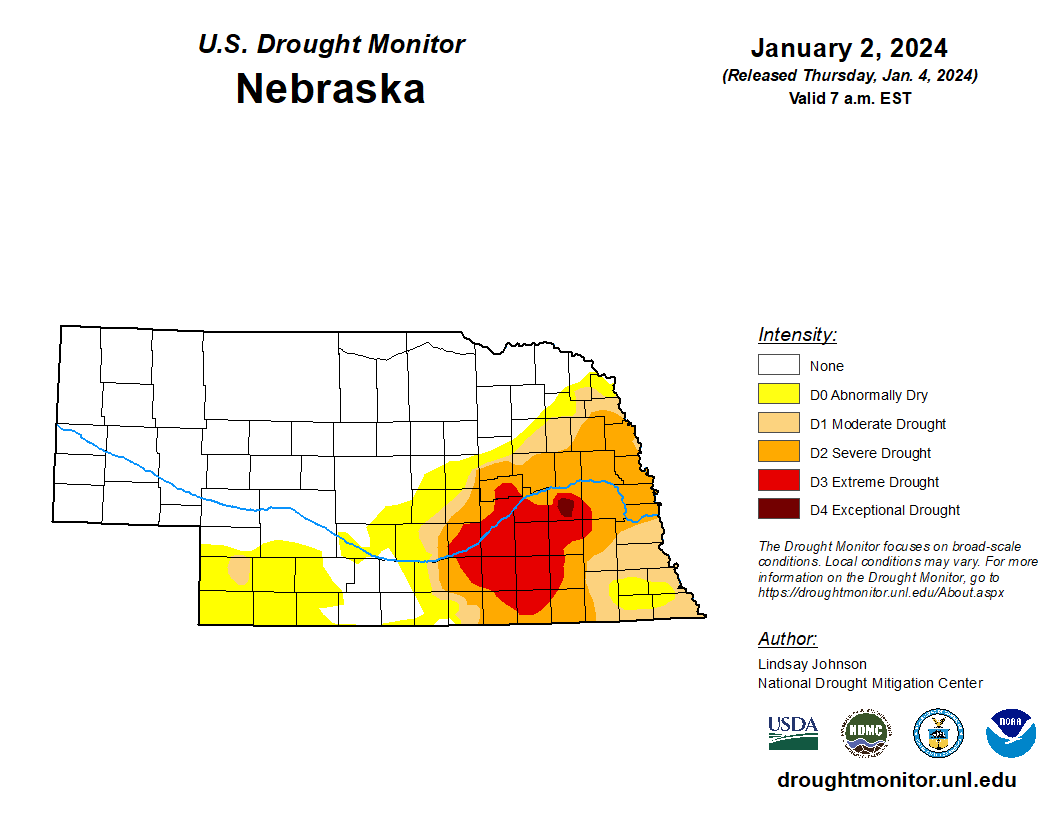
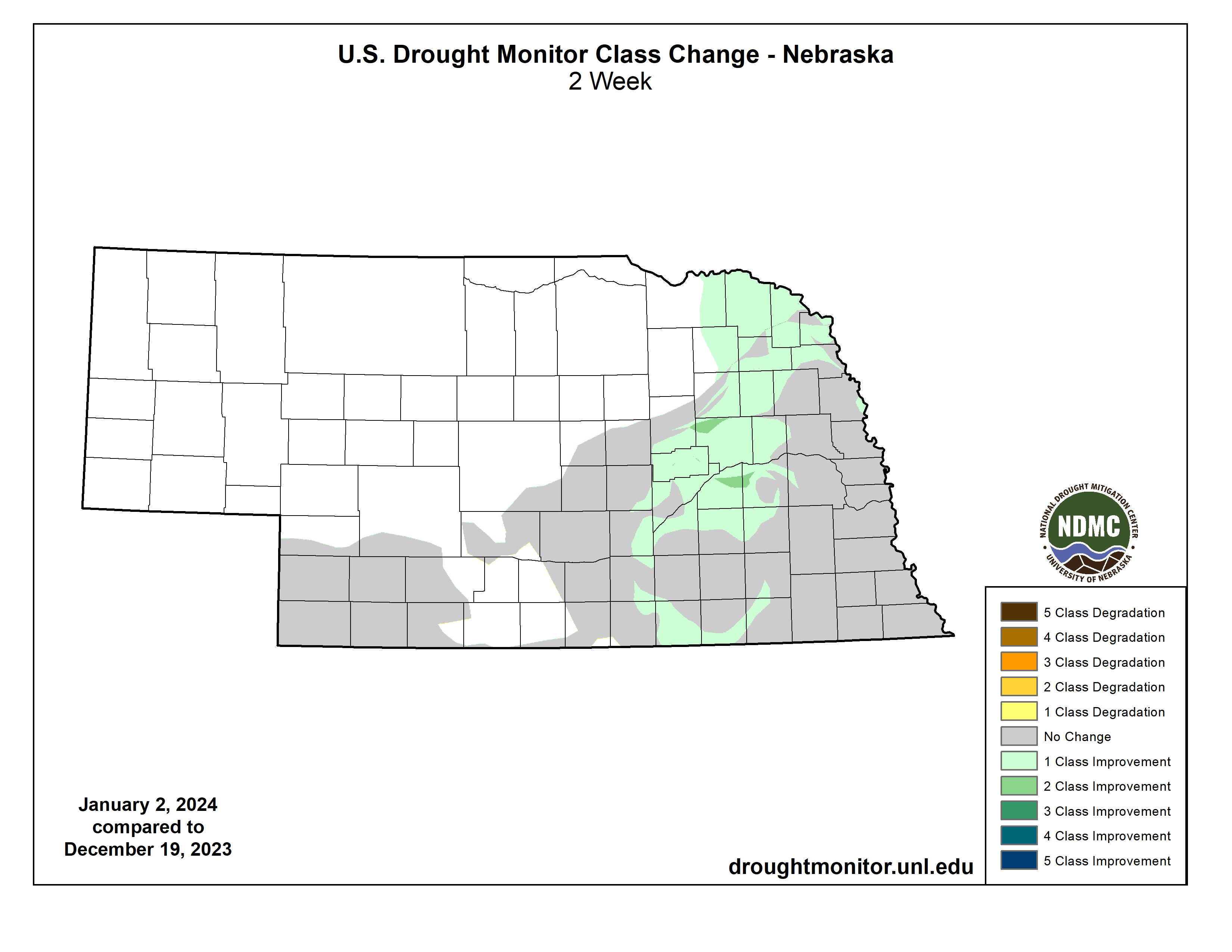
With significant precipitation (for this time of year) falling in the period around Christmas, we did see some meaningful improvement on the U.S. Drought Monitor. Much of east central NE saw a 1-category improvement and now almost all of the exceptional drought (D4) in the state is gone. Exception is a section of Butler County. For parts of Hamilton and Merrick counties, it was the first time out of D4 in several months. There is still a long way to go before the drought is over but the second half of December delivered very beneficial moisture to the eastern two-thirds of the state. The Panhandle generally missed out and was the only part of the state that was generally drier than average in December.
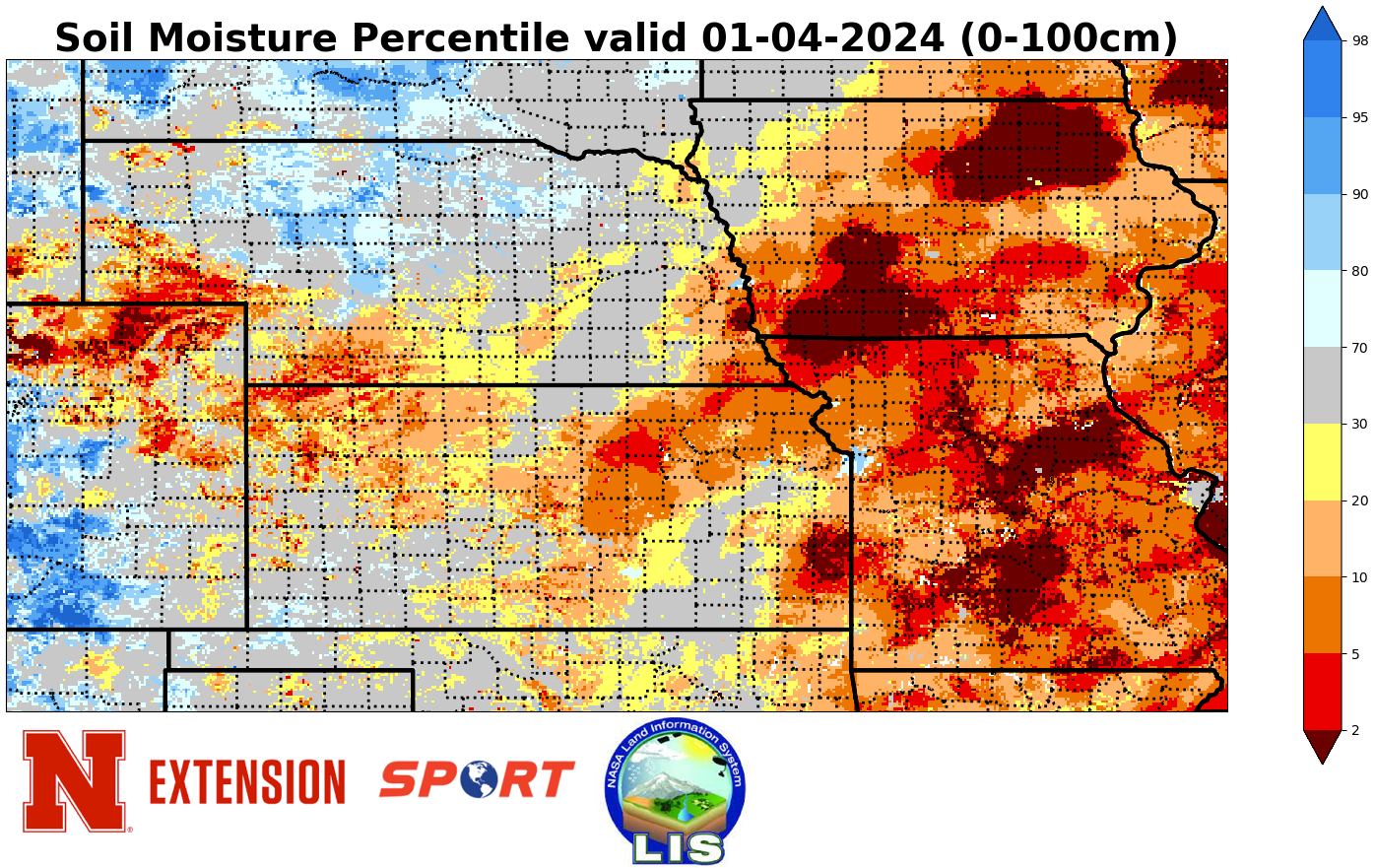
Since soil temperatures were above freezing at the time of the rain before Christmas, a good portion of that moisture (in theory anyway) infiltrated into the top part of the soil profile. Indeed, the latest SPoRT LIS maps show that soil moisture percentiles are back in a more "normal" range across much of East Central and Northeast Nebraska. This does not mean the soil profile has been entirely replenished but is better than at this time last year. Soil moisture is still deficient across the southeastern and southwestern corners of the state and is also on the low side in the southern part of the Panhandle.
Eric Hunt, University of Nebraska Extension