


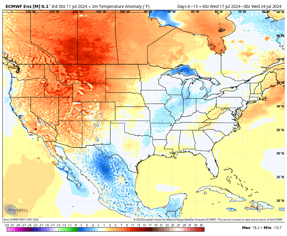
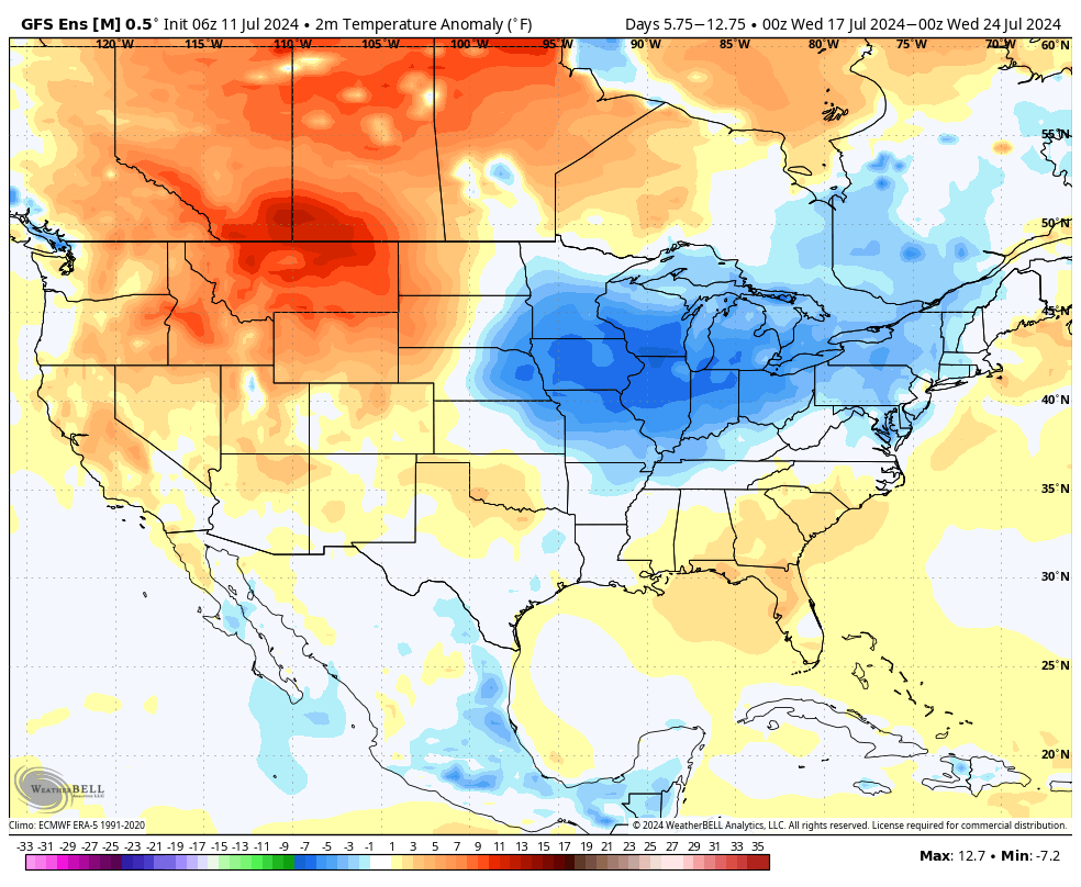


Heatwave
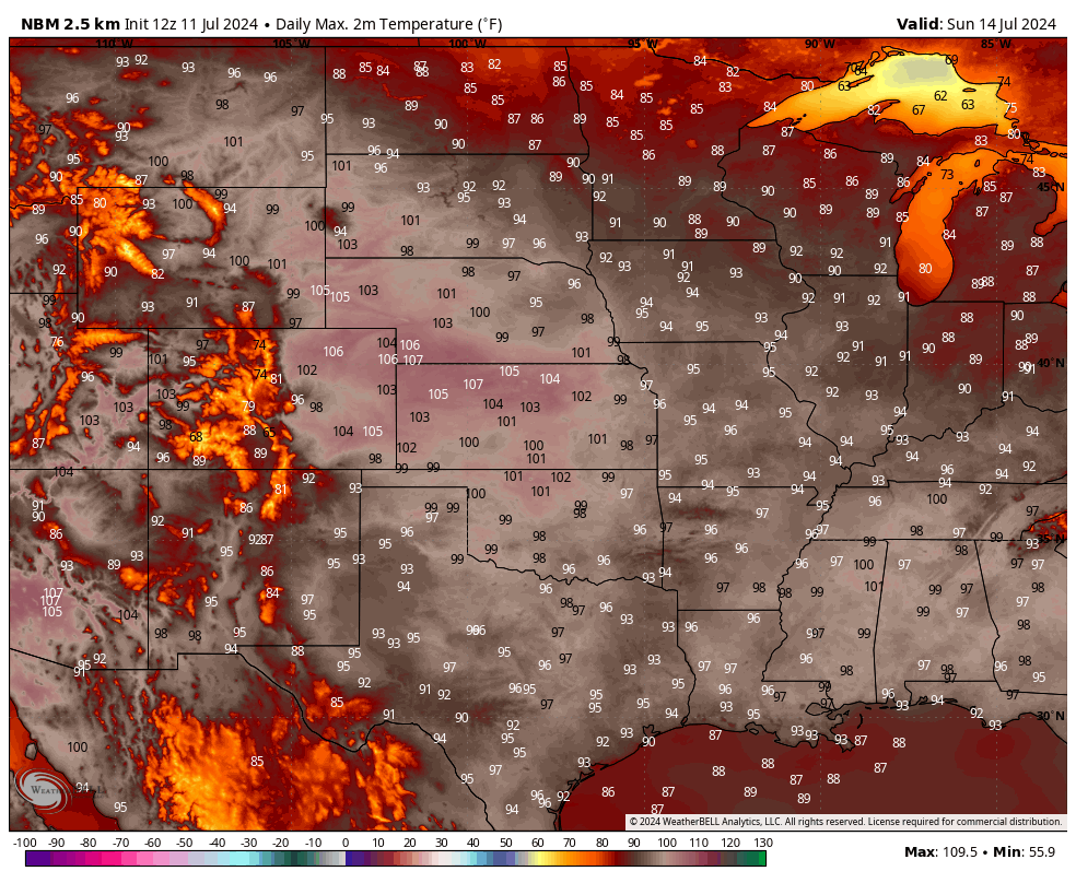
No, the disco band from the 1970's isn't paying us a visit. This is Mother's Nature version and I suspect it will be about as popular as a trip to the dentist for a root canal. Nevertheless it is coming and preparedness is key. The most immediate concern in the forecast is the impending heat that will be starting in western Nebraska today and spreading east over the next few days. Areas around Scottsbluff will be around 100F today and much of western Nebraska will be in the 100-104 range tomorrow-Monday. The heat will continue to escalate during the day on Saturday and by Sunday, temperatures will be over 95F statewide and temperatures likely will be 100F+ or higher across much of southern and western Nebraska. Temperatures could hit the magic 100F mark as far north as the I-80 corridor and could flirt with 108F around Benkleman and Imperial. In the eastern side of the state, dewpoints could be well into the 70's at times. This may keep the temperatures a bit under forecast highs but the apparent temperatures will likely be even worse. Be prepared for heat index values to approach 110-115F in the far eastern side of the state on Sunday and likely will be around 105F for consecutive days across a broad section of the state. Heat advisories will likely be issued statewide and sections of eastern Nebraska are likely to get an excessive heat warning. Some of the models do show some drier air mixing in on Sunday afternoon across southeast Nebraska. If this verifies, this would reduce the heat danger somewhat in places like Beatrice, Lincoln and Crete. But the models are likely underestimating evapotranspiration from crops given they have plenty of water to work with and it is peak ET season. There will be chances for scattered thunderstorms in west central Nebraska the next two days but this weekend should be dry for everyone.
Bottom line: This heat wave could set records in western Nebraska and needs to be taken seriously everywhere.
A quick look at ACIS shows record breaking maximum temperatures are a decent possibility in Scottsbluff, Chadron, Alliance, Imperial and North Platte on Sunday. Records may be broken on Saturday or Monday in a few spots as well.
Cooler weather and better chances of moisture to follow
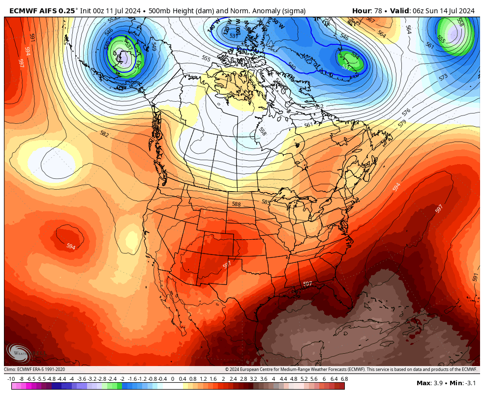
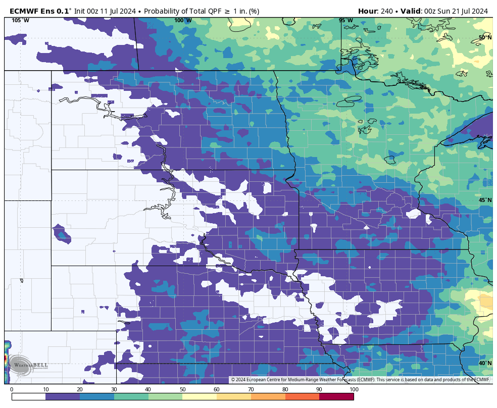
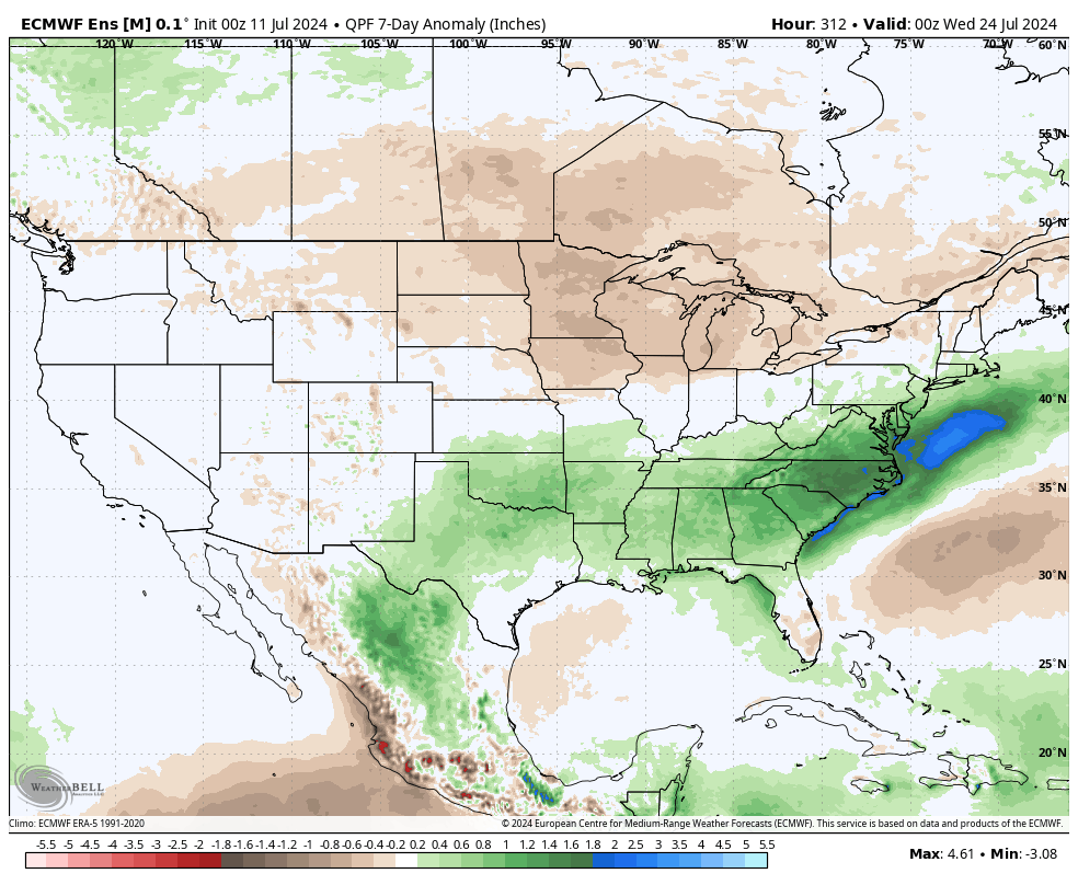
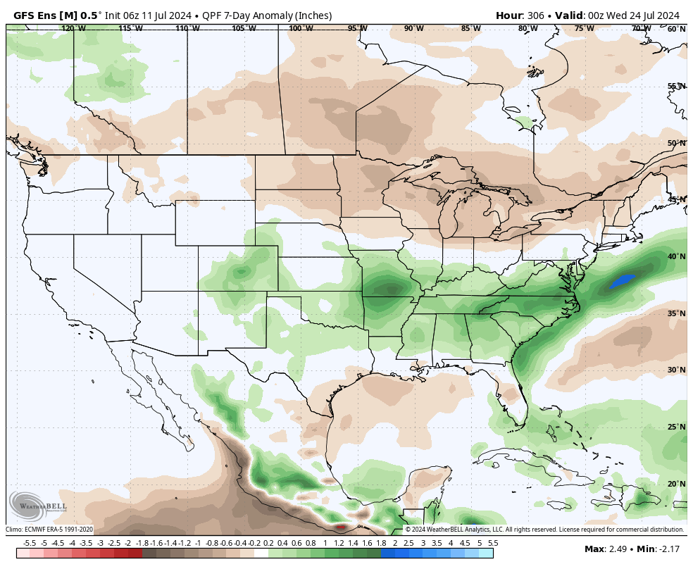
The strong mid-level ridge that is the culprit for the intense heat will begin to flatten out on Monday, which should keep temperatures a bit cooler than on Sunday. By Tuesday, a more pronounced change will begin to take shape as flow becomes more amplified, with ridging in the western U.S. and a trough entering the upper Midwest. This will help drive a surface cold front into the region by Tuesday morning and lead to good chances for showers and thunderstorms statewide. It will also bring much cooler temperatures. Models are not overly bullish on significant precipitation for most of the state but am a little suspicious that this could be underestimating convective activity. Heaviest precipitation is currently forecast between Big Springs and North Platte, which would be welcomed after it's 106 on Sunday. Regardless, everyone should get a chance for some rain next Tuesday into Tuesday night and a break from the heat. This break is likely to start Tuesday in areas north of Highway 20 and by Wednesday everyone should have highs in the lower to mid 80's.
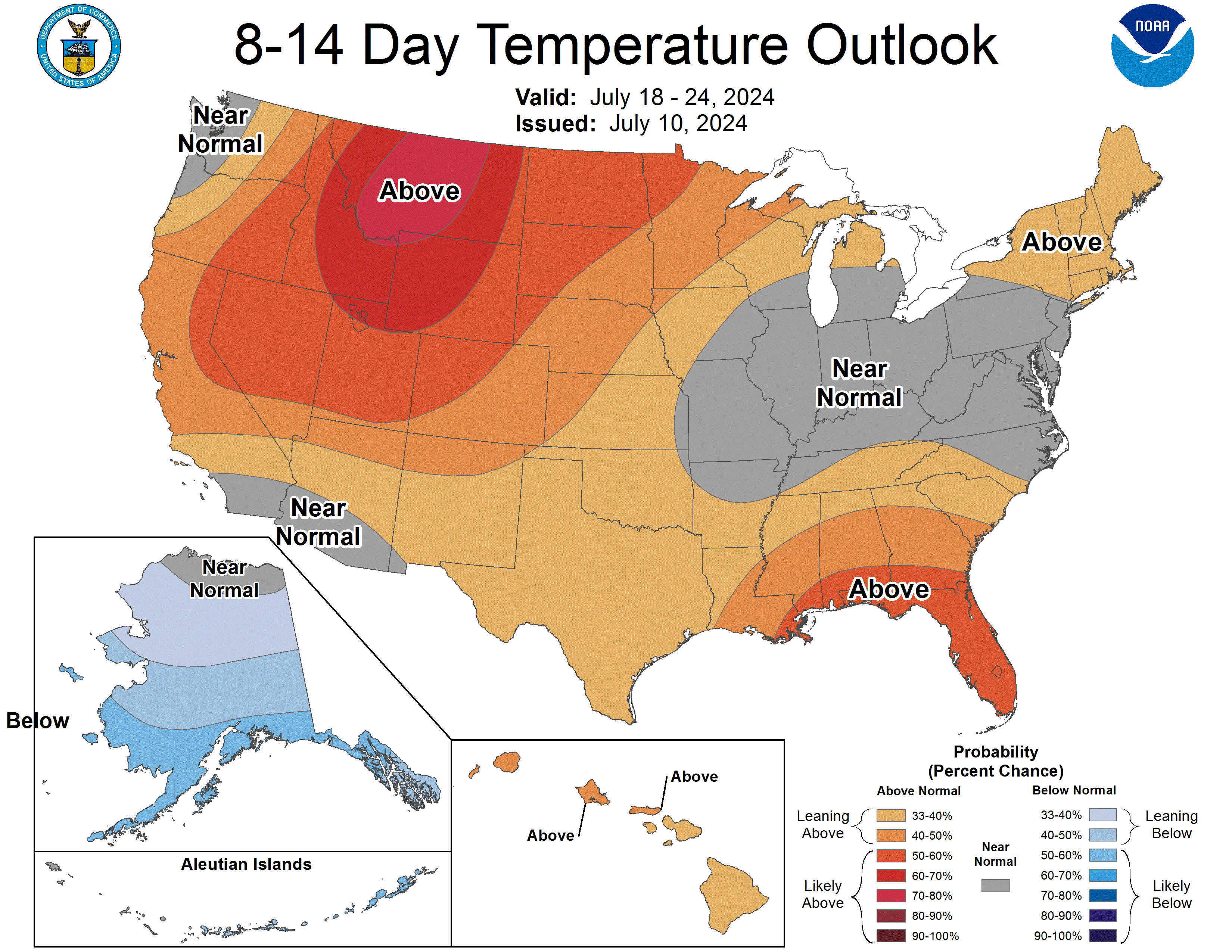
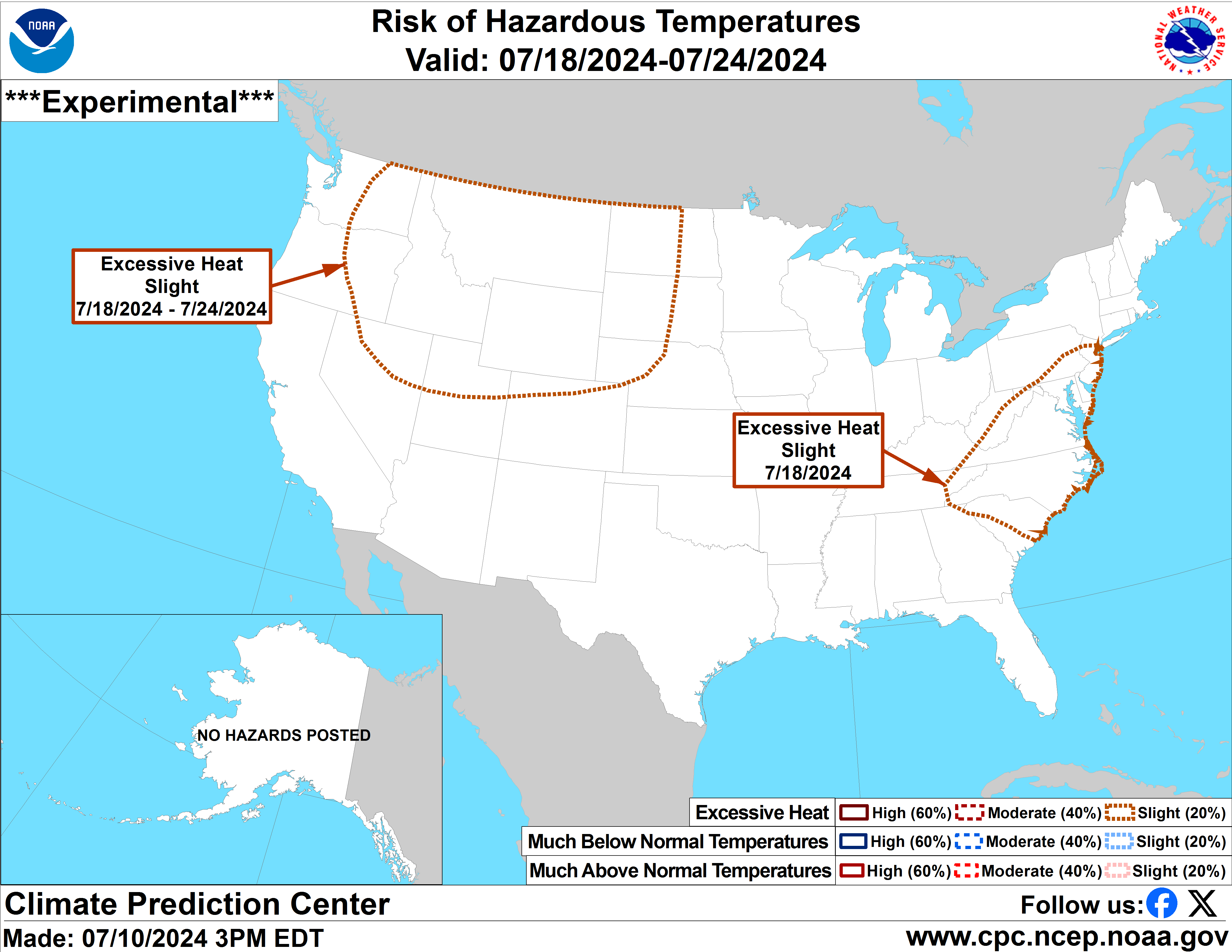
Cooler weather will be more short-lived in western Nebraska but the eastern half to third of the state is likely to get a break from the heat for the remainder of the week and into next weekend. Later in the week the upper-air pattern is expected amplify even further, which will strength the ridge in the western U.S. On the eastern periphery of the ridge, models give some indication of a potent shortwave moving into the Northern Plains, which could bring thunderstorms to the eastern half of the state. It is a ways out but concern for severe thunderstorms, including high winds, would exist should that come to fruition. As that ridge builds in the west, expect the heat to return to western Nebraska. The CPC already has much of the western U.S. (including the Panhandle) in a slight risk for excessive heat next weekend. That heat likely will be paying the rest of the state a visit eventually.
Oh Hail No
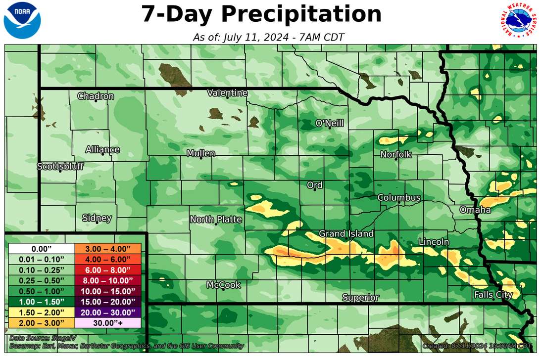
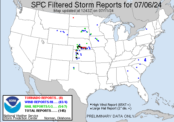
Last Saturday featured welcome rain across much of central and southeastern Nebraska, which helped eliminate the remaining abnormal dryness (D0) in the eastern half of the state. Unfortunately the rain also came with tornadoes and hail. Lots of damaging hail. A look at MODIS NDVI imagery (which can give insight to vegetation health) shows a big drop in NDVI between last week and this week in areas known to have hail. The most egregious example is from Dawson County between Gothenburg and Cozad where there appears to be a several miles long swath of hail damage. This is at least the third year in a row that there has been a massive, damaging hail event in the state in July.
Drought and Moisture Update
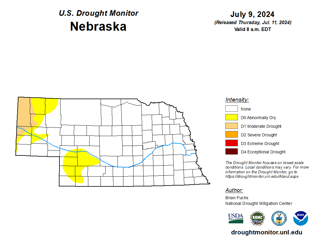
As mentioned in the previous paragraph, the remaining abnormal dryness in south central and southeastern Nebraska is now gone. Moderate drought (D1) is still in place across the western Panhandle with other abnormal dryness in the Panhandle and the West Central section of the state to the southwest of North Platte. A look at the latest soil moisture percentiles map from SPoRT LIS suggests there is a decent reserve of soil moisture across most of eastern and central Nebraska. This should keep crop stress from the pending heat to a more minimal level, though a few more of these 3-4 day stretches of intense heat over the next six weeks will take high end off the yield regardless of moisture conditions. The prolonged heat in western Nebraska in the coming days is also likely to more rapidly deplete soil moisture, which could lead to further degradation on the Drought Monitor in the coming weeks.
NASS Crop Progress update
Condition ratings for corn came in at 80 percent good-excellent (G-E) against 4 percent poor-very poor (P-VP) while soybean checked in again at 77 percent G-E and 5 percent P-VP. Corn is well ahead of the 5-year average with 21 percent in the silking stage. Soybean blooming and pod setting stages are also advanced compared to the 5-year average. Sorghum is rated at 84 percent G-E against 0 percent P-VP and is on par for heading. Winter wheat harvest is progressing ahead of average (28 percent complete) aGood yields are anticipated this year. 95 percent of oats have headed and are rated as 78 percent G-E and 2 percent P-VP. Pasture ratings of the season show 69 percent G-E against 3 percent P-VP. That is an improvement in conditions over a week ago. VegDRI continues to depict very good pasture conditions in the northern and eastern Sand Hills regions but poorer conditions in parts of the northwestern Panhandle where drought has developed. VegDRI also shows good conditions on crops across much of the state, except in the western Panhandle where VegDRI indicates more severe levels of water stress.
Temperature and Precipitation Roundup
Attached are .pdf's containing the maximum/minimum temperature, average temperature, number of days with maximum temperatures ≥95F, minimum temperatures ≥70F, degree days, and total precipitation for each station that had no missing days over the period from June 30- June 6. Includes CoCoRaHS observer reports. Below are the temperature and precipitation extremes around the state over the past week.
Maximum Daily High Temperature: 95F, Chadron Municipal Airport
Minimum Daily High Temperature: 68F, North Loup
Minimum Daily Low Temperature: 36F, Harrison 20 SSE
Maximum Daily Low Temperature: 68F, Omaha Eppley Airfield
Maximum Weekly Precipitation: 4.27", Callaway 0.2 S
Minimum Precipitation: 0.00", Multiple Locations
Eric Hunt, University of Nebraska Extension


