
Storms Friday night
An MCS looks likely to develop along the Front Range tomorrow afternoon and make its way into western Nebraska during the evening hours before paying a visit to the eastern 2/3 of the state during the late evening and overnight hours. Severe threat looks lower across eastern Nebraska but residents of western Nebraska (particularly in SW and WC Nebraska) should be prepared for possible hail and high winds. A half inch to inch of rain would seem fairly likely for most of the state tomorrow night, with some areas possibly picking up more.
Active weather next week
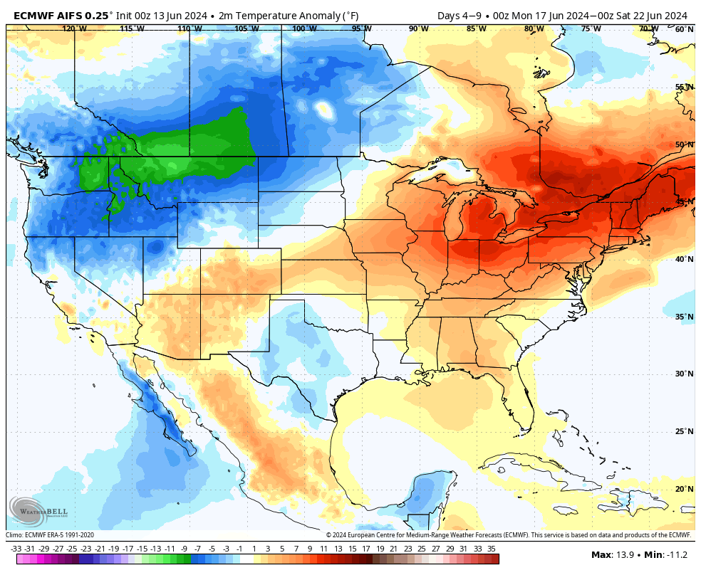
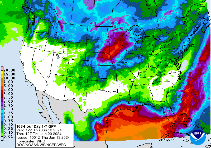
The projected pattern next week places a large ridge in the eastern U.S. and a trough in the northwestern U.S. That will put our region of the country in the "battle zone" between hot and humid and cooler, more pleasant air. With this setup, there are going to be periodic chances for thunderstorms next week. Hard to pinpoint exact timing but suffice to say this setup would favor not only chances for severe weather but also chances for flooding in the eastern half of the state. Heaviest totals in the 3-6" range would be most likely in central and northeastern Nebraska but most areas should get at least 1-2" next week, except for the Panhandle (where we could use that kind of moisture). This pattern will also keep the southeastern third of the state hot and muggy until midweek while residents of western Nebraska can enjoy cooler temperatures AND lower humidity. Next week might be a good excuse to go visit Chadron if you live in the east.
The One Percenters
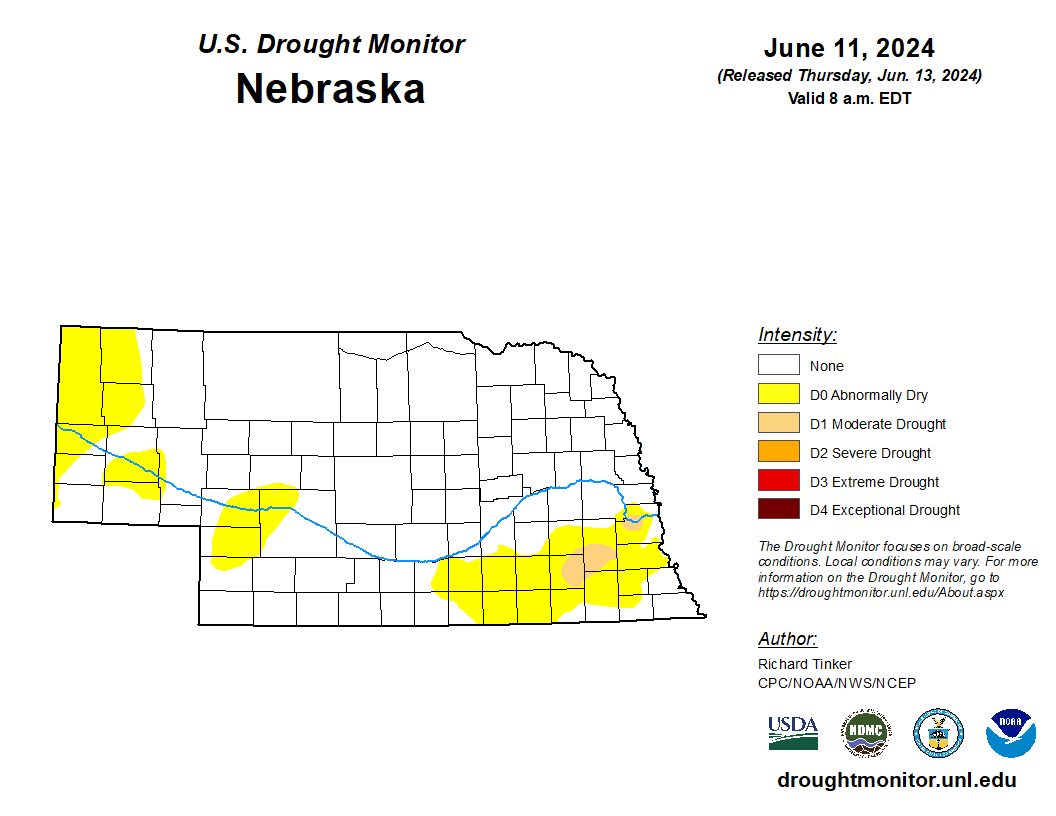
The latest U.S. Drought Monitor showed further reduction in drought in central Lancaster County, western Cass County, and northern Jefferson County thanks to last Friday evening's deluge. This means the north side of Lincoln is out of drought for the first time since the summer of 2022. It also means that we are down to just 1 percent of the state. being in drought. But there is still one pocket of drought left in northern Cass County and another one in southern Lancaster and eastern Saline County. Maybe precipitation in the next 7-10 days will be enough to get this area into D0, aka drought purgatory. There was degradation this week in the Panhandle, thanks to a drier than average spring and some signal in VegDRI of pasture stress. This is the area of most immediate concern for additional degradation as we move deeper into the summer.
Apologies for the relative brevity this week. Am on work related travel. A more full update will be available next week.
Eric Hunt, University of Nebraska Extension