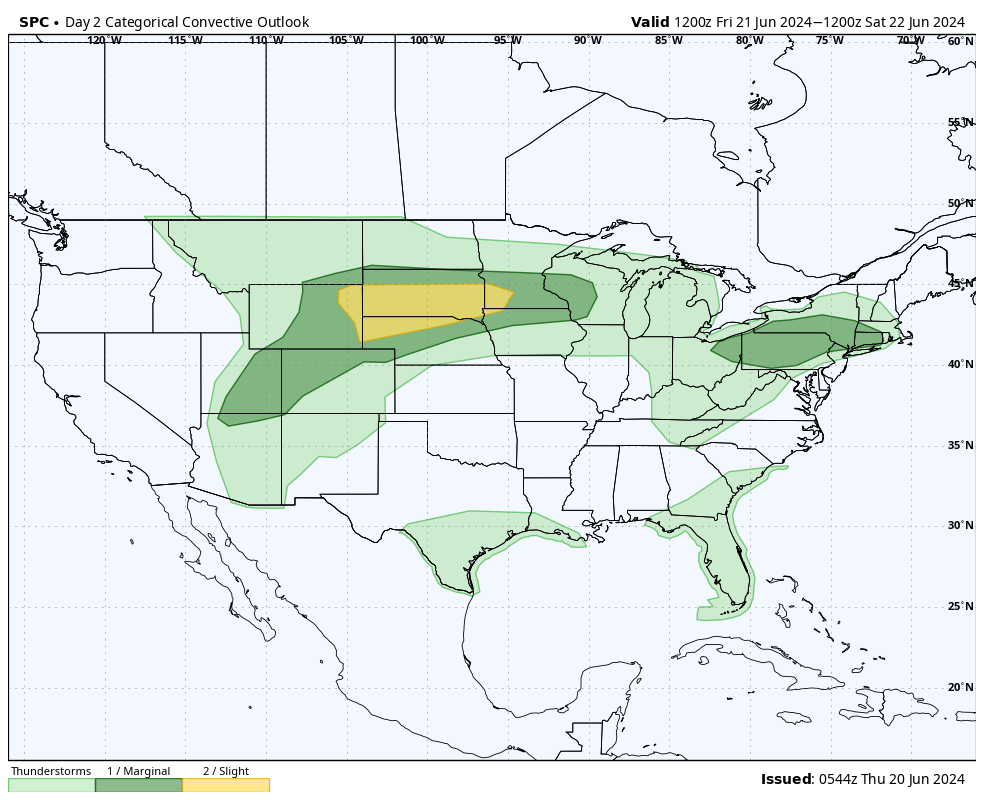
Stormy Nights
Tonight will feature good chances for thunderstorms (some severe) across the western third of the state, particularly between from Sidney/Alliance and Mullen/Valentine. Chances of storms are also good on Friday night in western and northern sections of the state with an outside chance of storms getting as far southeast as Columbus and Blair. Omaha, Lincoln, Grand Island, and Nebraska City areas are expected to remain dry.
Frontal passage Saturday
The warm front that is moving through the state now will eventually stall somewhere between Highway 20 and I-90 before advancing south as a weaker cold front during the day on Saturday. Models are indicating modest levels of surface based energy and some vorticity in the southeastern corner of the state so thunderstorms are certainly possible in areas along south of the Platte in eastern NE, even though chances right now look lower. Recommend paying attention to the forecast on Saturday morning to see if chances have increased. Temperatures should be a tad bit cooler on Sunday though still a little above seasonal averages across the state.
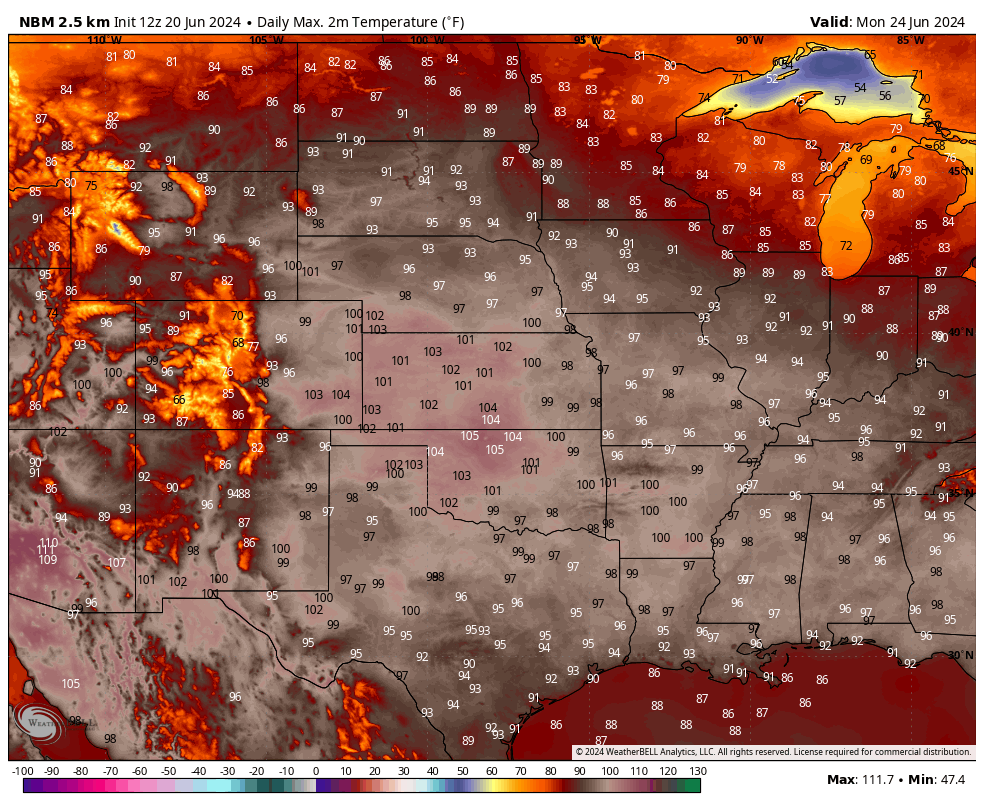
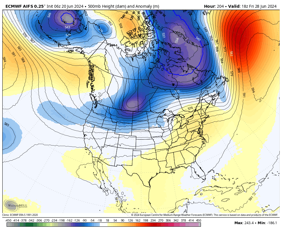
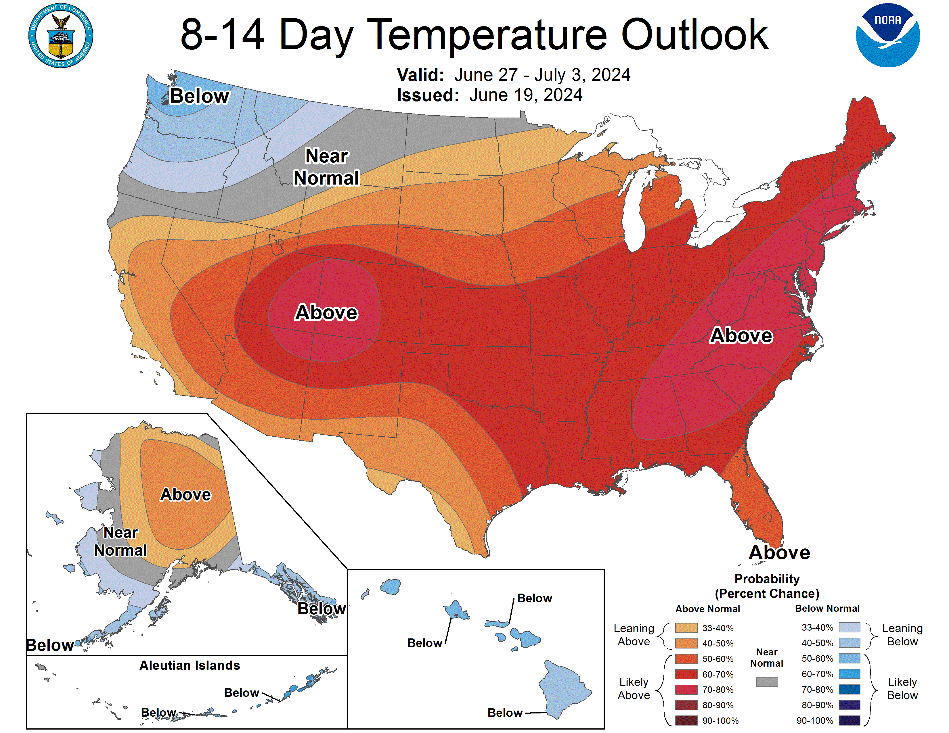
Hot Stuff
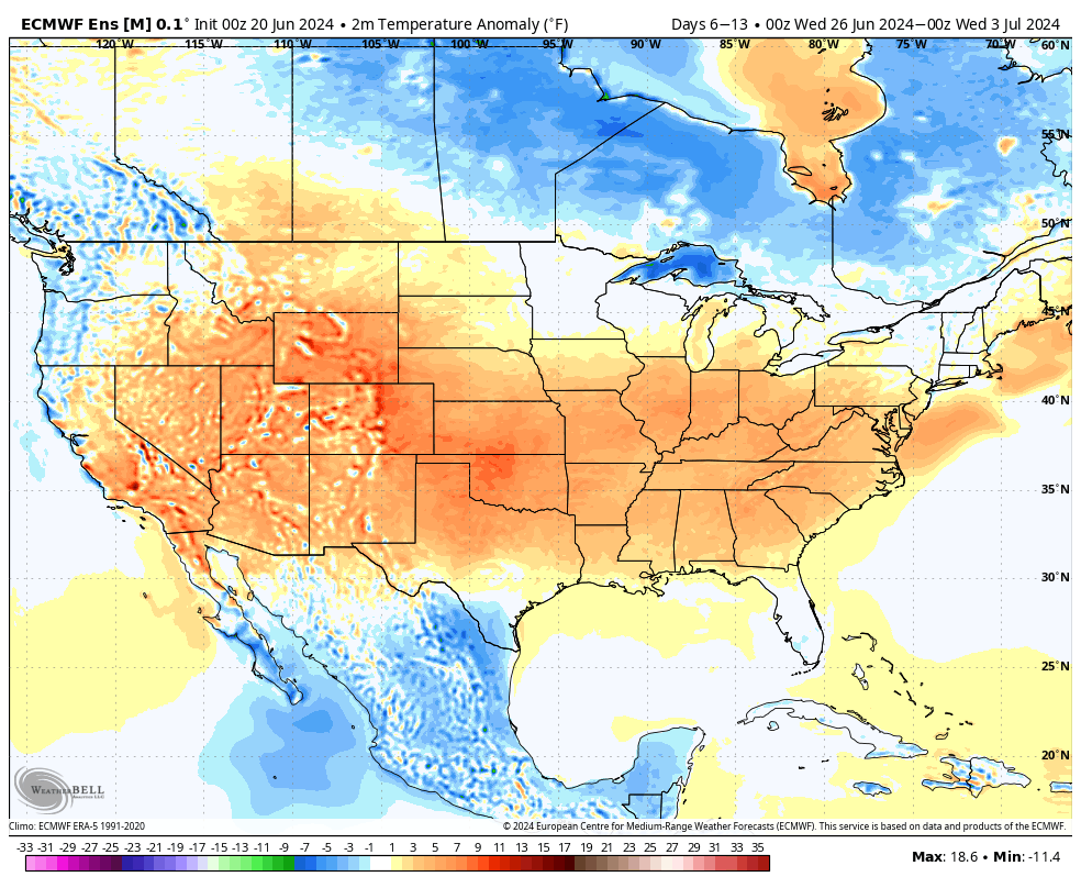
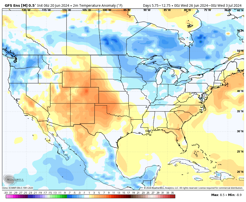
By Monday the ridge that is currently causing record heat in New England will be anchored over the central U.S. As a result temperatures in most of Nebraska will be as hot as disco music in 1978. Current output from the National Blend of Models suggest temperatures 95+ statewide with triple digits likely along the Kansas border and in parts of the Panhandle. In eastern Nebraska there will also, of course, be plenty of humidity. Expect heat index values to be in the 105-110 range along and south of I-80 in the eastern half of the state. It would be a good thing if the CWS done before Monday given the expected heat. Tuesday will be another hot day across the state, though likely a bit cooler than Monday. Heat index values on Tuesday may top out in the 100-105F range instead of 105-110F in Beatrice, Auburn, Geneva, and Clay Center.
Storms possible Tuesday night
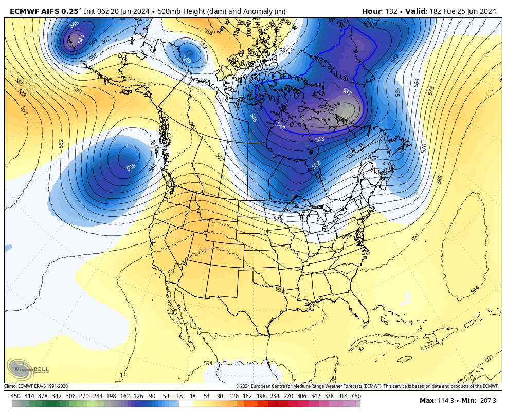
As the center of the ridge axis shifts to the west by late Tuesday, a shortwave trough will also be entering the upper Midwest. This potentially puts the Western Corn Belt, including eastern Nebraska, in a potentially favorable spot for a complex of storms to roll through overnight on Tuesday into Wednesday morning. Models aren't bullish on precipitation yet but they can often struggle with placement of convective systems this far out. The projected mid and upper level pattern does at least give the chance of thunderstorms, including high winds. Stay tuned to the forecast. Temperatures look to remain above average on Wednesday and Thursday, though less so than on Monday and Tuesday.
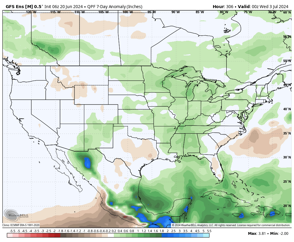
More chances for rain and cooler temperatures
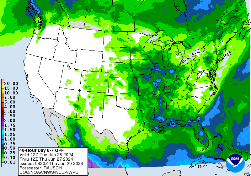
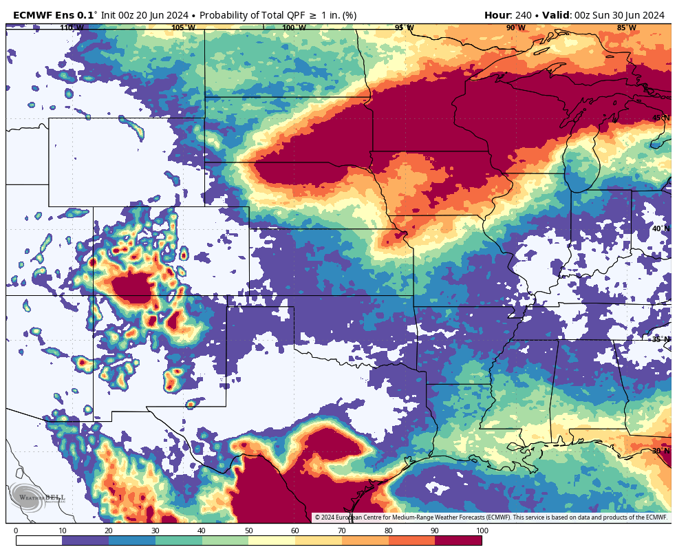
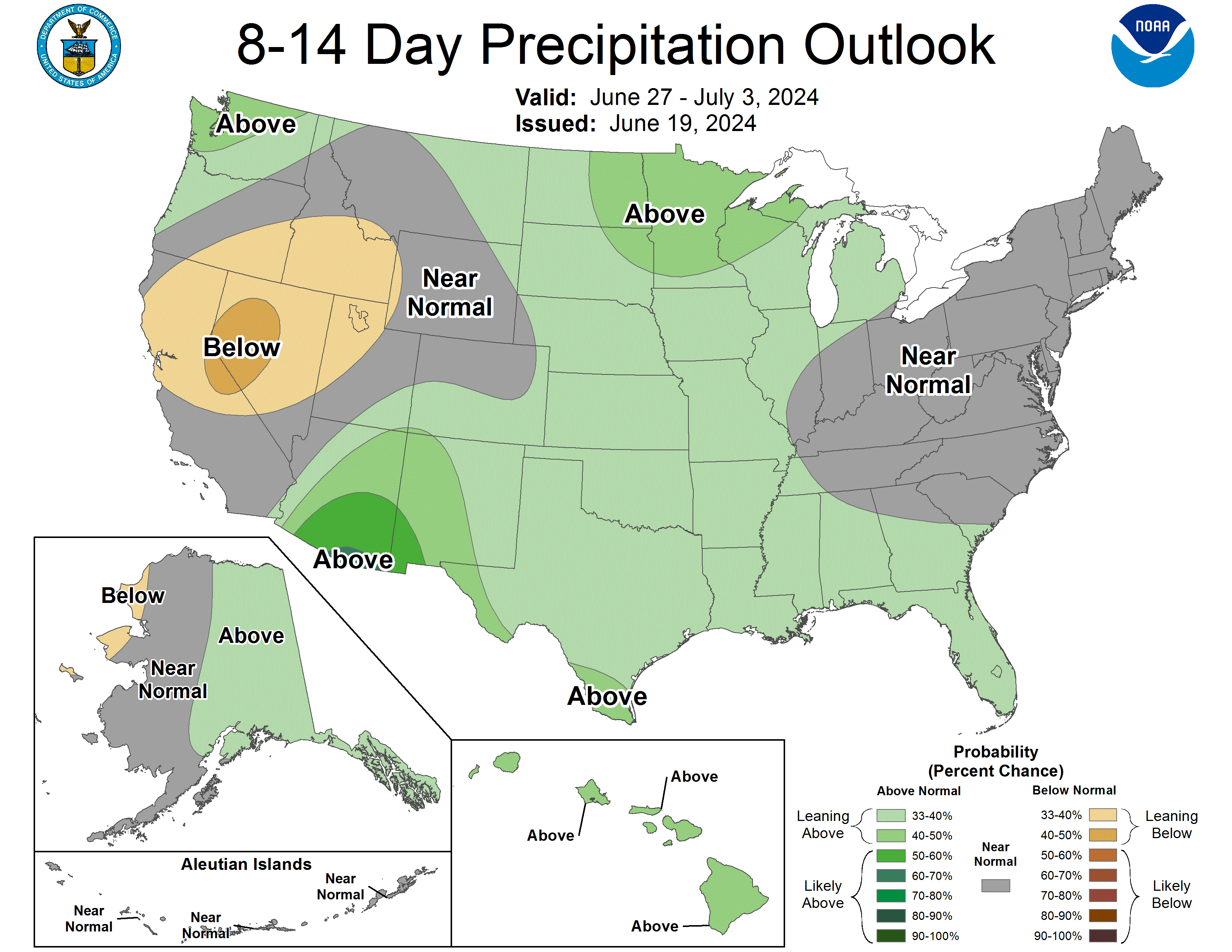
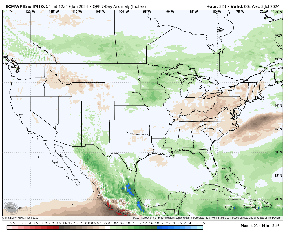
By later in the week the ridge looks to moves back to the eastern U.S. and a sharp trough will be centered along the Canadian border with eastern Montana. At the surface, the models are showing an area of low pressure moving east from the Front Range into the Northern Plains, which should bring a good chance of rain and thunderstorms to the eastern 3/4 of the state between Friday morning and Friday night. There will be additional chances of storms on Saturday too as additional energy traverses the area. Temperatures should be back to more seasonal levels in the 80's on Friday and Saturday as well. Looking into early July, there is some chance the eastern half of the state could get a bit longer break from hot temperatures and precipitation is likely to remain above average. Western Nebraska is more likely to remain warmer than average and less likely to get adequate moisture as we move into the 4th.
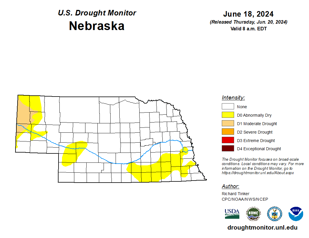
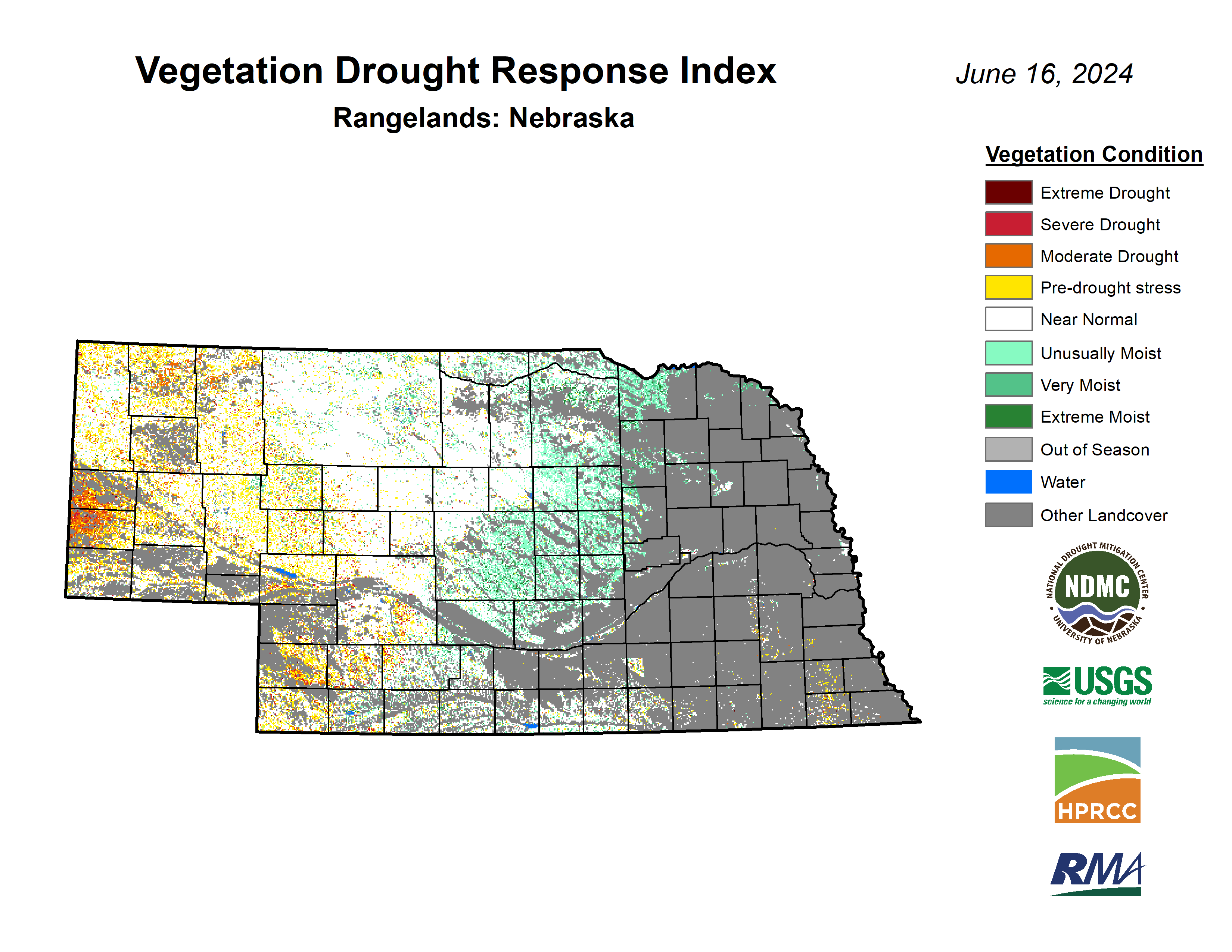
A Nebraska finally free of drought? Simon says "Not so fast!"
There is good news and bad news to report with regard to the U.S. Drought Monitor. The good news is the last of the drought in southeast Nebraska was upgraded to abnormal dryness this week. There is absolutely still a dry signal in southern Lancaster County (as an example) but is statistically closer to abnormal dryness (D0) than moderate drought (D1) for the time being. The bad news is drought was introduced into the western Panhandle from Scottsbluff and Gering up toward Harrison, where it has been quite dry (even by western Panhandle standards) over the past few months. This dryness is taking a toll on pastures according to VegDRI and is also starting to hurt the corn, sugar beet, and dry bean crops. The heat early next week is not going to help matters much either. For those keeping score at home, the last time we were officially free and clear of drought in Nebraska (on the USDM) was the map from June 16, 2020.
Chilly June morning
While much of the U.S. has been very warm to downright hot this week, temperatures were abnormally cool at times in north central and western Nebraska. This was especially true Wednesday morning when drier air, light winds, and a cool air mass helped lead to temperatures dropping well down into the 40's and even down into the mid 30's at a few sites. Temperatures in the 30's in mid-June aren't unheard of in the higher elevations of the Panhandle but it's definitely not typical. Some of those sites may have an 80F+ swing in temperatures between yesterday morning and next Monday afternoon. Hard to beat the swings of the High Plains!
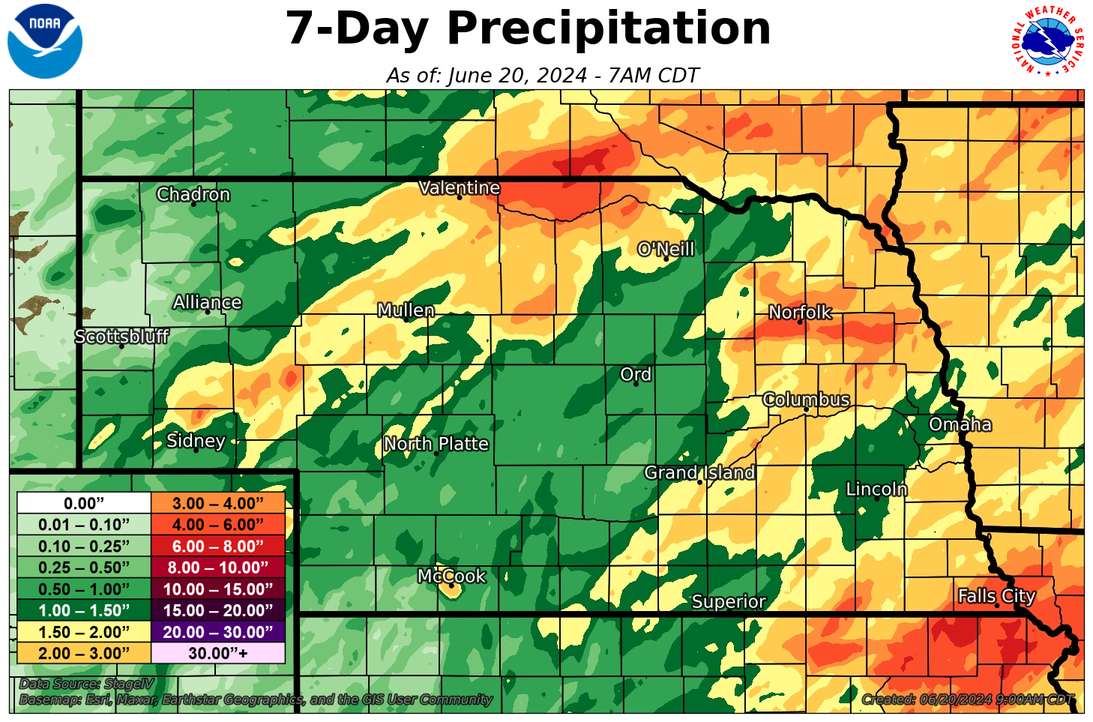
Recent precipitation
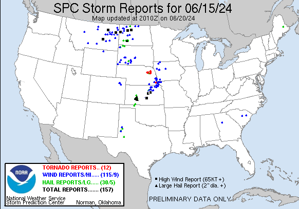
Most of the state received at least a half inch of rain over the past week and a large area of the state picked up an inch or so last Friday night as a complex of storms moved off the Front Range into the state. A few spots in the eastern Panhandle (Garden County) had 2-3". Areas between Norfolk and West Point picked up significant precipitation (as well as a few tornadoes) on Saturday evening as did the far southeast corner near Falls City, where upwards of 4-5" fell. On Sunday night into Monday morning, storms formed along a stalled out boundary giving the northern fringe of central Nebraska significant rainfall with 2-4" falling in parts of Cherry, Boyd, Keya Paha, and Holt counties. Most of eastern Nebraska picked up additional rainfall Tuesday evening along the cold front with an 1"+ common in York, Polk, and Butler counties.
Who didn't get any rain at all? That honor goes to the weather station at Lake Minatare in Scottsbluff County. Hopefully the next 48 hours are more generous.
NASS Crop Progress update
Corn emergence came in at 98 percent and soybean emergence at 90 percent. Condition ratings for corn came in at 81 percent good-excellent (G-E) against 4 percent poor-very poor (P-VP) while soybean checked in at 79 percent G-E and 3 percent P-VP. Sorghum planting is nearing completion with 92 percent planted and is rated at 83 percent G-E against 0 percent P-VP.. Winter wheat checked in at 72 percent G-E against 3 percent P-VP and was 97 percent headed. 70 percent of oats have headed and are rated as 71 percent G-E and 4 percent P-VP. Pasture ratings of the season show 63 percent G-E against 10 percent P-VP. That is a slight decline in conditions over two weeks ago. VegDRI continues to depict very good pasture conditions in the northern and eastern Sand Hills regions but poorer conditions in parts of the Panhandle where drought has developed.
Temperature and Precipitation Roundup
Attached are .pdf's containing the average temperature, growing degree days, and total precipitation for each station that had no missing days over the period from June 9- June 15. Includes CoCoRaHS observer reports. Below are the temperature and precipitation extremes around the state over the past week.
Maximum Daily High Temperature: 101F, Culbertson
Minimum Daily High Temperature: 63F, Bushnell Mesonet
Minimum Daily Low Temperature: 33F, Bushnell 15S
Maximum Daily Low Temperature: 75F, Superior
Maximum Weekly Precipitation: 4.87", Salem 5SW
Minimum Precipitation: 0.00", Minatare Dam (USBR)
Eric Hunt, University of Nebraska Extension


