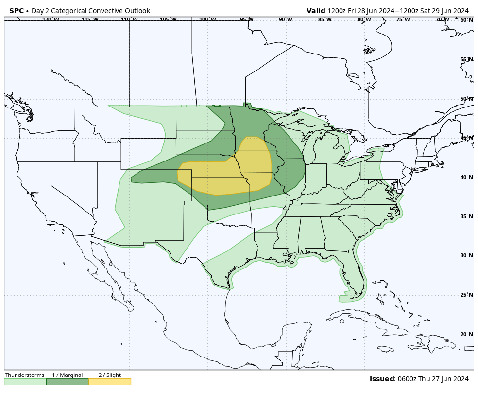
Severe storms possible tonight and tomorrow
The SPC has an Enhanced Risk of severe storms tonight across western Nebraska as a strong shortwave moves out of the northwestern U.S. into the northern Rockies. Ahead of it there is increasing moisture and instability being advected into the region so supercell type storms are possible across a wide section of the High Plains region this evening. Those storms may congeal into larger storm complexes and move east overnight but the severe threat is lower east of Grand Island. There is also a chance of severe stoms across a majority of the state tomorrow. Responsible culprit is the aforementioned shortwave trough moving out of the northern Rockies working its way toward the northern Great Lakes region. There is expected to be ample vorticity (spin) in place tomorrow across much of the state in the afternoon as a strong for late June cold front moves into the area. Question tomorrow is how much instability is in place. If clouds and scattered showers dominate the morning, there may not be sufficient heating in the afternoon to generate significant storm coverage. If there is sun by mid-morning temperatures in areas south of Ainsworth, temperatures will easily climb into the 80's and low 90's which will help increase the threat of storms developing in western and central Nebraska before moving east. Large hail and higher winds are the main threats. The threat should be mostly done by midnight Friday.
Pleasant temperatures this weekend
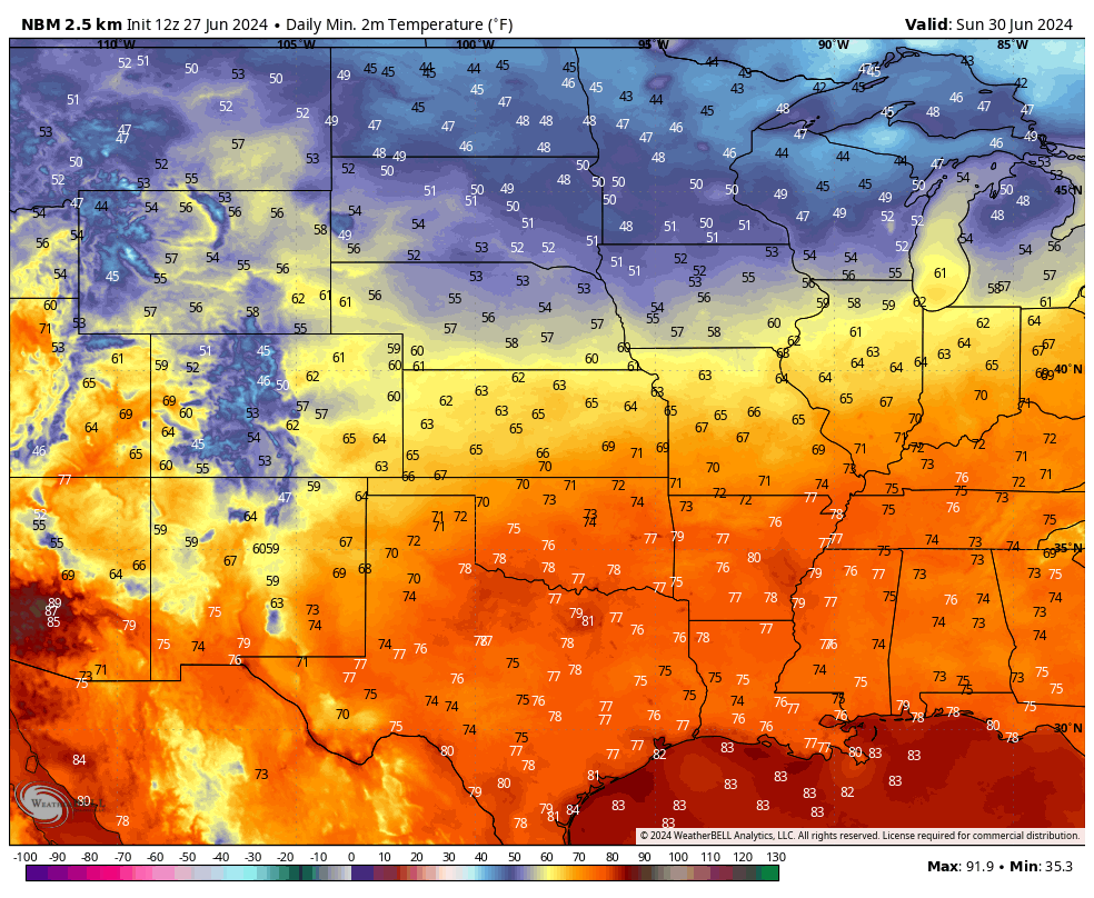
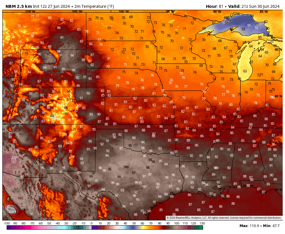
After the frontal passage we will be treated to a cooler and drier air mass. Temperatures should be in the 70's for highs in northern and western sections of the state with lower 80's elsewhere. With an area of high pressure overhead and clear skies/light winds, looks for temperatures to drop into the 50's statewide with some spots in north central and northeastern Nebraska possibly dipping into the upper 40's. Temperatures will remain pleasant across much of central and eastern Nebraska on Sunday but rebound into the upper 80's and lower 90's in the Panhandle.
Manic Monday
By Monday another trough will be moving into the northern Plains region and warmer, more unstable air is going to be moving back into the state that will interact with the dynamics of the shortwave. Exact details are still a little uncertain but there is going to be a possibility for at least one round of severe storms starting Monday afternoon across central and eastern Nebraska. WPC is showing a good chance for a half inch plus in central sections of the state with a good chance of 0.75-1.25" in eastern Nebraska. As we have seen often this growing season, some places could certainly get more (and much less). Recommend paying closer attention to the forecast for Monday afternoon and evening as that gets closer.
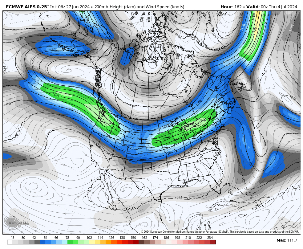
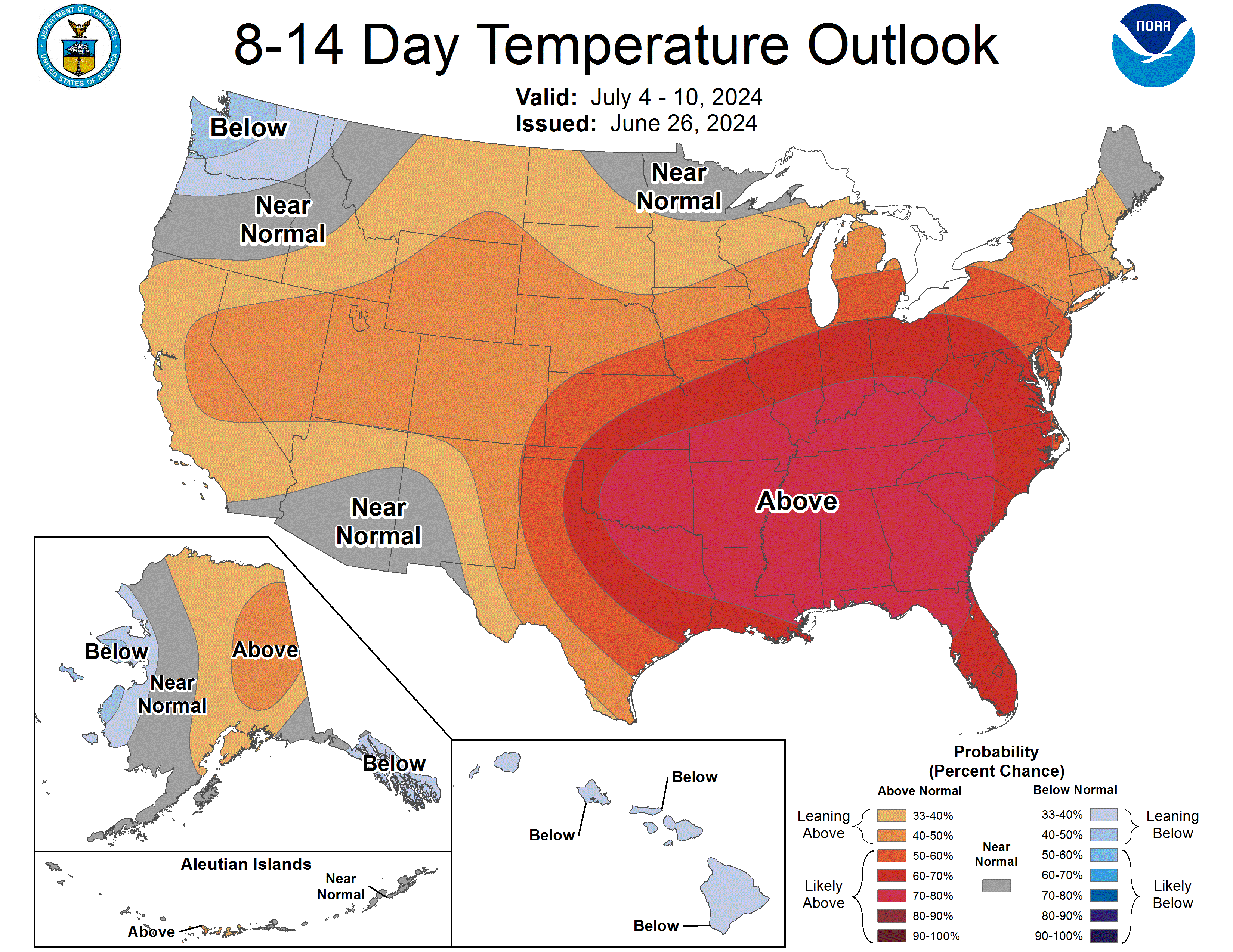
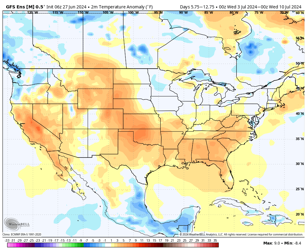
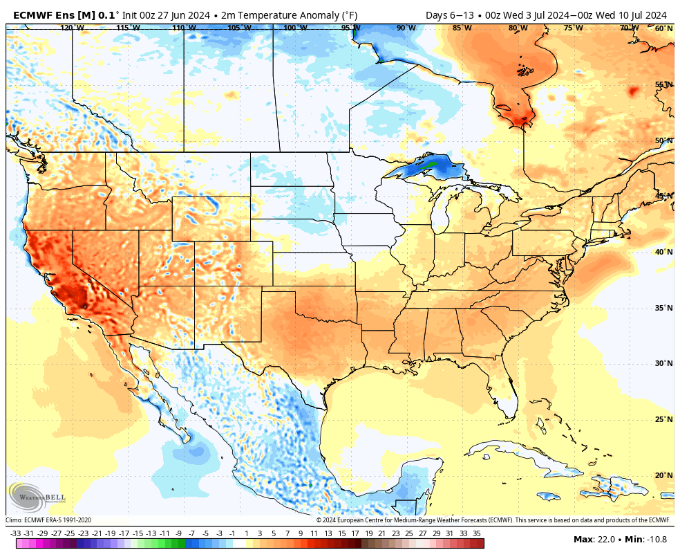
Mother Nature's Fireworks
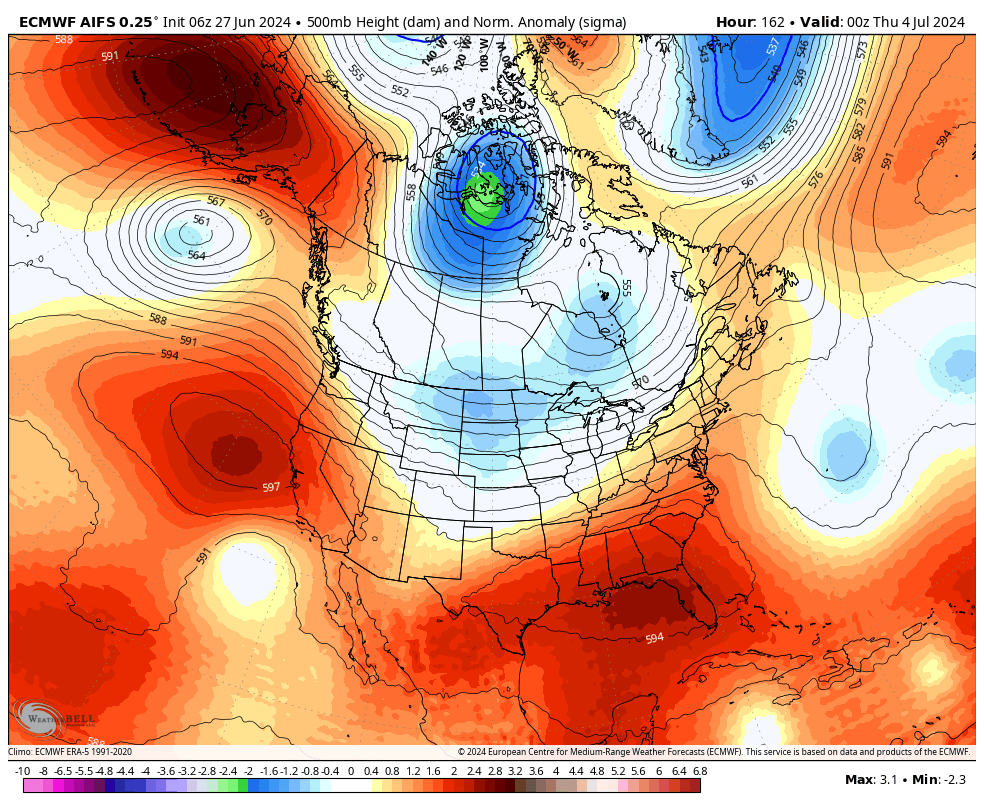
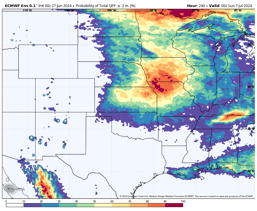
A look at the projected 200 mb wind speeds (Meteorology to English: the jet stream) shows a bit of a southern dip compared to recent weeks with decent wind speeds for July. This combined with a stout mid-level ridge over the southeast and south central U.S. and mid-level troughing over the northern Rockies will put the Central Plains to Central Corn Belt in an area favorable for storms around the 4th. Current model projections suggest there could be a round of thunderstorms traversing much of the state (sorry Panhandle) on Wednesday and another round moving in during the evening and overnight hours on the 4th into the 5th. It does not look like the 4th will be a total washout so no need to cancel planned outdoor activities yet. But be mindful that there will be chances for storms like last year with severe weather and heavy rainfall being possible. For what it's worth, the ECMWF ensemble shows a 50% or higher probability of 2" or more next week for areas of the state east of Lincoln and a good chance of 1" as far as west as Ogallala. Sioux and Banner counties are less likely to get the drought busting rains they need but some moisture should fall from the sky there next week.
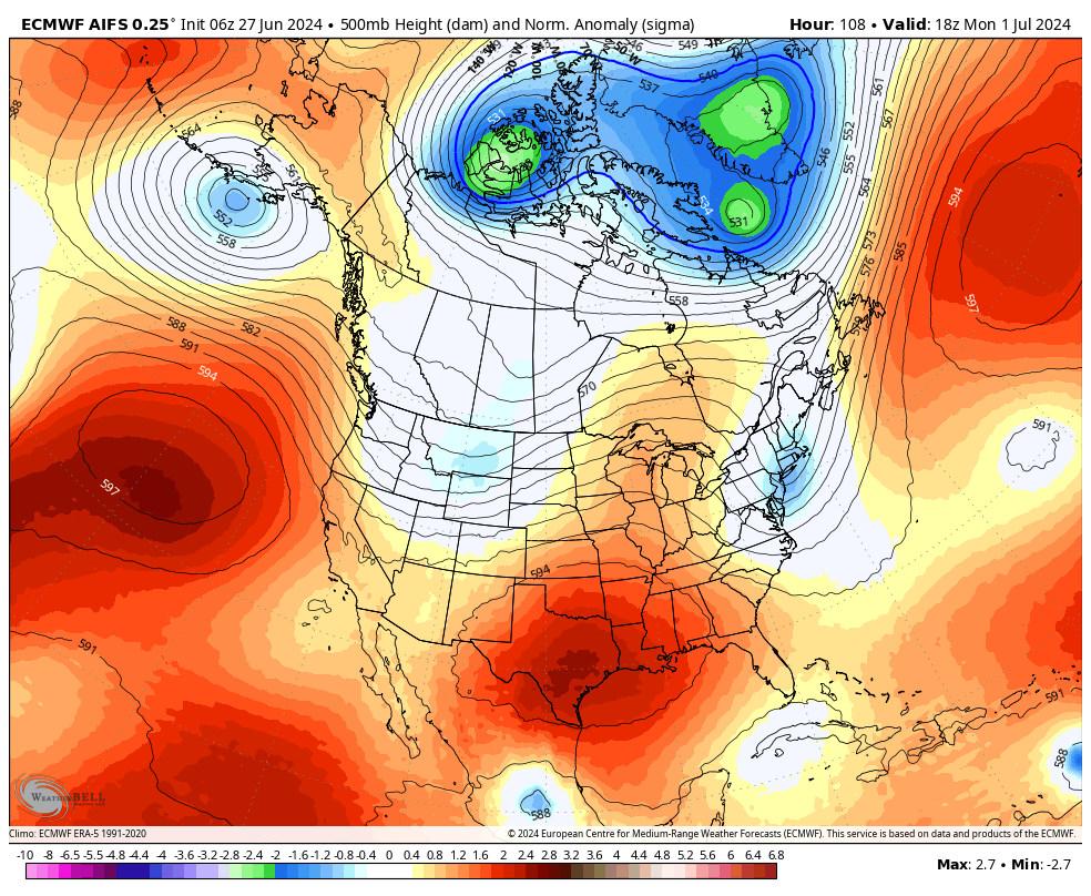
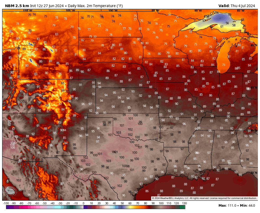
Temperatures on the 4th likely will be in the mid to upper 80's over much of the state with 90's more likely from Imperial to McCook. The end of the week currently looks a bit less active with temperatures at or slightly below seasonal normals. Expect highs in the 80's and lows in the 60's next weekend. A look beyond next week shows some signs that the heat may stay away for most of us until closer to the middle of the month. The "death ridge" that will be in place over the SEC Country (including new members Oklahoma and Texas) next week may build/shift north and westward after the 10th, which would bring the heat and humidity back.
Heat
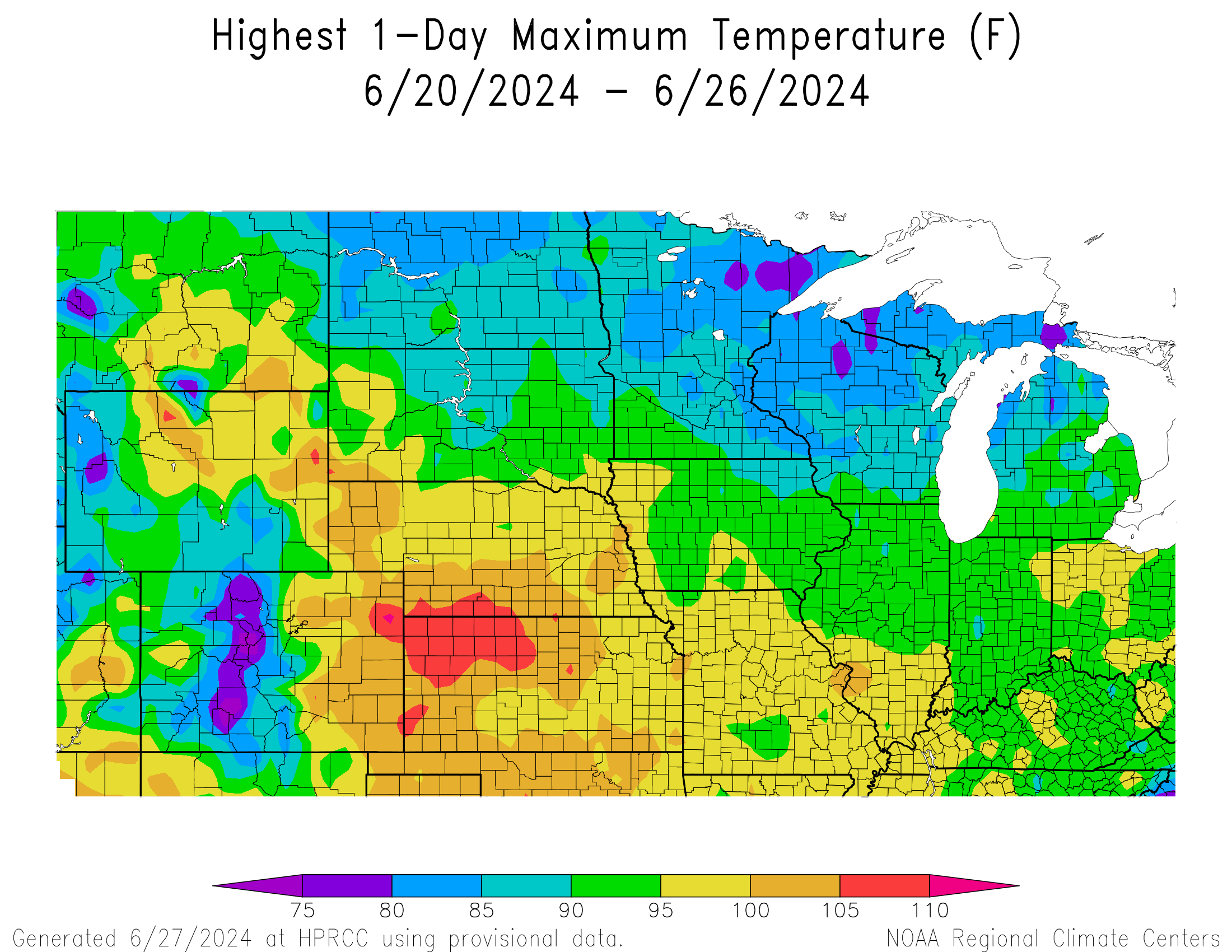
Speaking of heat, it was proper hot across the entire state on Monday and a majority of the state on Tuesday. Only sections of far southeast Nebraska, northeast and north central Nebraska stayed in the 90's on Monday with temperatures climbing over the 40C (104F) mark in south central and southwest NE. Temperatures cracked 100 again in spots on Tuesday as well. The heat came to end with a bang on Tuesday evening with heavy thunderstorms that produced large hail and flooding in parts of northern and east central Nebraska. Some tornadoes were also reported in Madison County, which seems to be a tornado magnet lately. Later on Tuesday night a complex of storms moved through much of eastern Nebraska giving some hot and thirsty crops a nice drink.
Excessive rainfall
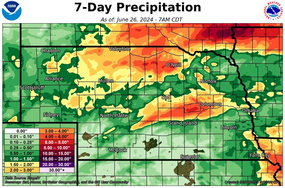
Some areas of the state had more than a nice drink late last week though. 3"+ in a 24 hour period was reported in diverse areas of the state including: northeast of Alliance in Box Butte County, between Ainsworth and O'Neill (where 5-6" fell), and from southern Custer County east into Sherman, Howard, Nance, and Merrick counties where 3-5" was common. Most of the state did receive a quarter inch or more of precipitation this week. Exceptions include far southwest NE (no rain for Imperial) and much of south central NE near the Kansas border where precipitation was more minimal between last Thursday and yesterday.
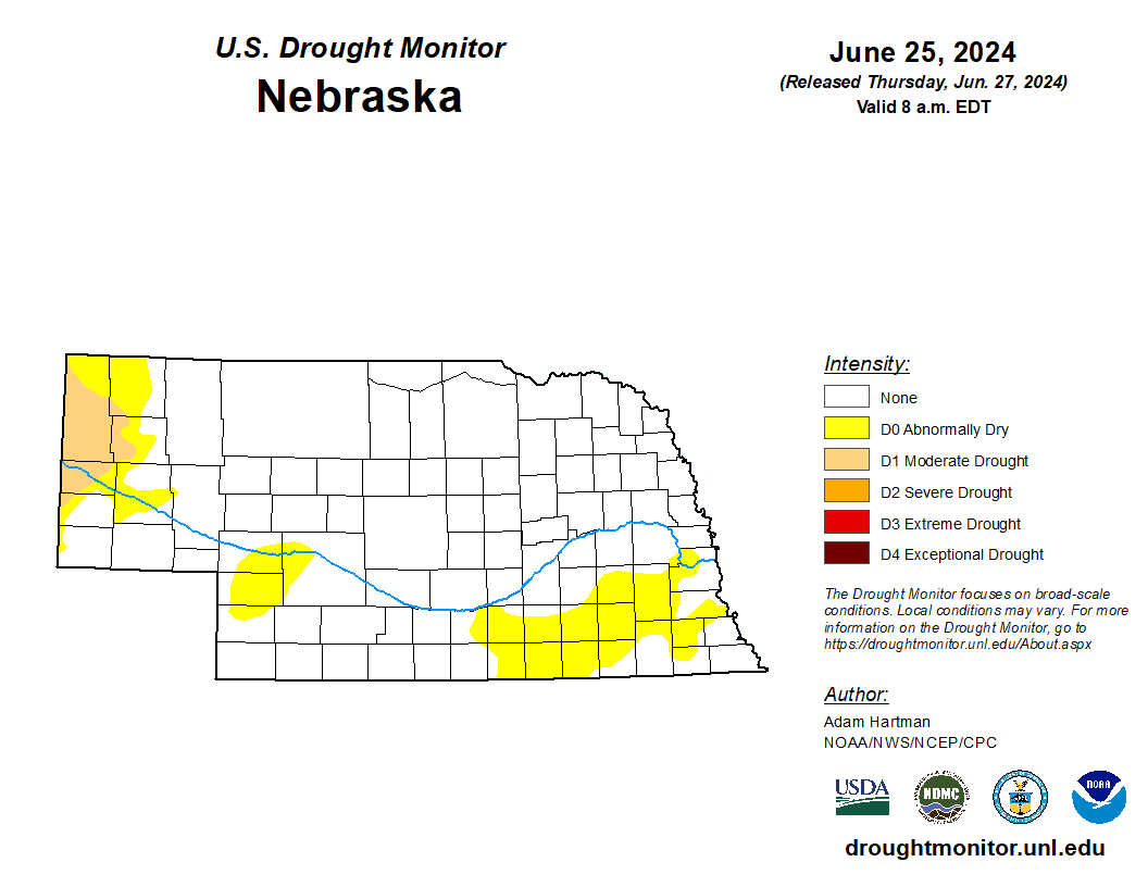
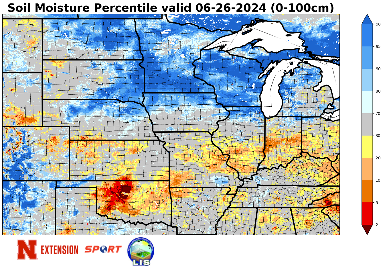
Ye Olde Drought Monitor
Not much change on the U.S. Drought Monitor this week compared to a lot of weeks the past several months but there are a few changes to report. The area of Box Butte County west of Alliance is now in D1 (moderate drought) and the area northeast of Alliance that picked up 3.5" got upgraded out of abnormal dryness. There was a bit of improvement in northern Keith and Lincoln counties where precipitation has mostly been above average of late. A section of Webster County went back into abnormal dryness based on recent dryness. Everyone else had status quo.
NASS Crop Progress update
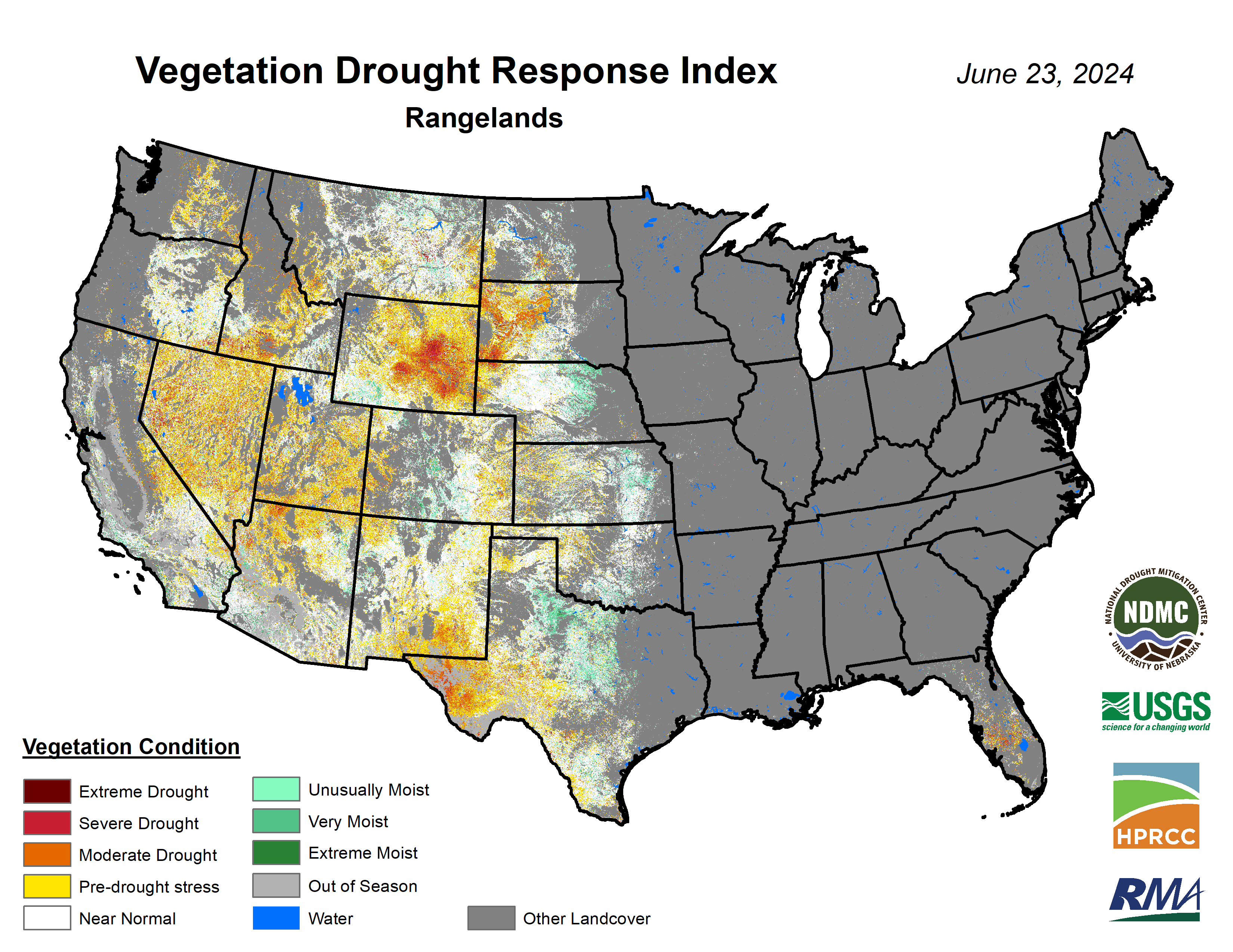
Condition ratings for corn came in at 82 percent good-excellent (G-E) against 3 percent poor-very poor (P-VP) while soybean checked in again at 79 percent G-E and 3 percent P-VP. Sorghum planting is nearing completion with 98 percent planted and is rated at 84 percent G-E against 0 percent P-VP. Winter wheat harvest has begun (2 percent complete) and checked in at 69 percent G-E against 5 percent P-VP. Good yields are anticipated this year. 84 percent of oats have headed and are rated as 79 percent G-E and 1 percent P-VP. Pasture ratings of the season show 71 percent G-E against 4 percent P-VP. That is an improvement in conditions over a week ago. VegDRI continues to depict very good pasture conditions in the northern and eastern Sand Hills regions but poorer conditions in parts of the Panhandle where drought has developed. VegDRI also shows good conditions on crops across much of the state, except in the western Panhandle where VegDRI indicates increasingly severe levels of water stress on pastures.
Temperature and Precipitation Roundup
Attached are .pdf's containing the maximum/minimum temperature, average temperature, growing degree days, and total precipitation for each station that had no missing days over the period from June 16- June 22. Includes CoCoRaHS observer reports. Below are the temperature and precipitation extremes around the state over the past week.
Maximum Daily High Temperature: 106F, Holdrege and Imperial
Minimum Daily High Temperature: 61F, Kilgore
Minimum Daily Low Temperature: 37F, Bushnell 15S
Maximum Daily Low Temperature: 76F, Falls City 4NE
Maximum Weekly Precipitation: 5.68", O'Neill
Minimum Precipitation: 0.00", Multiple locations
Eric Hunt, University of Nebraska Extension


