Stormy times ahead
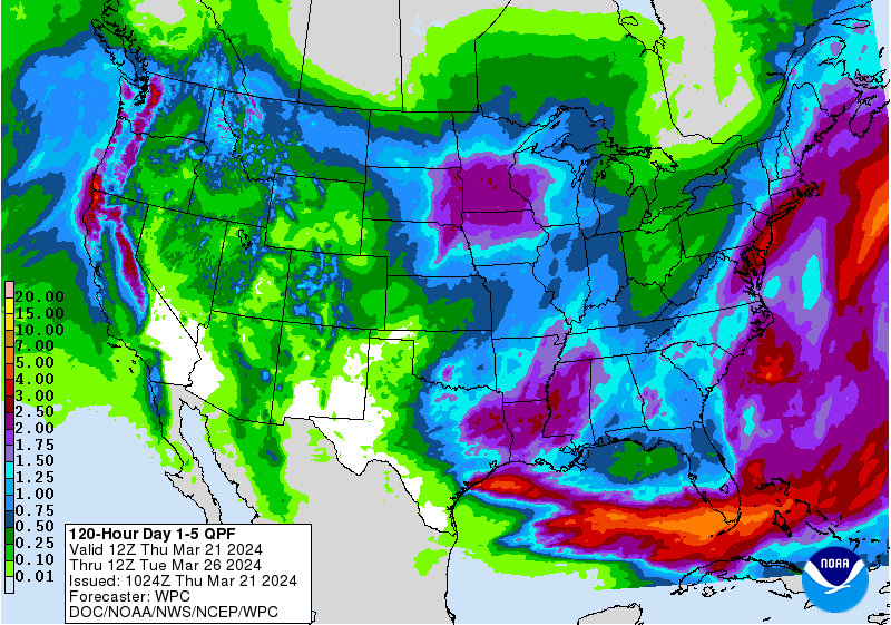
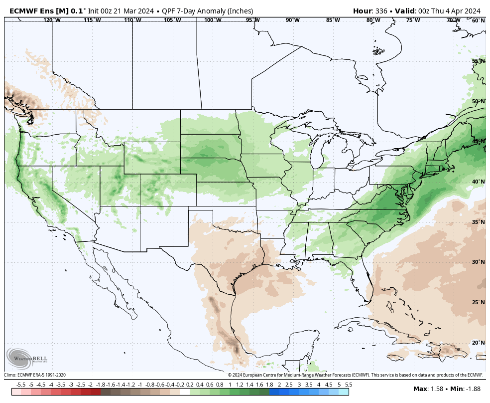
We need the moisture across the state and Mother Nature seems ready to oblige. The next few weeks will be an active one in our region of the country and there will be several chances for significant precipitation. A quick look at the new AI-enhanced European model suggests that much of central and eastern Nebraska could get over 2" of precipitation between now and early April, much of which would come in the form that will infiltrate nicely. Over the next 24 hours, higher fire danger exists in the western Panhandle and a round of showers is likely tonight across eastern Nebraska along and north of I-80. Precipitation amounts should generally be under 0.25" and will be under 0.1" closer to Lincoln.
Round 1 of Mother Nature's March Madness
Southeast Bracket: Rain should begin later Saturday evening and should continue into the morning hours on Sunday. A break in precipitation is likely for a while during the afternoon on Sunday but rain and maybe a few thunderstorms will move back in during the evening hours and continue into Monday morning. Storms in this area are not expected to be severe. Rain will likely change over to snow during the day on Monday. Significant accumulations aren't likely in this area and would mostly be confined to grassy surfaces. Nevertheless a few inches of snow can't be discounted particularly between York and Lincoln, where the transition will occur sooner and temperatures Monday will be colder. Total precipitation amounts in the region will likely range from 1.0 to 1.5 inches with an outside shot at closer to 2 inches around Wahoo. Winds will be strong.
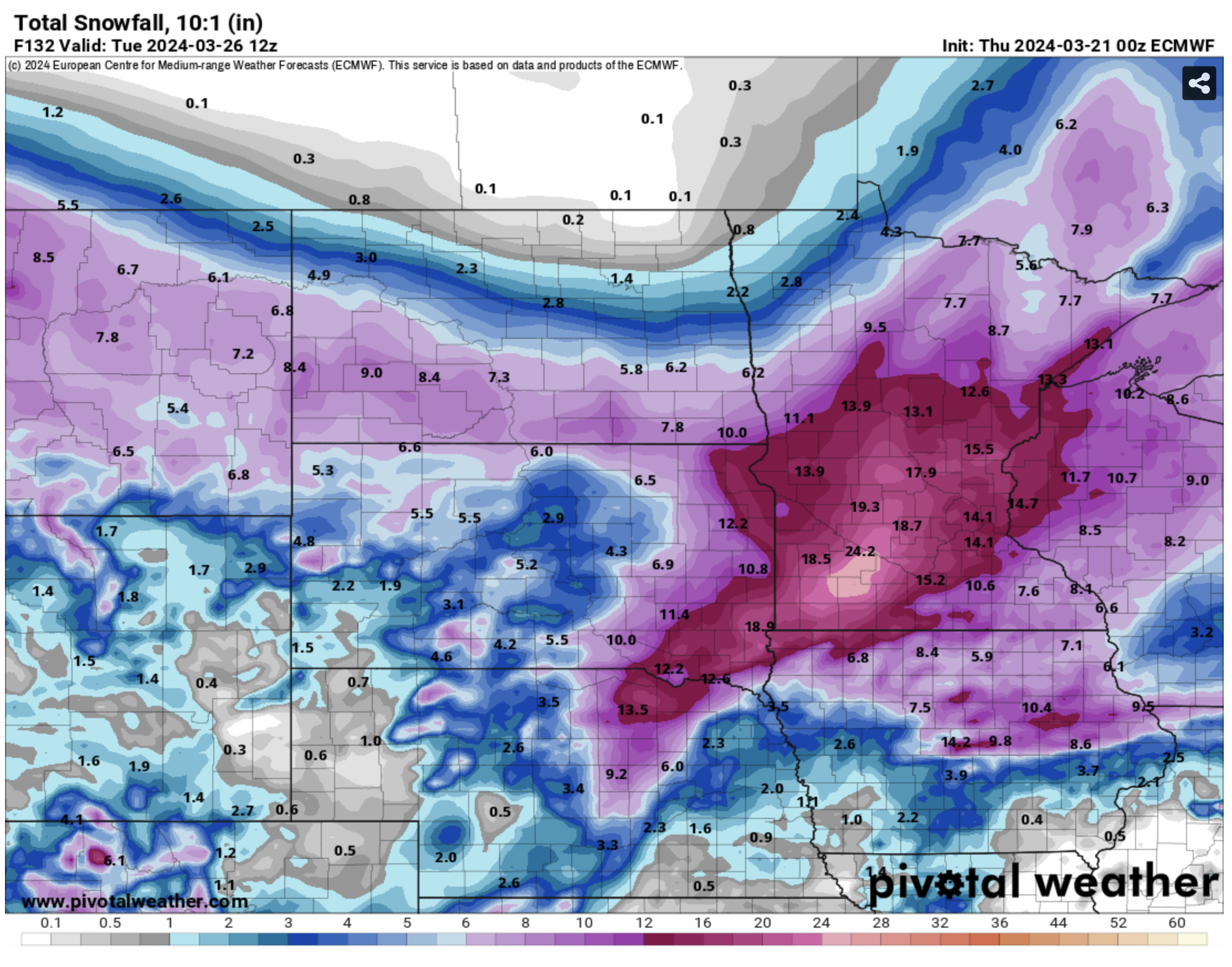
Northeast Bracket: The first part of the forecast is similar to the southeast bracket, with rain beginning early on Sunday morning and lasting for several hours. But this area is less likely to have an afternoon break in precipitation and rainfall may be a bit heavier at times Sunday evening than across southeastern Nebraska. Excessive rainfall is not expected but rainfall over an inch seems a good bet and rainfall amounts closer to 2 inches may be possible between Wayne and South Sioux City. Rain will transition to snow during the early morning hours on Monday and may be heavier at times in the Highway 81 corridor. 1-3" of snow would seem more likely around Blair and Tekamah with snowfall amounts of 3-6" more likely between Columbus and Hartington. Snowfall could get closer to the 6-12" range between Albion and Niobrara, where snow will fall for longer and potentially be heavier at times. With the wind, we could be looking at some drifting of snow.
Central Bracket: This region has the potential to see significant snow in the northern section and severe weather on Sunday afternoon toward the Kansas border. As with the other regions, rain is likely Sunday morning with freezing rain possible around Valentine and Ainsworth. What we need to watch during the day on Sunday is how far north a warm, more unstable nose of air makes it. The upside is places like Minden, Red Cloud, and Republican City could get closer to 60 on Sunday afternoon with some peaks of sun. The downside is there will be some chance for severe storms developing during the afternoon hours. Currently the threat seems stronger down in Kansas but residents of far south central Nebraska should be aware of the risk. By Sunday night precipitation should be widespread and will pick up in intensity toward Monday morning. In the northern third of the region, the transition to snow could start by Sunday night with everywhere else transitioning over by daybreak Monday. Snowfall amounts will be lowest between the Kansas border and Grand Island (1-3" most probable range), 4-8" will be likely in the eastern section of the Sand Hills, and amounts of 12-15" are possible around O'Neill and Ainsworth. This will be in combination with stronger wind speeds so near-blizzard conditions could be realized for a period of time in the Highway 20 corridor. Total precipitation amounts should be between 1 and 2 inches across the region.
Western Bracket: Rain is likely across the region later Saturday night into Sunday morning, especially east of Sidney. Rain should transition to snow on Sunday night across the eastern Panhandle and western portions of the Sand Hills. Accumulations of snow likely will be less than in the central section of Nebraska, but snow amounts of 3-6" are certainly possible in Cherry County down to Mullen with 1-3" more likely from North Platte down to McCook. Lesser amounts of snow can be expected in the Panhandle. Total precipitation in the region will range from around under a third of an inch from Harrison to Scottsbluff to closer to an inch around Valentine. Amounts between a half and three quarters of an inch seem probable across most of west central Nebraska.
Round 2 of Mother Nature's March Madness
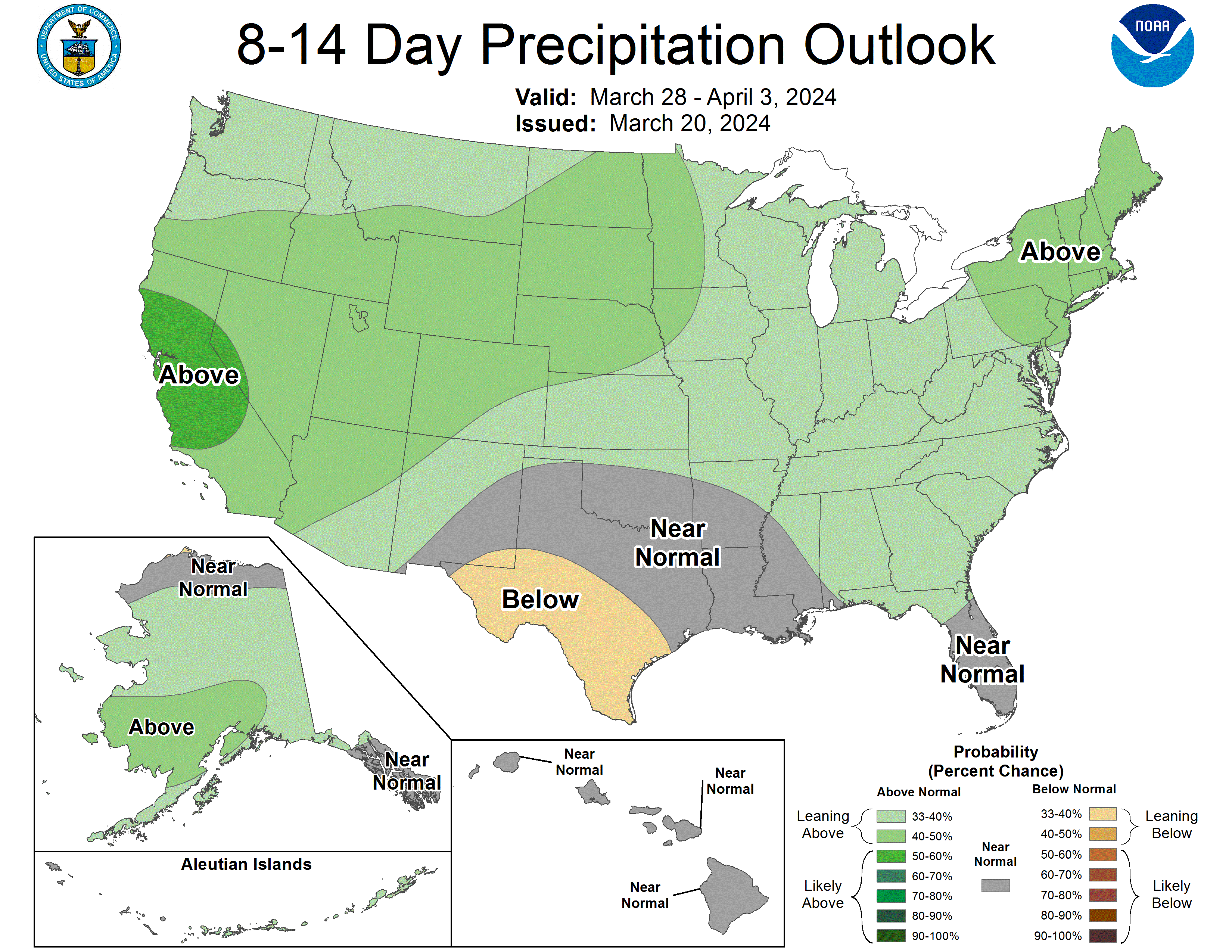
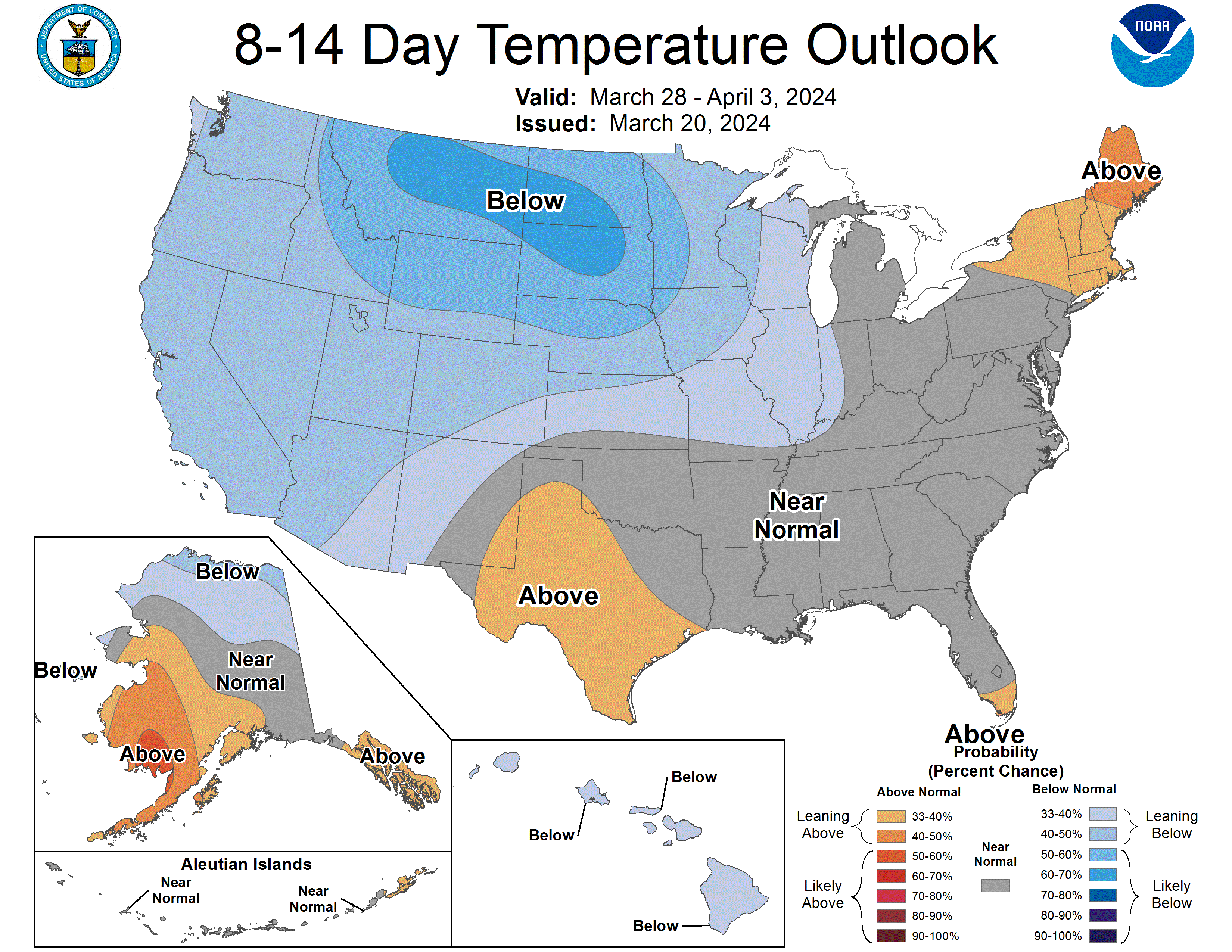
We will get a break in precipitation with some moderation in temperatures during the middle of the week but then our attention turns to another storm system entering the central U.S. on Friday. This one seems less potent than the one preceding it and the one following it after Easter. But this also is likely to bring a shot of moisture to the state- more likely to be rain than snow, except in the Panhandle, but we will need to watch how this evolves. Temperatures are likely to be seasonally cool in the upper 30's to upper 40's as we head into Easter. Total amounts from the storm system later next week are more likely to be under an inch but most places currently look in line to pick up 0.25-0.75". Another more potent storm is likely to pay the central U.S. a visit after Easter, which could bring additional beneficial moisture to areas currently in drought. Cannot completely discount heavier snowfall occurring over the state the week after Easter though that is certainly not my official projection at this time.
Drought and Soils Update
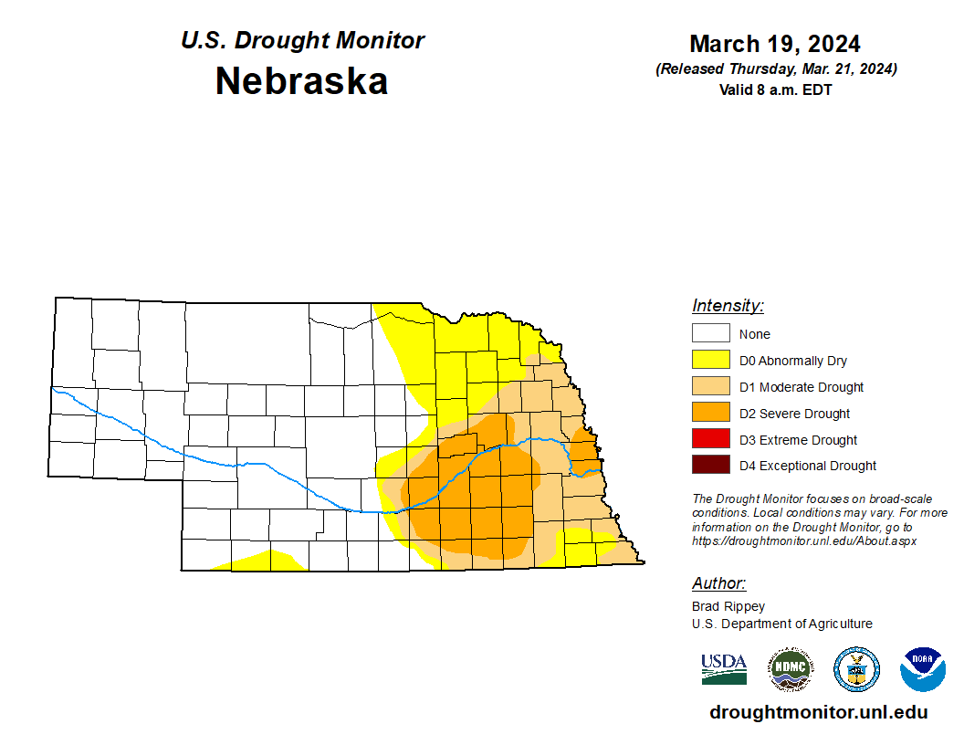
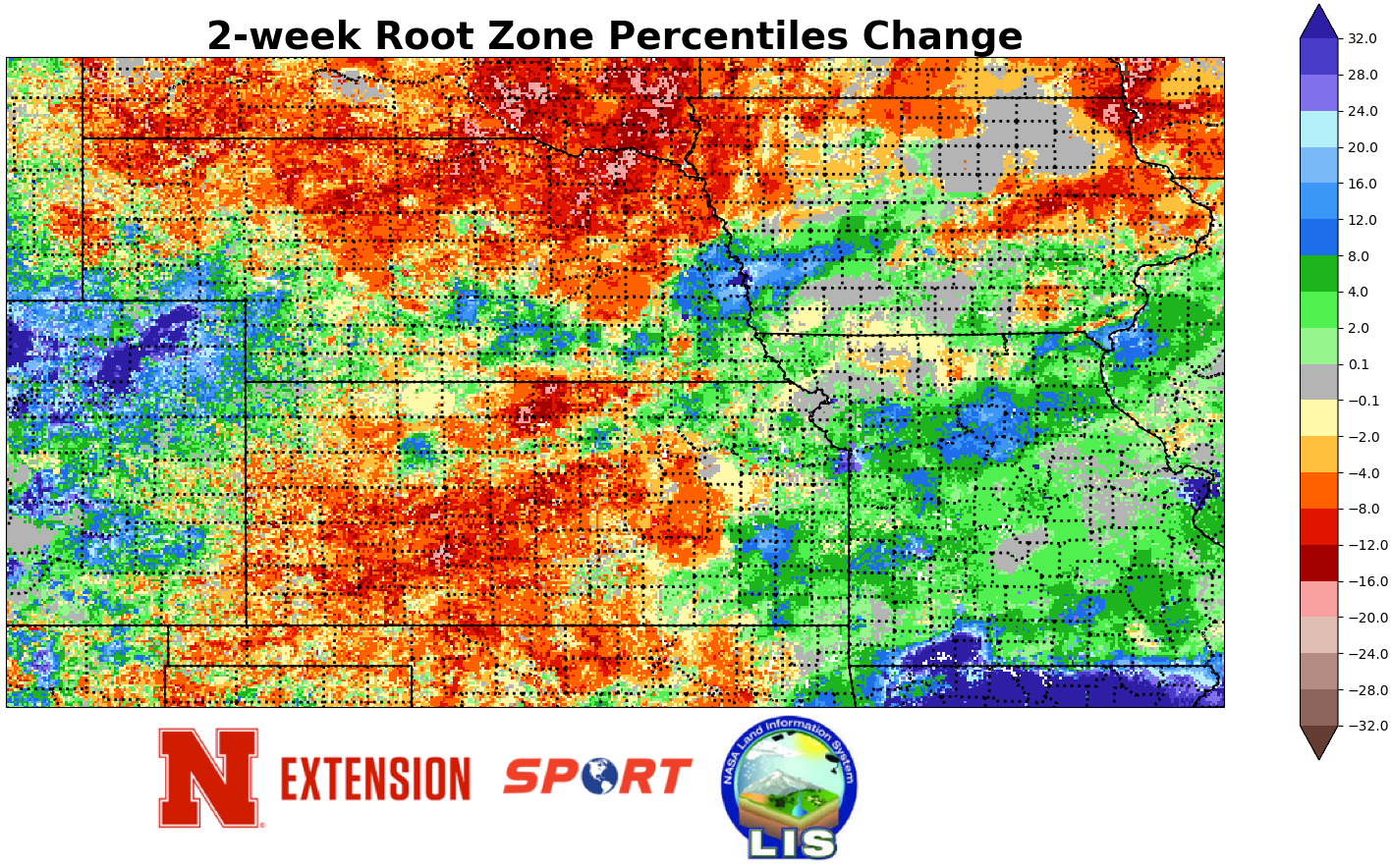
With the dry stretch of weather now going on two months in northeast Nebraska, there was further expansion of abnormal dryness (D0) on the Drought Monitor to now include all or most of Cedar, Antelope, Knox, Pierce, Holt, Boyd, and Wheeler counties. In addition to the near-historic dryness in this area dating back 60-days, the record warm February and warm start to March has meant a marked decline in top soil moisture and a decline in overall root zone soil moisture. So the rainfall (and snow) is needed in this area to prevent further degradation in the coming weeks.
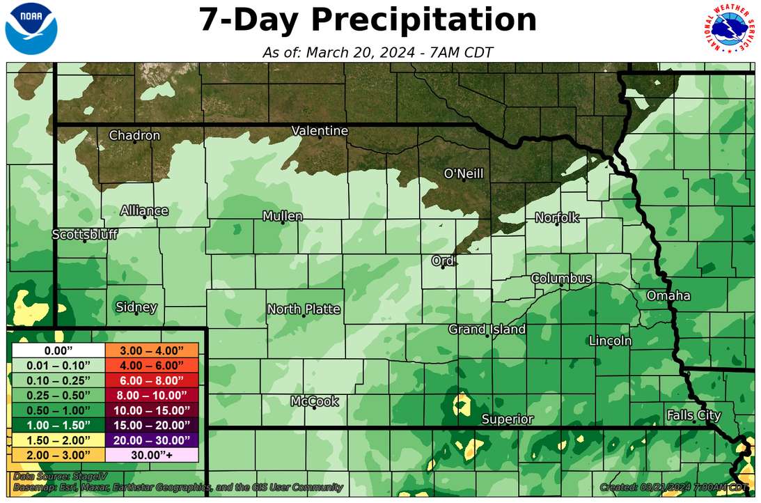
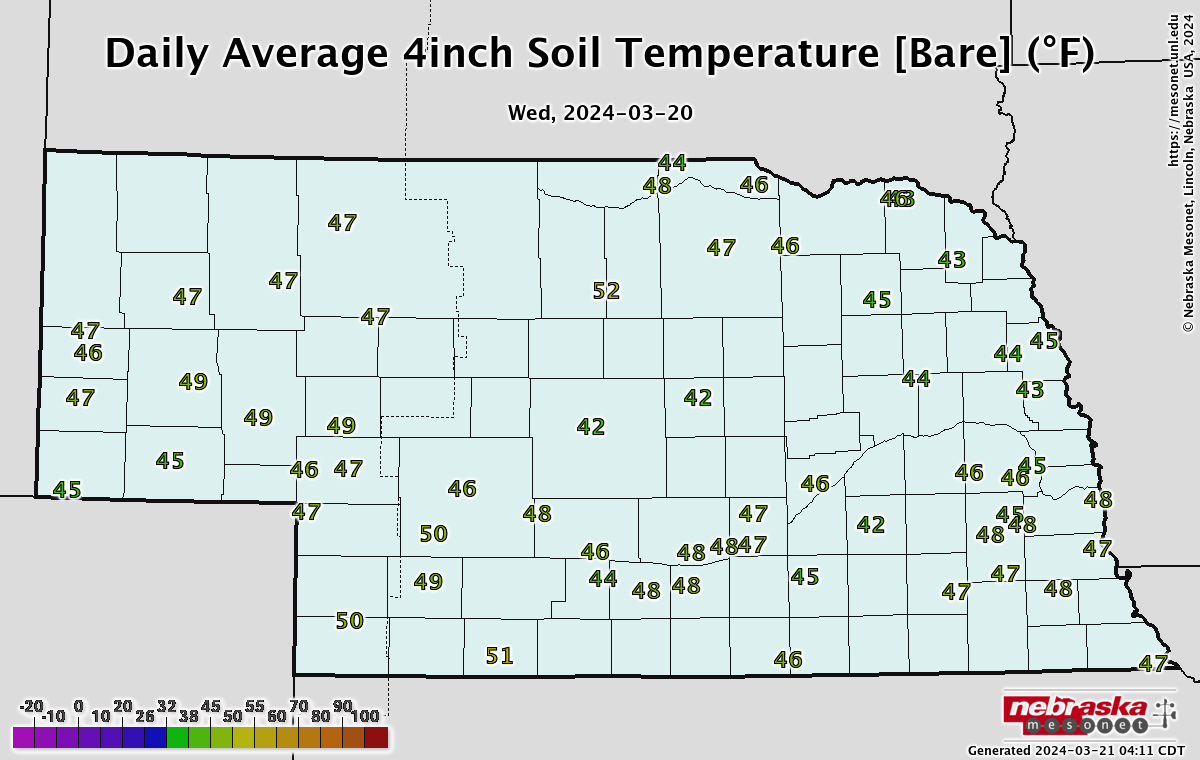
Further south in east central and southeastern Nebraska where decent precipitation last Thursday morning, there was some improvement in soil moisture according to SPoRT LIS. But an additional 1-2" of rain would certainly be welcome in this area as well. Soil temperatures statewide are generally in the 40's statewide, which means there won't be any frozen soil issues to reduce infiltration of the expected precipitation this weekend.
2023 County Yield Winners
USDA NASS released its county numbers for 2023 corn and soybean early this week and let's take a look to see who came out on top (minimum of 100 thousand acres):
Highest Overall Corn Yield: Dawson County - 234.5 bushels per acre
Highest Rainfed Corn Yield: Cass County- 195.7 bushels per acre
Highest Total Corn Production: Custer County - 45.68 million bushels
Highest Overall Soybean Yield: Antelope County - 59.6 bushels per acre
Highest Rainfed Soybean Yield: Cass County- 58.6 bushels per acre
Highest Total Soybean Production: Gage County - 8.1 million bushels
Eric Hunt, University of Nebraska Extension