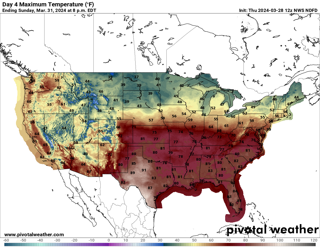
Brief warmup
After a week of colder temperatures, we are enjoying a return to mild temperatures across most of the state today and tomorrow for the eastern third of the state. Temperatures are likely to be in the lower 70's across southeastern Nebraska and in the 65-70 range in east central and northeast Nebraska. A cold front will slide through the state Friday night and bring more seasonal to perhaps slightly below seasonal temperatures to the state for Saturday and Sunday.
Stalled front to our south and precipitation chances
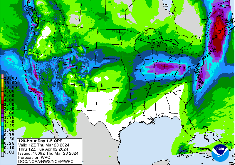
The aforementioned cold front will stall to our south over the weekend. So if you want temperatures in the upper 70's and 80's, a trip to Topeka or Tulsa may be in order. The upside is the frontal boundary will be a focal point for precipitation chances starting Saturday night through Tuesday morning across the state. The first round of precipitation in association with a shortwave moving from the northern Rockies into the High Plains on Saturday night into Sunday which will bring precipitation to the Panhandle and Sand Hills. Snow is rather likely in the northwestern part of the state with this system, with amounts up to 4" possible. This precipitation will slide east through Sunday morning, giving the northeastern quadrant of the state a chance at some moisture. Amounts in northeastern NE will be lighter than further west, where up to 1" of liquid-water equivalent will be possible.
By later Sunday our attention turns to the deeper trough in the southwestern U.S. and surface low that looks to develop somewhere between eastern CO and western KS. The low pressure will help to initiate precipitation in western NE on Sunday afternoon and will spread to the east on Sunday night into Monday morning. Most of the state looks to get some precipitation from this, though the southwest corner between Imperial and McCook is currently projected to get the least. Precipitation amounts (and types!) further north and east are a little uncertain because the overall strength and speed of the storm is a bit uncertain.
Snow an April Fools joke or real possibility?
The European model keeps the low more open and progressive (i.e., moving along) whereas the GFS is favoring a slightly stronger surface low that closes off (i.e., lingers around). If the latter ends up being the more correct solution, eastern Nebraska is likely to have a longer period of moderate to heavy rain Monday night while the central portion of the state may be in line for a period of moderate to heavy snow. Under that scenario Holdrege, Kearney, and Loup City could certainly see a quick 3-6". Snow would be possible as far east as Seward and Schuyler. The upside of this solution though is the areas of the state in drought would be more likely to get the whole inch of liquid moisture.
If the European solution is more correct, snowfall in central NE is a pretty low risk and rainfall amounts in central and eastern Nebraska are more likely to be on the order of a third to two-thirds of an inch. Furthermore, precipitation would be to our south and east by Tuesday morning. What is more certain is it will be a bit chilly for April 1st (Monday) with highs in the lower to mid 40's statewide and any severe storm risk will be well to our southeast. But that is more typical for early spring.
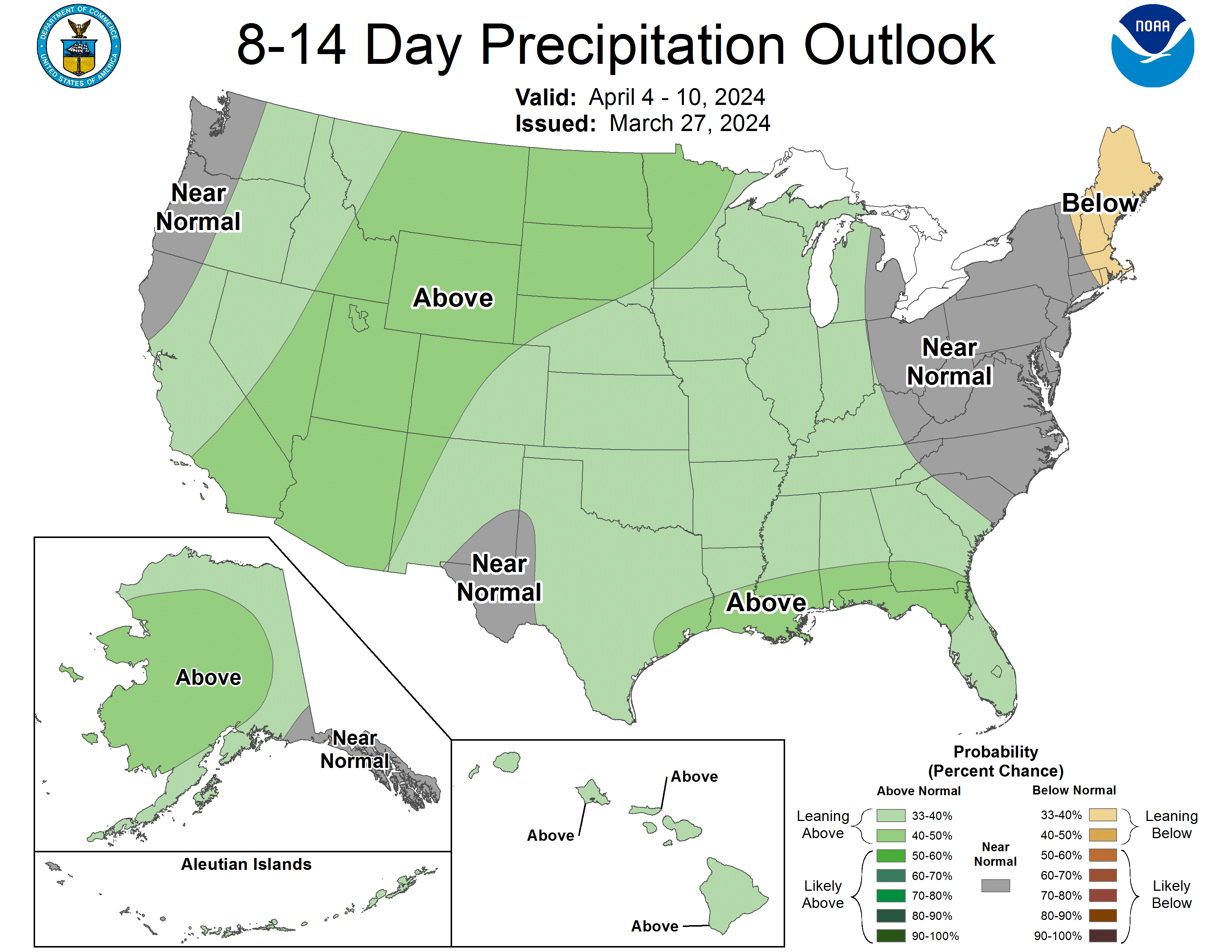
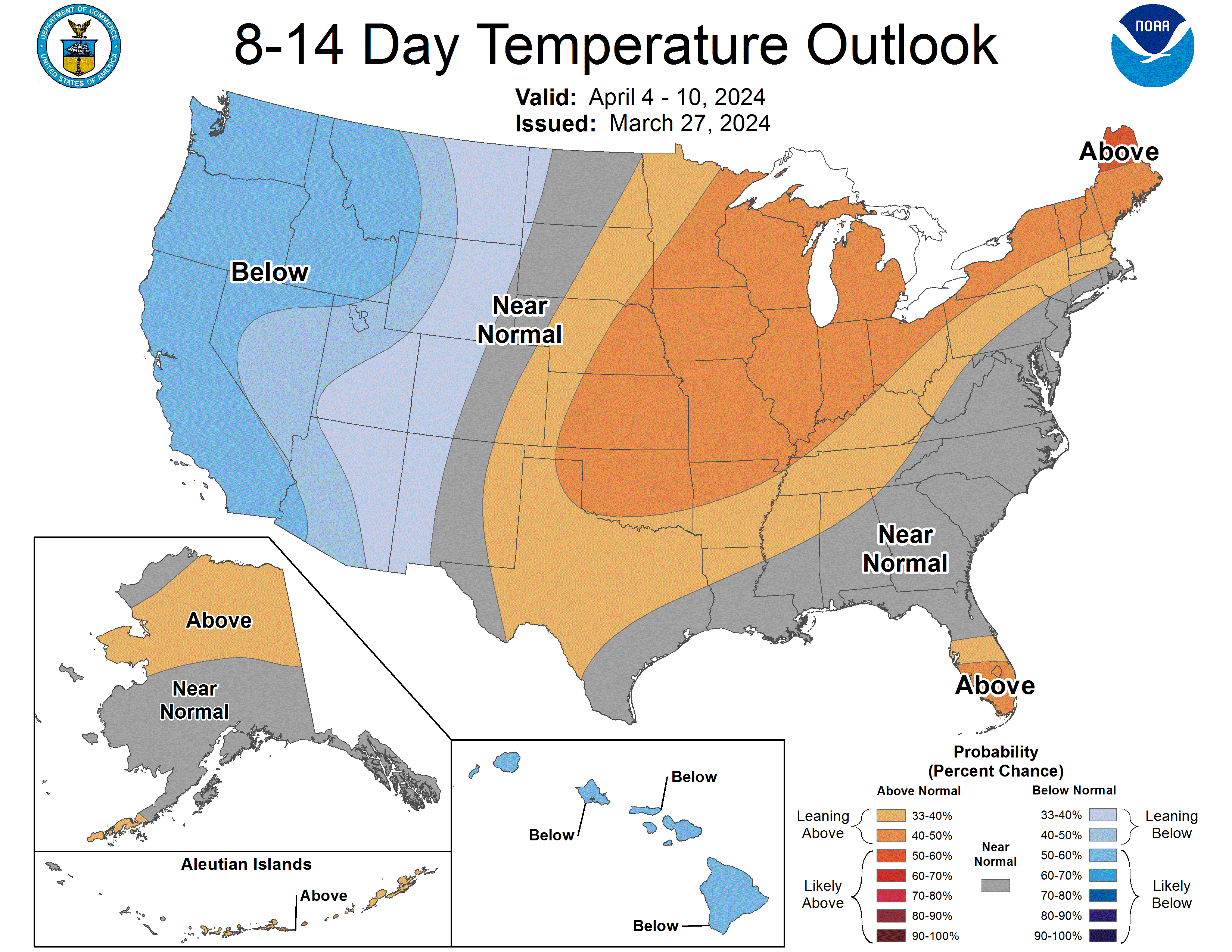
Midweek warm-up followed by more precipitation chances next weekend
After the early week storm exits, upper-level ridging will return to the north central U.S. for Wednesday and Thursday. This will bring warmer temperatures in the 60's to the state and a decent amount of sun. Another storm system may be entering the state by the end of the week bringing a chance for precipitation by next weekend. There is still a good bit of uncertainty as to what exactly transpires but there could be something brewing that we need to pay attention to.
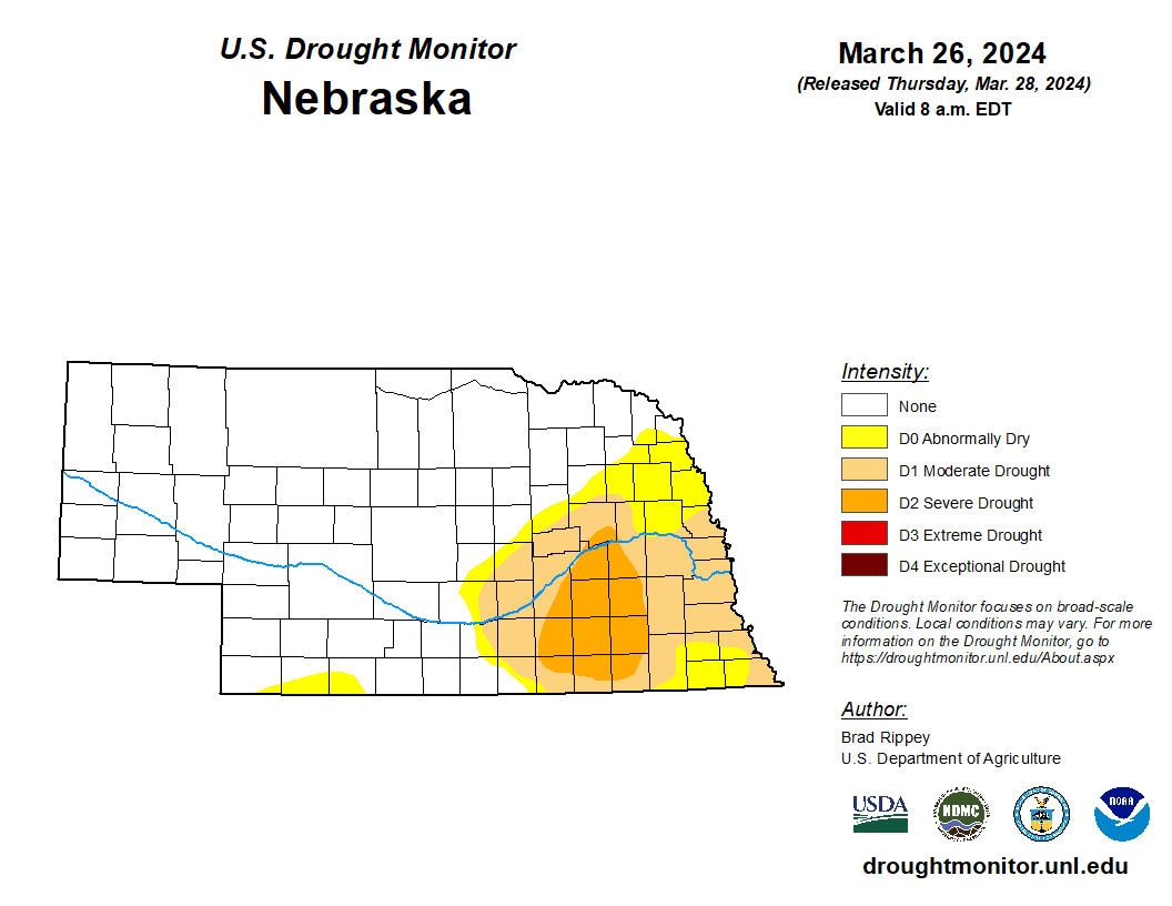
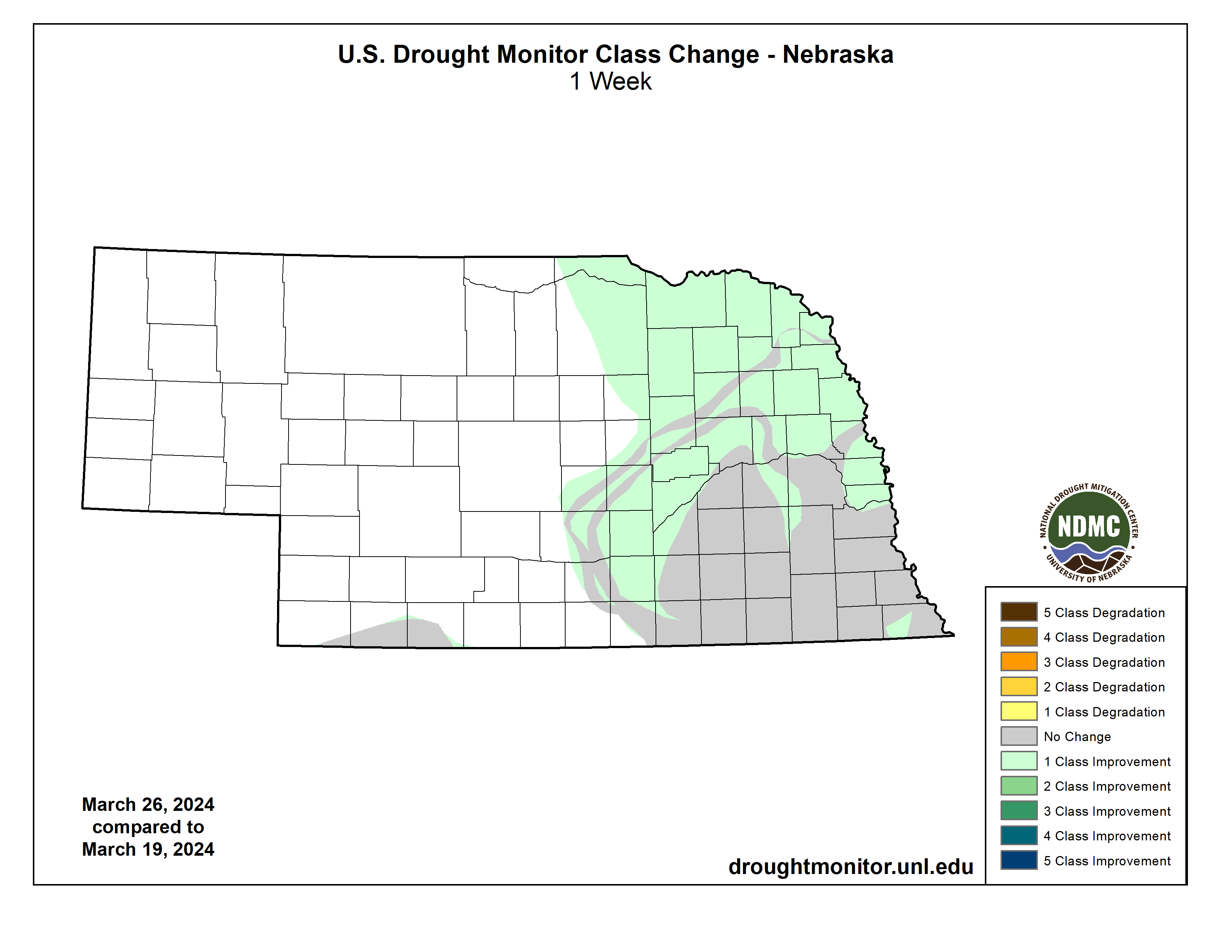
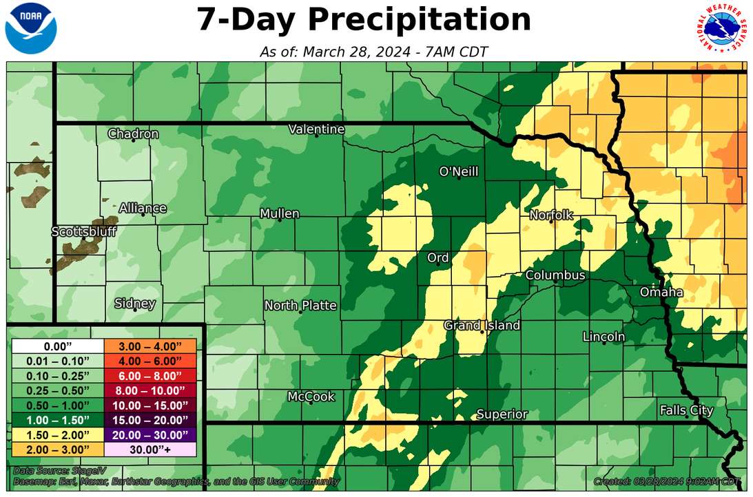
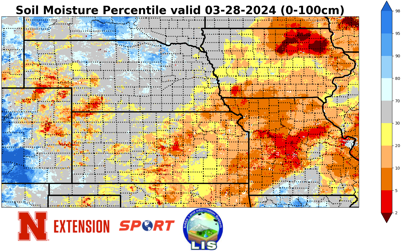
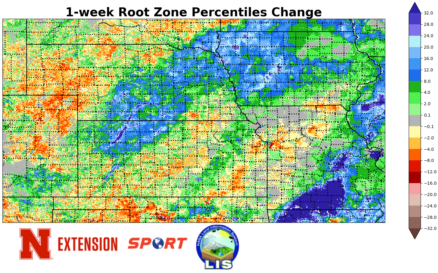
Drought Improvements
Last weekend's storm system brought generous precipitation to most of the state (sorry Scottsbluff) and many areas saw 1-2" of liquid equivalent fall between Saturday night and Tuesday morning. Heaviest amounts ranged from Harlan and Furnas counties in south central Nebraska north and northeast through Grand Island, Fullerton, Norfolk, and South Sioux City. Thus, much of central and northeastern Nebraska saw a 1-category improvement on the Drought Monitor. Other improvements were noted over the Omaha metro in Douglas and Sarpy counties (from severe to moderate drought) and a small pocket of improvement from moderate drought to abnormal dryness in Richardson County. The recent moisture was beneficial at putting moisture back in the soil, particularly in northeast Nebraska where the top part of the soil profile had gotten pretty dry.
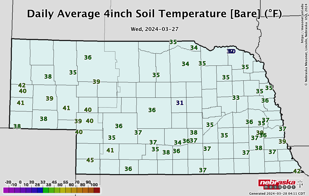
Soil Temperatures
Soil temperatures across the state have dropped off quite a bit over the last ten days with most of the 4" bare soil temperatures across the state currently in the mid to upper 30's. These numbers should come back up somewhat in the next few days with more sunshine and warm weather. There is also some chance of an extended period of mild temperatures starting this next week but with deeper troughs likely to be paying us a visit with some regularity into April, consistently staying above that 50F mark for planting may get tricky until we get deeper into April.
Eric Hunt, University of Nebraska Extension