I Love a Rainy Night
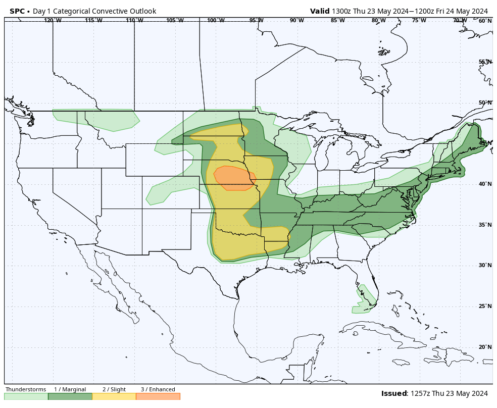
In the short-term, a potent storm system will be moving into the Northern Plains with a trailing cold front that will traverse the state starting later today through the early morning hours tomorrow. This will be the focus of a line of severe storms developing this evening in west central Nebraska and moving east. The SPC has put much of central and eastern Nebraska in the Enhanced Risk of severe weather, primarily because of hail and wind damage threats. So Eddie Rabbitt may love a rainy night but given the severe weather risk and given there are areas that don't need more rain at the moment, his feelings may not be shared by most Nebraskans tonight. The line of storms should be to Kearney, Ord, and O'Neill by 10 PM and into the Lincoln-Omaha metro areas between 2-4 AM. The good news is that the storms won't be paying anyone an extended visit so precipitation amounts should be more on the order of a half inch to an inch for most locations east of North Platte. After the frontal passage, expect breezier winds from the northwest tomorrow and cooler temperatures in the 60's for most of the state.
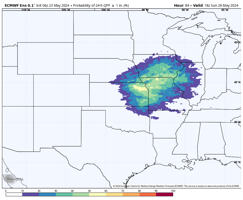
More storms Saturday night
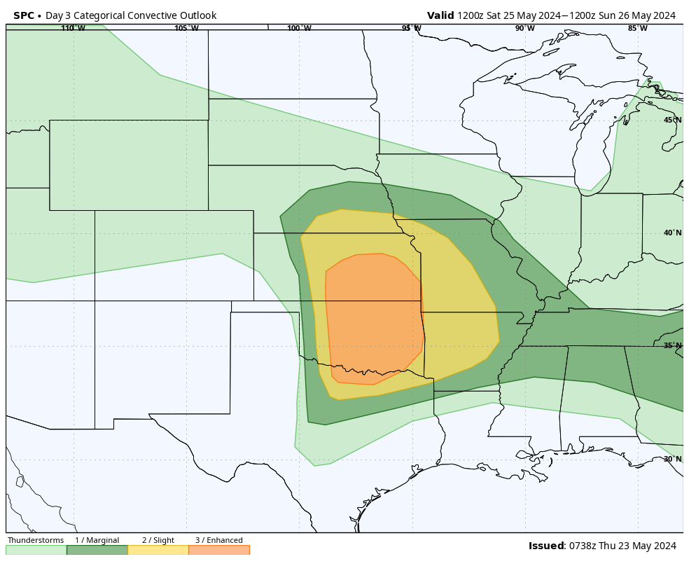
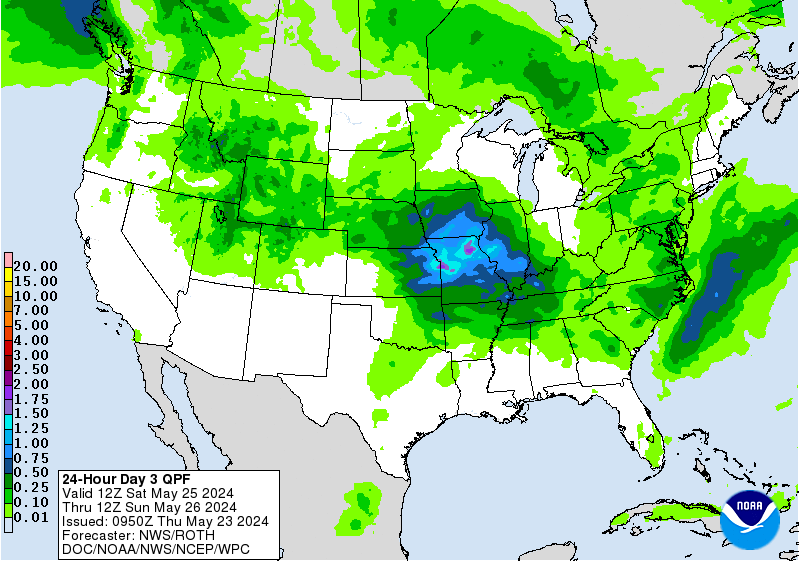
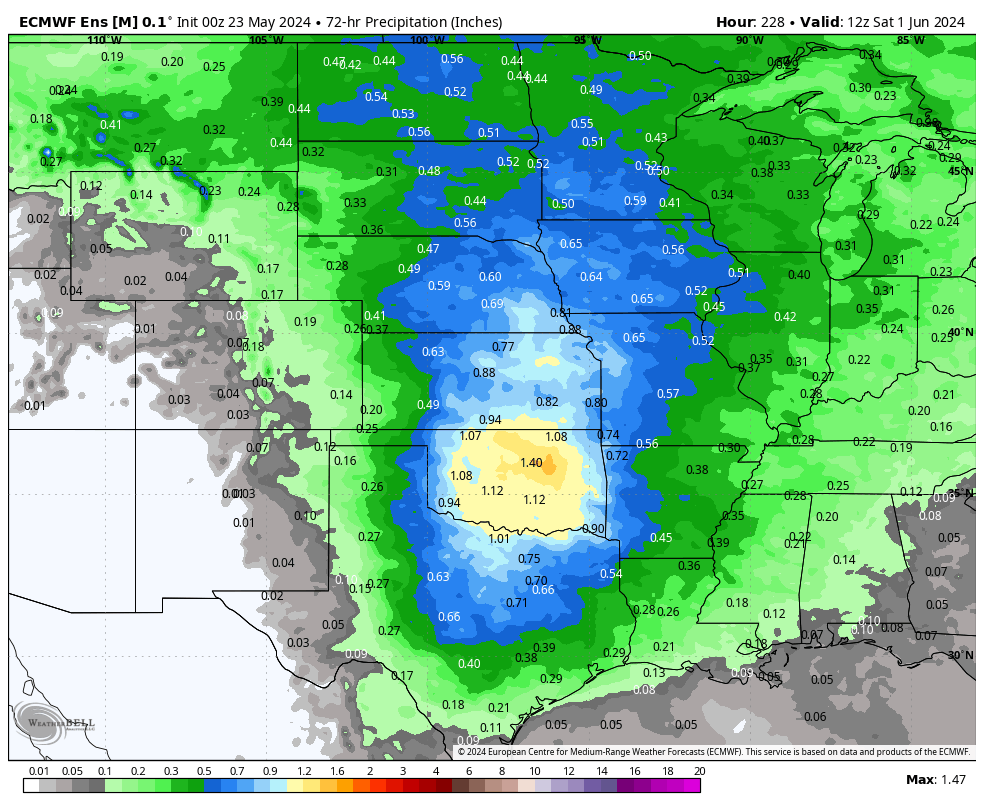
Mother Nature isn't done with us after tonight either as we will have another trough entering the Plains region on Saturday. The setup is favorable for severe weather across much of the central Plains and western Corn Belt region, including south central and southeastern sections of the state on Saturday night into early Sunday morning. The next thing we will have to watch out for is how far north and west the storm tracks. If it ends up being a bit farther north and west than is currently advertised, expect the probability of 1-2" of rain going up across eastern and south central Nebraska. Some precipitation is projected to fall across the western portion of the state but certainly less than we are expecting further east.
Ideal outdoor weather then more rain
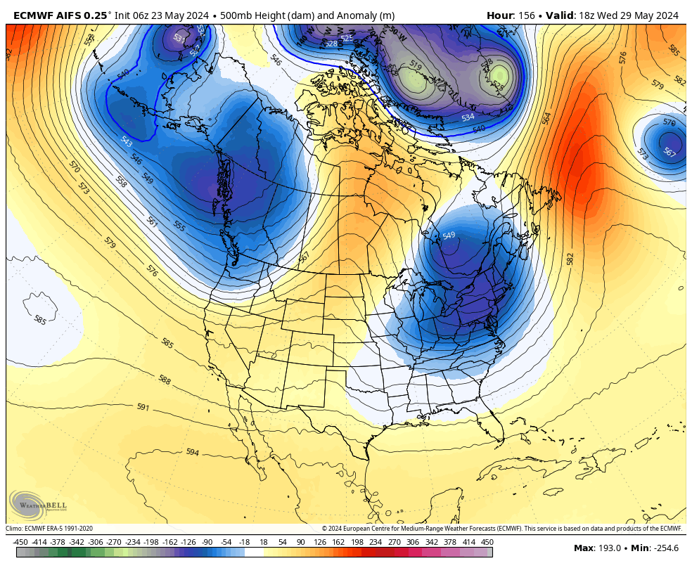
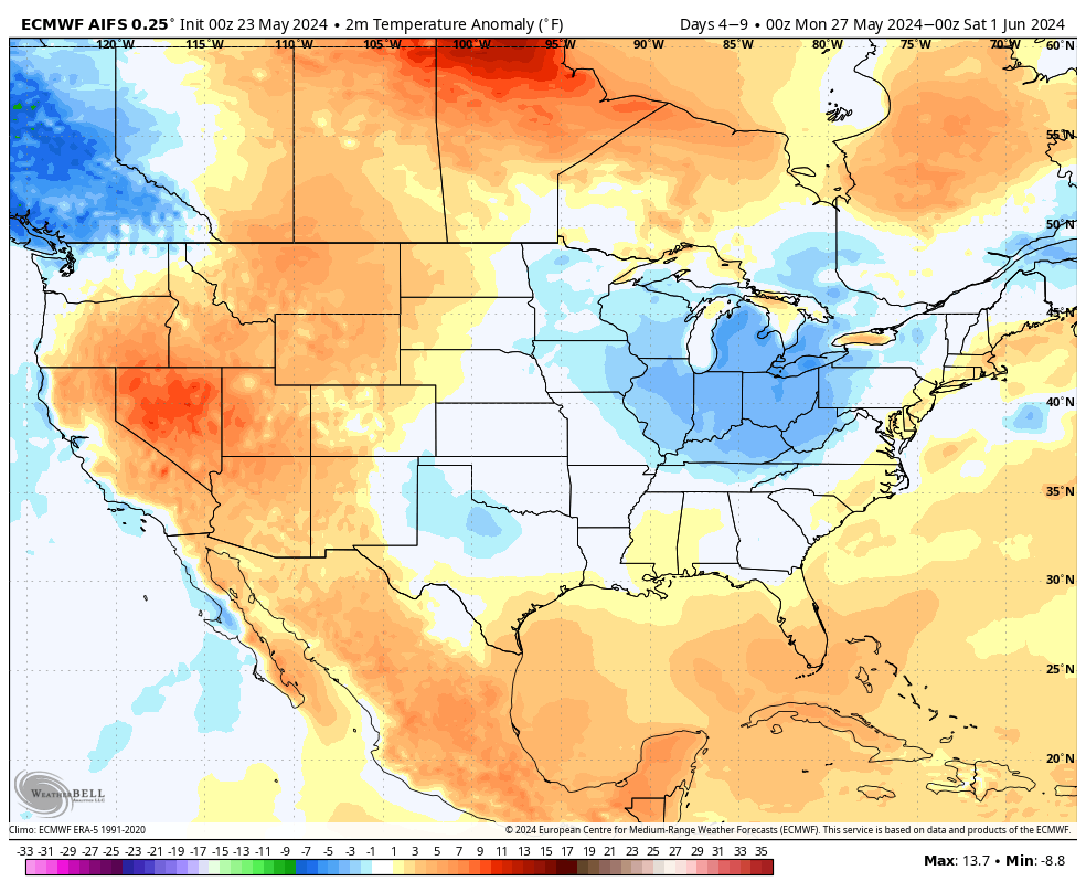
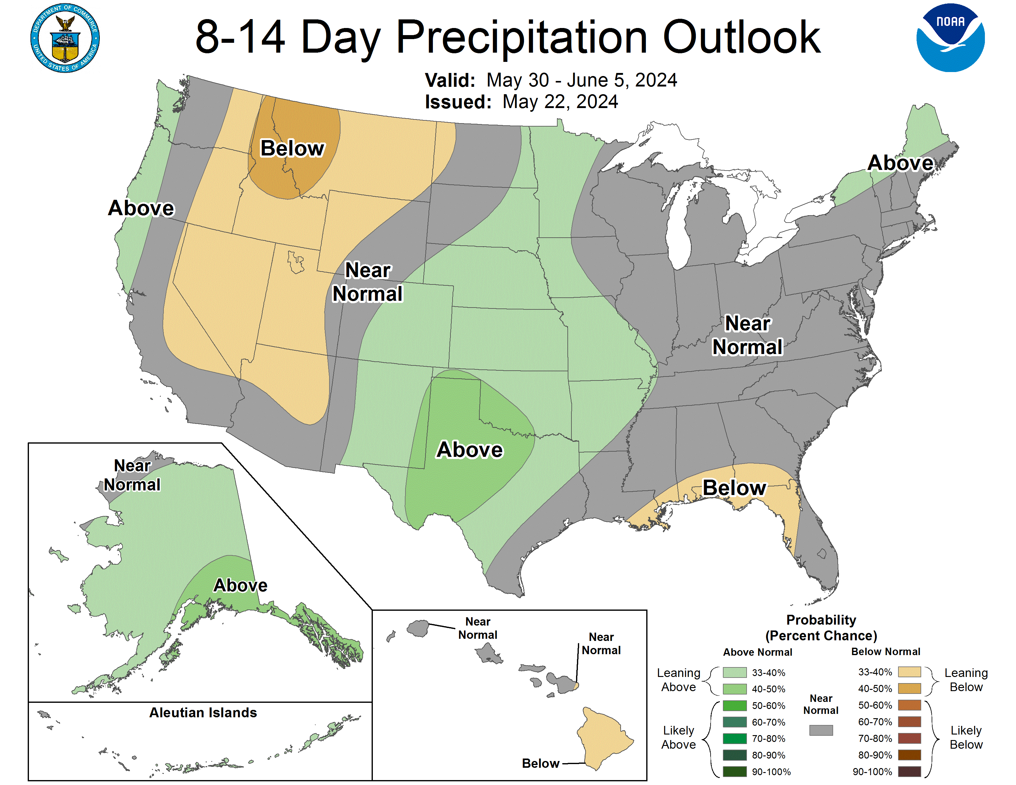
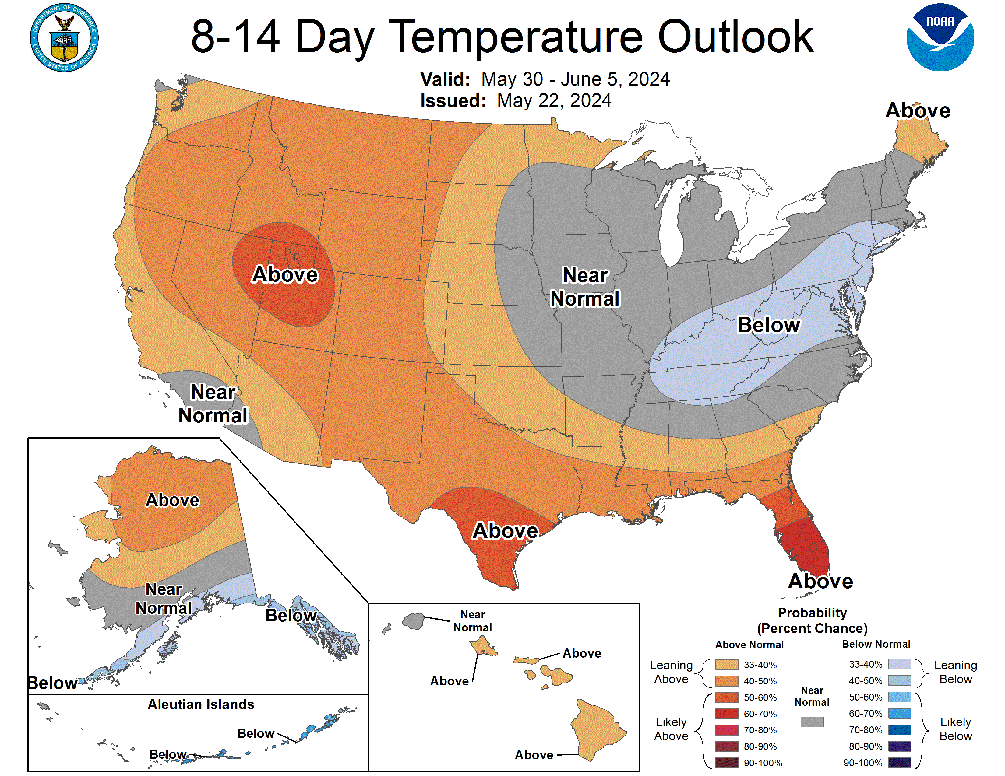
By Memorial Day most of the area should be rain free and the first half of the work week looks quite nice statewide with temperatures getting into the 70's and low 80's, with warmer anomalies as you go west. However, this break in precipitation is likely under 100 hours. As we move into the end of the week, we will see a decent fetch of moisture coming up from the Gulf and a few disturbances passing through the region in more zonal flow that are likely to produce precipitation across the state. Rainfall amounts are not looking especially impressive at the moment- under a quarter inch in the Panhandle to an inch possible across parts of eastern Nebraska- but it may be unwelcome rain for producers trying to finish up planting or needing to replant, as will undoubtedly be the case in a lot of areas of east central Nebraska. Temperatures look seasonal at the end of the week in the 70's.
Drought improvements and excessive moisture
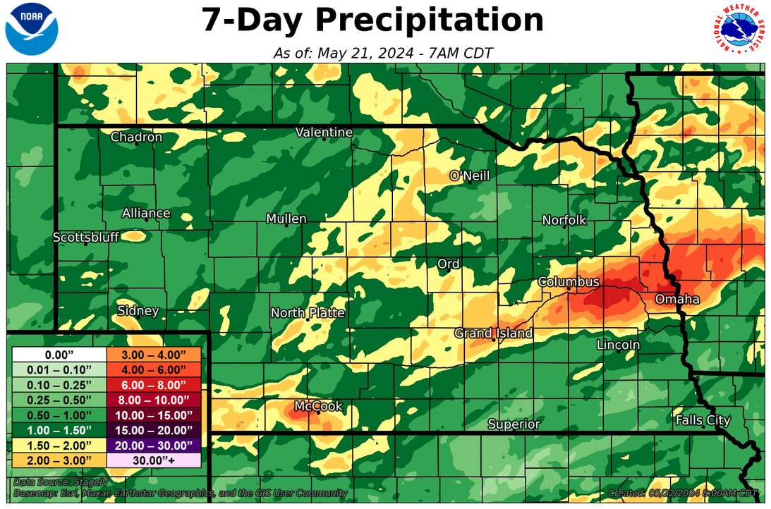
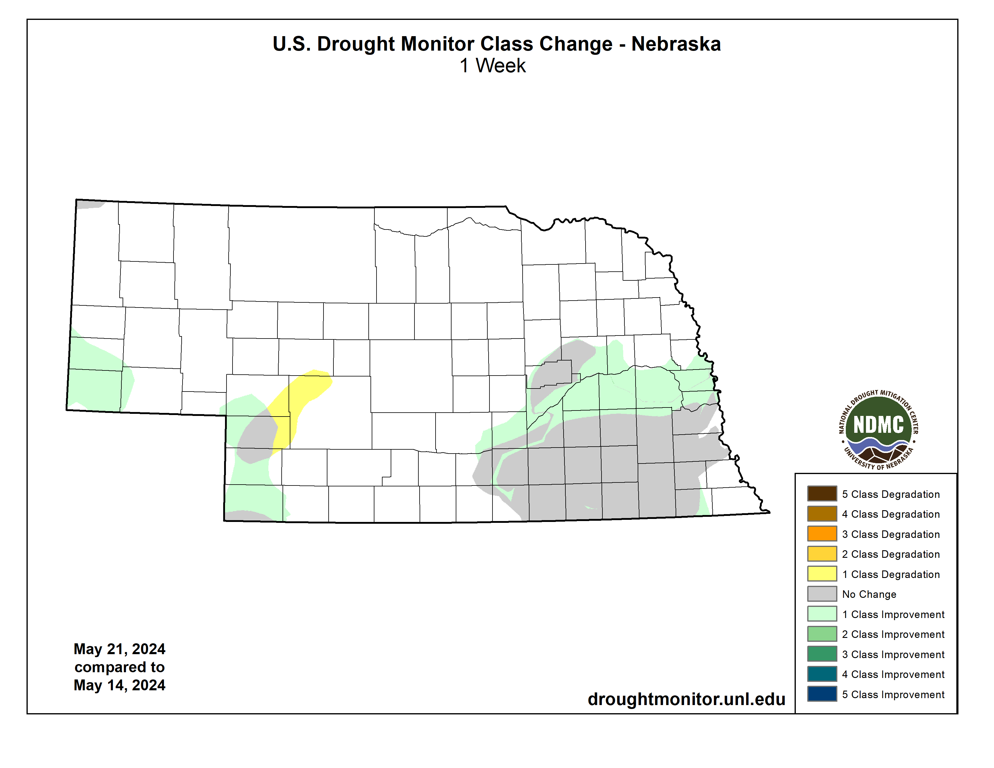
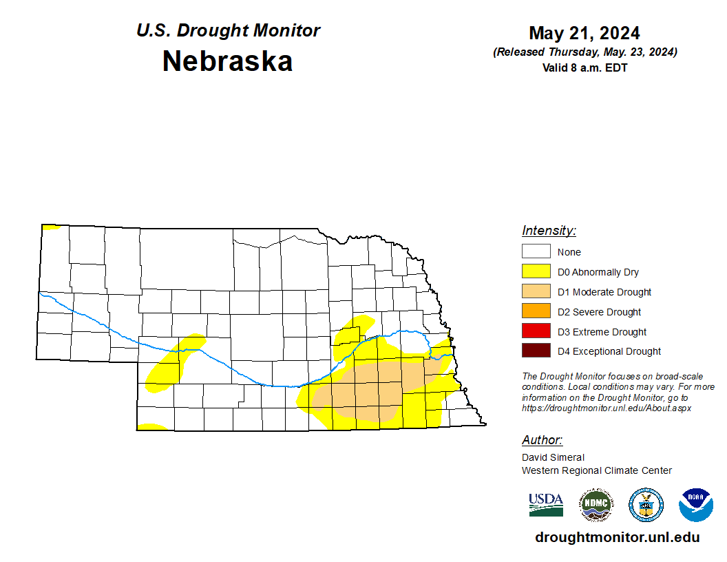
The entire state saw rain over the last week but suffice to say there were significant inequalities. Areas east of Beatrice picked up under a tenth while the area between David City and west Omaha had over 7". The latter led to a lot of flooded basements, roadways, and fields. There were also several reports of hail earlier in the week though we thankfully missed out on the worst of the tornado outbreak this past Tuesday. The heavy rainfall in the Highway 30 corridor did lead to broad 1-category improvements and the Omaha metro area is now free of drought. The southwestern section of the state saw significant rainfall that was more humane in total (1.5-3 inches) and more needed than further east. This led to some elimination of abnormal dryness in Dundy and Chase counties. Same story in Kimball and Banner counties where 1.5-2.0" fell earlier in the week. The state as a whole is down to less than 7 percent in drought and less than 20 percent in abnormal dryness or worse. Certainly a positive. The one area that did see a bit of degradation was an area between Ogallala and North Platte that just isn't getting the rains that surrounding areas are.
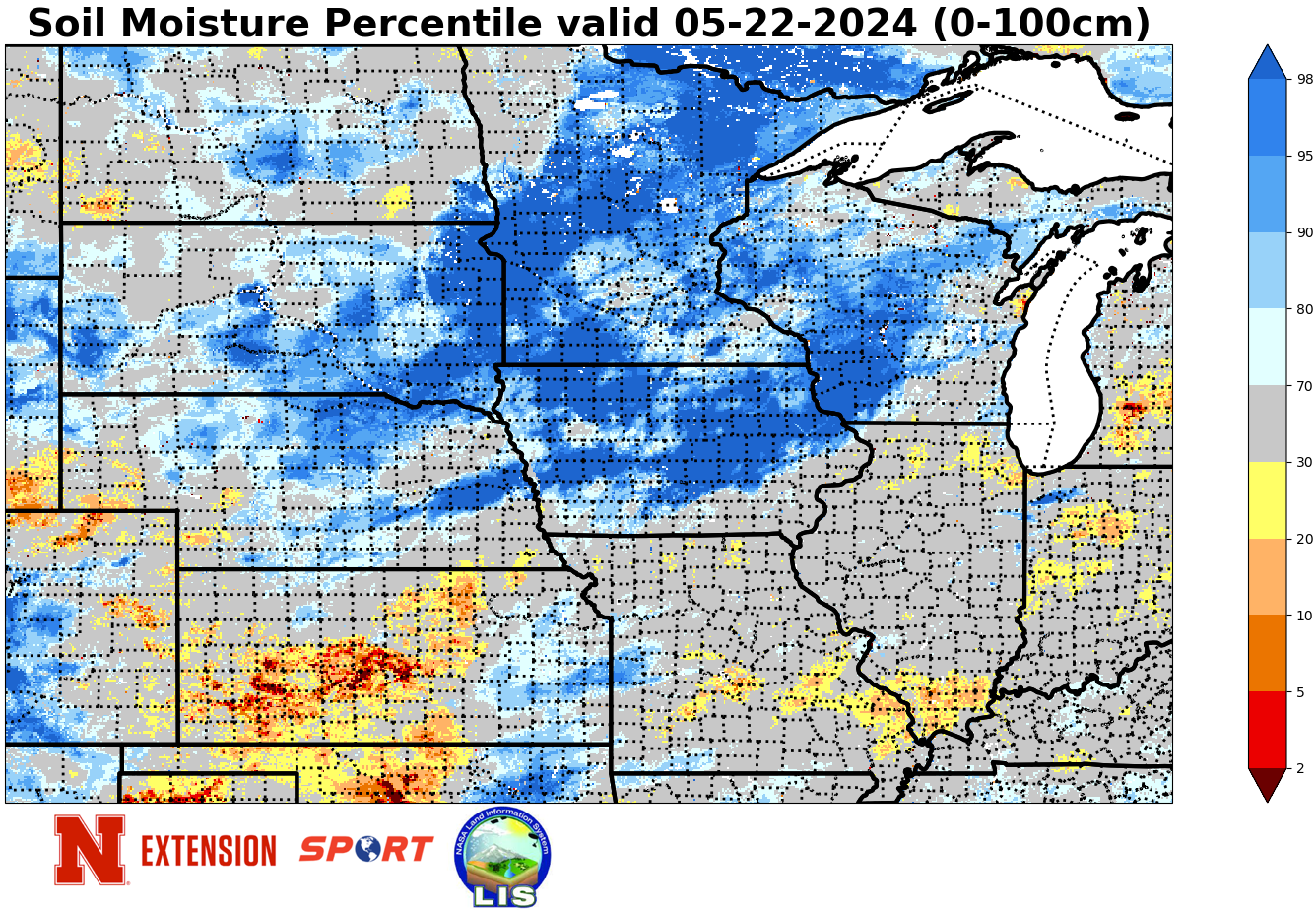
Soil moisture percentiles for the top 1 meter of soil show very little dryness for the time of year. Only a few pockets in western Nebraska have drier than average soil moisture percentiles. The bigger problem now is the amount of the state with excessively wet soils, which includes the area from Central City over to Blair that got historic levels of precipitation Monday night and a broader section of north central Nebraska between Ainsworth and O'Neill and Lynch down to Burwell.
NASS Crop Progress update
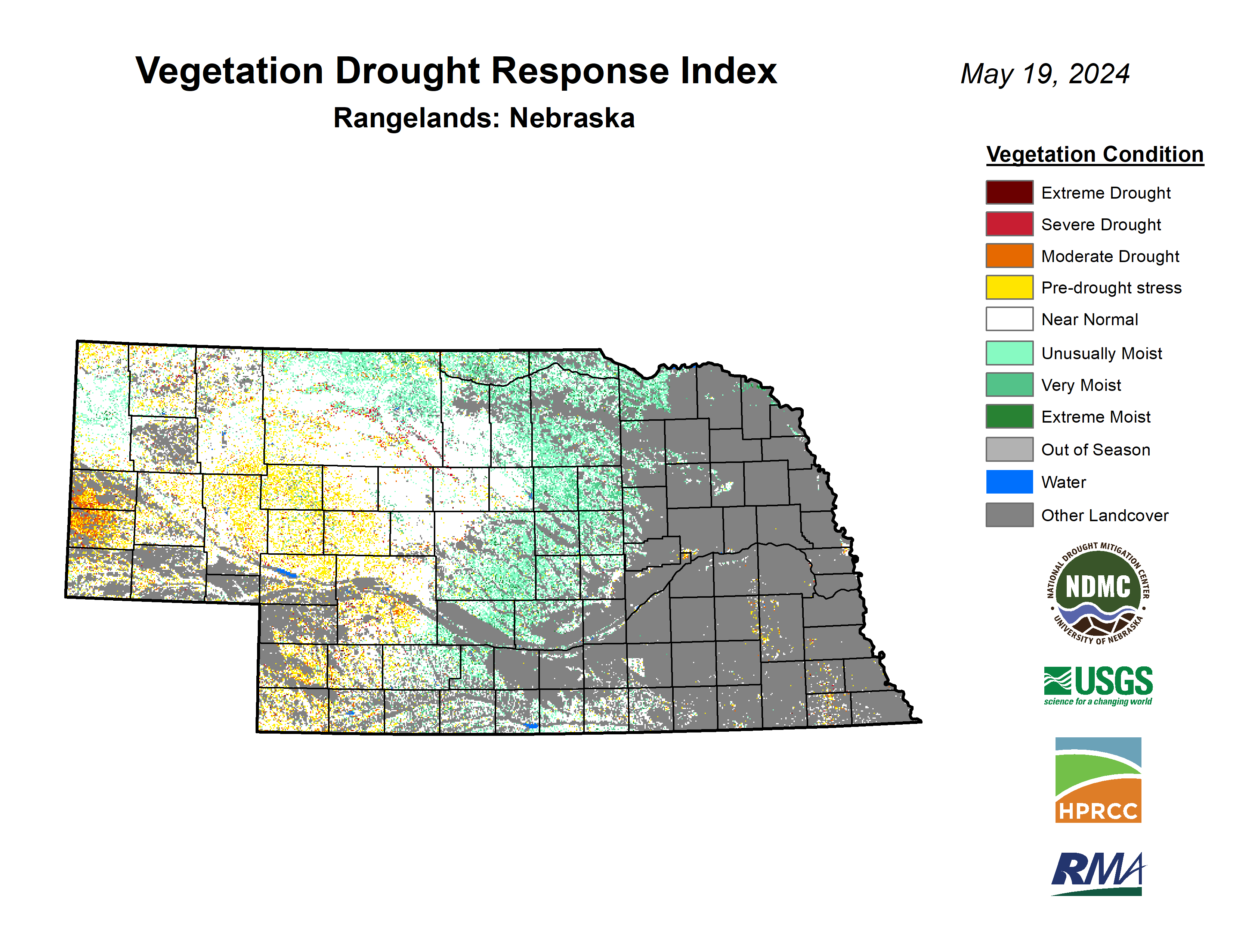
79 and 60 percent of corn and soybean respectively had been planted as of the end of last week. This is a significant increase from the week before but still below the 5-year averages for both. Corn emergence came in at 38 percent and soybean emergence was 21 percent. Both are behind the 5-year average but ahead of years like 2008, 2013 and 2019. Sorghum planting is also off to a slow start with 14 percent planted. Winter wheat checked in at 76 percent good-excellent against 5 percent poor-very poor, significantly higher than in recent years, and checks in at 22 percent headed. This is above the 5-year average. Almost 90 percent of oats have emerged. Pasture ratings of the season show 56 percent good to excellent against 8 percent poor to very poor. That is also a significant improvement over last year at this time, though the good-excellent percentage has declined somewhat in recent years. VegDRI continues to depict very good pasture conditions in the northern and eastern Sand Hills regions with near-average or slightly dry conditions to the southwest of Mullen.
Temperature and Precipitation Roundup
Attached are .pdf's containing the average temperature, growing degree days, and total precipitation for each station that had no missing days over the period from May 12- May 18. Includes CoCoRaHS observer reports. Below are the temperature and precipitation extremes around the state over the past week.
Maximum Daily High Temperature: 92F, Culbertson
Minimum Daily High Temperature: 59F, O'Neill
Minimum Daily Low Temperature: 29F, Bushnell 15S
Maximum Daily Low Temperature: 62F, Auburn 5 ESE
Max Weekly Precipitation: 8.65", Bennington 2.9 SSW
Min Precipitation: 0.03", Filley 0.4 NNW
Eric Hunt, University of Nebraska Extension


