Week Ahead Outlook
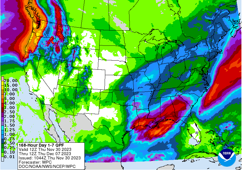
The next 24-36 hours bring a decent chance of meaningful moisture, in the form of rain and snow, to far southeastern Nebraska. Latest output from the HRRR shows the northwestern shield of precipitation from the upper level trough will encompass Richardson, Nemaha, and Pawnee counties with some chance of measurable precipitation as far north as Nebraska City. It is expected to begin as rain this evening and then transition to a mix of sleet and snow overnight. The bulk of precipitation will be to our southeast in accordance with the track of the low. Nevertheless, areas near Falls City can expect up to 2" of snow with some ice mixed in. So plan accordingly if you have travel plans in that part of the state tomorrow morning. There are additional chances for light snow or a mix tomorrow afternoon in the southeastern quadrant of the state. But any amounts tomorrow will be light.
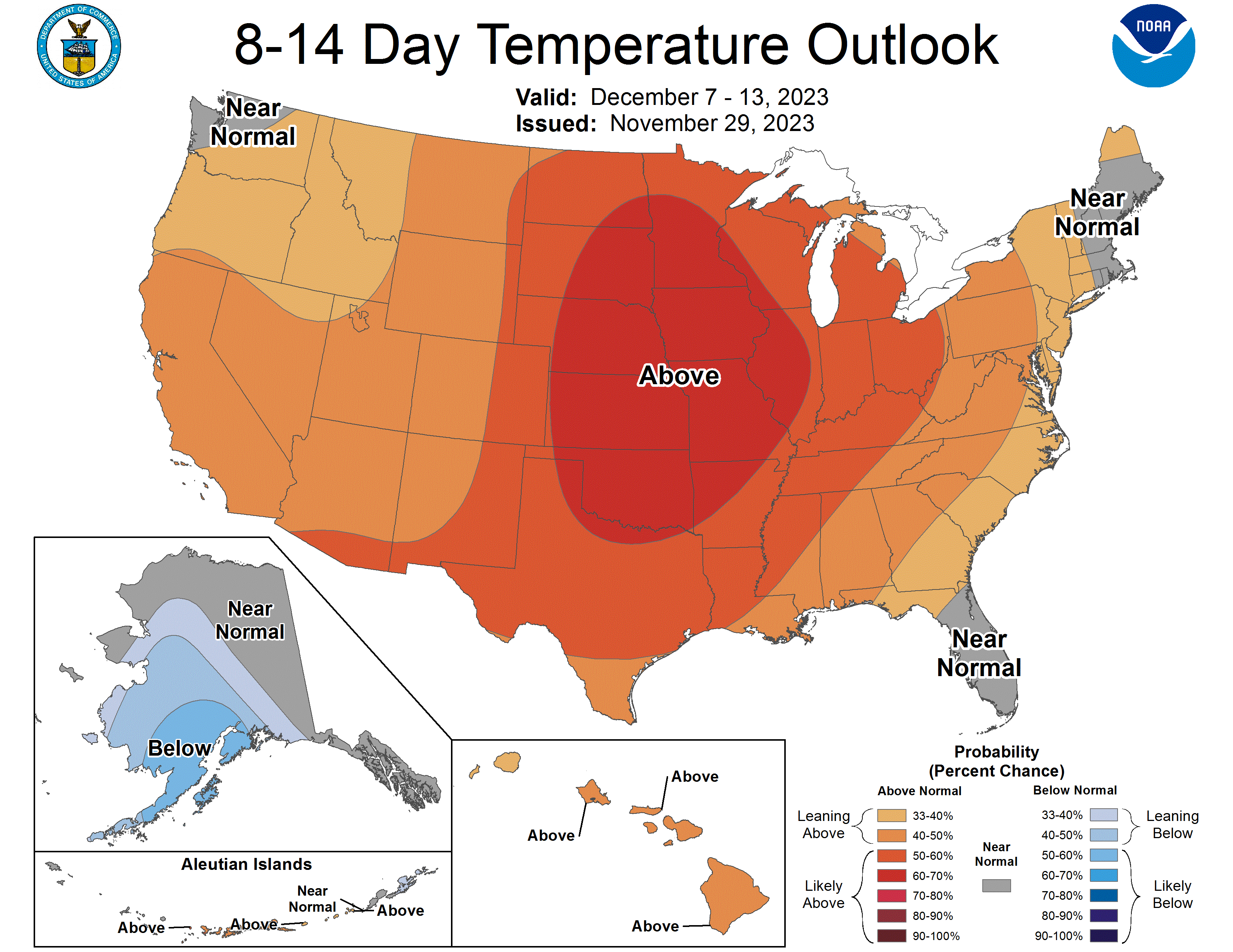
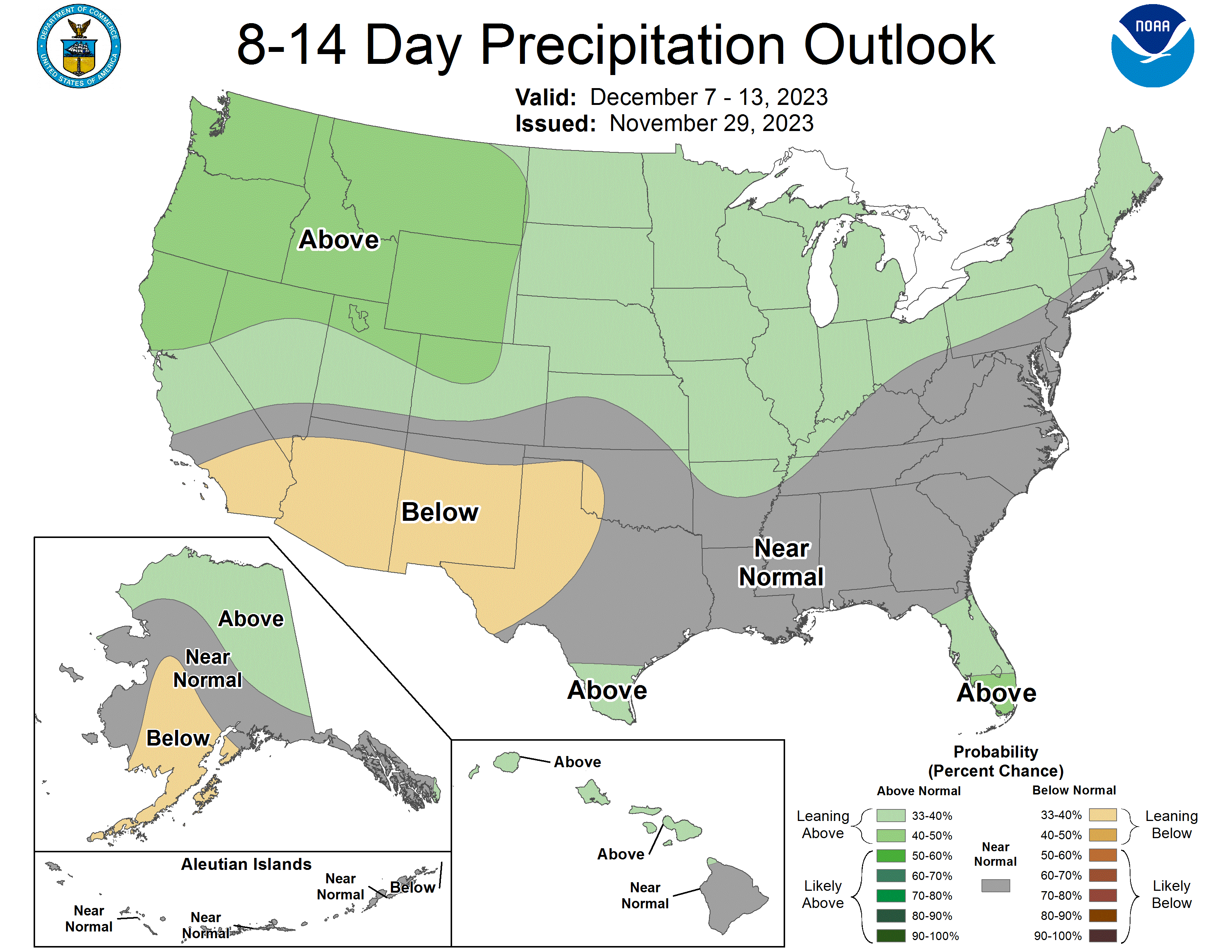
As we head into next week, we will be dominated by ridging aloft. This will greatly limit the chances of precipitation and keep us on the mild side. Temperatures will generally be above 50 in western Nebraska for much of next week and for the entire state on Wednesday and Thursday. Right now it appears that Thursday will be the warmest day of the week with 55-60F likely statewide, possibly even somewhat over 60F in southwestern Nebraska. There is a chance for showers across the state late Monday into Tuesday but right now that chance is low and any precipitation that does fall will be light. There may be something brewing by the end of next weekend so it's possible the week after next may be more eventful in terms of impactful weather.
Precipitation Update
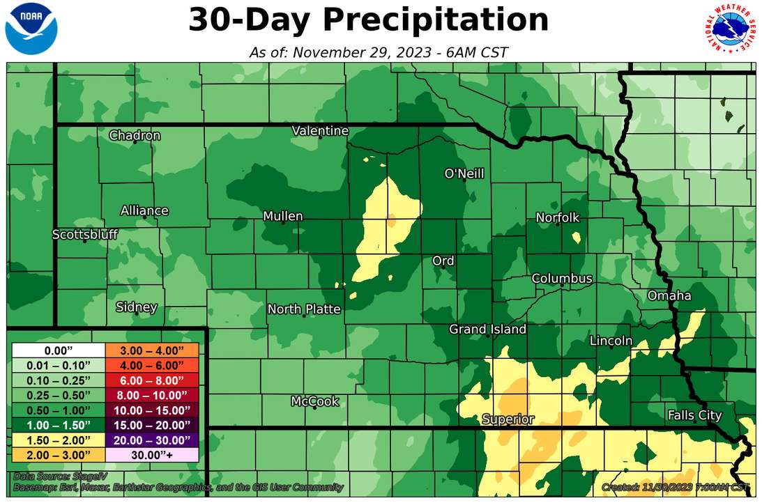
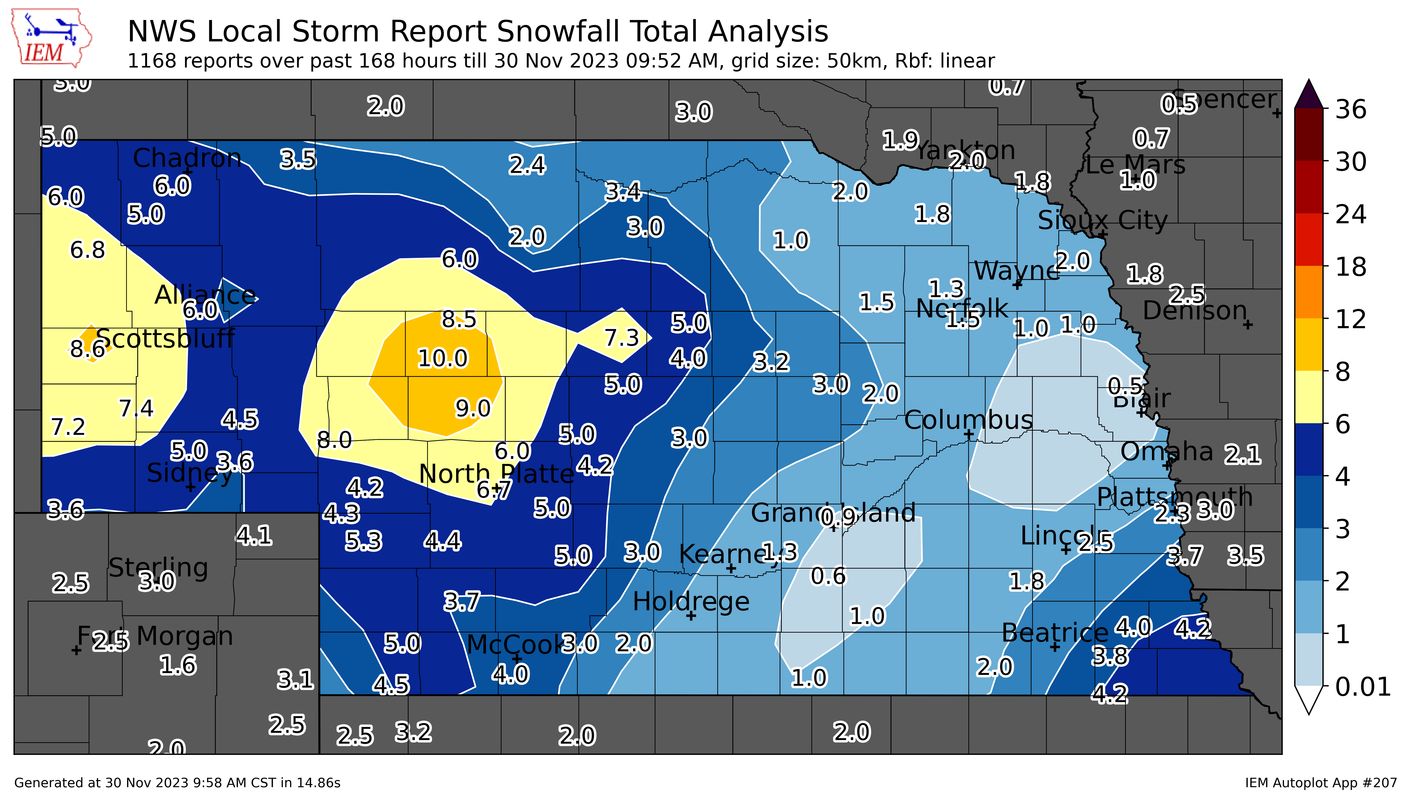
Most of the state picked up meaningful precipitation last week, with most locations in central and eastern Nebraska receiving between 0.40-0.75" of rain early last week and most of the Panhandle and West Central Nebraska picking up over 0.50" of liquid water equivalent from snow later in the holiday week. Heaviest rain totals early last week were found across portions of Clay and Nuckolls County, where over an inch was reported. Heaviest snowfall reports came out of Hooker County (10") and Scottsbluff (~ 8") .
Drought Monitor Update
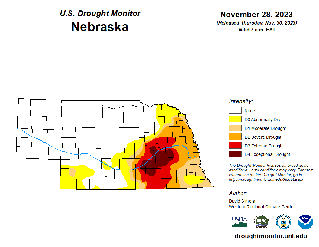
The recent precipitation has led to some positive changes on the U.S. Drought Monitor. On last week's USDM, there was improvement from D4 to D3 in parts of Nuckolls and Clay counties. This does not mean this area is anywhere close to being out of drought; it's just a mild improvement. Further north and west, the precipitation led to eradication of more abnormal dryness (D0) in the Sand Hills. Elsewhere, the precipitation was welcome but not enough to "move the needle" in places where drought is still prevalent.
Wheat Update
Winter wheat checked in with a rating of 49% Good to Excellent against 14% Poor to Very Poor. This is considerably better than last year when it checked in with 20% G-E against 39% P-VP.