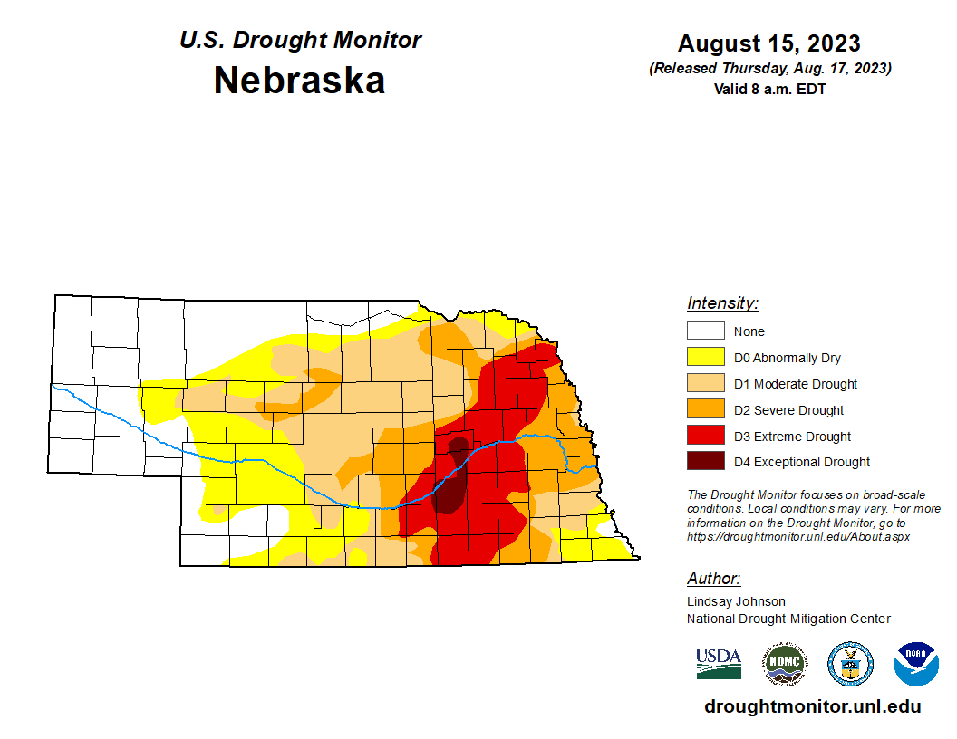
Drought Update
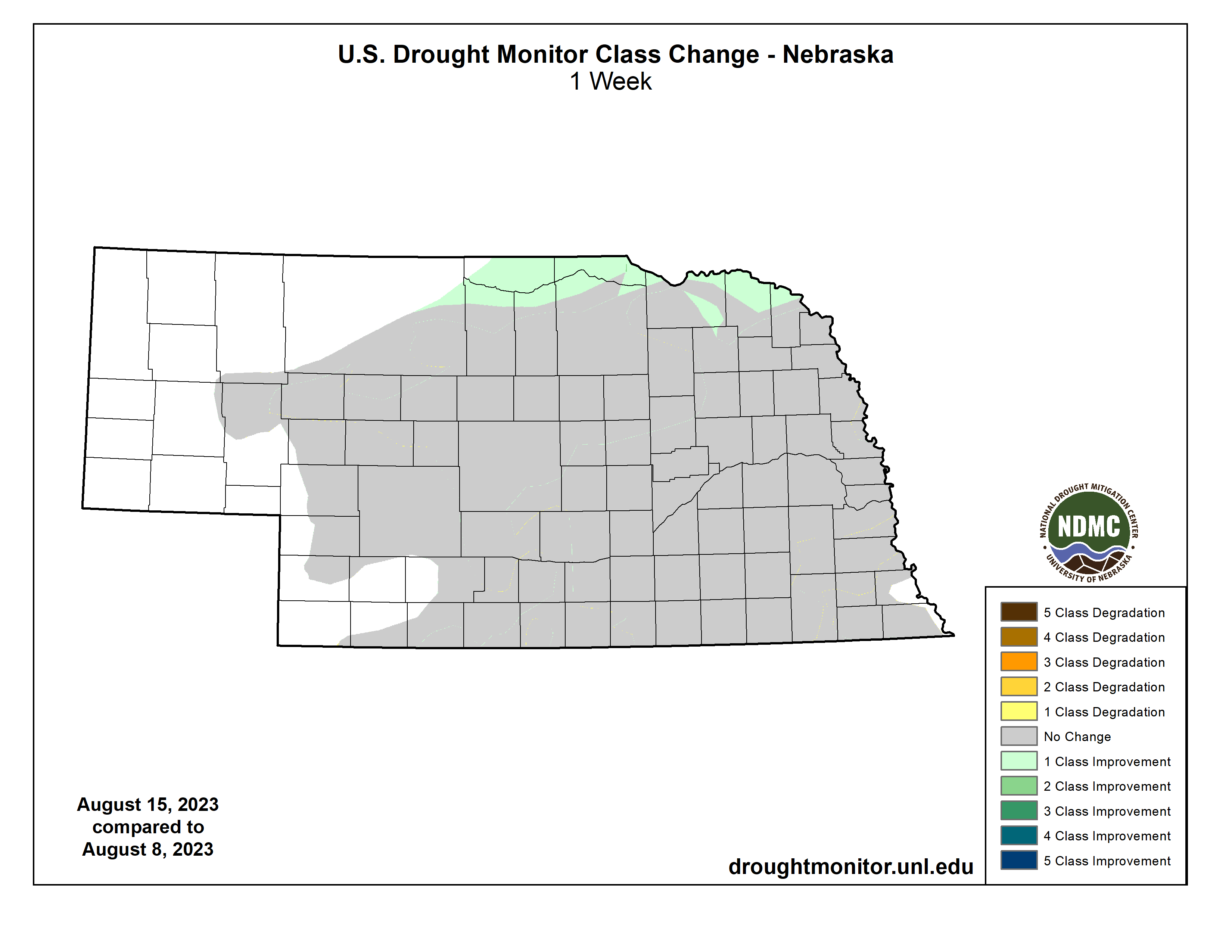
There was additional improvement in the north central part of the state, eliminating more D0 (abnormal dryness). There is roughly 30 percent of the state free of drought and abnormal dryness, which is the highest statewide percentage of "None" since the map on July 27, 2021. If the upcoming forecast verifies, there will likely be degradation in the near future for parts of the state that have been short on rainfall over the past 30 days
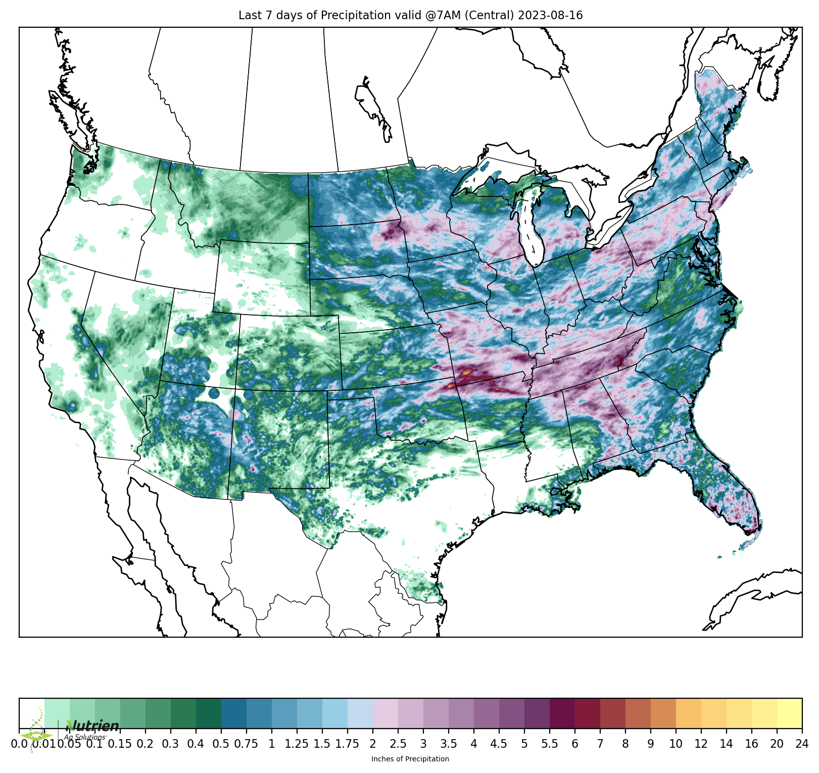
Precipitation Update
Most of the state received some precipitation over the past week but most places picked up under an inch, with most of west central Nebraska picking up less than a quarter inch. Heaviest precipitation fell in north central Nebraska in Keya Paha County, where 2-3" was common. Most of the northeastern corner of the state picked up 1-2" over the past seven days, which didn't lead to further improvement on the USDM but both soil moisture and vegetation indicators have improved quite a bit in that area over the past month. 1-2" also fell over northern Lancaster, Cass, and Nemaha counties on Sunday, which was the most significant precipitation for some of those areas in three weeks. Little to no precipitation has fallen anywhere in the state since this past Sunday and only the Panhandle has any realistic chance of precipitation in the next 4-5 days.
Soil moisture update
Now that the SPoRT LIS data disk outage has been resolved, I can show their root zone percentiles maps again. As with any modeled soil moisture product, it is best to view as guidance and not to take 100% literally. For quick background, this is a land surface model run under NASA's Land Information Systems (LIS) framework with assimilation of Soil Moisture Active Passive (SMAP) data and compared against a longer climatology to determine percentiles. In this case, it is showing that most of central and eastern NE are under the 50th percentile for soil moisture. Keep in mind that the 25th percentile is not the same thing as 25% of available water. It simply is a reflection of having more or less soil moisture than average for this time of year. But what I do think is useful in this map is that it is a reflection that we haven't had a lot of deeper recharge of moisture this summer, even though many of these same places have had a wetter and cooler last 6-7 weeks. It simply is difficult to get strong recharge in the summer after such acute dryness in the spring. A quick check of soil moisture data from various Mesonet sites shows that there isn't much deep moisture at many sites. Therefore, it is going to be critical for the soybean crop that rain returns by the end of the month as most places don't have the capacity to get into September without rain.
Vegetation and crop progress update
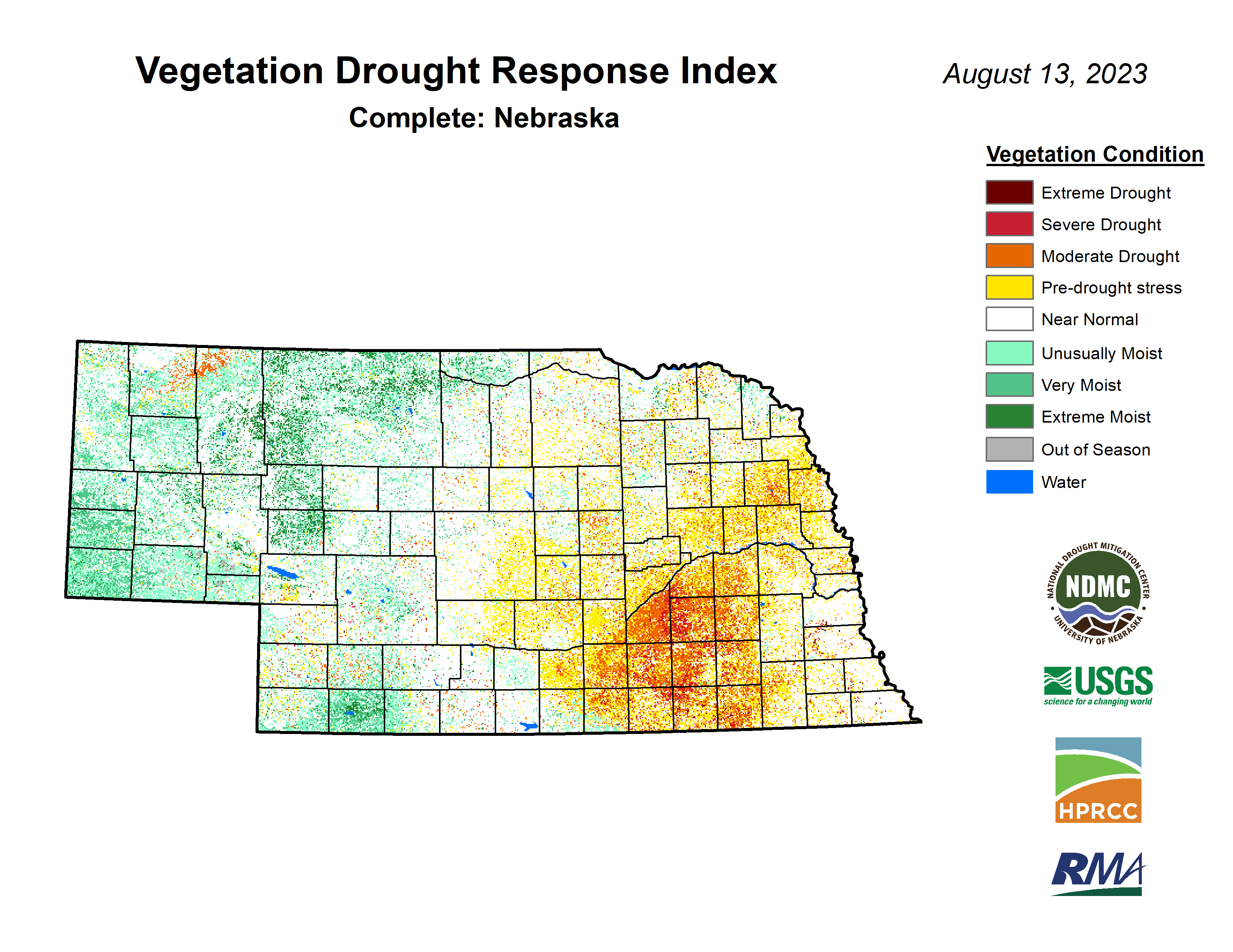
The latest VegDRI map shows that conditions are generally good across the rainfed southeast portion of the state. Average to good conditions exist over increasing portions of northeastern Nebraska as well. Thus, I think there is decent credibility that corn yields in the state will exceed yields from 2022. The area with the most stress continues to be in Hamilton, York, Clay, Fillmore, Nuckolls and Webster counties.
The latest crop progress report shows that almost 70% of corn is in the dough stage and over 20% is now in the dent stage. 16 percent is rated as poor to very poor (P-VP) and 61 percent rated as good to excellent (G-E). The stability of that P-VP number for the last six weeks is indicative of a year that is unlikely to be above trend but also not likely to be well under trend. Those fields where corn is into the dent stage are likely to be less affected by the upcoming heat, though significant yield loss can absolutely still occur after corn gets into the dent stage.
A strong majority of soybean are setting pods (76%) with ratings of 16 percent P-VP and 58 percent G-E respectively. The lack of precipitation in the forecast is probably more concerning for soybean, as most places probably still need at least one more good rain to help boost pods and overall yield. Sorghum is about on target with 14% into the coloring stage and ratings continue to be quite good. Pastures are rated at 62 percent G-E against only 8 percent P-VP. Wheat harvest is more or less complete