

Drought Update
Mostly status quo to report this week on the U.S. Drought Monitor. Roughly 68 percent of the state is in drought, a percentage that has remained stable for the last several weeks. There was no change in the worst categories of drought.
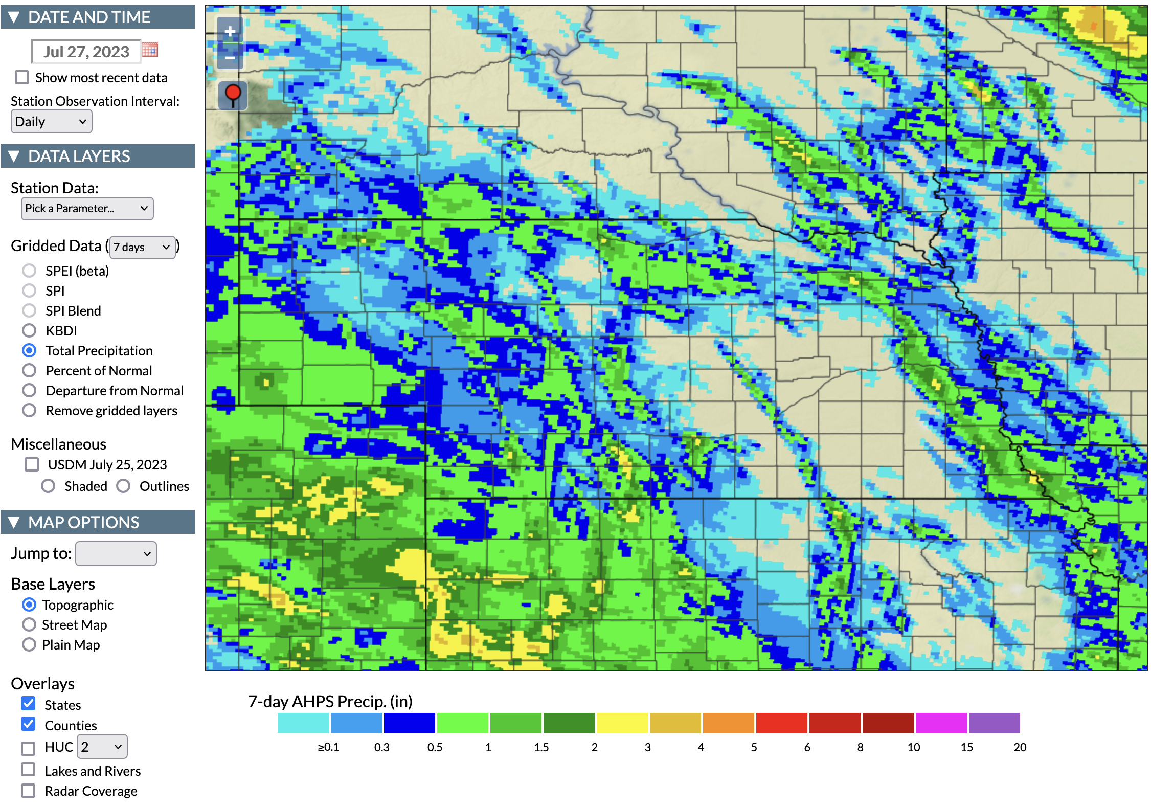
Precipitation Update
The past seven day stretch was the driest 7-day stretch since June for most of the state. There were a few big winners though that picked up 2+ inches over the past week. This includes the area around Wahoo in Saunders County and from western Gosper County into Araphoe. Most of the southeastern corner of Nebraska also picked up a half inch with on Sunday night, a bonus before we got into the heat. There were also pockets of the Panhandle that picked up over an inch of moisture over the past week. The areas that needed it most generally didn't pick up meaningful rain however.
Heat Returns
After a relatively long stretch without heat, the past week has seen a return to hotter conditions, with particularly hot weather the past few days, especially along the Kansas border in south central and southwestern Nebraska where high temperatures have been approaching 104F the past few days. The eastern sixth of the state got a break on Tuesday when clouds held temperatures in the 80’s and cloud cover this morning is helping some too. While temperatures have generally been under 100 in eastern Nebraska, the humidity has been very high with 80+ dewpoints common in the afternoon the past few days. Yesterday’s big heat index winner was the Lincoln airport, which managed a heat index of 121F. Daily average temperatures yesterday exceeded 80F everywhere in the state except in the Panhandle, which had much cooler overnight lows.
The forecast is better this weekend, especially in the eastern side of the state where many sites will get a few days with highs in the 80’s and more reasonable overnight lows. There is a return to heat next week, with fairly hot conditions forecast next Monday-Wednesday and possibly Thursday. The good news is there is a better chance of rain this weekend so some places may seem some recharge before the next round of heat.
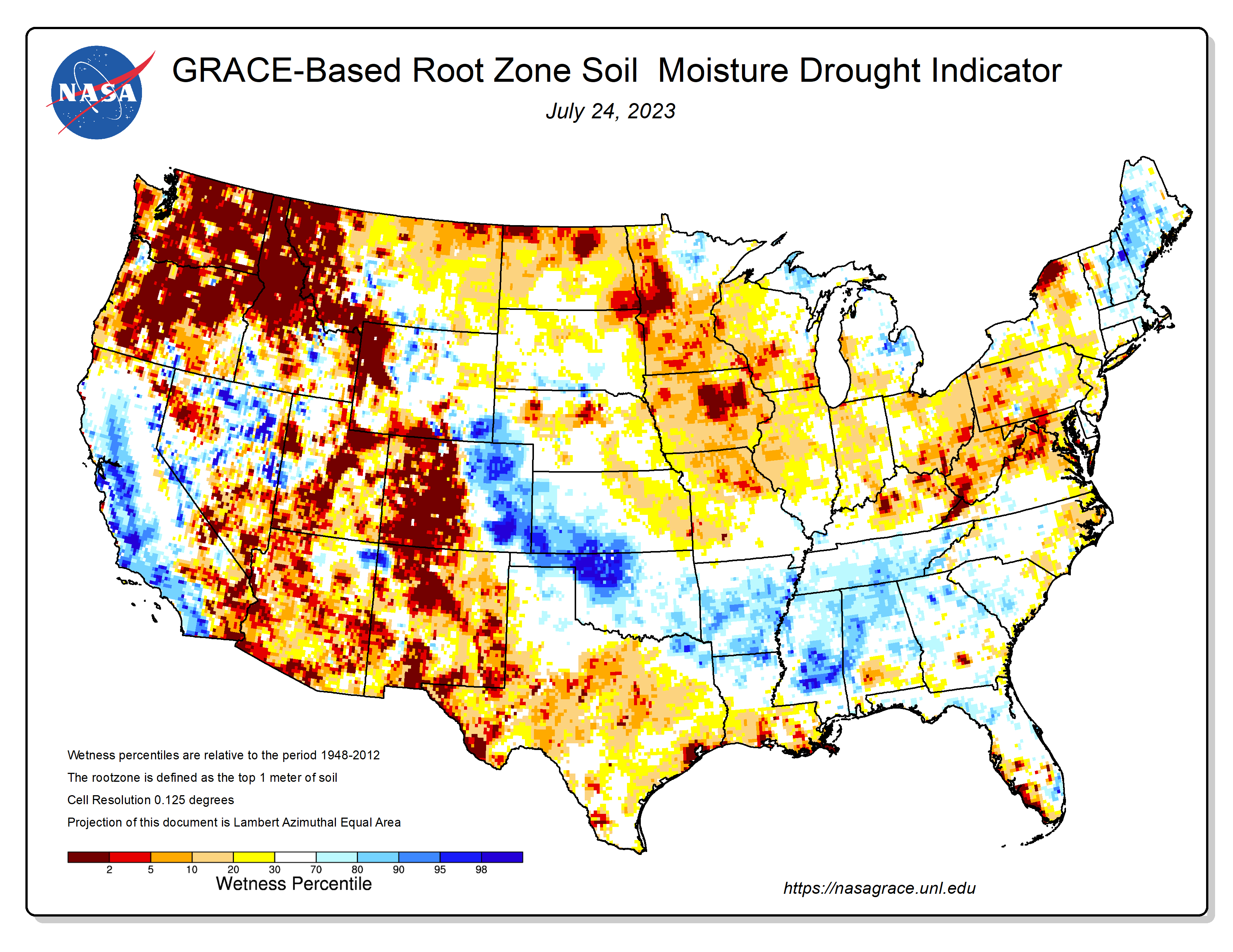
Soil Moisture
Speaking of soil moisture, the latest root zone percentiles map from GRACE shows that most of the state isn’t in terrible shape, most places are around normal for late July in the top part of the profile. However, the observed soil moisture (under grass cover) at the Mesonet sites would indicate that this map is probably a bit of an optimistic assessment of soil moisture.
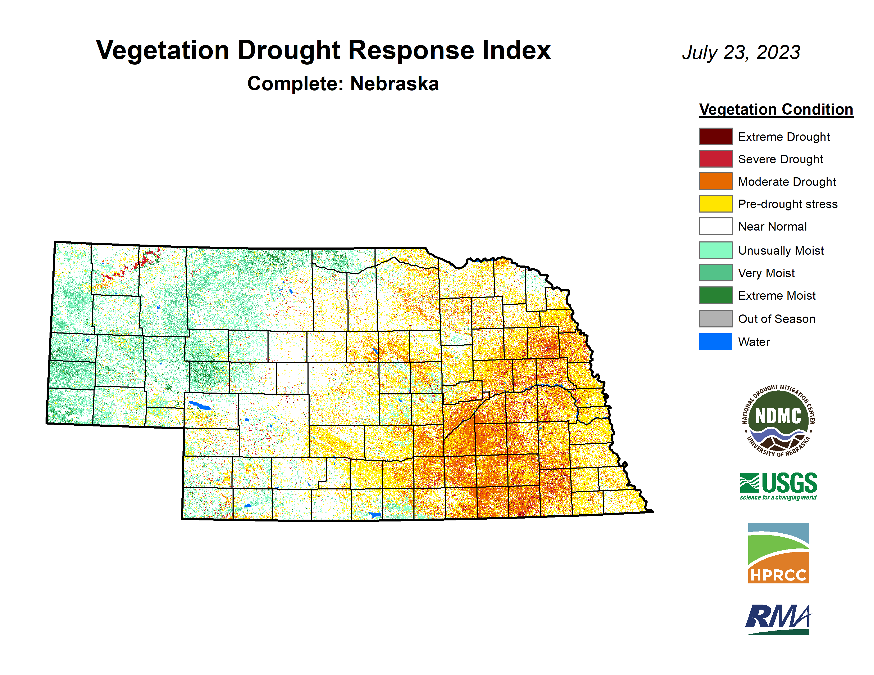
Vegetation and Crop Condition Update
The latest VegDRI map continues to be in good agreement with the U.S. Drought Monitor map, which shows the worst conditions in the area between Grand Island and York and down toward the Kansas border with broad vegetation stress on rainfed crops in the areas west of Lincoln. Areas east of Lincoln are in much better shape. Conditions in the western third of Nebraska are quite good for this time of year, though the recent heat won’t be good for pastures with cool season grasses.
Pastures continue to improve slowly and the percentage of pasture statewide in poor to very poor condition is at 11%, lowest in several months. Better news still is that 59% of statewide pasture is in good to excellent condition. Corn and soybean came in at 15% and 19% poor-very poor respectively on the latest NASS update. Those numbers are essentially identical to the numbers on every Crop Progress Report this month. The good news is that those percentages on corn were worse at this time last year and August should be more favorable than last year. But the persistence of those numbers says to me that there is an absolute ceiling on corn and soybean yields in the state this season.
Given the recent consistency of that poor-very poor number, it makes sense to conclude that there are simply a number of dryland fields that aren’t going to produce much this year due to the acute dryness through late June, particularly in the areas west of Lincoln. There is definitely potential for a good crop in the traditional rainfed area of southeastern Nebraska though if we can keep the spells of heat to shorter durations the rest of the season.
Corn is well into the reproductive stage with 77 percent at silking and 10 percent into the dough stage. The silking percentage is above the 5-year average of 70 percent. About 75% soybean in the state is considered to be in the blooming stage and 33% are setting pods. These numbers are right around the 5-year average. Sorghum is starting to head and is in reasonably good shape with 63 percent considered good-excellent but is behind on heading, likely due to the cooler temperatures that prevailed in recent weeks. Wheat harvest gained momentum last week going from 21 to 43 percent. But this is still well below average.