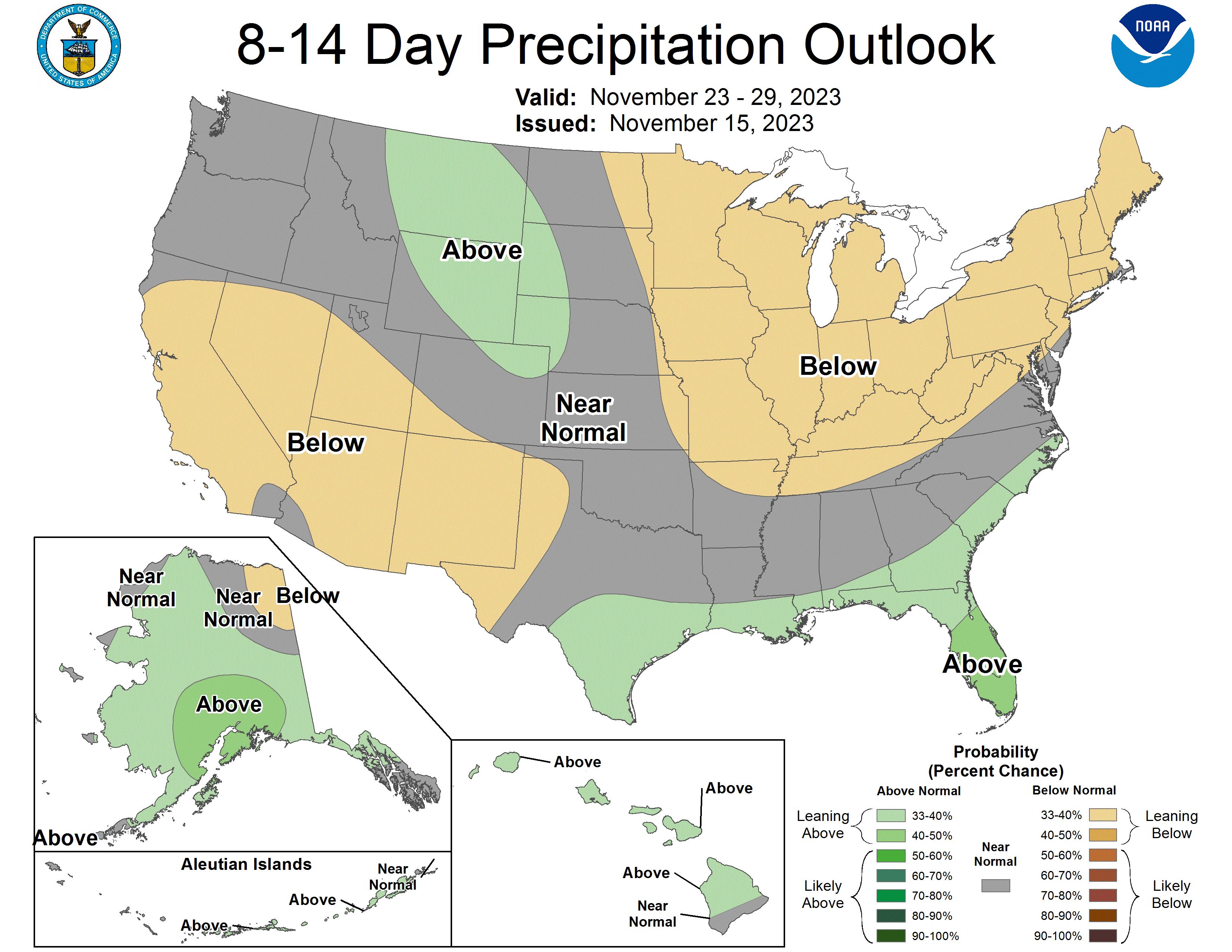


Moisture Coming?
It has been a very dry month across the state and many places have yet to receive measurable precipitation this month. While that has been great for completing harvest and getting fall field work done, it hasn't been great for the ongoing drought across south central and eastern sections of the state. More on that in a little bit. Regardless, it does appear that a change is coming early next week in the form of a storm moving into the High Plains from the Southwest. I wish I could promise that all locations east of Kearney and south of Norfolk were in for a two-day soaking that would yield over two inches of rain. For what it's worth the last few GFS runs have been just a bit further north with the surface low and a lot more aggressive on moisture transport into central and eastern Nebraska, which could yield upwards of 1.5" across a broad swath from Kearney east. The ECMWF has been more consistent with south central and southwest Nebraska being the favored areas for over half an inch of rain. We'll see what happens but I'm cheering for the GFS.
The Details
By Sunday morning, a decent mid and upper level trough will be moving into the Southern Plains with an associated surface low developing in eastern CO on Sunday and moving ESE into Oklahoma by Monday. If the storm were moving to the ENE, then I would feel much more confident about central and eastern sections of Nebraska picking up good moisture. But the storm is most likely to take a more east to east-southeast track given the expected upper air pattern. Thus, the heaviest precipitation is most likely to be to our south in Kansas and Oklahoma, with only southwest and south central Nebraska being in a favorable area for over a half inch of rain. Nevertheless most of the state is currently expected to receive some moisture between Sunday afternoon and Monday evening. There is not a lot of deeper cold air to work with so only parts of western Nebraska have a chance at seeing some light snow mixed in with rain.
A Cold Thanksgiving
There is increasing confidence in much colder air invading the state and most points east of the Rockies the second half of next week. While this won't be record or historic cold, it will be a big change from the mild weather that has dominated the state for most of the month. The first frontal passage should come through sometime on Wednesday with at least one and possibly two reinforcing shots of cold air thereafter. As of now, temperatures on Thanksgiving are likely to be under 40 for highs statewide and may not even crack 30 in parts of northeast Nebraska. So make sure those winter coats are handy. The good news is travel is expected to be good (i.e., free of snow) in this region Wednesday-Friday. But there may be something brewing in the western section of the state by the end of next week. So pay careful attention to the forecast and plan accordingly.
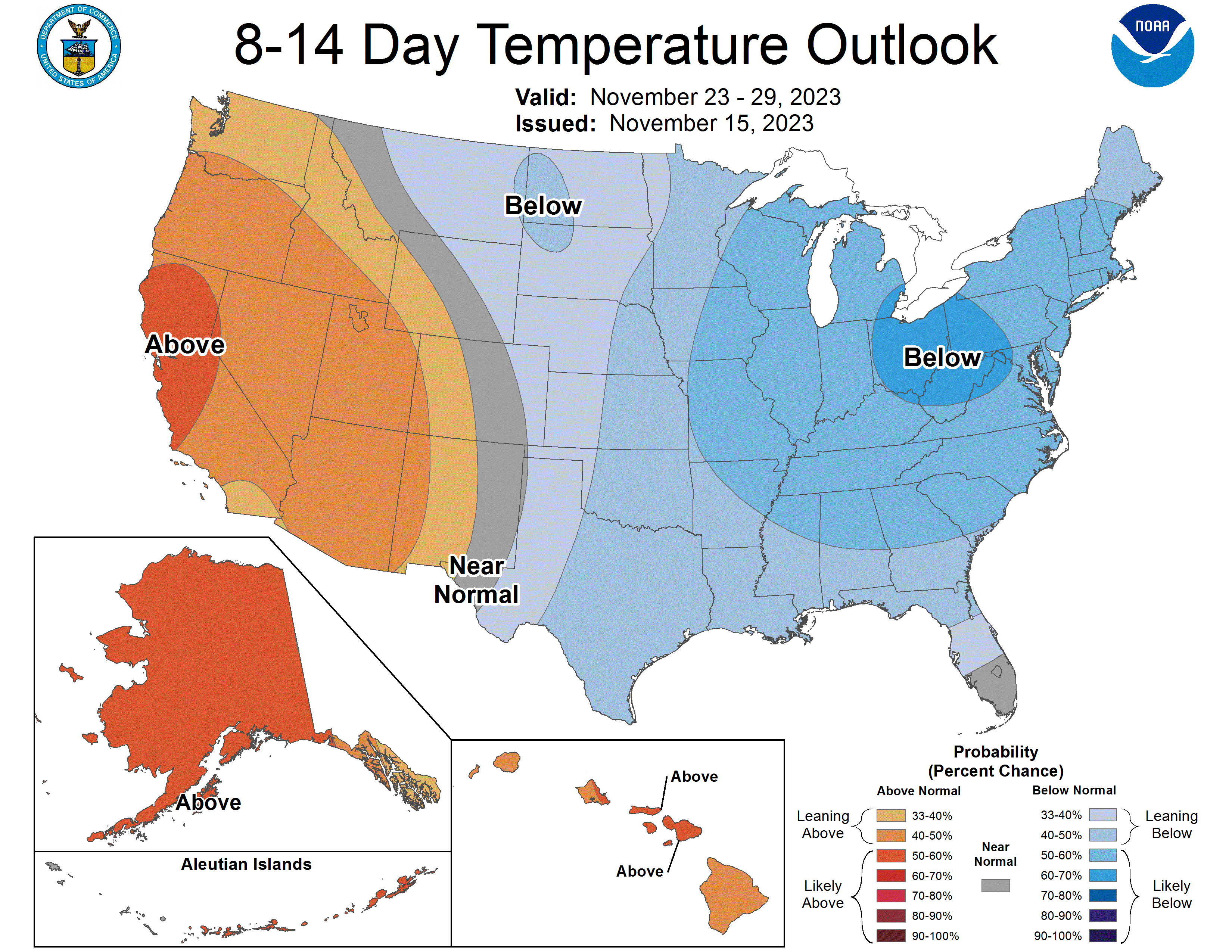
Precipitation, and Temperature Update
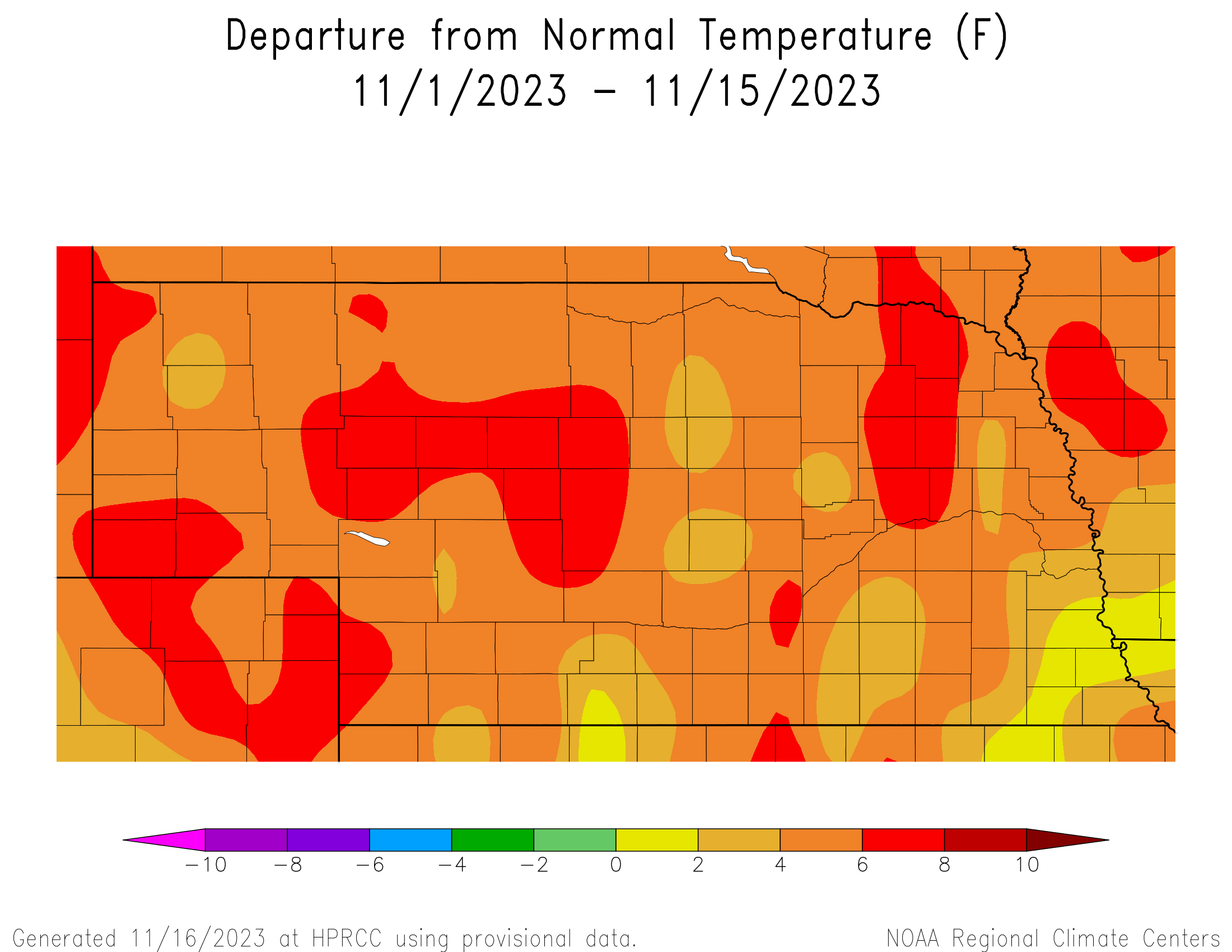
Roughly half of the state has yet to receive measurable precipitation this month and the biggest winner appears to be around Hildreth, where a whole 0.34" has fallen this month. So it's been a very first half of the month. It has also been unseasonably warm with temperatures generally running 5-8F above average this month in the east central and northeast sections of the state and 3-5F above average elsewhere. Over the last week temperatures have been running even warmer than that with most ASOS/AWOS stations coming in at 10-15F above average for maximum temperatures. Most of the state has managed a high of 70F at least once since Sunday and some parts of southeast Nebraska had 3-4 straight days with highs in the low 70's. Very warm for mid-November.
Soil moisture and Drought Update
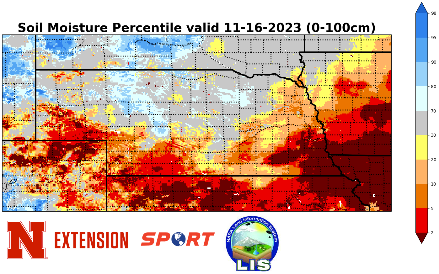
As has been the case for the past several weeks, soil moisture percentiles have been lowest in southeastern and southwestern Nebraska and highest in the north central and northwestern sections of the state. The difference is an increasing percentage of southeastern Nebraska is under the 5th percentile for soil moisture as the dry and warm conditions have led to additional loss of soil moisture. The consistent lack of recent soil moisture in those areas is one reason there has been some recent degradation, including this week. After going under the 25 percent mark for the state in drought two weeks ago, that number has started creeping back up with roughly 27 percent of the state in drought now. This is still a significant improvement over even earlier this fall but recent trends are concerning. If the next cold snap ends up sticking around for a while, we are going to be in jeopardy of going into the winter without any meaningful recharge in the hardest hit drought areas of central and eastern Nebraska.