


Winter wonderland
After a long stretch of mostly warm weather, especially for eastern Nebraska, Mother Nature is going to give us our first taste of winter this weekend. It is already quite chilly in western and north central Nebraska and that cold air will be invading the eastern portion of the state later today. Could see some additional showers along it through early evening in eastern NE as well. Tomorrow will be chilly and blustery statewide with highs in the 30's and low 40's (warmest southeast) but dry.
On Saturday we will start to see the effects of the trough moving into the central Great Plains. This does not look to be a repeat of the October 1997 storm that brought very heavy snow amounts to parts of the state. But a good portion of the state can expect some light snow during the day on Saturday, with accumulations of 2-4" possible in the Sand Hills. Most of the western and northern halves of the state can expect 1-2" total by Sunday morning. The forecast is a bit trickier in the east central and southeastern portions of the state. In the morning and early afternoon hours, precipitation is more likely to fall as light rain and possibly mix with snow north of I-80. Later in the day, there is a chance of having a heavier snow band set up between Columbus and Lincoln. This is not the expectation but some model runs have hinted at a 700-mb frontal snow band in this area. It would certainly make the second half of the football game interesting if that happened. The next concern is the possibility for light freezing drizzle across southeastern Nebraska on Saturday night. This would not be a significant icing event (under a 0.10" of ice) but any amount of ice is unwelcome when most of the trees are still full of leaves. The ground temperatures are still quite warm so most roads may stay wet but might be a good idea to have the generators ready just in case if you live near the Kansas border from Superior and points east.
After the precipitation ends it will be a cold few days with highs well below average from Sunday-Tuesday. Some parts of north central Nebraska may spend the better part of 60 hours below freezing starting Friday night and suspect highs will be within a few degrees of freezing for a large portion of the state on Saturday and Sunday. Monday looks somewhat warmer but there will be a reinforcing shot of colder air as the polar vortex stretches one more time on Halloween. Current forecast highs are in the upper 30's to 40's across the state on Halloween but model guidance would suggest all but the Panhandle and far southeast would struggle to get above the mid 30's for highs. Expect temperatures to be in the 20's at Trick or Treat time in the northern and western portions of the state and between 30-35 in the Lincoln-Omaha metro areas. Not a record cold Halloween but definitely not one of our warmer ones!
Mild and dry end to the week
Temperatures look to moderate on Wednesday to the 40's and then back to seasonal levels in the 50's on Thursday as we have zonal flow bringing a Pacific air mass in. It looks to get even warmer by Friday and Saturday with 60's being common for highs nearly everywhere. Might even crack the 70 degree mark in parts of southern and western Nebraska on Saturday. All signs currently point to dry conditions next week for the state so harvest should be able to progress more in the second half of the week.
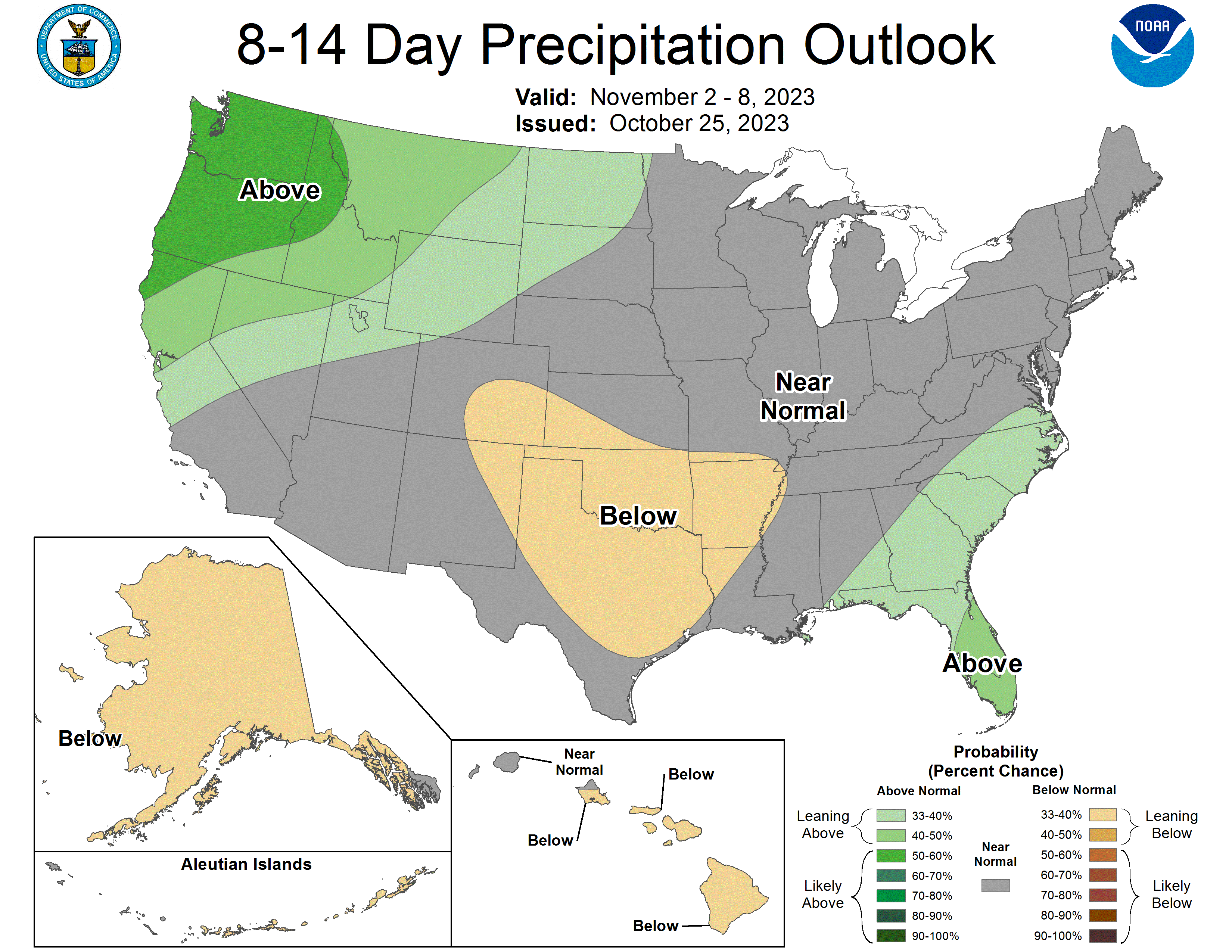
Precipitation and Drought Monitor update
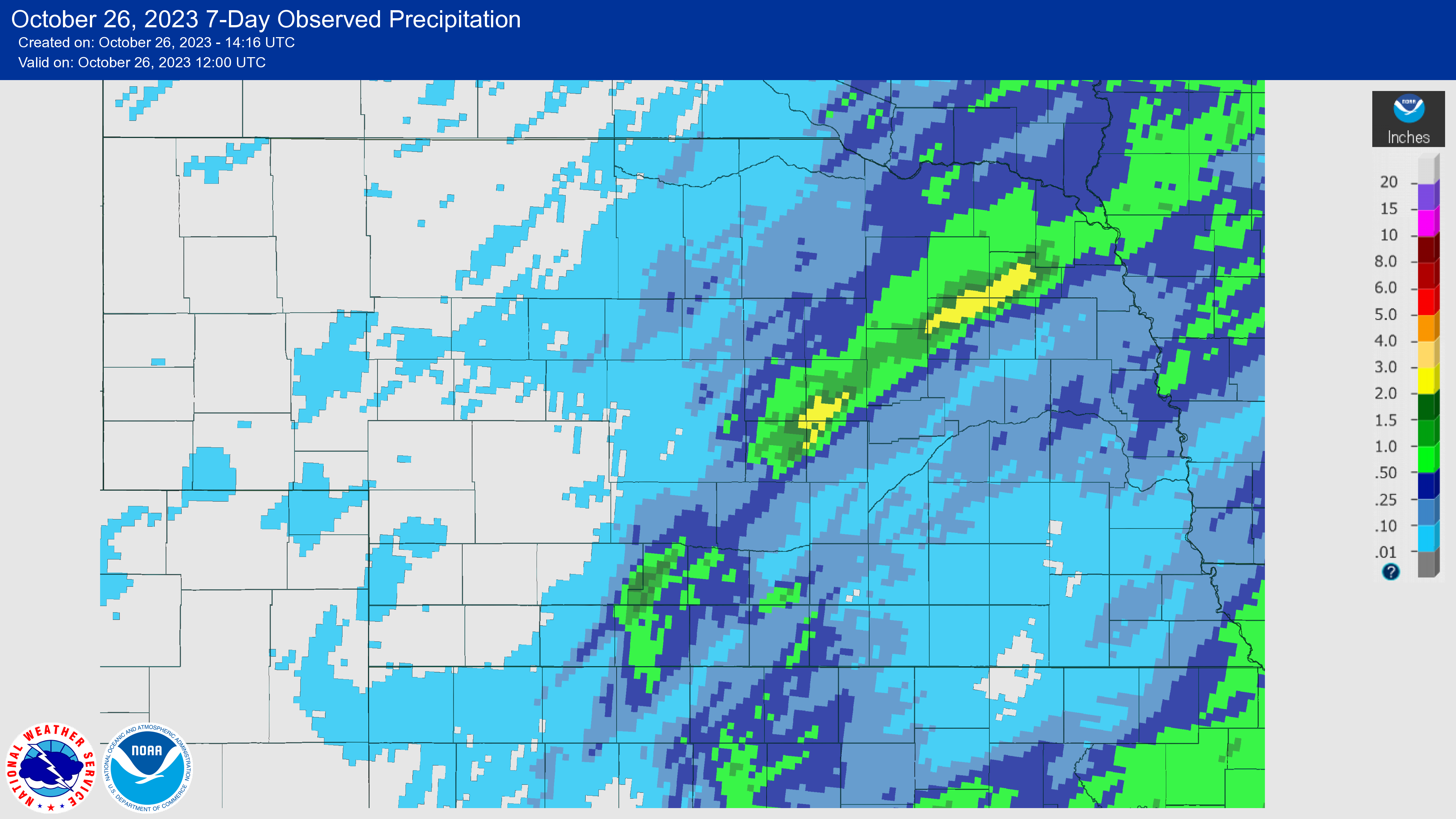
The Drought Monitor was the same as last week except for the introduction of abnormal dryness (D0) in Chase County. Unfortunately the rain that looked so promising for eastern Nebraska generally didn't materialize as the storm ended up taking a track that pushed the moisture southeast of the state. However, for the second time this month parts of central and northeast Nebraska picked up some heavy precipitation along a frontal boundary. In this case a broad swath from Loup City to Wayne picked up over an inch of moisture, with over 3" around Norfolk. This puts Norfolk within realistic range of having its wettest October on record if a few inches of snow falls on Saturday. In the worst drought areas, rainfall generally was under 0.15" this week. Additional precipitation is possible in the next 6 hours but not anything that is going to move the needle on the Drought Monitor
Soil Moisture and Harvest update
SPoRT LIS root zone soil moisture percentiles are similar to last week with most areas north of the Platte being over the 30th percentile and most areas south of the Platte being under the 30th percentile. Harvest is moving along with 62 percent of corn, 83 percent of soybean and 54 percent of sorghum harvested according to Monday's Crop Progress Report. Almost 90 percent of wheat has emerged and pasture ratings checked in with 44% good to excellent against 18% poor to very poor.
Eric Hunt, University of Nebraska Extension and Nebraska State Climate Office