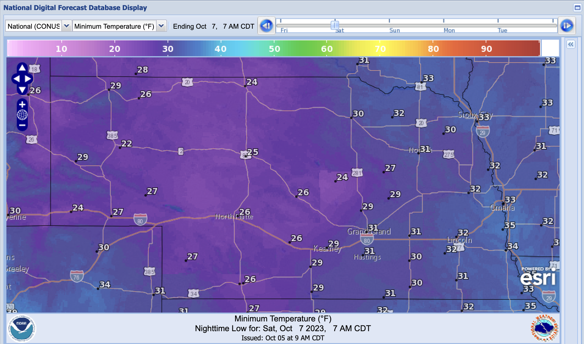
Current forecast is for temperatures to be sub-freezing on Saturday morning for all but the southeastern corner of the state
A strong upper trough and associated cold front will move through the state tomorrow and bring us our first real shot of cool air this fall. There is a chance of showers along the front across the northern half of the state overnight tonight and across the southern half of the state tomorrow morning. Rainfall amounts should mostly be under a tenth of an inch- more likely just enough to spot up your car. Winds will be strong from the northwest on Friday afternoon and skies should start to clear along with a drop in relative humidity. Thus, there will still be some enhanced fire risk due to the higher winds and lower humidity levels. By Friday night winds will start to back off and temperatures will start to drop into territory we haven't seen yet this season. Current forecast is for minimum temperatures to be in the 20's across most of central and western Nebraska and in the lower 30's across most of eastern Nebraska.
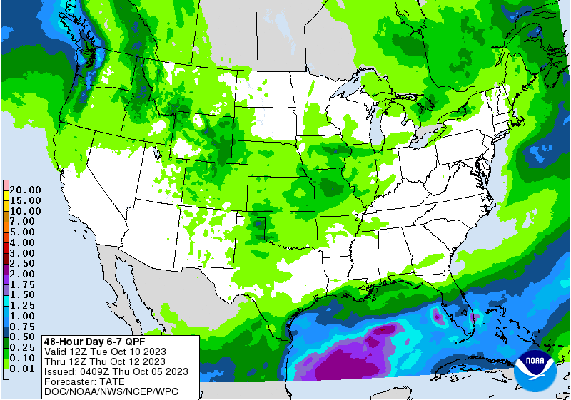
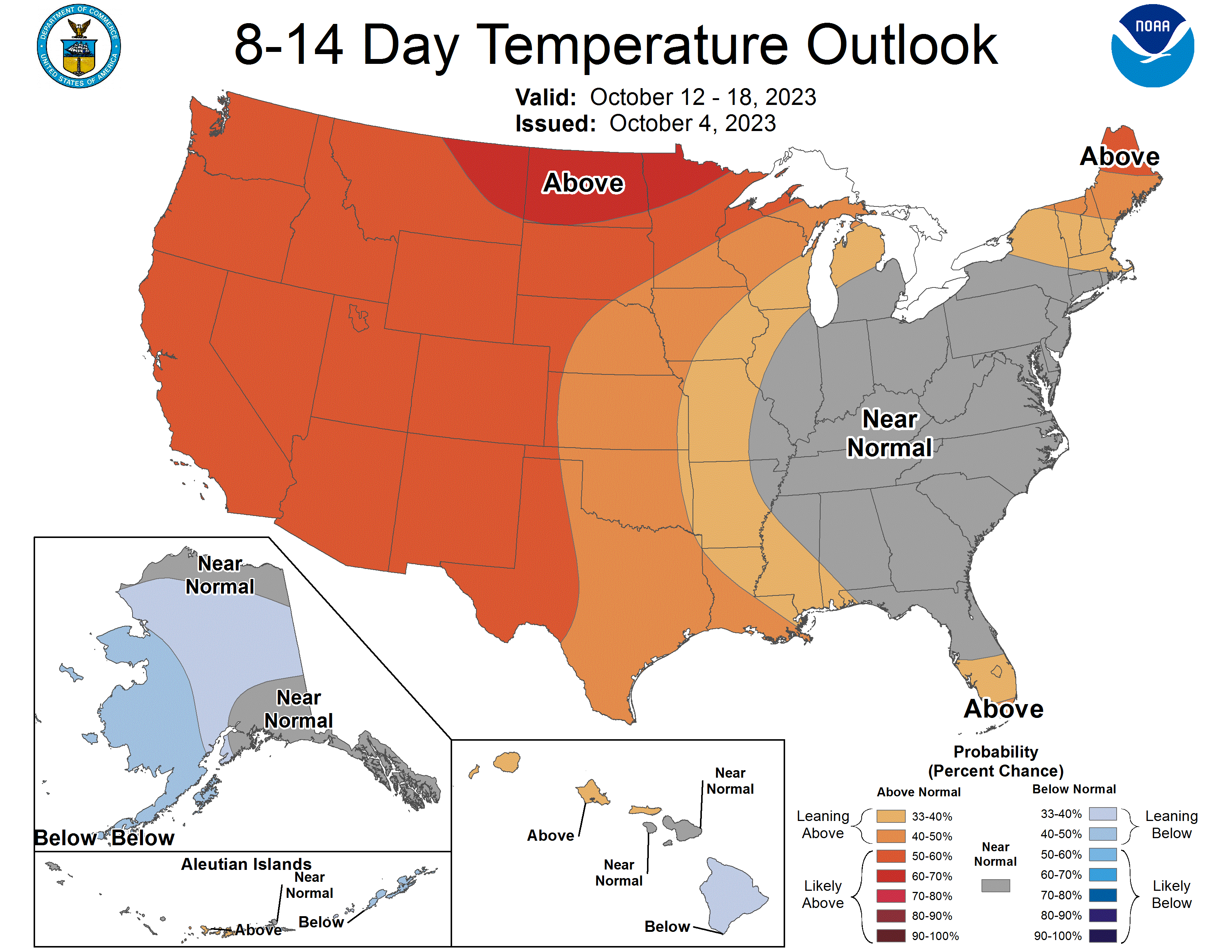
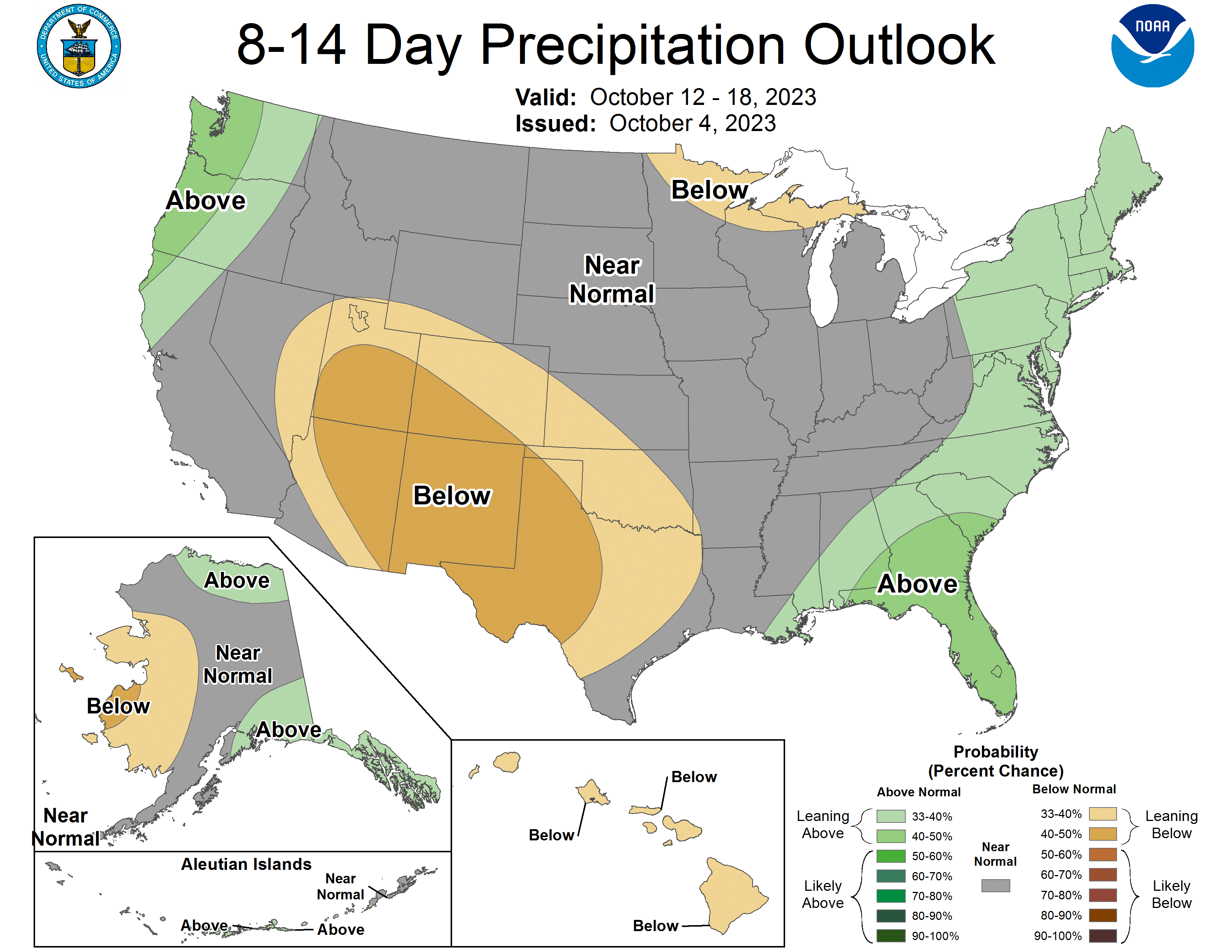
Storm system next week
The beginning of next week looks great for fall harvest or wheat planting, albeit a bit on the seasonally cool side in the eastern portion of the state. Next Tuesday looks just about perfect statewide, with warmest readings likely to be found in the southwestern part of the state. Models are starting to show some signal for a storm system moving into the High Plains region the middle of next week. However, there is still uncertainty regarding the exact timing, placement and directional movement of the surface low, and strength. The latest run of the ECMWF shows a surface low tracking across Kansas and then veering northeast toward the Great Lakes region but that track has not been consistent from run to run in recent days.
Meteorology to English Translation: There's something out there but we don't know exactly what it will be yet.
Right now it appears the Panhandle and the southern third of the state are favored for precipitation, with some chance it could be in the 1-2" range. But I'd really like to see more consistency in the models before putting any real confidence in those amounts. We should have a much better idea of the storm track and possible precipitation amounts or impacts by the end of the weekend.
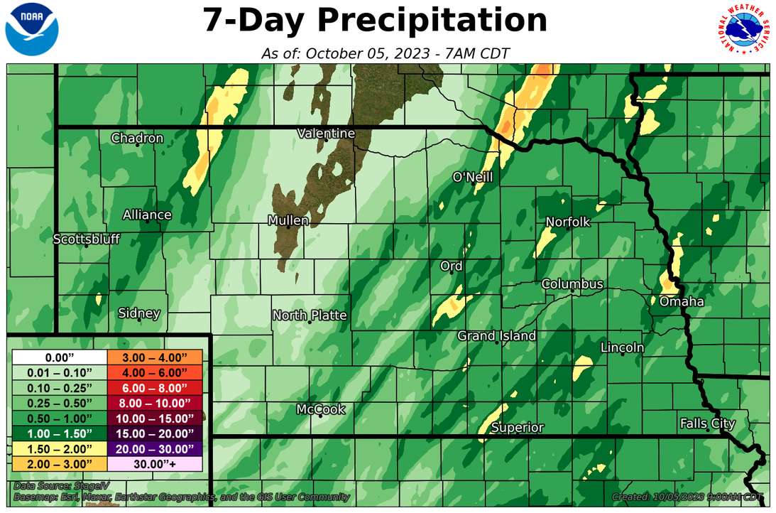
Recent Precipitation and Recent Record Heat
Most of the state had over half an inch of rain in the last week, which is a first in a good while. The exception was the western Sand Hills down into the Imperial area, which generally saw amounts under a tenth of inch. The good news is big chunks of southeastern Nebraska picked up over an inch of rain, which was badly needed given the severity of the drought. This area also saw several days in a row with record heat over the last week with temperatures in the upper 80's to mid 90's and breezy south winds. Other big winners include Sherman County, Blair, O'Neill, and the area between Hay Springs and Gordon in northwestern Nebraska.
The following locations set record highs in the last week. For Lincoln it was the first time with record highs on three consecutive days (with records that still stand) since June 1988.
Omaha- 2 days: 9/29 (95), 9/30 (94)
Lincoln- 2 days: 9/29 (96), 9/30 (96), 10/1 (94)
Norfolk- 1 days: 9/29 (95)
Grand Island - 1 day: 9/29 (95)
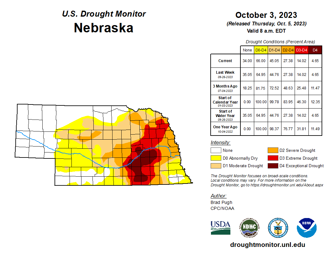
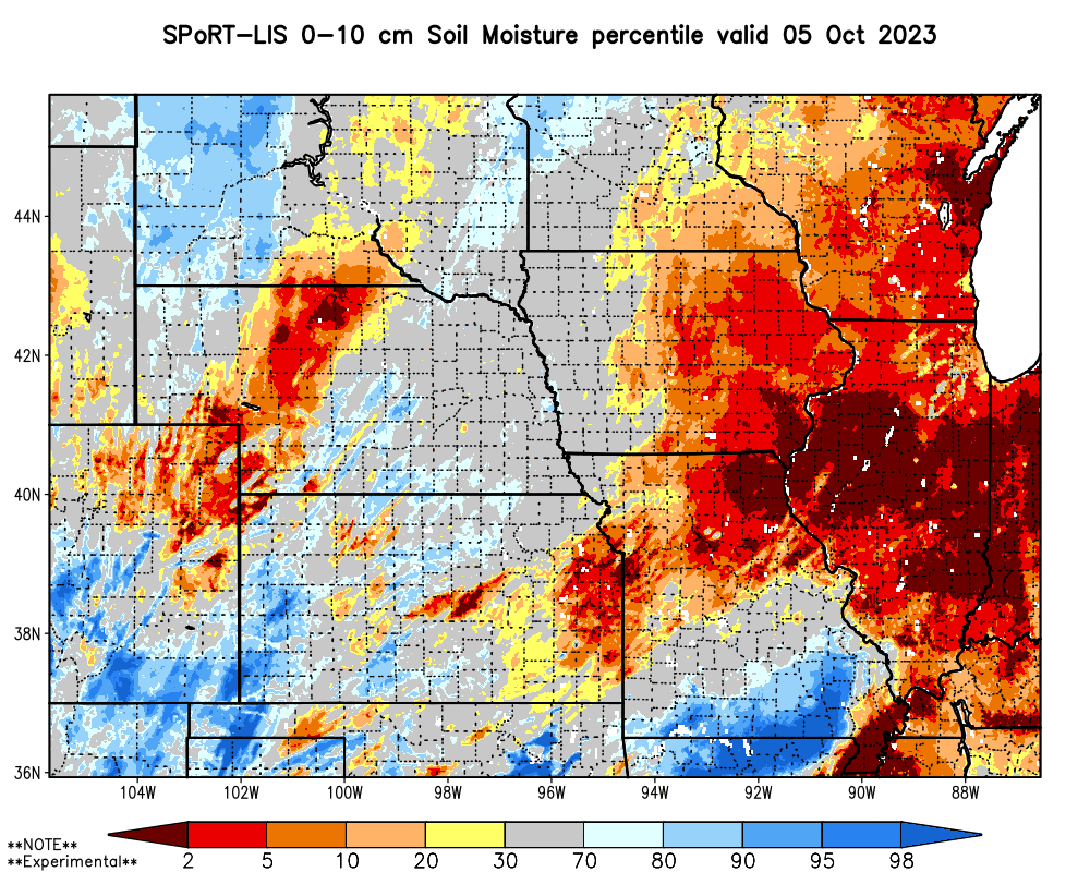
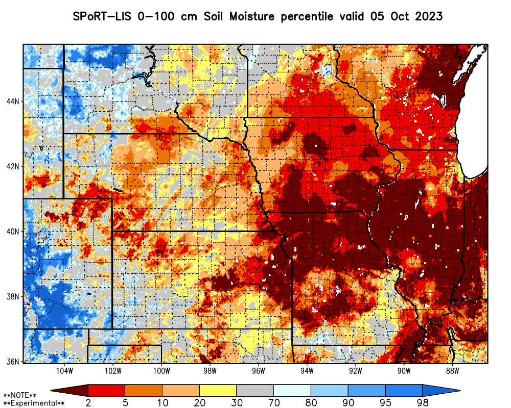
Soil Moisture and Drought Monitor Update
The precipitation earlier this week led to decent improvements in top layer soil moisture, according to SPoRT LIS. While these soil moisture maps should be interpreted with a grain of salt, I would say with confidence that most of the eastern half of the state is in better shape now than at this time last week. For anyone ready to plant wheat in southeastern Nebraska, this recent moisture was well timed, and hopefully ensures that a much better stand of wheat will come up this fall compared to last fall. Root zone soil moisture is still not great in most of the eastern half of Nebraska, with particularly low values in the far southeastern part of the state where abnormal dryness was introduced on this week's U.S. Drought Monitor. This, of course, does not mean that the root zone in Richardson County has 2% of available water. But it does mean that the average soil moisture value over the modeled layers (0-10 cm, 10-40 cm, 40-100 cm) is in the 2nd percentile. A good soaking next week would make a big difference though.
Crop Condition Update
Corn is at 86% maturity (8% points ahead of schedule). Corn harvest is progressing nicely at 22%, which is 5 points ahead of the 5-year average. Soybean is ahead of schedule for dropping leaves at 95% and soybean harvest is 29% complete, which is a big jump from last week and 2 points ahead of the 5-year average. 64 percent of sorghum was mature and 14% had been harvested. Winter wheat planting is also ahead of schedule this year with 79% planted, 7% above the 5-year average and a ~20 point increase compared to last week. Pasture ratings improved again this week with 53% G-E and 16% P-VP.
Eric Hunt, University of Nebraska Extension