Cooler finish to week
Temperatures will be seasonally cool across the eastern half of Nebraska and chilly out in the western side of the state tomorrow. Highs likely holding under 60 for all and may struggle to get out of the lower 40's tomorrow afternoon in the highest elevations. Scattered showers will also be possible tomorrow though most of the rain should be out of the state by daybreak tomorrow. It will generally be cloudy statewide tomorrow.
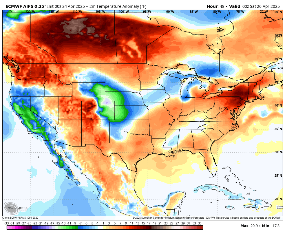
Figure 1. Temperature anomalies on Friday afternoon
Saturday should be a bit warmer across the state, albeit still seasonally cool with highs mostly 58-65°F statewide. Might be closer top 70°F in the Panhandle where there will be more sun.
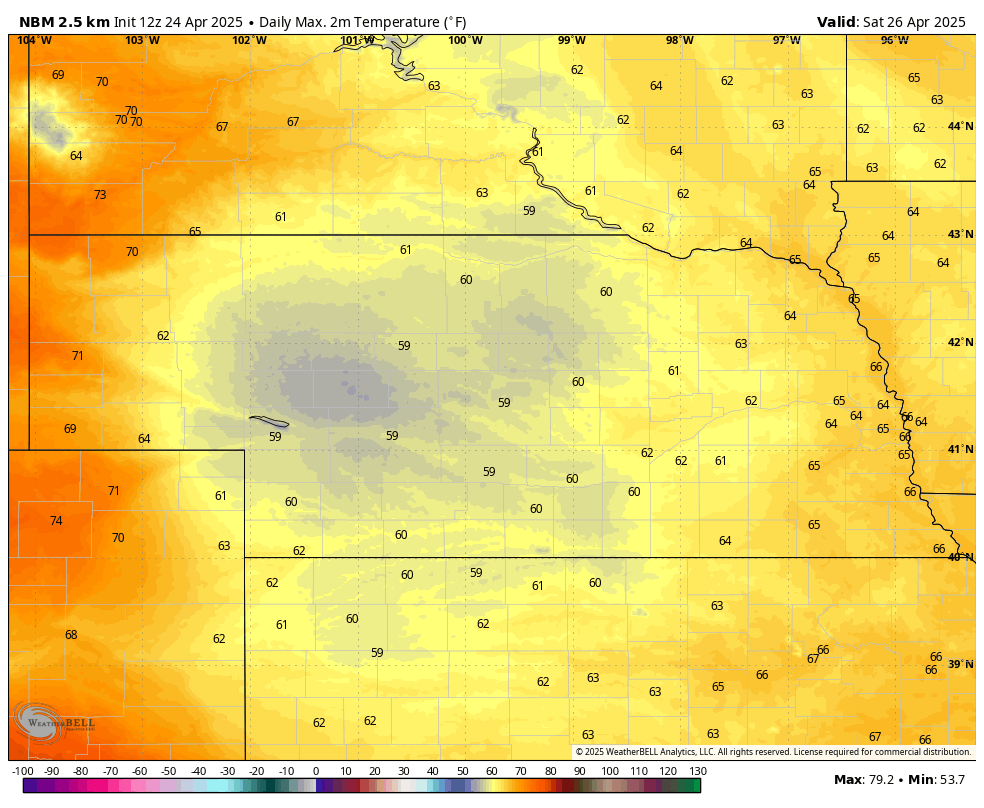
Figure 2. Maximum temperatures Saturday afternoon
Precipitation chances over the weekend
Showers will be likely across west central and central sections of the state in the afternoon and will slide east into eastern Nebraska on Saturday night into Sunday morning. Significant precipitation is not likely but any rainfall would be welcome, particularly in the Sand Hills. Additional precipitation will be possible in the eastern side of the state on Sunday afternoon. Winds will be a bit breezy on Sunday across the state and on Monday in eastern Nebraska as well. Fire danger may be elevated in areas of west central Nebraska that didn't get recent precipitation.
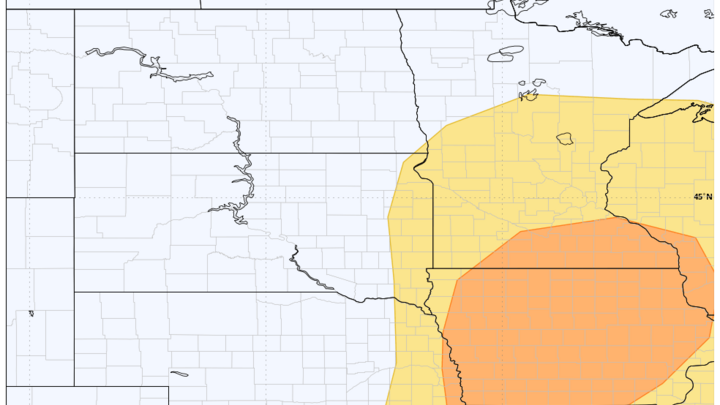
Severe storms possible Monday
The Storm Prediction Center has put much of the middle of the country in the risk area for severe weather on Monday afternoon and evening, including eastern Nebraska.
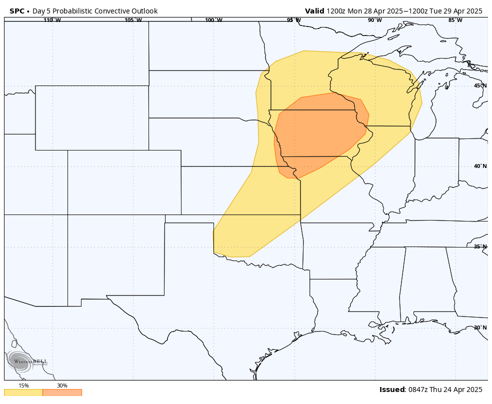
Figure 3. SPC outlook for severe storms on Monday
The culprit is an upper level trough that will be moving out of the southwestern U.S. into the north central region of the country between Sunday and Monday.
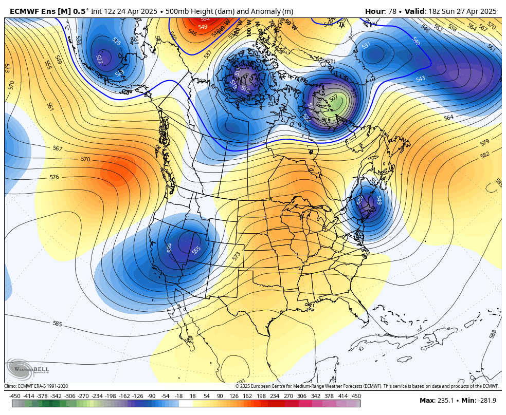
Figure 4. 500-mb height anomalies for Sunday afternoon
At the surface low pressure will develop on Sunday in eastern Colorado and move into the Dakotas on Monday. The exact track of the low pressure and its trailing cold front to its south-southwest will have a major impact on what happens on Monday. If the surface low is closer to Aberdeen, SD on Monday afternoon, then thunderstorms likely wouldn't develop west of Highway 81 as the front (and drier air) will have already moved through that section of the state. If it ends up being closer to Bismarck, ND then that severe weather risk (including the enhanced risk) would expand into areas between Highway 281 and Highway 77.
Right now it would seem that storms developing south and east of a line from Wayne to Fairbury would be most likely with the far eastern side of the state having the best chance of hail, damaging winds, and tornadoes. This could produce very large hail if everything lines up right. Recommend paying close attention to the forecast this weekend as we get more details about how this is likely to evolve. It also will be a warm day in eastern Nebraska with temperatures perhaps making a run at 90°F in spots.
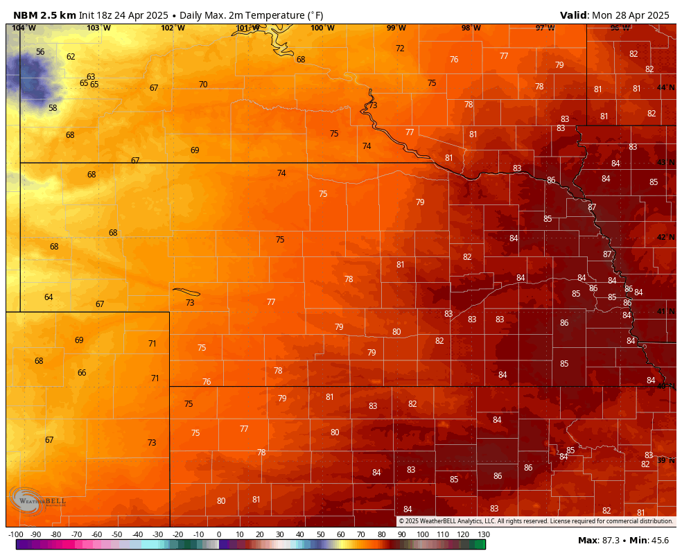
Figure 5. Projected high temperatures on Monday
More rain chances Thursday and then a dry stretch
After a few quiet days, a trough will move from Canada into the north central U.S. by Wednesday and at the surface a cold front will push through the region. If moisture return is sufficient, there will be a good chance of showers across the southeastern 2/3 of the state early Thursday. How much rain may fall is uncertain but the latest ECMWF AI model does show a chance at over a quarter of an inch for much of central Nebraska.
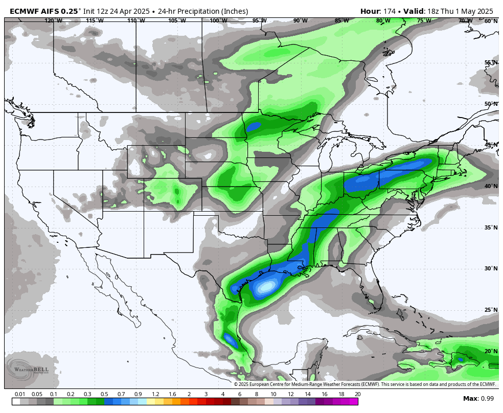
Figure 6. Possible precipitation later next week
After next Thursday, it does appear that the state and most of the north central region are likely to go over dry for a stretch of 4-7 days. Chances for moisture may increase closer to the end of the 8-14 day outlook period from the CPC. But it is possible that the first half of May is pretty dry across the state and region, which is not good news for areas needing to recover from drought. Temperatures are also likely to be above average in the first part of May.
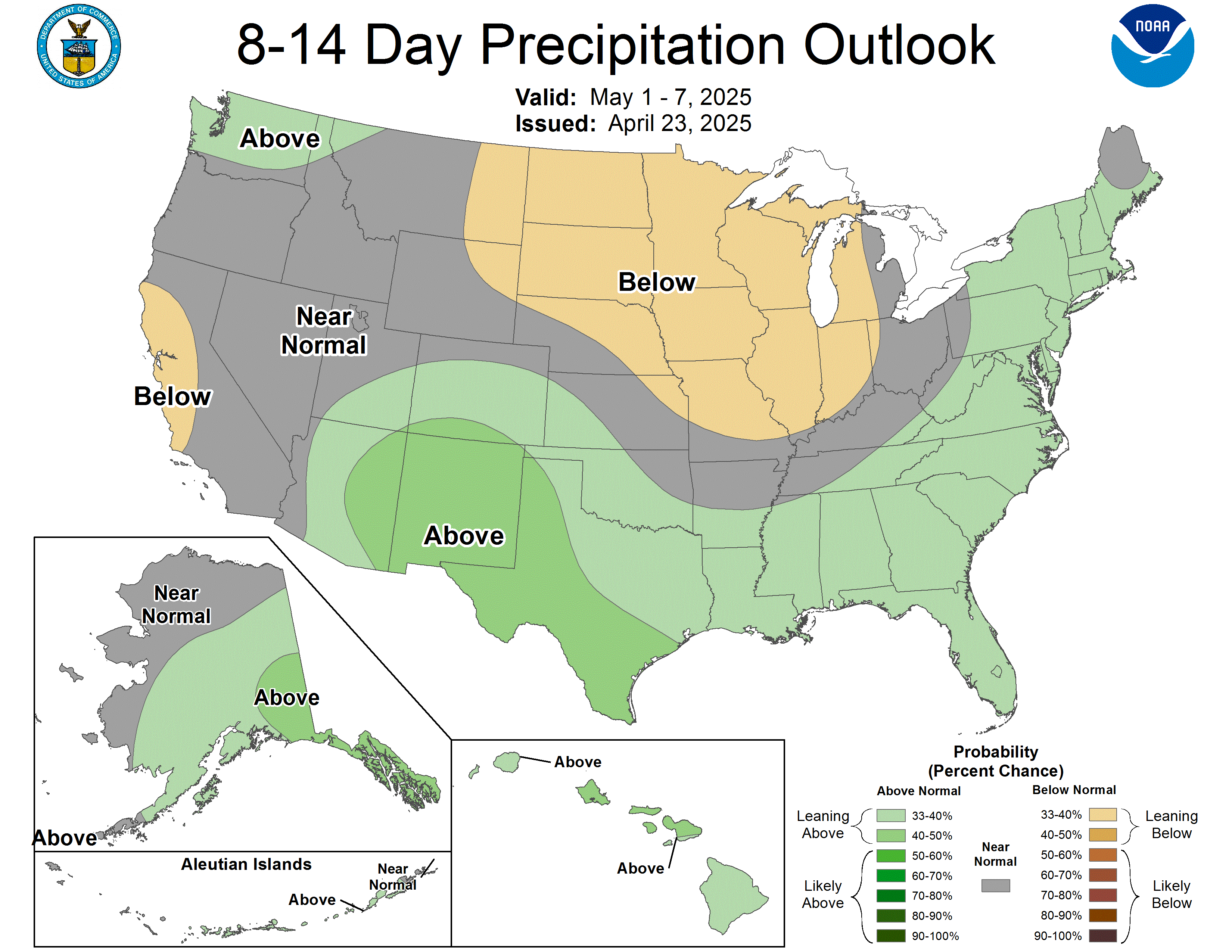
Figure 7. CPC's 8-14 precipitation outlook
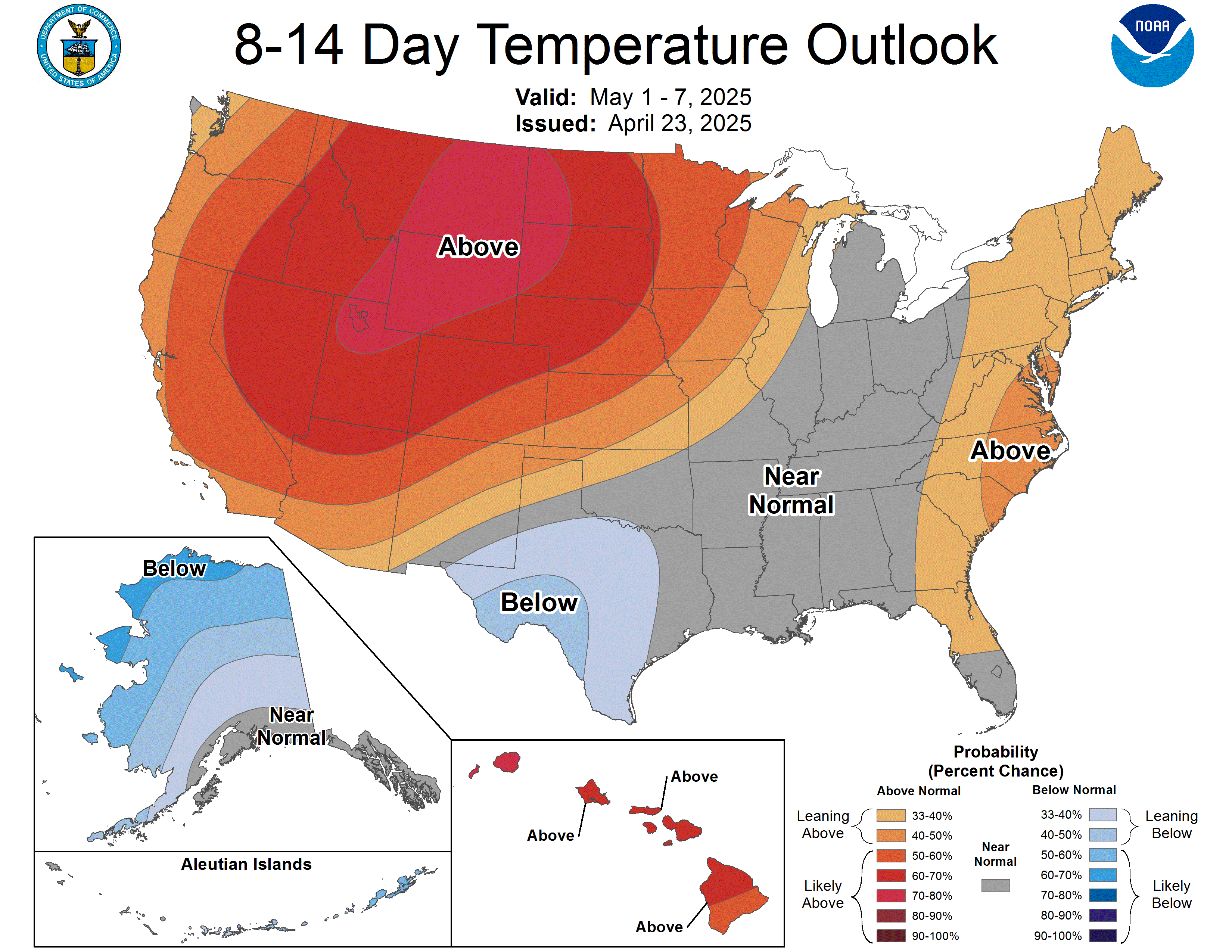
Figure 8. CPC's 8-14 temperature outlook


