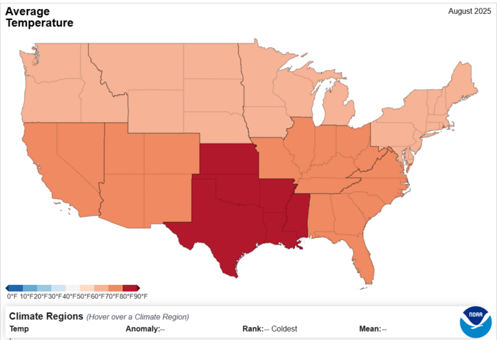
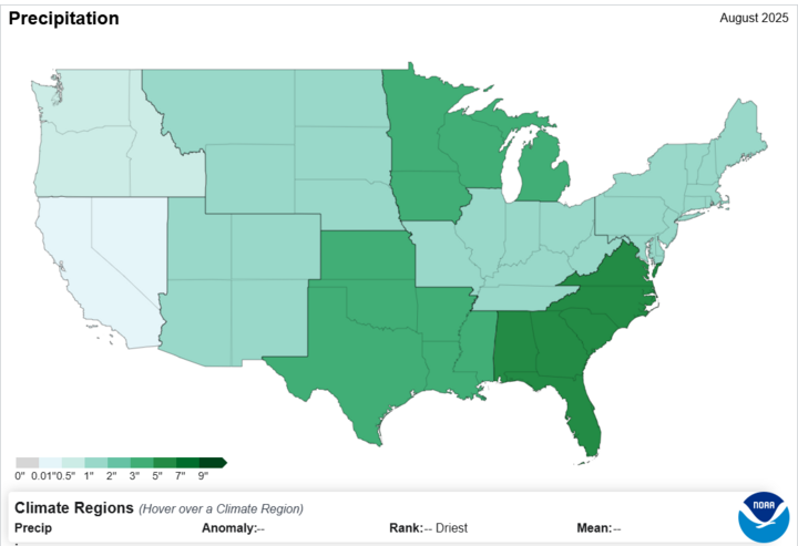
As the month of September draws to a close, we can now look back on what led us into the month for our August Climatological Summary for the state of Nebraska. To start off our discussion, I took a look at what the National Centers for Environmental Information had to say regarding average monthly temperatures. The NCEI put the statewide average temperature for Nebraska in August 2025 to around 71.2°F, which was 1.5°F below the average and ranked as the 42nd coolest August on record. Most climate divisions were near or below average, with the largest deviation in eastern and central Nebraska due to the changes in elevation and topography. Looking at the NOAA NCEI U.S Climate Normals, the statewide average precipitation was 4.35 inches, which is about 1.10 inches above the 20th-century average precipitation and ranked as the 22nd wettest August on record. Southern and eastern counties recorded the greatest surpluses, while the Panhandle and parts of western Nebraska were closer to normal or slightly below. For the U.S. overall, August 2025 was the 18th warmest and 30th wettest on record. The graph below depicts the trend of cooler temperatures seen over the month of August.
Heavy precipitation in southern and eastern Nebraska supported one- and two-category drought improvements, particularly in areas that had been seen drought stress earlier in the summer. On a lighter note, soil moisture recharge was noted across crops and general pasture areas. However, with lingering abnormally dry or moderate drought conditions in western Nebraska, this will affect crop harvest and will reduce the amount of grass for grazing cattle. The graph below depicts the average precipitation for the month of August for the state. Note that while Nebraska did not cross the average threshold of 1", we still experienced heavy periods of precipitation.
Severe storm activity was mostly concentrated in southern and eastern Nebraska, especially between the dates of August 9th and 10th, where heavy gusts of 60+ mph wind were experienced, as well as heavy rains, and power outages. There were also some particularly strong systems that occurred over Labor Day weekend. Localized flooding was reported where totals exceeded 5 inches in less than 48 hours. Wind and hail events were scattered throughout the month, as well, so it was by no means an uneventful month regarding convective activity.
With the cooler finish to August, combined with wetter conditions in parts of the state, the High Plains Regional Climate Center (HPRCC) reported that crop maturation slowed slightly in corn and soybeans, while winter wheat planting and sugar beet harvest began in the Panhandle under mixed soil conditions. Pasture and grassland health improved in southern and eastern counties thanks to timely rainfall; statewide, the USDA reported around 50% of pastures rated good to excellent by the end of the month. Still, some portions of western Nebraska remained rated poor to very poor.
Here are the temperature and precipitation extremes around the state in August 2025:
Maximum high temperature: 105°F, Imperial
Minimum high temperature: 59°F, Norfolk
Maximum low temperature: 76°F, McCook
Minimum low temperature: 38°F, Harrison 4 SE
Maximum precipitation: 7.45", Beatrice 4 NNE
Minimum precipitation: 0.87", Scottsbluff 2 E
To end the report, I would like to mention the record daily rainfall totals that were set in southeast Nebraska during localized storm events at the end of the month. Cooler nighttime lows became more common late in August, signaling the seasonal transition.
As an extra note, I would also like to add in my summary video from a online meeting held September 15th:


