
Snow likely tonight in east-central Nebraska
A strong area of surface high pressure in Saskatchewan has pushed a backdoor cold front (one that brings colder air in with northeast winds) through the state and temperatures this afternoon will be noticeably cooler than yesterday. Later today a small, but potent shortwave aloft will be entering the state from the west and helping to produce enough rising motion to generate precipitation in eastern Nebraska and western Iowa. Precipitation will start as rain this evening but then is expected to transition to snow as evaporative cooling takes control.
The models are mostly in agreement about the best potential for 3" or more of snow occurring around from Wahoo into western Iowa. It is possible that somebody gets 6" if heavy snow rates are prolonged over a location for a few hours. Snow likely would accumulate mostly on grass but streets may be slushy in the morning if heavy snow rates persist for any period of time. The moisture is certainly welcome but given how warm it was in the second half of March, I can certainly understand those who are annoyed at the prospect of snow after Easter. It is interesting to note that the NOAA HRRR is keeping most of the area dry overnight but that model is the exception. So I would plan on some snow tonight in the Omaha and Lincoln metro areas.
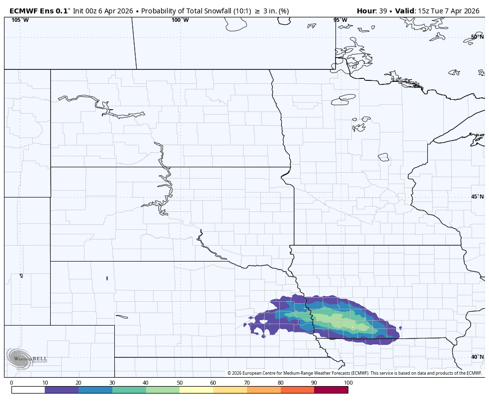
Figure 1. Chances of 3" of snow according to the ECMWF ensemble
Temperatures tomorrow are likely to be on the seasonally chilly side for much of east central, northeast, and north central Nebraska with highs in the 30's to mid 40's. Warmer temperatures likely near the Kansas border and in western Nebraska, where 65-70°F and sunshine is probable.
Good late-week moisture chances eastern Nebraska
Temperatures will shoot back into the 60's and low 70's statewide on Wednesday, so any snowmen built tomorrow morning will have short lives. Another cold front will push through Wednesday afternoon and evening in response to upstream troughing. This will open up chances for showers and storms along the front. Severe weather is possible in the southern part of the state.
This front looks likely to stall to our southeast on Thursday and with various shortwaves traversing the central U.S., it does appear that there will be good chances for rain across south central and eastern Nebraska on Thursday night into Friday morning. Additional chances for rain will return this weekend for the whole state. But it does appear the best chances for getting more significant moisture will be in southeast Nebraska. Areas of the state that need drought relief the most have a higher probability of having another drier than average week.
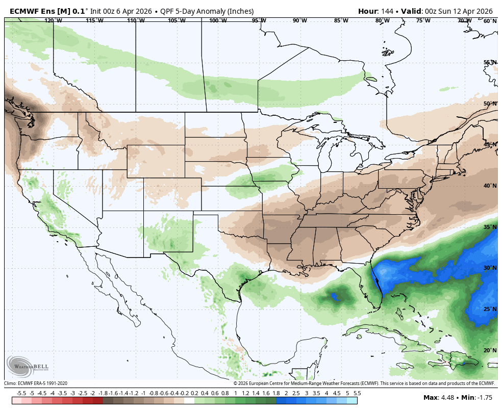
Figure 2. ECMWF ensemble 5-day precipitation anomalies through Saturday evening


