Winter returns
A deep trough will move into the north central U.S. by Sunday morning and a surface low will be moving quickly east through the state and western Illinois on Sunday afternoon. Precipitation will be likely on the east and north side of the system. This most likely will be in the form of rain to start with but should transition to snow quickly along and north of Highway 20. Snow may be moderate at times around O'Neill and Ainsworth and it wouldn't shick me to see blizzard warnings issued from Holt to Dakota counties. Further south, it should be all rain on Sunday morning. Snow will be possible in eastern Nebraska on Sunday afternoon. Wind speeds will be strong from the north so travel may be difficult on Sunday, particularly in the northeast part of the state.
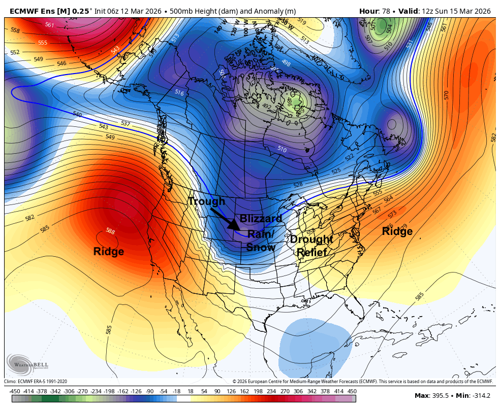
Figure 1. 500-mb height anomalies on Sunday morning
Precipitation totals will likely be highest in the northeast corner of the state where the duration of precipitation will be longest and unfortunately, it is probable that no rain will fall in southwest Nebraska. Snowfall totals over 3" will be possible along and north of Highway 20. Travel will likely be difficult in the northern part of the state on Sunday, especially with sustained winds of 20-30 mph.
Figure 2. WPC precipitation projections for this weekend
The front should clear the entire state by mid-morning on Sunday and temperatures will be cold. Highs likely will be below freezing for the western half of the state and will drop below freezing statewide by mid-afternoon. With winds persisting into Monday morning and temperatures dropping into the single digits and teens, wind chill values likely will be below 0 across the eastern and northern halves of the state and in the single digits elsewhere. Highs likely will remain below in northeast Nebraska on Monday and may stay subfreezing across all of eastern Nebraska. Temperatures will bounce back into the 30's in central Nebraska and into the 40's in western Nebraska. Temperatures may remain below freezing for over 48 hours in much of eastern Nebraska.
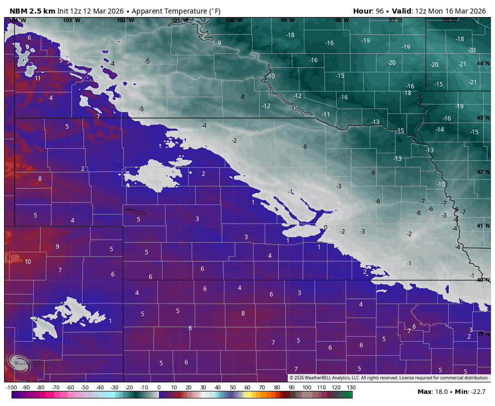
Figure 3. Projected wind chills on Monday morning
Another weak system will move into the region Monday night on the periphery of the building western ridge and there will be a chance of snow east of Highway 281 on Tuesday morning. Accumulations likely would be light and the snow would not stick around long given the moderating temperatures on Tuesday. Still will be seasonally cool in eastern Nebraska but highs in the 50's are likely in central Nebraska and temperatures in the 60's are likely out west.
Swing back to warm temperatures
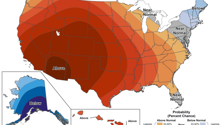
A massive ridge will be building across the southwestern U.S. by mid-week, which will help bring much warmer temperatures to all of us by Wednesday afternoon. The ridge looks to peak in strength on Thursday before flattening out somewhat by next weekend. Regardless, it will be dry statewide and it will be warm. Highs should be in the 70's statewide on Thursday and I would not be surprised to see 80's across most of the state. Temperatures may be a bit cooler on Friday but still very warm for the middle of March. Temperatures look to remain mild through early the week after next but it does look like it will be closer to average (50's) by the 23rd-24th.
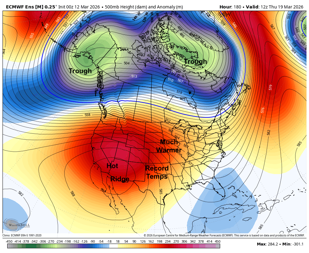
Figure 4. 500-mb height anomalies on Thursday morning
No moisture is likely to fall out of the sky after Tuesday morning and the state may remain bone dry through later in the month. The CPC's 8-14 day precipitation outlook calls for drier than average favored across our entire region. It is possible we see a return to more zonal or even southwest flow toward the end of the month. This would increase chances for moisture and bring in more seasonal temperatures. But there is no sign for significant precipitation in the near future for the most stricken places in the western half of the state.
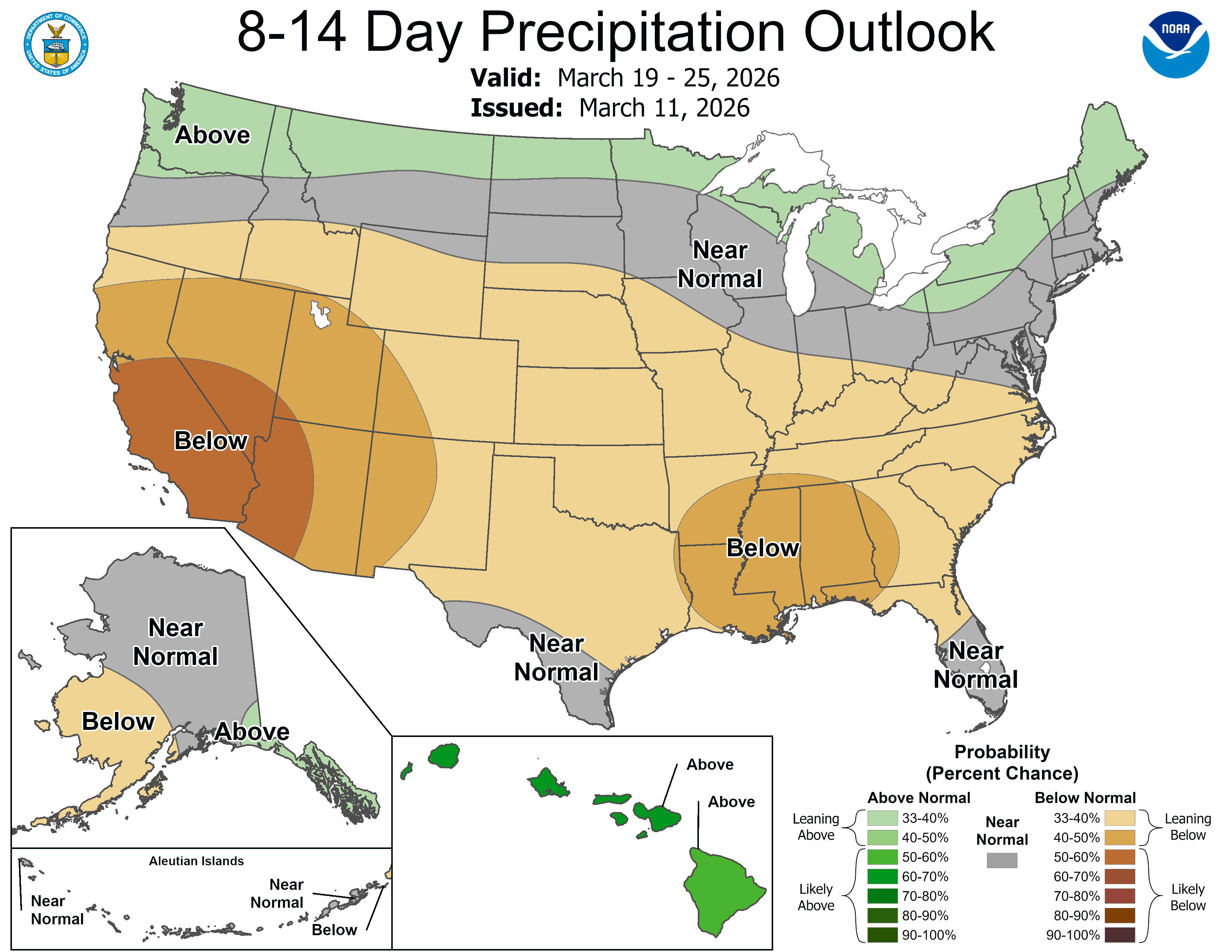
Figure 5. CPC's 8-14 day precipitation outlook