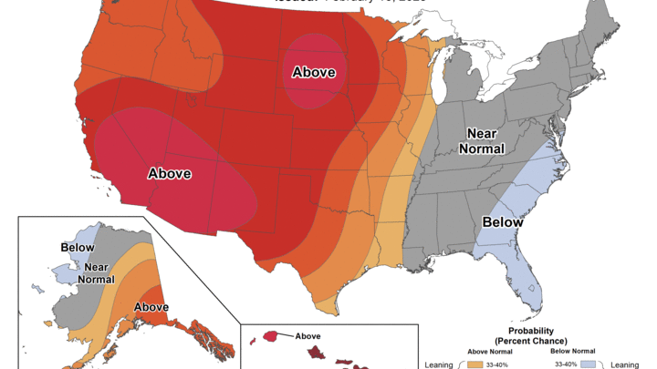
Very cold week but warmer weather on the horizon
Snow has been falling over most of the state over the last 12 hours and temperatures are in the single digits above and below 0 currently. Another round of snow is likely for most of the state later tonight and tomorrow morning with additional accumulations of 2-4" across the Kansas border. It will be very cold the next four days and some records are likely to fall. But the polar vortex stretching under the trough in the troposphere will ease by the end of the work week and ridging will build back into the western U.S.
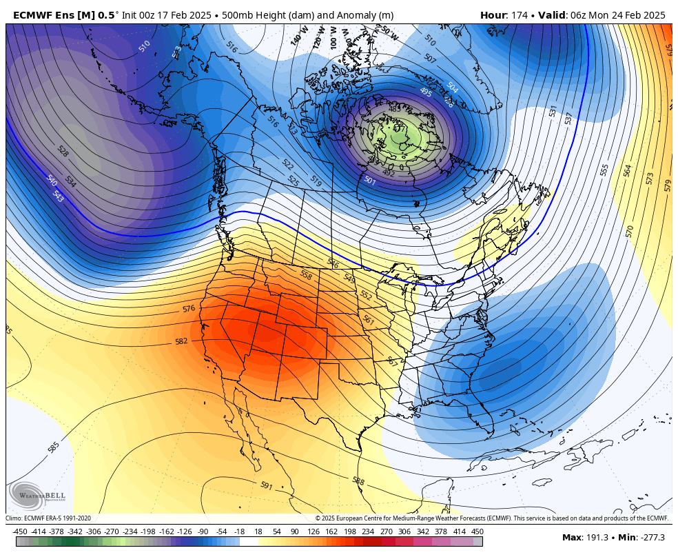
Figure 1. 500-mb height anomalies early next week
The ridging will be responsible for bringing in a warmer air mass and there will be a downslope component to the winds. This will allow temperatures to shoot into the 40's (east) and 50's (west) on Sunday and temperatures are likely to be in the upper 50's to mid 60's next Monday and Tuesday. Some places could have close to a 90 degree swing in temperatures between Wednesday/Thursday morning and next Monday afternoon. Precipitation looks unlikely after tomorrow for the next week.
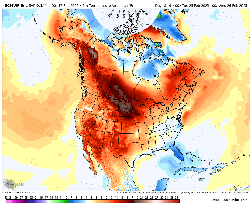
Figure 2. Projected temperature anomalies next Tuesday afternoon.


