
Severe storms and snow possible tomorrow
After an abysmal March we are finally seeing a more typical spring pattern. This will continue over the next few days as a system moves out into the central U.S. Most indications are that the surface low will move from central Kansas northeast into Iowa during the day tomorrow, which will keep most of the state out of the warm, moist sector. But it is possible that severe storms could develop in far southeast Nebraska tomorrow afternoon and any westward shift in the low pressure track would put more of eastern Nebraska in the warm sector. Temperatures tomorrow will be cool and raw for most of the state with strong winds from the north while Falls City shoots into the mid 70's. The northern Panhandle and northern Sand Hills areas may see periods of snow showers during the day tomorrow.
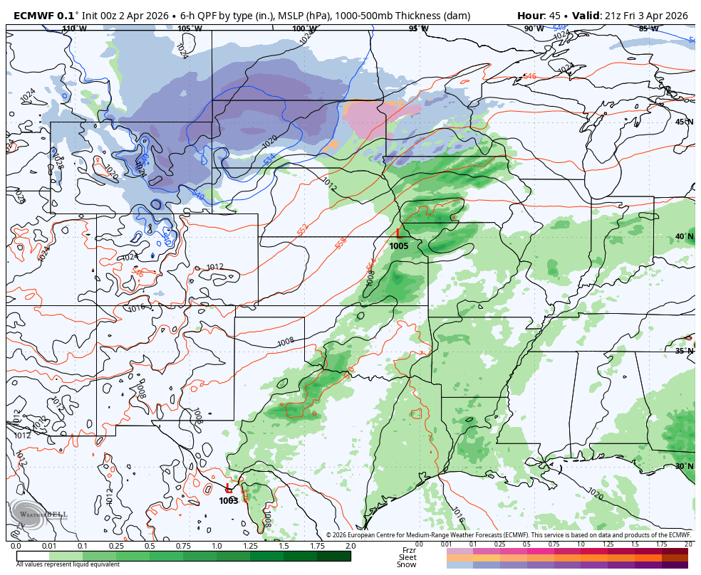
Figure 1. Projected weather map for tomorrow afternoon
Chilly Easter morning
Saturday will be rather brisk with highs in the mid 40's (northeast) to mid 50's (southwest) and a breeze from the north. Winds will back off on Saturday night and with clear skies, it should be rather chilly on Easter morning. Low is the mid to upper 20's are likely statewide. Temperatures should rebound nicely on Sunday afternoon though with widespread temperatures in the 60's to lower 70's. Winds will be on the breezy side from the northwest in the afternoon and fire danger will be elevated in western Nebraska where less precipitation fell in the last 24 hours.
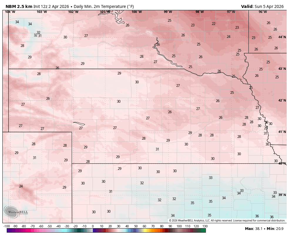
Figure 2. Projected lows on Easter morning
Cool start to the work week
A deep trough will move into the eastern part of the continent by early next week and this will drag a strong cold front into the north central U.S. on Sunday night into Monday morning. This will shift winds back to the north-northeast and they will bring in seasonally cool temperatures on Monday statewide and on Tuesday in the eastern half of the state. Highs likely will be in the 40's for most of the state on Monday and in the upper 40's (east) to 50's (central and west) on Tuesday afternoon. A hard freeze would be probable for much of the state on Tuesday morning.
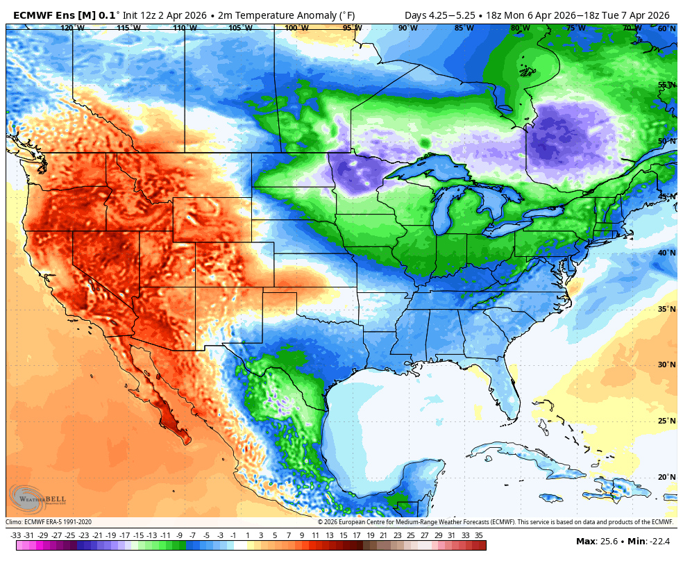
Figure 3. Temperature anomalies between Monday and Tuesday
Wet finish to the week
Temperatures should moderate nicely on Wednesday as ridging temporarily returns to the region. Highs in the upper 60's to 70's are likely statewide. But another cold front looks poised to get through the state on Wednesday night into Thursday in response to troughing along the U.S.-Canada border that will be sliding east. A shortwave will be moving across the state after the frontal passage and may help produce a rain-snow mix on Thursday morning across the state with chances for accumulating snow along and north of Highway 30.

Figure 4. Precipitation chances next Thursday
By later in the week, ridging will be prominent across the eastern U.S. and another trough will be moving out of the southwestern U.S. A prolonged period of rising motion associated with the shortwaves and the upper level low will lead to widespread precipitation across at least the eastern half of the state by late Friday into Saturday. An inch or more is possible along and east of Highway 81. Temperatures are likely to remain cool through the end of next week. Upper-level ridging seems likely to return closer to April 15th, which would bring back the warm, dry weather.
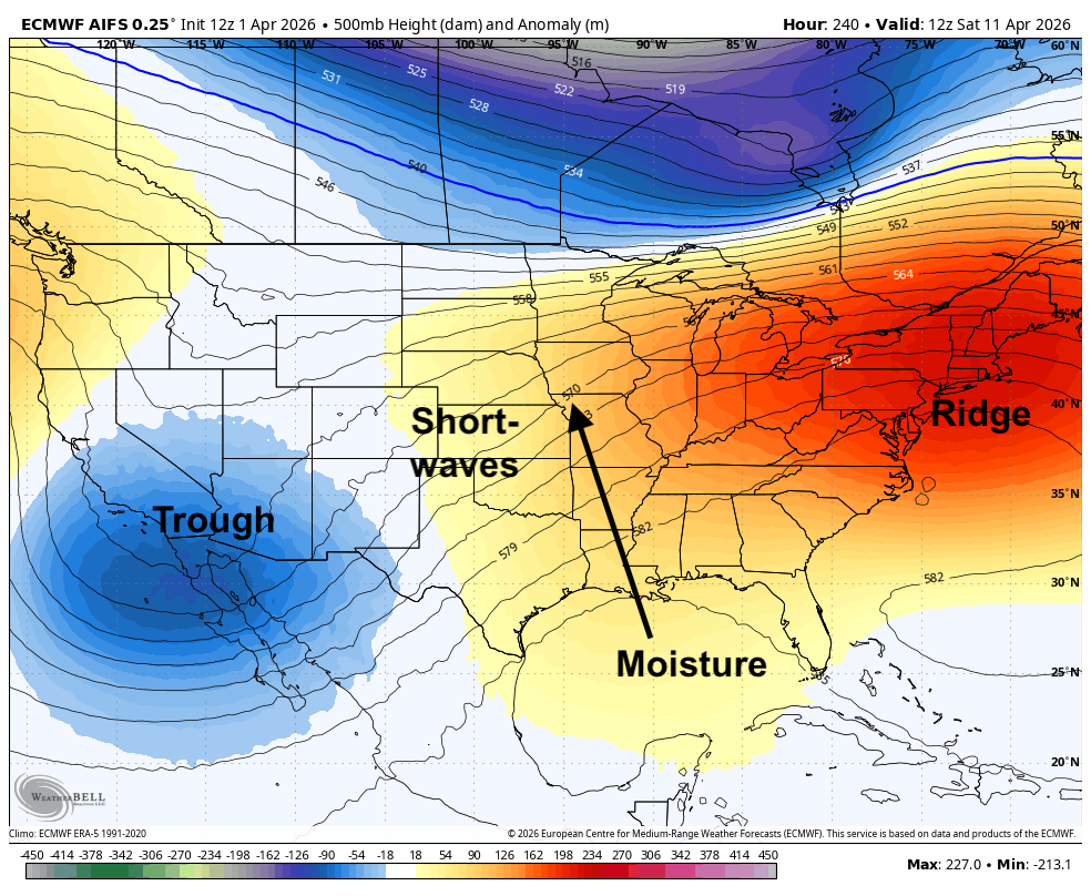
Figure 5. Projected 500-mb height anomalies next Friday


