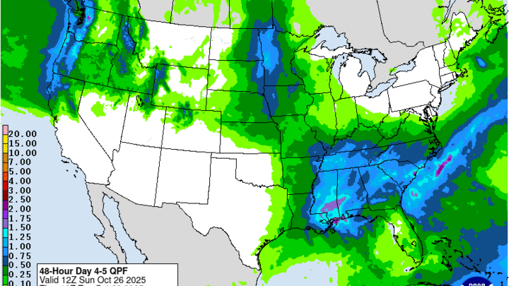
Rain chances the next 48 hours
A look at analysis from last night (Figure 1) shows a deep trough over Ontario and strong northwest flow coming into this region. This eastern trough has been responsible for bringing in the cooler temperatures and lower humidity this week. There also was a slow moving upper-level low over southern California that is going to take the I-40 route through the southern U.S.
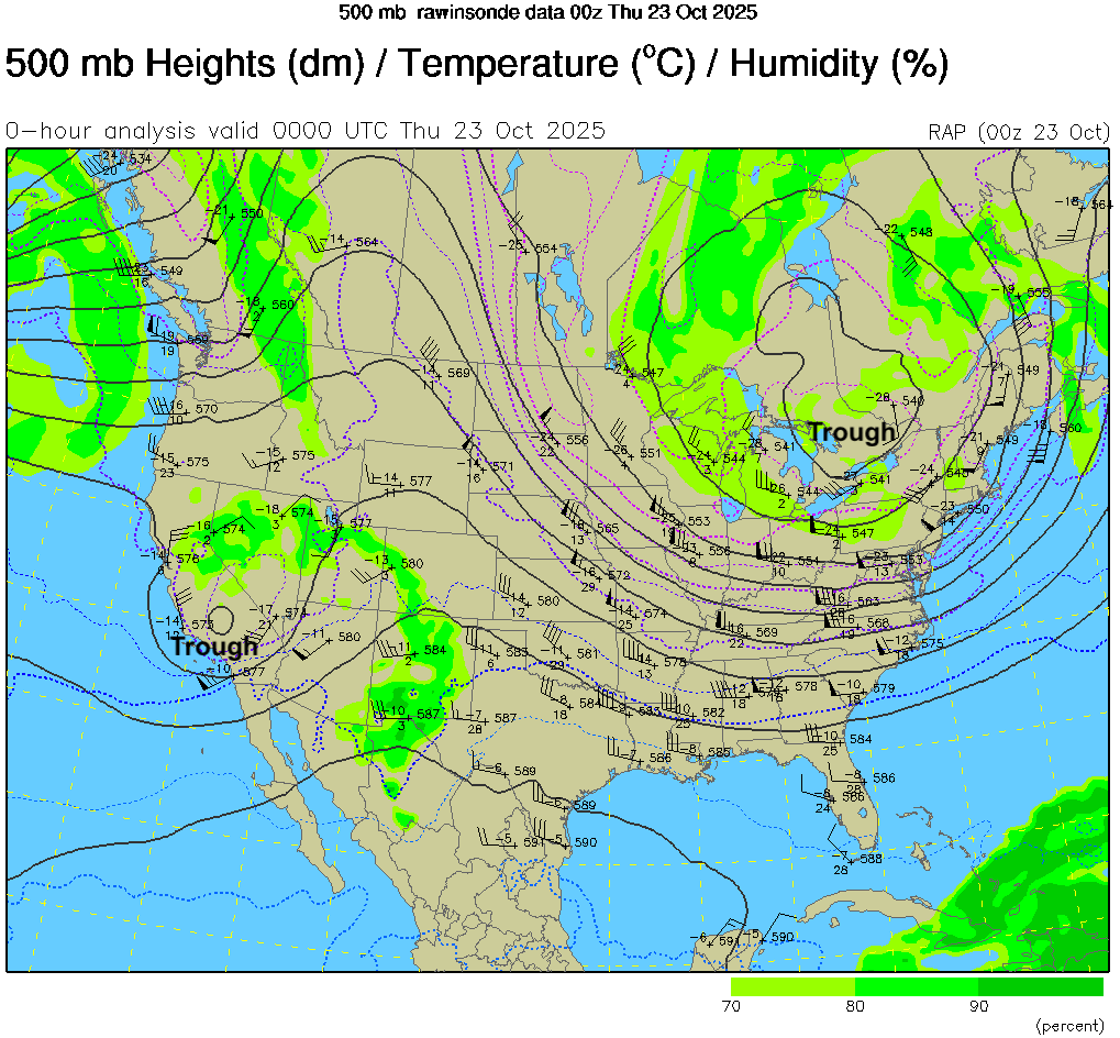
Figure 1. 500-mb plot from 00Z today
This upper level low will be responsible for helping induce generous precipitation amounts across the southern Plains tomorrow into Saturday. The bigger question is how far north the precipitation makes it. Most of the model projections keep the bulk of the precipitation south of the Nebraska-Kansas border but areas between Hebron and Rulo will have a better chance of getting showers tomorrow afternoon. The upper level low will help keep the eastern half of the state socked in with clouds and cooler temperatures in the 50's. Western Nebraska will see more sun and warmer temperatures in the 60's.
The upper level low will mostly remain to our south on Saturday but cloud cover will likely be extensive and there will be chances for showers across eastern Nebraska. The game Saturday is not likely to be a washout but having rain gear may be wise. Temperatures also will likely be at or just slightly below seasonal values in the afternoon with seasonally warm nights. Sunday should be dry but cloud cover is likely to be extensive in eastern Nebraska and may be extensive in western Nebraska as well.
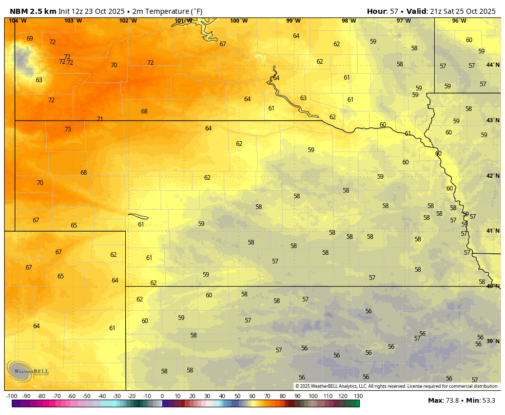
Figure 2. Projected temperatures at 3 PM CDT/2 PM MDT on Saturday
Rain chances early next week
The beginning of next week will feature broader troughing across the northwestern U.S. with ridging building over Hudson Bay (Figure 3) The broader troughing is part of a jet extension that is working its way across the Pacific and will drench the Pacific Northwest this weekend into early next week. That energy will make its way into the Plains region and will be tapping into some moisture coming in from the south and east to bring rain chances to most of the state. Rain chances are rather slim in the Panhandle but everyone else has a chance of getting some moisture between Monday morning and early Tuesday afternoon, with the better chances of rain on Monday evening and early Tuesday further east. Skies are likely to be cloudy across the state during this period. Temperatures will be seasonal overall with warmer than average nights and slightly below average temperatures.
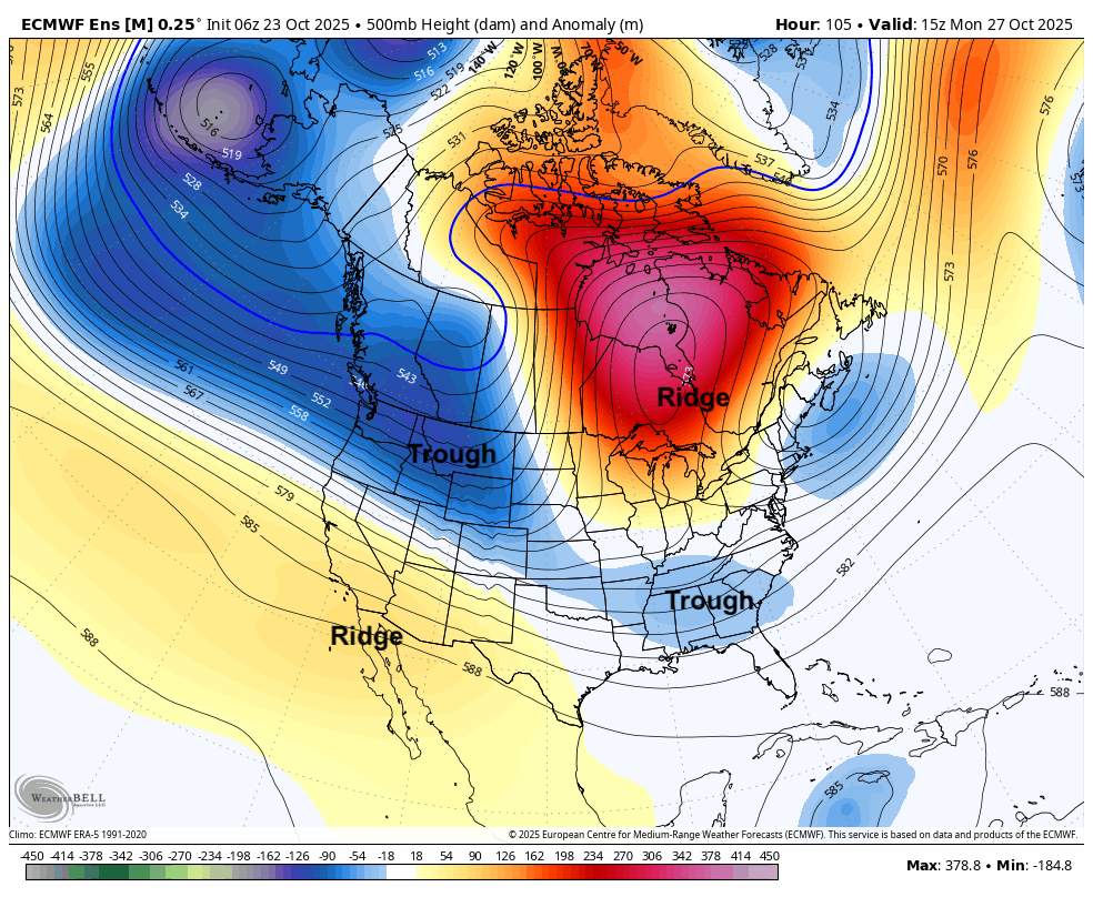
Figure 3. Projected 500-mb height anomalies next Monday morning
Sun returns
If you live in the eastern half of the state I would recommend enjoying the sunshine today because it may be mostly absent until next Wednesday. By then the trough will be to our east and ridging will start to build back into the western U.S. This will help clear out the clouds and temperatures should start warming back up into the 60's across western Nebraska. The rest of the state likely will see temperatures at seasonal levels in the mid 50's to low 60's range for highs as winds will remain out of the north to northwest. Halloween looks dry and seasonal for evening festivities with temperatures projected to be in the 40's at 7 PM. Won't be the warmest Halloween but certainly won't be 1991 when ice and snow ruined Trick or Treat for many.
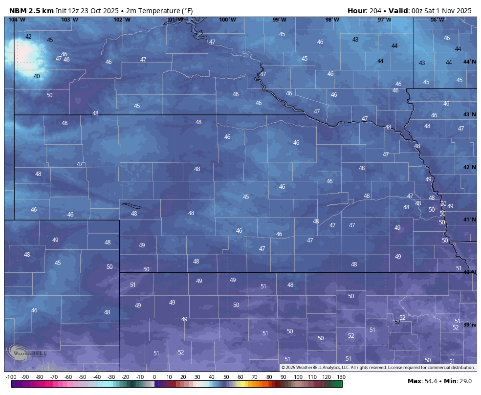
Figure 4. Projected temperatures at 7 PM on Halloween
Mild start to November?
A weak cold front may work its way into the state next Saturday, which would produce a chance of showers across the state. Precipitation does not look significant and temperatures are likely to be in the 50's and 60's. A look beyond next week suggests ridging will be prominent across the western half of the continent in the first part of November. This would keep temperatures on the mild side to start November. Temperatures over 70°F may make a return for some or perhaps most of us for a few days the week after next. This pattern would keep us dry and mostly free of clouds. Good weather for finishing up harvest and getting fall yard work done.
If the Madden Julian Oscillation ends up being a dominant signal for us in November, the odds of it being a very mild and dry month will be elevated as Phase 5/6 through most of November (which is essentially saying the best rising motion is around Indonesia) is projected by global models. This historically suggests ridging being prominent west of the Great Lakes, which would be a warm/dry signal. Novembers have been generally above to well above the 20th century average in the last decade and this year may not be a break in that trajectory.
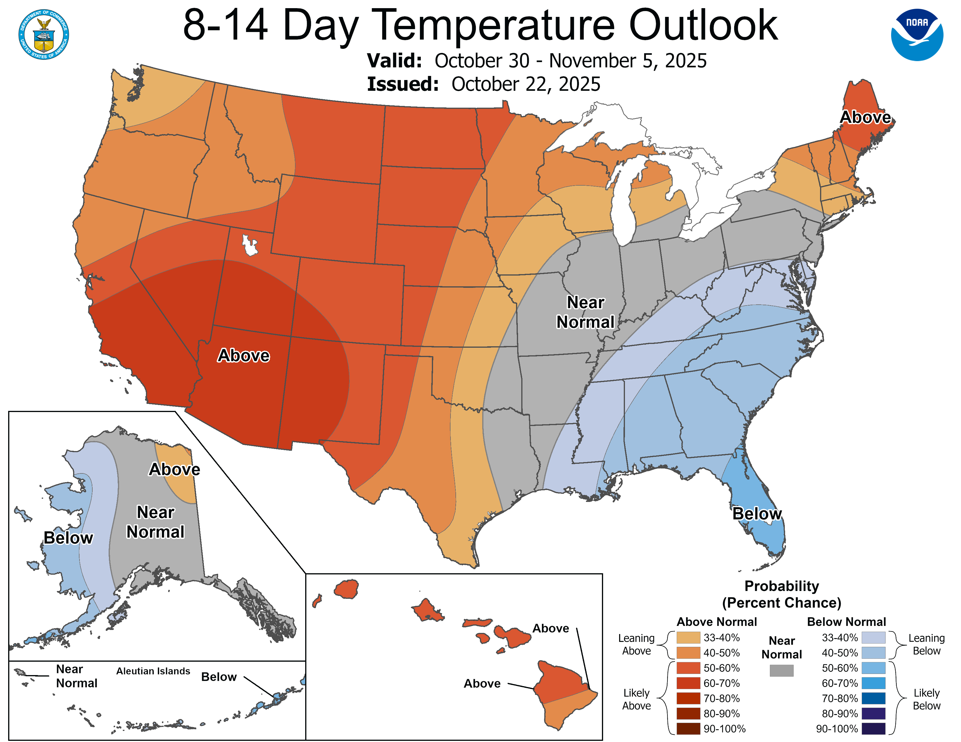
Figure 5. CPC 8-14 day temperature outlook


