Wet November
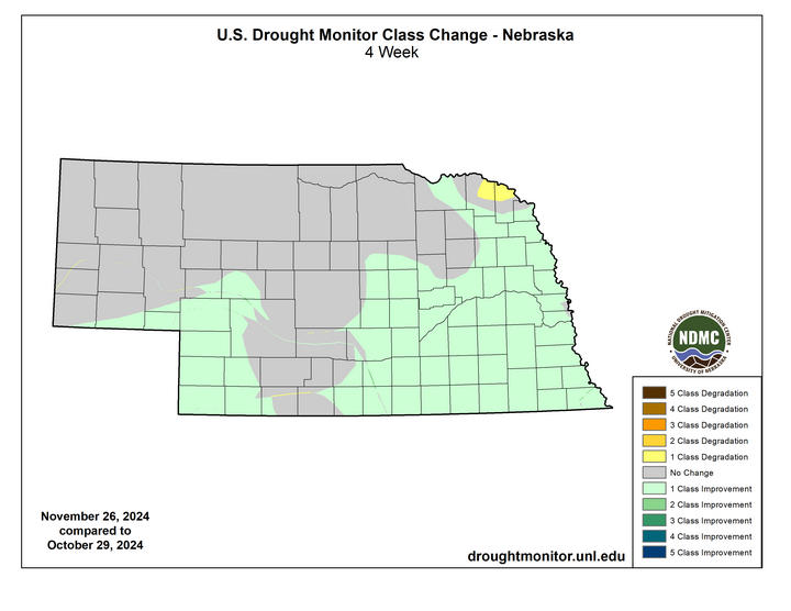
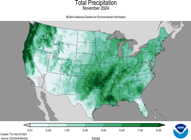
November 2024 was the 7th wettest on record in Nebraska, with a statewide average of 2.02" that was 1.17" above the 20th century average. This was the wettest November in the state since 1998 and broke a string of four consecutive years with a drier than average November. Several locations in south central and eastern Nebraska had over 4" for the month. Pockets of eastern Nebraska had over 5 inches. No station officially had its wettest November but several were in the top-5 wettest. Precipitation was sufficient enough in much of eastern and south central sections of the state to warrant a one-category improvement on the U.S. Drought Monitor.
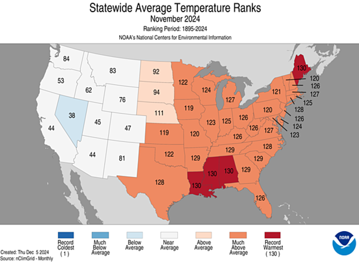
Warmer than average
November 2024 had a statewide average of 40.0F, 4.1F above the 20th-century average and good for 20th warmest on record. This is consistent with a trend toward warmer temperatures in November with 20 of 25 Novembers since 2000 being above the 20th century average. Temperatures were warmest relative to average in eastern Nebraska and closest to average in the southern Panhandle. Colder temperatures did arrive for everyone the week of Thanksgiving, with eastern Nebraska catching the brunt of the colder air. A few sites in the Panhandle dipped below zero during this period and most locations in the eastern half of the month had 1-2 days of subfreezing highs at the end of the month. The warmer temperatures were helpful in keeping soil temperatures safely above freezing allowing the precipitation to infiltrate effectively. This helped soil moisture recover during the first half of the month to closer to normal levels for places that picked up 4-5".