
Cold weekend with chance of snow south
A weaker trough will be moving into the Central Plains Friday night into Saturday morning, which will bring a chance for light snow to areas along and south of I-80. Accumulations likely under an inch.
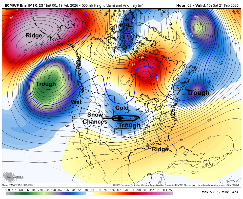
Figure 1. 500-mb height anomalies on Saturday with detailed features
With northwest flow aloft prevalent through the weekend, temperatures will be seasonally chilly both Saturday and Sunday. Highs will likely range from the upper 20's to mid 30's, with warmer temperatures toward the western side of the state. Lows in the single digits and lower teens will be prominent through Monday morning. Subzero temperatures may be possible Monday morning in eastern Nebraska if the snow pack is sufficiently deep.
All aboard the rollercoaster!
After a cold start to the day Monday, upper level ridging will move into the central U.S. and much warmer temperatures will invade from the southwest. Highs will still be fairly cool in eastern Nebraska on Monday with highs in the mid to upper 30's but will warm into the 40's (central) and 50's (west). Temperatures will warm up even more on Tuesday with temperatures getting into the 60's and possibly lower 70's in western Nebraska, lower to mid 60's in the central part of the state, and mid 50's to lower 60's in the eastern section. The snow should melt pretty quickly Monday afternoon and Tuesday morning, so temperatures shouldn't have too many issues shooting up 20-30°F between Monday afternoon and Tuesday afternoon in the eastern side of the state.
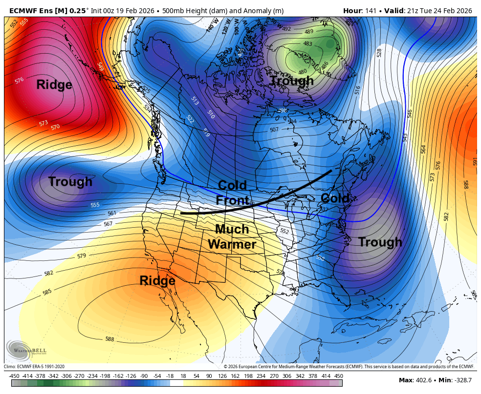
Figure 2. 500-mb height anomalies on Tuesday afternoon
But that warmth will be short-lived as another front comes barreling through the state Tuesday night into early Wednesday. This will bring a brief return to more seasonally cool temperatures and a chance for rain or a rain/snow mix on Wednesday morning. The WPC is not bullish on much of anything falling out of the sky with the mid-week frontal passage but there will be a chance of some moisture.
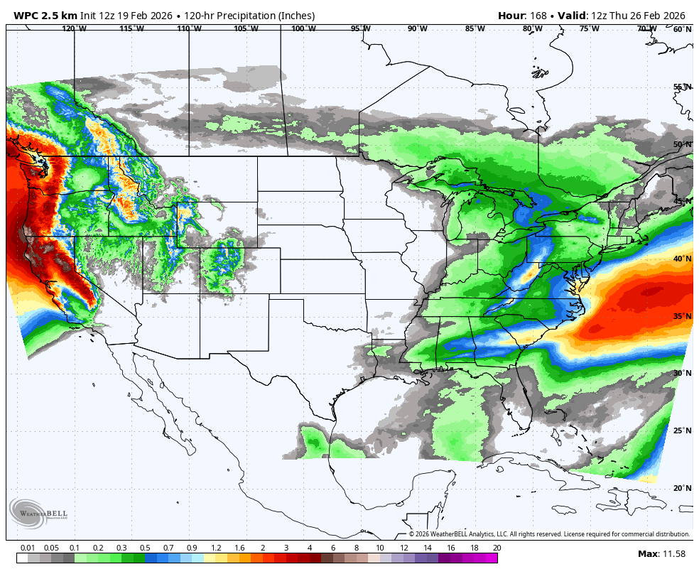
Figure 3. WPC projected precipitation between Sunday and Thursday
Potential for more cold next weekend
Temperatures should rebound fairly quickly by Thursday and the workweek appears to finish mild at this point. The CPC's 8-14 day outlook calls for a good chance of above average temperatures for next weekend and into early March.
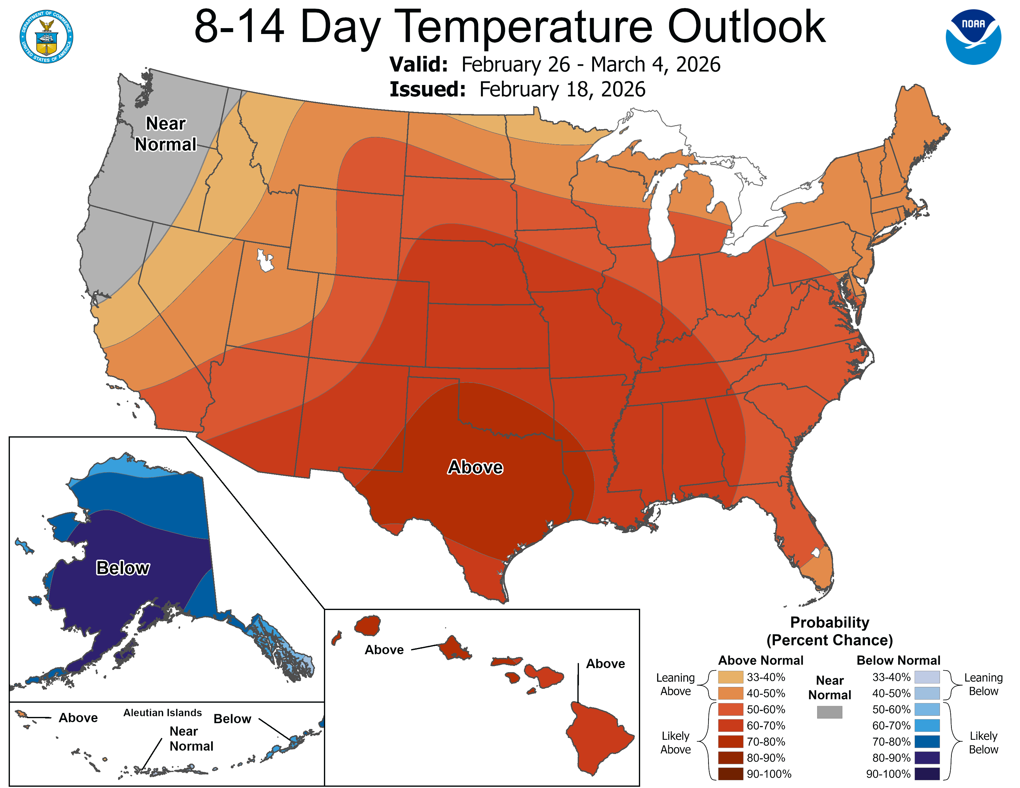
Figure 4. CPC's 8-14 day outlook
However, that outlook verifying is contingent on troughing staying in Canada and not sliding down into the north central U.S., which has been indicated as a possibility by some recent model runs. If that ends up happening, temperatures next Saturday and Sunday could be quite chilly. If that doesn't, then next weekend and the first day(s) of March should be reasonably nice. There are some signals for a more active weather pattern opening up in the first week of March. This could mean useful moisture, especially for central and eastern Nebraska. Prospects for western Nebraska are more bearish but there is a sliver of hope.
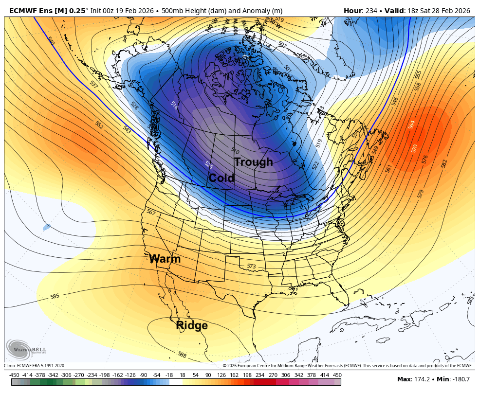
Figure 5. Projected 500-mb height anomalies next Saturday


