Cold Front
Temperatures will bounce back to seasonal levels in the mid 50's to around 60 today for everyone west of Highway 77. Cooler temperatures may prevail in extreme eastern Nebraska due to more cloud cover. By tomorrow morning, another trough will be moving into the north central U.S. and at the surface a cold front will move through the state. This will knock down temperatures back into the 40's with breezy winds from the north-northwest. Winds should back off in the evening but it will be a cooler night for Trick or Treat and other festivities. Temperatures will be seasonally cool on Saturday with highs in the 40's in central and eastern Nebraska with temperatures bouncing back into the 50's after lows of 8-18°F in the Panhandle. Temperatures will be a bit cool for the game on Saturday evening, with wind chill values likely in the 30's in the second half.
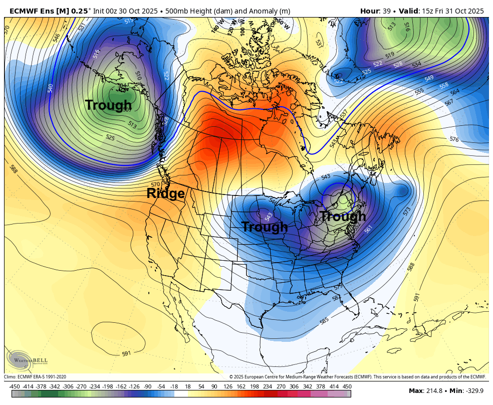
Figure 1. 500-mb height anomalies tomorrow morning
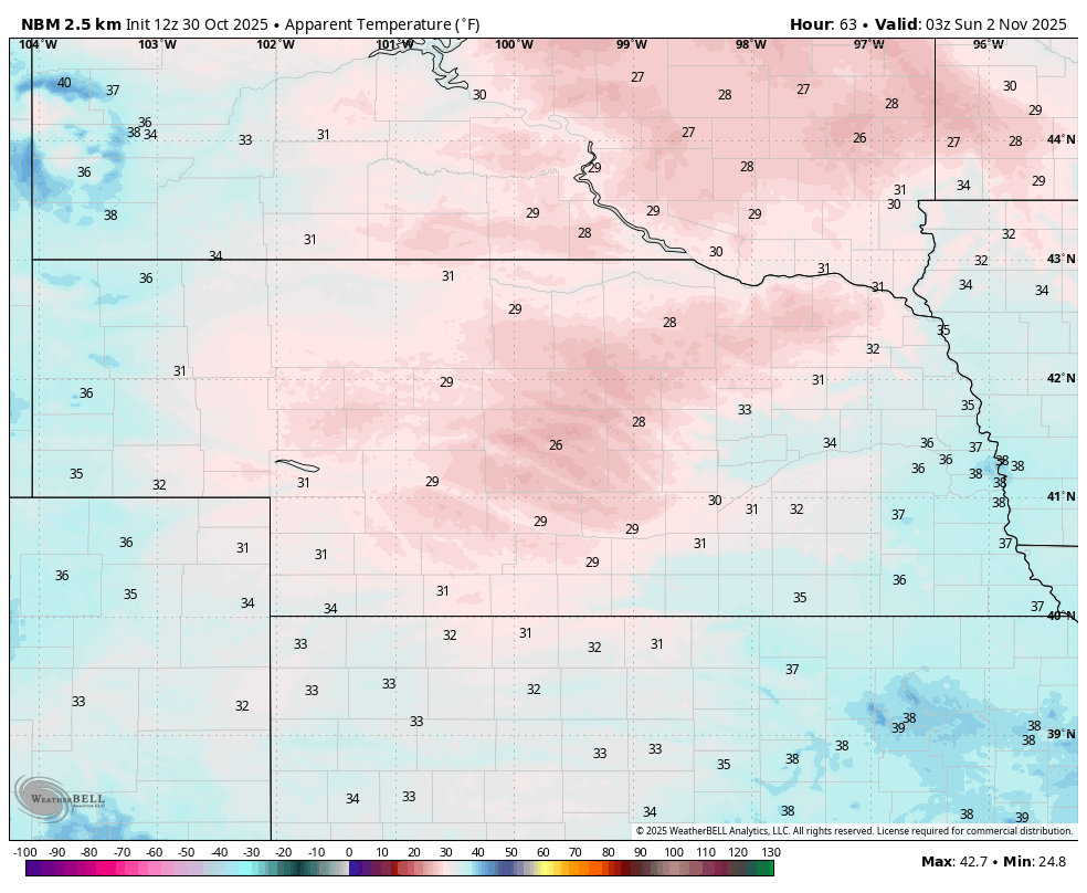
Figure 2. Projected wind chill values on Saturday evening
Seasonally Warm and Dry
Temperatures will bounce back on Sunday statewide with maximum temperatures ranging from the upper 50's in far eastern Nebraska to the mid and upper 70's in the Panhandle. Temperatures in the 60's will be common on Sunday between Highways 183 and 77. All in all, a nice day for November 2nd!
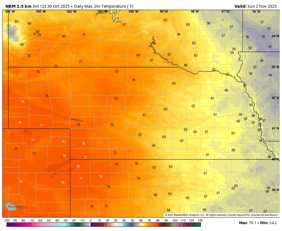
Figure 3. Projected maximum temperatures on Sunday afternoon
Temperatures will cool off a little bit on Monday across western sections of the state as a weak front will move through the state on Sunday night. Ridging will build back into the region early in the week and this will persist through at least next Friday. This will mean plenty of sunshine and temperatures generally getting into the 60's and lower 70's. Another weak front may move through the state later in the week. That would bring a slight chance of moisture to the northern and eastern sections of the state but any precipitation will be light.
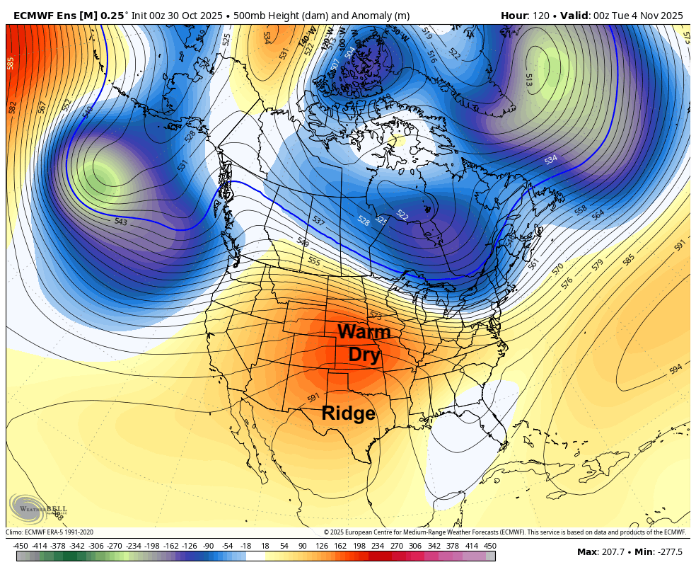
Figure 4. 500-mb height anomalies next Tuesday
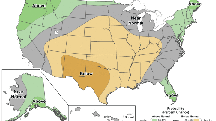
Warm and dry likely to persist
Ridging is likely to remain a prominent feature across the central and western U.S. through at least the middle portion of the month. I think it is possible that this is the dominant pattern through the week leading up to Thanksgiving. This will favor temperatures that are above and perhaps well above average at times and dry conditions. We are entering our driest time of year and it is possible, perhaps probable, that most places in the state will receive under a quarter inch of total precipitation over the next 2-3 weeks. Some places may even get goose eggs for precipitation in the first half of the month. A more active pattern may be possible late in the month. But in the immediate future, it is very unlikely that we will be dealing with early winter storms traversing the state.
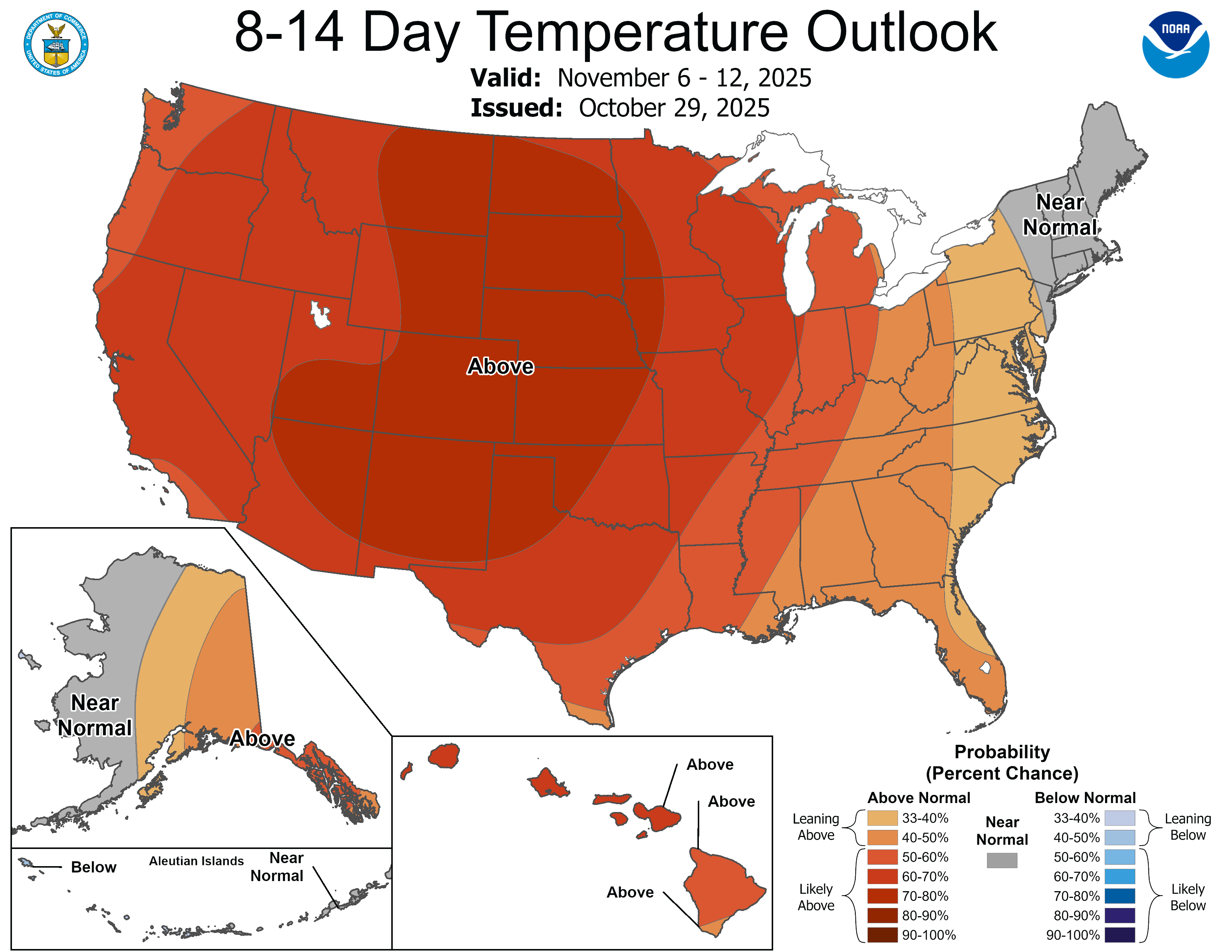
Figure 5. CPC's 8-14 day temperature outlook
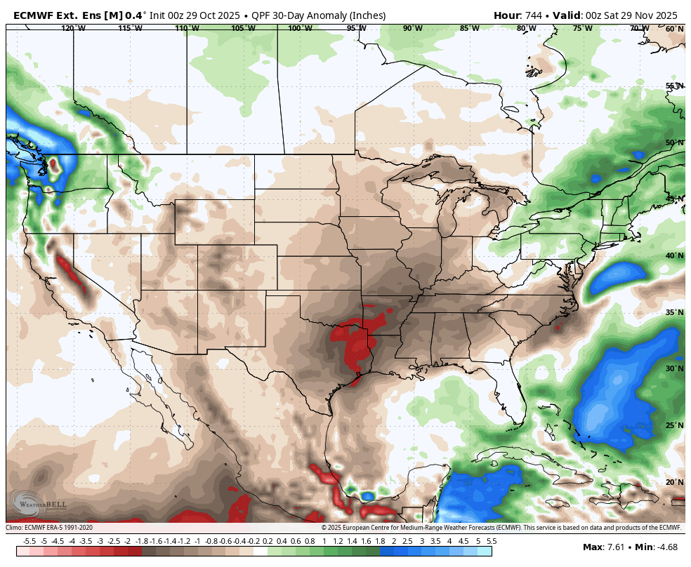
Figure 6. Projected 30-day precipitation anomalies


