Cooler week
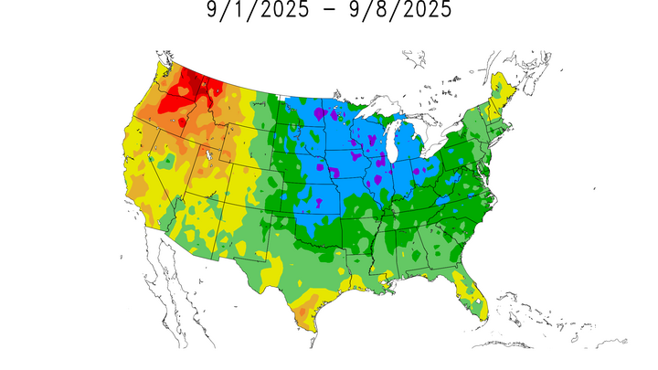
Temperatures in Nebraska remained cool most of the week due to the northwesterly flow aloft that moved through the state. The highs across the central and eastern portion of the state ranged between the upper 60s to mid 70s, which is not normally seen during late summer in the Midwest. Western parts of the state, such as Scottsbluff and North Platte also experienced cooler than average temperatures with breezy winds coming from the northwest. Temperatures were coldest on Saturday morning with temperatures dropping into the 20's in parts of the Panhandle and into the 30's across much of northern and west central sections of the state. Lincoln and Omaha also experienced lower temperatures with lows dipping into the lower 40's.
A quick look at analysis of anomalies at 850-mb showed that cooler air that advected into central Nebraska this past week due to a zonal to northwesterly flow that had been tied to an upper-level low from Ontario Province. Major fronts that have happened in the state this past week have included a high-pressure system that made its way across the northern Great Plains Region, which helped to fortify the dry conditions, and cool, dry air that was experienced earlier this week. Luckily, a warm front is expected to bring some warmer conditions into Nebraska early next week.
In summary, Nebraska experienced a cooler-than-normal week (Figure 1), which looks to transition into warmer and more seasonable conditions with scattered precipitation chances as the ridge builds. As mentioned earlier, this past week was dry for much of the state. However, with that warm front that is moving in, there is expected to be precipitation that will bring probabilities of rain and thunderstorms to the eastern side of the state.

Figure 1. Station analysis of the average high and temperatures for the cities of Omaha, Lincoln, Norfolk, Grand Island, North Platte, and Scottsbluff over the past week. All of these are between 5-8°F below average for this time of year.


