Drought Monitor improvements
The precipitation that fell in the Sand Hills last Wednesday night and across a majority of the state earlier this week led to pockets of improvements for Nebraska on the U.S. Drought Monitor. Improvements were mostly confined to areas that had well over 2 inches of rain and where indicators like soil moisture percentiles showed real improvement. While the rain was certainly welcome and some improvement in drought status did occur, 90 percent of the state is still in drought and 55 percent of the state in severe drought or worse. This does represent improvement numbers compared to last week (98% in drought, 62% in severe drought or worse) but it is still the highest percentage of the state in drought at this point in the season since 2022. Furthermore, there was a small pocket in southwest Nebraska and another area in the western Panhandle that saw degradation to severe drought (D2) and extreme drought (D3) respectively.
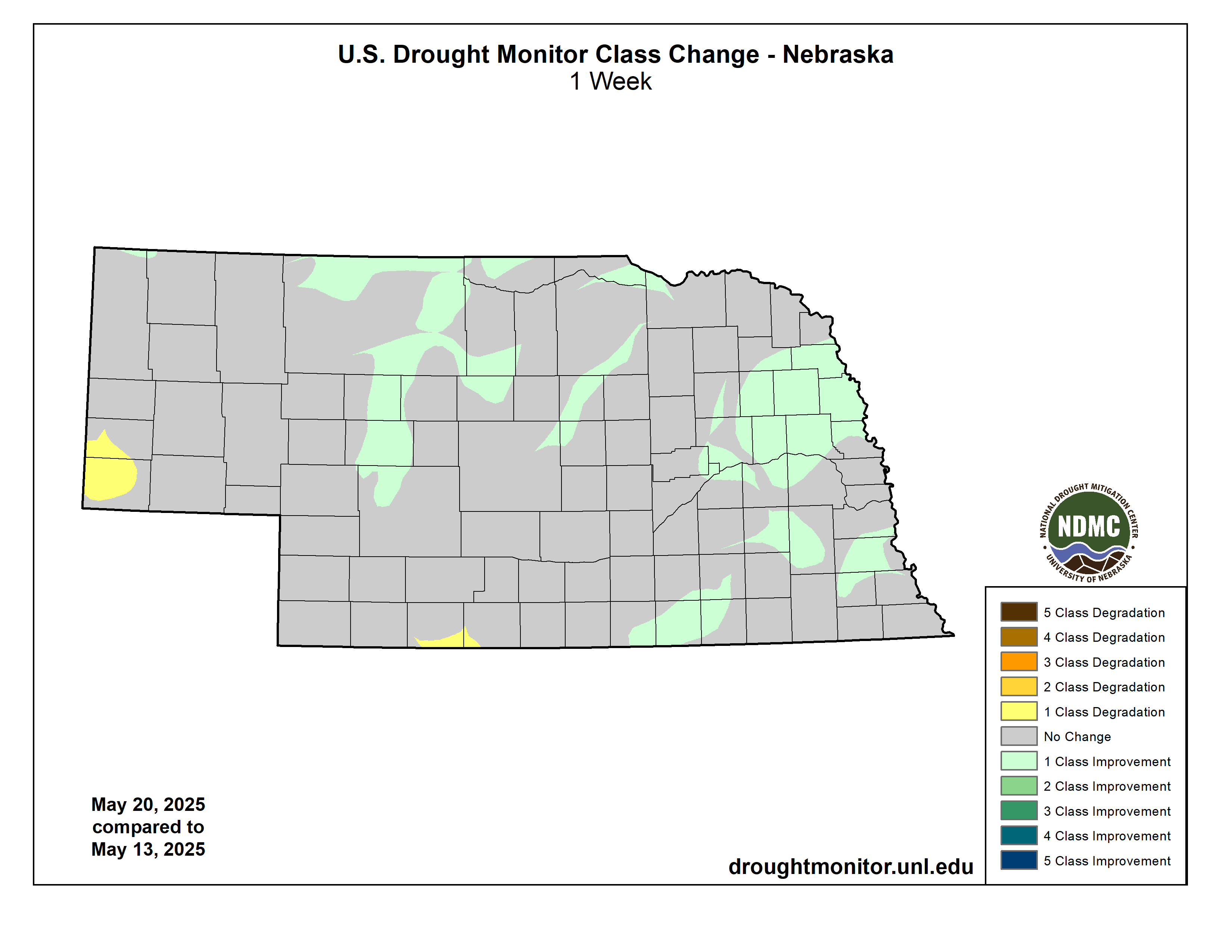
Figure 1. USDM improvements over last week's map.
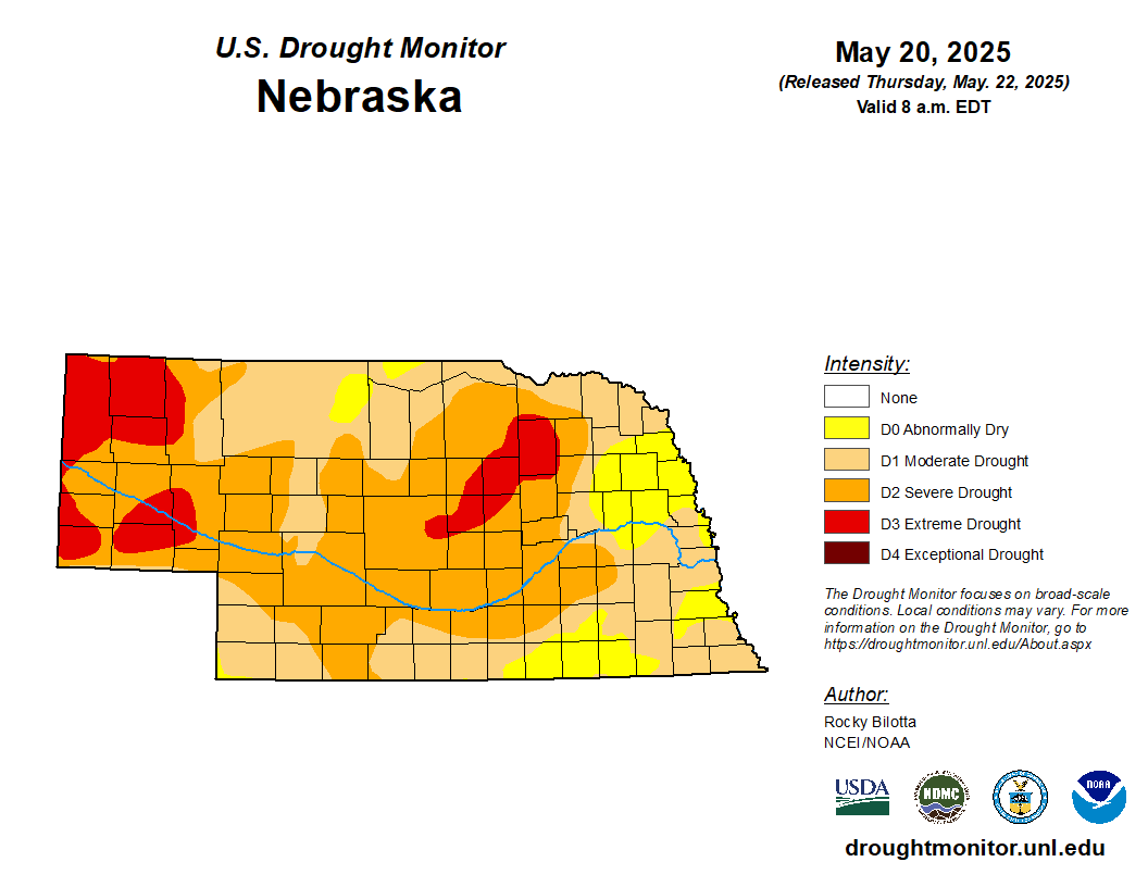
Figure 2. Latest U.S. Drought Monitor
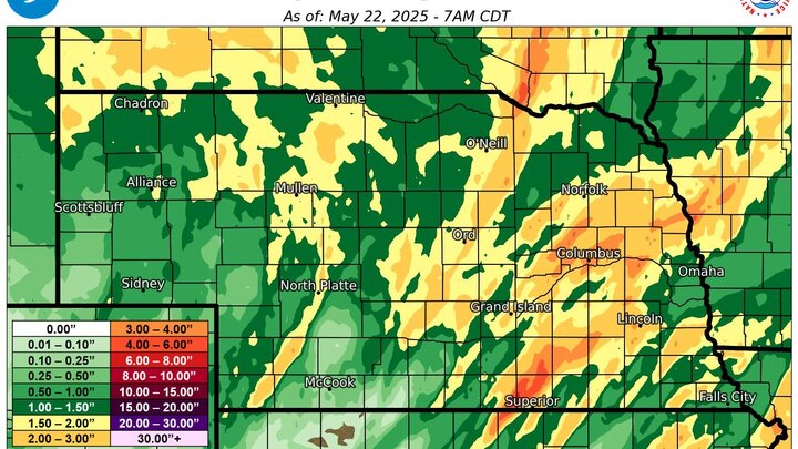
Recent precipitation totals
Most of the state has received over an inch over the last 10 days and some pockets in the Sand Hills and south central Nebraska received over 4". Biggest winner was Thedford, which has received 7.33" since early last week. Unfortunately Mother Nature was less generous to southwestern Nebraska and pockets of southeast Nebraska.
Figure 3. 10-day MRMS precipitation totals with observed precipitation from various sites shown in the black numbers. Map courtesy of Eric Snodgrass, Nutrien Ag Solutions.
Soil moisture update
Soil moisture did improve across most of the state over the last week. But in most cases the improvements took soil moisture percentiles from abysmally low numbers to just dry. Nowhere in the state has moist soils for late May according to the latest SPoRT LIS map, as is the case for many areas in the domain shown below in Figure 4, and only pockets of northeast Nebraska and the Sand Hills are even in the near-normal range. The remainder of the state has a root zone water content that is at least below the 30th percentile, if not below the 20th percentile. Thus, some of the improvements on the Drought Monitor will be short-lived unless we can keep getting regular, meaningful precipitation events.
This weekend's precipitation will be welcome but is not likely going to be enough to move the needle in most locations. Might only be enough to stave off degradation in some cases. Will be worth seeing what happens in early June- a stalled cold front near the KS-NE border, as suggested by some recent model runs, would certainly increase the chances for widespread drought improving rains in areas that really need it (e.g., southwest NE).
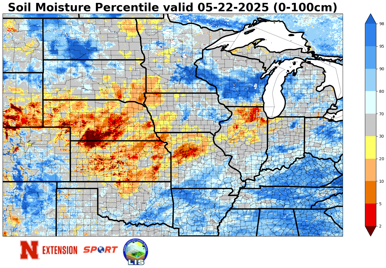
Figure 4. Soil moisture percentiles


