36 percent of state in drought
The latest U.S. Drought Monitor, which was released yesterday morning, shows the areal coverage of drought in the state is down to 36 percent. Most of this is in western Nebraska and the Highway 34 corridor in eastern Nebraska. Severe drought is still present in parts of the southern Panhandle and southwest Nebraska but covers less than 10 percent of the state. This is a significant improvement compared to two months ago when over half of the state was in drought.
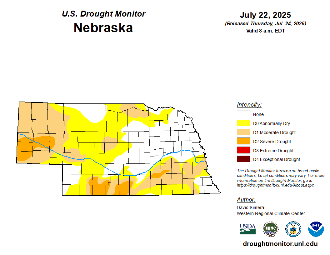
Figure 1. Latest U.S. Drought Monitor
A third of the state is now free of all drought and abnormal dryness (D0), with the majority of northeast Nebraska falling into this category. The southeast and southwest corners are also (mostly) free of all drought and D0. The consistent precipitation that has been falling over most of the state has led to good crop conditions with corn yields expected to be at or above trend at most locations modeled in the first simulation report (see related links). QuickDRI also shows that there is wet/good conditions across most of the state. Exceptions would be the western Panhandle, southwest Nebraska near McCook, and mild stress possible in Fillmore and Saline counties.
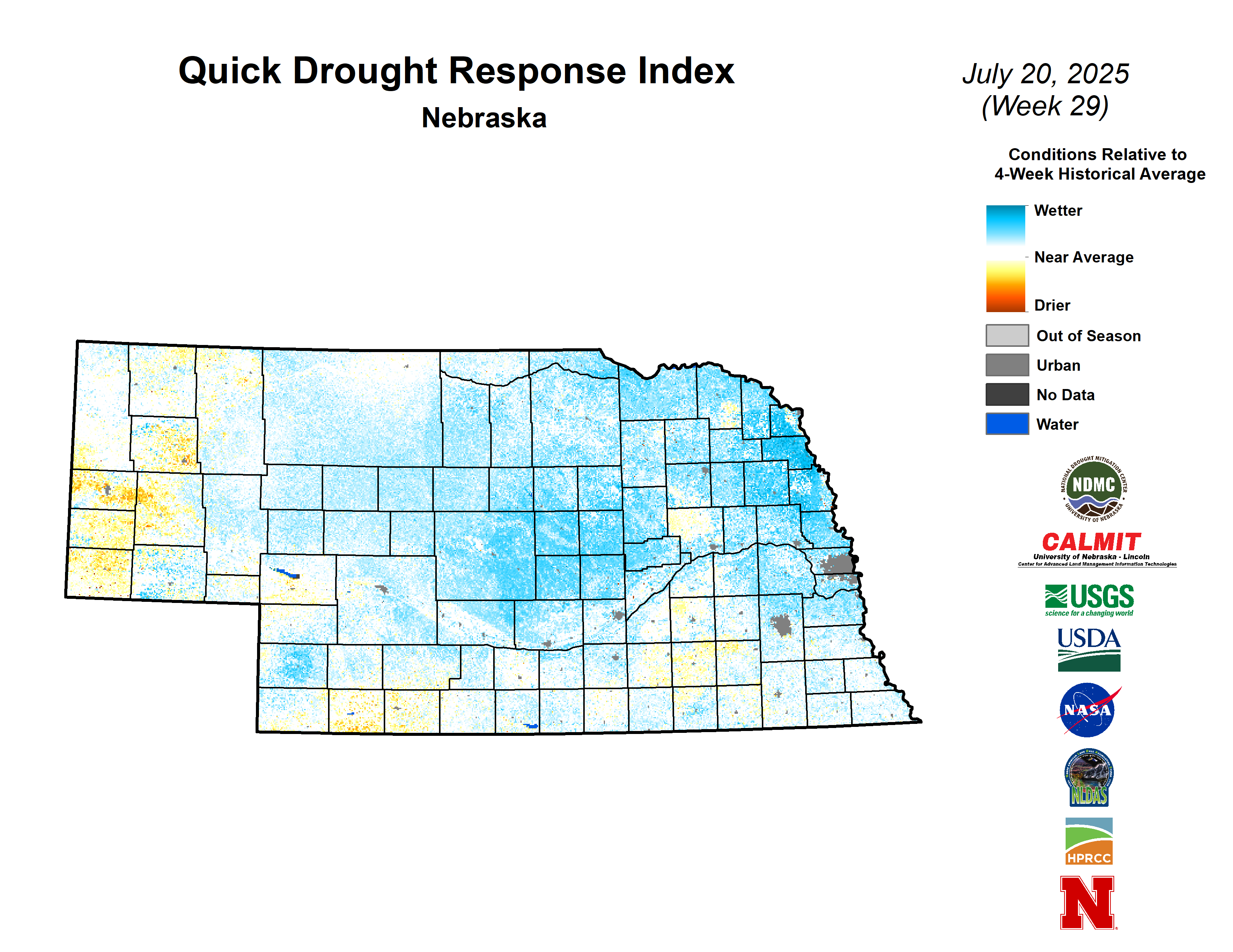
Figure 2. Latest QuickDRI map